Category:Gedney Drove End
Jump to navigation
Jump to search
village in Lincolnshire, England | |||||
| Upload media | |||||
| Instance of | |||||
|---|---|---|---|---|---|
| Location | Gedney, South Holland, Lincolnshire, East Midlands, England | ||||
 | |||||
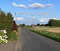
Gedney Drove End is a village in the civil parish of Gedney and the South Holland district of Lincolnshire, England.
Media in category "Gedney Drove End"
The following 38 files are in this category, out of 38 total.
-
B1359 in Gedney Drove End (geograph 3568688).jpg 2,369 × 1,644; 1.67 MB
-
Cows grazing the base of the sea bank (geograph 3568975).jpg 2,786 × 1,765; 1.7 MB
-
Drainage ditch - geograph.org.uk - 75399.jpg 640 × 428; 76 KB
-
Drainage Ditch Near Gedney Drove End - geograph.org.uk - 318787.jpg 640 × 480; 107 KB
-
Farmland and sea bank near Gedney Drove End (geograph 3188964).jpg 2,025 × 1,485; 1.19 MB
-
Farmland at Gedney Drove End (geograph 3218982).jpg 2,335 × 1,171; 1.44 MB
-
Farmland near Gedney Drove End (geograph 3188461).jpg 2,464 × 1,926; 1.82 MB
-
Farmland near Gedney Drove End (geograph 3188945).jpg 3,264 × 2,448; 2.24 MB
-
Flat farmland near Gedney Drove End (geograph 3218901).jpg 3,264 × 2,448; 3.03 MB
-
Foot path north of Bleak House Farm, Gedney Drove End (geograph 2793363).jpg 4,320 × 3,240; 5.43 MB
-
Footpath across the farmland (geograph 3188979).jpg 3,264 × 2,448; 2.99 MB
-
Footpath, gedney Drove End - geograph.org.uk - 75351.jpg 640 × 421; 60 KB
-
Gedney Drove End- Dawsmere Road (geograph 3218972).jpg 2,228 × 1,892; 1.93 MB
-
Gedney Drove End- Marsh Road (geograph 3218910).jpg 1,865 × 1,444; 1,002 KB
-
Gedney Drove End- Marsh Road (geograph 3218921).jpg 3,264 × 2,448; 3.05 MB
-
Heron near Gedney Drove End - geograph.org.uk - 602374.jpg 480 × 640; 85 KB
-
Is this the Northern Lights near Gedney Drove End? (geograph 2671702).jpg 4,320 × 3,240; 5.35 MB
-
Mown grass verge along the B1359 (geograph 3568535).jpg 2,069 × 1,751; 1.49 MB
-
Out in the outmarsh - geograph.org.uk - 1419852.jpg 640 × 480; 90 KB
-
Path across the farmland to Gedney Drove End (geograph 3188951).jpg 1,938 × 1,487; 969 KB
-
Polytunnel at Gedney Drove End (geograph 3218894).jpg 3,189 × 2,351; 2.52 MB
-
Postbox in Gedney Drove End (geograph 3568707).jpg 2,951 × 2,223; 2.22 MB
-
Potholes in the lawn - geograph.org.uk - 1419894.jpg 640 × 480; 109 KB
-
Road heading towards Gedney Drove End (geograph 3188471).jpg 1,923 × 1,338; 1.03 MB
-
Salt marsh at Gedney Drove End (geograph 2671495).jpg 4,320 × 3,240; 5.52 MB
-
Salt marsh in The Wash near Gedney Drove End (geograph 2671544).jpg 4,320 × 3,240; 5.07 MB
-
The B1359 road to Gedney Drove End (geograph 3568526).jpg 2,687 × 2,170; 2.4 MB
-
The Rising Sun - geograph.org.uk - 602280.jpg 640 × 480; 83 KB
-
The Road To Gedney Drove End - geograph.org.uk - 318663.jpg 640 × 480; 163 KB
-
The Wildfowler on the Wash (geograph 2790809).jpg 4,320 × 3,240; 5.2 MB
-
The Wildfowler on the Wash (geograph 3218958).jpg 2,673 × 2,059; 1,006 KB
-
To the Wash, near Gedney Drove End 1995 (geograph 5048801).jpg 2,265 × 1,344; 2.31 MB
-
Trig point at Gedney Drove End (geograph 2671618).jpg 4,320 × 3,240; 5.6 MB
-
Tylers Cottage along the B1359 (geograph 3568531).jpg 1,859 × 1,354; 1 MB
-
White House Farm (geograph 3568959).jpg 2,556 × 2,196; 2.43 MB
-
Wildfowler on the Wash (geograph 3568723).jpg 3,264 × 2,448; 3.08 MB
-
Public Road Near Lodge Farm - geograph.org.uk - 602395.jpg 640 × 472; 62 KB


