Category:Gary Johnson maps
Jump to navigation
Jump to search
Subcategories
This category has the following 4 subcategories, out of 4 total.
2
Media in category "Gary Johnson maps"
The following 27 files are in this category, out of 27 total.
-
1994 New Mexico gubernatorial election results map by county.svg 810 × 810; 17 KB
-
2016 Presidential Election by Vote Distribution Among States.png 800 × 495; 141 KB
-
August 1, 2012 LP, GP, CP Ballot access.png 979 × 749; 83 KB
-
California 2016 Libertarian Primary results by County.png 508 × 600; 45 KB
-
California Libertarian presidential primary results, 2016.svg 810 × 810; 63 KB
-
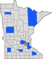
Libertarian Minnesota Caucus results by county.png 2,000 × 2,276; 343 KB
-
Libertarian Party 2016 ballot access.png 959 × 593; 68 KB
-
Libertarian Party ballot access (2016).svg 959 × 593; 32 KB
-
Libertarian Party presidential election results (United States of America).png 1,500 × 8,000; 1.45 MB
-
Libertarian Party presidential primaries results, 2012.svg 959 × 593; 34 KB
-
Libertarian Party presidential primaries results, 2016.png 1,512 × 934; 30 KB
-
Libertarian Party presidential primaries results, 2016.svg 990 × 627; 154 KB
-
LibertarianConventionVotes.png 720 × 445; 19 KB
-
LP Preference Votes .svg 998 × 693; 63 KB
-
Minnesota Libertarian presidential caucus election results, 2016.svg 744 × 744; 353 KB
-
Missouri Libertarian presidential primary, 2016.svg 284 × 252; 54 KB
-
Nebraska Libertarian presidential primary by county, 2016.svg 282 × 133; 42 KB
-
New Mexico gubernatorial election 1998.svg 208 × 215; 23 KB
-
North Carolina Libertarian presidential primary results, 2016.svg 810 × 316; 80 KB
-
NY Independence Party ballot access 2016.png 959 × 593; 62 KB


