Category:Garmouth, Moray
Jump to navigation
Jump to search
village in Moray, Scotland, UK | |||||
| Upload media | |||||
| Instance of | |||||
|---|---|---|---|---|---|
| Location |
| ||||
| Population |
| ||||
| Area |
| ||||
 | |||||
English: Garmouth is a village in Moray, north east Scotland. It is situated close to the mouth of the River Spey, and the coast of the Moray Firth at nearby Kingston (originally called the 'Port of Garmouth', it was renamed after a number of shipbuilders from Kingston-Upon-Hull found success there).
Subcategories
This category has the following 2 subcategories, out of 2 total.
G
- Garmouth Water Tower (5 F)
S
- Spey Viaduct, Garmouth (24 F)
Media in category "Garmouth, Moray"
The following 74 files are in this category, out of 74 total.
-
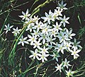
A lone Wild Garlic plant on Spey gravel. - geograph.org.uk - 446374.jpg 640 × 426; 112 KB
-
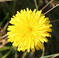
Another Hawkish Flower - geograph.org.uk - 580995.jpg 640 × 608; 266 KB
-
Autumn Gentian (Gentianella amarella) - geograph.org.uk - 229005.jpg 299 × 640; 177 KB
-
Barley Field - geograph.org.uk - 844590.jpg 640 × 427; 258 KB
-
Bell Heather (Erica cinerea) - geograph.org.uk - 581131.jpg 640 × 386; 188 KB
-
Binn Hill - geograph.org.uk - 14427.jpg 640 × 425; 243 KB
-
Binn Hill snapped from the southwest. - geograph.org.uk - 186733.jpg 640 × 427; 65 KB
-
Birdwatch Corner - geograph.org.uk - 6673.jpg 640 × 285; 120 KB
-
Burnet Rose (Rosa pimpinellifolia) - geograph.org.uk - 229293.jpg 640 × 508; 194 KB
-
Common Storksbill (Erodium cicutarium) - geograph.org.uk - 581118.jpg 640 × 465; 243 KB
-
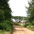
Corskie Farm - geograph.org.uk - 749518.jpg 640 × 480; 68 KB
-
Corskie Farm - geograph.org.uk - 801227.jpg 640 × 427; 225 KB
-
Corskie Farm, Garmouth - geograph.org.uk - 153783.jpg 640 × 480; 76 KB
-
Dead Tree - geograph.org.uk - 198200.jpg 535 × 640; 267 KB
-
Devil's Bit Scabious (Succisa pratensis) - geograph.org.uk - 581142.jpg 640 × 499; 242 KB
-
Dwellings at Garmouth - geograph.org.uk - 756294.jpg 640 × 480; 88 KB
-
Encroaching Shingle - geograph.org.uk - 580892.jpg 640 × 413; 247 KB
-
Fields near Corbiewell - geograph.org.uk - 6676.jpg 640 × 377; 161 KB
-
Fields near Corbiewell - geograph.org.uk - 6677.jpg 640 × 339; 141 KB
-
Finfan - geograph.org.uk - 198183.jpg 640 × 220; 97 KB
-
Finfan Farm House - geograph.org.uk - 198189.jpg 640 × 451; 230 KB
-
Finfan Farmyard - geograph.org.uk - 198186.jpg 640 × 372; 213 KB
-
Forget-me-nots by the Essil backwater. - geograph.org.uk - 438774.jpg 640 × 426; 175 KB
-
Former Free Kirk - geograph.org.uk - 840468.jpg 640 × 529; 224 KB
-
Fungi - geograph.org.uk - 229288.jpg 640 × 487; 259 KB
-
Garmouth Hotel - geograph.org.uk - 840460.jpg 640 × 407; 198 KB
-
Garmouth Hotel - geograph.org.uk - 885585.jpg 640 × 480; 63 KB
-
Garmouth in Evening Light - geograph.org.uk - 843419.jpg 640 × 427; 226 KB
-
Golf Court - panoramio.jpg 4,320 × 3,240; 5.73 MB
-
Hawkish Flower - geograph.org.uk - 580984.jpg 640 × 633; 295 KB
-
Heather or Ling (Calluna vulgaris) - geograph.org.uk - 228998.jpg 640 × 427; 321 KB
-
King Charles II plaque.jpg 898 × 616; 199 KB
-
Kingston - geograph.org.uk - 13109.jpg 640 × 400; 190 KB
-
Lagoon at Kingston. - geograph.org.uk - 326175.jpg 640 × 480; 76 KB
-
Lein Nature Reserve - geograph.org.uk - 6674.jpg 640 × 345; 150 KB
-
Looking from the water tower - geograph.org.uk - 749504.jpg 640 × 480; 66 KB
-
Looking northwest to Wallfield. - geograph.org.uk - 186711.jpg 640 × 427; 73 KB
-
Looking towards Tugnet - geograph.org.uk - 749512.jpg 640 × 480; 72 KB
-
Millennium Milepost - geograph.org.uk - 1367667.jpg 427 × 640; 316 KB
-
New Mains - geograph.org.uk - 198204.jpg 638 × 640; 342 KB
-
New Stynie - geograph.org.uk - 198207.jpg 640 × 437; 210 KB
-
Newton Farm near Garmouth - geograph.org.uk - 153805.jpg 640 × 480; 81 KB
-
Nissen Hut near rifle range - geograph.org.uk - 73262.jpg 640 × 427; 134 KB
-
Old Railway Bridge, Garmouth - geograph.org.uk - 279705.jpg 640 × 480; 67 KB
-
Orange Birch Bolete (Leccinum versipelle) - geograph.org.uk - 229282.jpg 640 × 518; 345 KB
-
Pill Box - geograph.org.uk - 580975.jpg 417 × 640; 240 KB
-
Pill box and defences - geograph.org.uk - 73214.jpg 640 × 427; 127 KB
-
Pill Box and TankTraps - geograph.org.uk - 580954.jpg 640 × 408; 224 KB
-
Pill Boxes and TankTraps - geograph.org.uk - 581111.jpg 640 × 426; 269 KB
-
Pond at the Lein - geograph.org.uk - 229274.jpg 640 × 427; 255 KB
-
Red Tree Among the Green - geograph.org.uk - 580978.jpg 462 × 640; 310 KB
-
Rifle Range - geograph.org.uk - 228970.jpg 640 × 292; 123 KB
-
Rifle Range - geograph.org.uk - 228973.jpg 640 × 237; 98 KB
-
Rifle Range - geograph.org.uk - 228974.jpg 640 × 269; 142 KB
-
Rifle range - geograph.org.uk - 73210.jpg 640 × 427; 132 KB
-
Roadside Verge - geograph.org.uk - 844600.jpg 427 × 640; 293 KB
-
Signpost on Moray Coastal Trail - geograph.org.uk - 73259.jpg 640 × 427; 158 KB
-
Standing Stones and Water Tower - geograph.org.uk - 749489.jpg 640 × 480; 114 KB
-
Standing Stones at Garmouth - geograph.org.uk - 749495.jpg 640 × 480; 117 KB
-
Tank Traps - geograph.org.uk - 580906.jpg 640 × 418; 227 KB
-
Tank Traps - geograph.org.uk - 580914.jpg 411 × 640; 255 KB
-
Tank Traps - geograph.org.uk - 580922.jpg 431 × 640; 247 KB
-
The Post Office at Garmouth - geograph.org.uk - 756238.jpg 640 × 532; 69 KB
-
The Sea of Stones - geograph.org.uk - 6357.jpg 640 × 288; 171 KB
-
Thrift (Armeria maritima) - geograph.org.uk - 580958.jpg 381 × 640; 194 KB
-
Trees In Autumn Light - panoramio.jpg 4,320 × 3,240; 7.92 MB
-
Turn right for Lochhill. - geograph.org.uk - 186653.jpg 640 × 427; 74 KB
-
Upper Ashfield near Garmouth. - geograph.org.uk - 153779.jpg 640 × 480; 93 KB
-
Windpump - geograph.org.uk - 73267.jpg 640 × 427; 90 KB


