Category:Garlogie
Jump to navigation
Jump to search
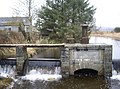
English: Garlogie is a roadside hamlet in Aberdeenshire, Scotland. It was, during the 19th century, the site of a textile milling settlement using water from Loch of Skene. The mill is now a museum. Garlogie also has an inn.
village in Aberdeenshire, Scotland, UK  | |||||
| Upload media | |||||
| Instance of | |||||
|---|---|---|---|---|---|
| Location | Aberdeenshire, Scotland | ||||
| Located in or next to body of water |
| ||||
 | |||||
Subcategories
This category has the following 2 subcategories, out of 2 total.
C
- Cullerlie Stone Circle (15 F)
D
Media in category "Garlogie"
The following 173 files are in this category, out of 173 total.
-
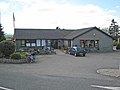 "Flora's cafe", Fiveways - geograph.org.uk - 840045.jpg 640 × 480; 55 KB
-
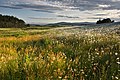 A field of flowers - geograph.org.uk - 1389946.jpg 640 × 428; 186 KB
-
-
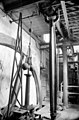 Beam engine, Garlogie - geograph.org.uk - 1045501.jpg 423 × 640; 68 KB
-
 Downstream from the Loch of Skene - geograph.org.uk - 1770116.jpg 640 × 480; 94 KB
-
 Garlogie cottage - geograph.org.uk - 588686.jpg 640 × 480; 192 KB
-
 Garlogie Mill Power House.jpg 640 × 480; 102 KB
-
 Gas Pipeline wayleave - geograph.org.uk - 12449.jpg 426 × 640; 199 KB
-
 Lane past Inverord Cottage - geograph.org.uk - 606959.jpg 640 × 480; 148 KB
-
 Leadside farmhouse - geograph.org.uk - 1770121.jpg 640 × 480; 77 KB
-
 Old farm implements - geograph.org.uk - 581361.jpg 640 × 480; 131 KB
-
 Old farming implements - geograph.org.uk - 588687.jpg 640 × 467; 195 KB
-
 Old milestone - geograph.org.uk - 582652.jpg 480 × 640; 131 KB
-
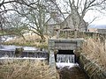
 The sluice at Garlogie Dam - geograph.org.uk - 521586.jpg 640 × 480; 225 KB
-

-
 Upper Dam, Milton of Garlogie - geograph.org.uk - 1770103.jpg 640 × 442; 108 KB
-
 View of Garlogie from Brewthin - geograph.org.uk - 586399.jpg 640 × 480; 89 KB
-
 View of the Dee - geograph.org.uk - 14074.jpg 640 × 480; 52 KB
-
 Weir and sluice - geograph.org.uk - 1770120.jpg 640 × 474; 86 KB
-
 A converted steading at Broomfield - geograph.org.uk - 581751.jpg 640 × 480; 102 KB
-
 A cottage at Broomfield - geograph.org.uk - 581749.jpg 640 × 480; 111 KB
-
 A cottage at Redhill - geograph.org.uk - 581614.jpg 640 × 480; 112 KB
-
 A pond close to Leuchar Moss - geograph.org.uk - 1088351.jpg 640 × 425; 94 KB
-
 A windbreak of trees - geograph.org.uk - 586416.jpg 640 × 480; 79 KB
-
 Access road to Netherton of Garlogie - geograph.org.uk - 1190691.jpg 640 × 480; 48 KB
-
 Access to Barnton - geograph.org.uk - 584982.jpg 640 × 480; 115 KB
-
 Access to Burrel'ley - geograph.org.uk - 1061124.jpg 640 × 519; 104 KB
-
 Access to Gask Quarry - geograph.org.uk - 1190730.jpg 640 × 480; 134 KB
-
 Access to Newhall - geograph.org.uk - 581740.jpg 640 × 480; 136 KB
-
 Access to Quiddies Mill farmhouse - geograph.org.uk - 582580.jpg 640 × 480; 84 KB
-
 Access to Schoolhill Cottage - geograph.org.uk - 584967.jpg 640 × 480; 38 KB
-
 Access to West Coldstream - geograph.org.uk - 586097.jpg 640 × 482; 65 KB
-
 An entrance to Garlogie Wood - geograph.org.uk - 1190604.jpg 640 × 480; 74 KB
-
 An intriguing wooded mound - geograph.org.uk - 586395.jpg 640 × 480; 96 KB
-
 Approach to Fiveways at Schoolhill - geograph.org.uk - 1061112.jpg 640 × 359; 48 KB
-
 Approach to Newleuchar - geograph.org.uk - 584991.jpg 640 × 470; 56 KB
-
 Baads Cottage, near Anguston - geograph.org.uk - 627901.jpg 627 × 470; 132 KB
-
 Barn at Brewthin - geograph.org.uk - 581600.jpg 640 × 466; 64 KB
-
 Barnton - geograph.org.uk - 581686.jpg 640 × 480; 104 KB
-
 Barnton farm - geograph.org.uk - 584983.jpg 640 × 480; 82 KB
-
 Barnton Farm - geograph.org.uk - 628061.jpg 627 × 470; 145 KB
-
 Benthoul Croft - geograph.org.uk - 630110.jpg 618 × 470; 118 KB
-
 Bog with sedge - geograph.org.uk - 613853.jpg 640 × 480; 84 KB
-
 Braigiewell - geograph.org.uk - 582622.jpg 640 × 480; 35 KB
-
 Braigiewell Farm - geograph.org.uk - 414274.jpg 640 × 480; 169 KB
-
 Braigiewell farm, Hill of Fare behind - geograph.org.uk - 729134.jpg 581 × 440; 171 KB
-
 Brewthin - geograph.org.uk - 586403.jpg 640 × 480; 90 KB
-
 Bridge near Quiddies Mill - geograph.org.uk - 582587.jpg 640 × 408; 76 KB
-
 Broadwater farm - geograph.org.uk - 606978.jpg 640 × 480; 114 KB
-
 Broomfield - geograph.org.uk - 366434.jpg 640 × 480; 91 KB
-
 Broomfield crossroads - geograph.org.uk - 581755.jpg 640 × 480; 63 KB
-
 Burnside - geograph.org.uk - 514647.jpg 640 × 480; 115 KB
-
 Burnside Cottage - geograph.org.uk - 514673.jpg 640 × 480; 115 KB
-
 Carnie - geograph.org.uk - 550269.jpg 640 × 480; 94 KB
-
 Cornhill cottsge - geograph.org.uk - 584979.jpg 640 × 480; 89 KB
-
 Corrichie Burn battle monument - geograph.org.uk - 258921.jpg 640 × 480; 132 KB
-
 Corrichie Burn battle monument - geograph.org.uk - 258922.jpg 640 × 640; 181 KB
-
 Corrichie Burn monument - geograph.org.uk - 258919.jpg 480 × 640; 104 KB
-
 Cottage by B9125 - geograph.org.uk - 586412.jpg 640 × 480; 130 KB
-
 Cottages at Garlogie - geograph.org.uk - 588668.jpg 640 × 480; 125 KB
-
 Cottages at Garlogie - geograph.org.uk - 588671.jpg 640 × 480; 115 KB
-
 Cottages at Garlogie - geograph.org.uk - 588674.jpg 640 × 480; 188 KB
-
 Cows with calfs, Braigiewell - geograph.org.uk - 729166.jpg 587 × 440; 150 KB
-
 Craigton Croft House - geograph.org.uk - 258931.jpg 575 × 640; 85 KB
-
 Craigton crossroads - geograph.org.uk - 305563.jpg 640 × 448; 77 KB
-
 Dogleg in road at Braigie - geograph.org.uk - 582630.jpg 640 × 459; 102 KB
-
 Domestic geese on pond at Brewthin - geograph.org.uk - 581603.jpg 640 × 480; 167 KB
-
 Double-bend - geograph.org.uk - 586387.jpg 640 × 480; 109 KB
-

-

-

-
 Dry stone walls at Little Finnercy - geograph.org.uk - 387874.jpg 640 × 461; 75 KB
-
 East Finnercy Farm - geograph.org.uk - 414197.jpg 541 × 288; 209 KB
-
 East Finnercy Farm - geograph.org.uk - 414311.jpg 640 × 480; 117 KB
-
 Easter Echt - geograph.org.uk - 514662.jpg 640 × 480; 117 KB
-
 Easter Echt Croft - geograph.org.uk - 514636.jpg 640 × 480; 118 KB
-
 Easterhill - geograph.org.uk - 584985.jpg 640 × 439; 68 KB
-
 Electricity pylons - geograph.org.uk - 582619.jpg 640 × 480; 67 KB
-
 Entrance to Broomfield - geograph.org.uk - 366441.jpg 640 × 480; 137 KB
-
 Entrance to Garlogie Mill - geograph.org.uk - 581356.jpg 640 × 480; 120 KB
-
 Entry to Green Farm, Raemoir - geograph.org.uk - 259697.jpg 640 × 412; 57 KB
-
 Fairy of the Pond - geograph.org.uk - 14073.jpg 480 × 640; 164 KB
-
 Gairloch - geograph.org.uk - 259665.jpg 640 × 442; 57 KB
-
 Garlogie dam - geograph.org.uk - 588675.jpg 640 × 480; 169 KB
-
 Garlogie hamlet - geograph.org.uk - 581376.jpg 640 × 480; 80 KB
-
 Garlogie to Hill of Fare - geograph.org.uk - 550284.jpg 640 × 480; 100 KB
-
 Garrick - geograph.org.uk - 582638.jpg 640 × 480; 108 KB
-
 Garrick Cottage - geograph.org.uk - 582644.jpg 640 × 480; 90 KB
-
 Garrick crossroads - geograph.org.uk - 582639.jpg 640 × 480; 79 KB
-
 Gas pipeline marker post - geograph.org.uk - 581691.jpg 480 × 640; 102 KB
-
 Gated cottage - geograph.org.uk - 258924.jpg 640 × 422; 56 KB
-
 Gated entrance to Garlogie House - geograph.org.uk - 581372.jpg 640 × 480; 172 KB
-
 Gateposts - geograph.org.uk - 514629.jpg 480 × 640; 114 KB
-
 Grey geese over Braigiewell - geograph.org.uk - 582627.jpg 640 × 480; 43 KB
-
 Hill of Braigie - geograph.org.uk - 414249.jpg 640 × 480; 147 KB
-
 Hirn junction on B977 - geograph.org.uk - 258927.jpg 640 × 417; 73 KB
-
 Hopeton - geograph.org.uk - 581683.jpg 640 × 480; 103 KB
-
 Hopton - geograph.org.uk - 581679.jpg 640 × 480; 92 KB
-
 Hopton Farm - geograph.org.uk - 628082.jpg 627 × 470; 121 KB
-
 Horsewells - geograph.org.uk - 585504.jpg 640 × 480; 107 KB
-
 Horsewells Cottage - geograph.org.uk - 588464.jpg 640 × 480; 177 KB
-
 Inverord Cottage - geograph.org.uk - 606969.jpg 640 × 480; 84 KB
-
 Lambs in a field near Hopton Farm - geograph.org.uk - 665655.jpg 531 × 540; 176 KB
-
 Leuchar Moss - geograph.org.uk - 581607.jpg 640 × 480; 96 KB
-
 Leuchar Moss - geograph.org.uk - 728899.jpg 567 × 425; 180 KB
-
 Leucharbrae, croft - geograph.org.uk - 671679.jpg 533 × 400; 85 KB
-
 Little and East Finnarcy - geograph.org.uk - 582609.jpg 640 × 511; 70 KB
-
 Loch of Skene - geograph.org.uk - 259667.jpg 640 × 480; 39 KB
-
 Lochan near Westerton - geograph.org.uk - 387837.jpg 640 × 395; 53 KB
-
 Looking across Leuchar Moss - geograph.org.uk - 32644.jpg 640 × 480; 89 KB
-
 Looking downstream Gormack Burn - geograph.org.uk - 582596.jpg 480 × 640; 139 KB
-
 Looking upstream Gormack Burn - geograph.org.uk - 582598.jpg 480 × 640; 146 KB
-
 Monrowan cottage - geograph.org.uk - 584988.jpg 640 × 468; 64 KB
-
 Monument to the Battle of Corrichie Burn - geograph.org.uk - 258915.jpg 480 × 640; 106 KB
-
 Mound with copse - geograph.org.uk - 305324.jpg 640 × 508; 75 KB
-
 Myreside lane - geograph.org.uk - 259700.jpg 640 × 451; 115 KB
-
 Nashick from B9119 - geograph.org.uk - 582662.jpg 640 × 480; 86 KB
-
 Newcroft - geograph.org.uk - 606953.jpg 640 × 480; 94 KB
-
 North Quartains - geograph.org.uk - 588470.jpg 640 × 480; 131 KB
-
 Northton - geograph.org.uk - 582601.jpg 640 × 480; 87 KB
-
 Northton plantation - geograph.org.uk - 586414.jpg 640 × 480; 92 KB
-
 Old schoolhouse by Couper's Road - geograph.org.uk - 582590.jpg 640 × 480; 81 KB
-
 Picnic area at Garlogie - geograph.org.uk - 30427.jpg 640 × 480; 132 KB
-
 Plough and stubble - geograph.org.uk - 586367.jpg 640 × 480; 57 KB
-
 Quartains - geograph.org.uk - 586080.jpg 640 × 443; 69 KB
-
 Quartains Moss - geograph.org.uk - 588482.jpg 640 × 480; 143 KB
-
 Quartains Moss - geograph.org.uk - 588496.jpg 640 × 480; 186 KB
-
 Redhill Croft - geograph.org.uk - 581617.jpg 640 × 480; 65 KB
-
 Road by Benthoul - geograph.org.uk - 585562.jpg 640 × 466; 72 KB
-
 Road by Knockquharn Cottages - geograph.org.uk - 514625.jpg 640 × 480; 71 KB
-
 Road from Quartains to Horsewells - geograph.org.uk - 586065.jpg 640 × 519; 46 KB
-
 Road junction near Scotstown - geograph.org.uk - 514644.jpg 412 × 557; 56 KB
-
 Road SSE from Horsewells - geograph.org.uk - 585514.jpg 480 × 640; 76 KB
-
 Road through Cairnie Woods - geograph.org.uk - 606985.jpg 640 × 480; 147 KB
-
 Road towards Anguston - geograph.org.uk - 585576.jpg 640 × 482; 65 KB
-
 Road towards Schoolhill - geograph.org.uk - 581692.jpg 640 × 480; 80 KB
-
 Road towards Strathburn - geograph.org.uk - 581689.jpg 480 × 640; 71 KB
-
 Rustic signpost^ - geograph.org.uk - 366463.jpg 640 × 640; 34 KB
-
 Schoolhill Cottage - geograph.org.uk - 584969.jpg 640 × 480; 42 KB
-
 Scotstown Farm - geograph.org.uk - 441751.jpg 640 × 480; 150 KB
-
 September Cottage - geograph.org.uk - 581620.jpg 640 × 507; 81 KB
-
 Springhill Standing Stone - geograph.org.uk - 257899.jpg 320 × 240; 11 KB
-
 St Duthac Cottage on B977 - geograph.org.uk - 258928.jpg 640 × 437; 79 KB
-
 St Duthac's Cottage - geograph.org.uk - 366612.jpg 640 × 480; 98 KB
-
 Standingstones farm - geograph.org.uk - 584987.jpg 640 × 480; 62 KB
-
 Standingstones Farm - geograph.org.uk - 630091.jpg 614 × 460; 189 KB
-
 Steading near East Finnarcy - geograph.org.uk - 582614.jpg 640 × 480; 110 KB
-
 Strathburn - geograph.org.uk - 581695.jpg 640 × 480; 114 KB
-
 T-junction by Horsewells - geograph.org.uk - 586071.jpg 640 × 447; 47 KB
-
 Templefold - geograph.org.uk - 584974.jpg 640 × 480; 87 KB
-
 The converted steading by Wickerinn - geograph.org.uk - 296925.jpg 640 × 480; 75 KB
-
 The former 'Raemoir Hotel' - geograph.org.uk - 253504.jpg 640 × 475; 93 KB
-
 The Leuchar Burn - geograph.org.uk - 588683.jpg 480 × 640; 175 KB
-

-

-
 The sluice at Garlogie Dam - geograph.org.uk - 588685.jpg 640 × 480; 199 KB
-
 Tidying Up Windblow - geograph.org.uk - 374930.jpg 640 × 512; 151 KB
-
 Track to Benthoul Farm - geograph.org.uk - 662120.jpg 475 × 633; 128 KB
-

-
 Track to Broadwater farm - geograph.org.uk - 606948.jpg 640 × 480; 105 KB
-
 Track to Cornhill Farm - geograph.org.uk - 628077.jpg 627 × 470; 119 KB
-
 Track to Easterhill - geograph.org.uk - 581687.jpg 640 × 480; 103 KB
-
 Track to Hopton - geograph.org.uk - 581682.jpg 640 × 480; 88 KB
-
 Track to Quartains Moss - geograph.org.uk - 584978.jpg 640 × 480; 99 KB
-
 Track west from Horsewells - geograph.org.uk - 585508.jpg 640 × 480; 72 KB
-
 Unidentified tower - geograph.org.uk - 366453.jpg 480 × 640; 79 KB
-
 View across sedge - geograph.org.uk - 387864.jpg 640 × 480; 123 KB
-
 View to woodland - geograph.org.uk - 32643.jpg 640 × 480; 92 KB
-
 View towards Finnercy lochan - geograph.org.uk - 387858.jpg 640 × 480; 113 KB
-
 West Cullerley - geograph.org.uk - 387765.jpg 640 × 449; 94 KB
-
 Westerton farm buildings - geograph.org.uk - 387848.jpg 640 × 480; 61 KB
-
 Who killed his dog^ - geograph.org.uk - 259698.jpg 640 × 400; 62 KB
-
 Wickerinn - geograph.org.uk - 296922.jpg 640 × 480; 49 KB


