Category:Galagayin fortress
Jump to navigation
Jump to search
former fortification in the Mugan district of Azerbaijan | |||||
| Upload media | |||||
| Instance of | |||||
|---|---|---|---|---|---|
| Location | Qalaqayın, Sabirabad District, Azerbaijan | ||||
| Located in or next to body of water | |||||
| Inception |
| ||||
| Dissolved, abolished or demolished date |
| ||||
| |||||
Media in category "Galagayin fortress"
The following 17 files are in this category, out of 17 total.
-
Attack Jawad.jpg 800 × 956; 338 KB
-
Attack to Khanate of Ardebil.jpg 1,450 × 2,020; 644 KB
-
Attack to khanate of Javad.jpg 800 × 956; 1,010 KB
-
Attack to Khanate of Karabakh.jpg 1,450 × 2,020; 1.49 MB
-
Cavad (Tzawat) və Qalaqayın (Cellan).png 992 × 1,245; 1.82 MB
-
Cavad xanlığı.1750.jpg 800 × 956; 135 KB
-
Cavad xanlığı.1768.jpg 800 × 956; 144 KB
-
Cavad xanlığı.1792.jpg 800 × 956; 130 KB
-
Cavad xanlığı.1796.jpg 800 × 956; 128 KB
-
Cavad xanlığı.jpg 800 × 956; 359 KB
-
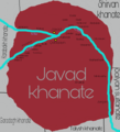
Javad khanate (eng).png 800 × 881; 228 KB
-
Javad khanate.png 800 × 881; 239 KB
-
Map - Special Collections University of Amsterdam - OTM- HB-KZL 31-08-29.tif 7,530 × 6,377; 137.38 MB
-
Maris Caspii (Reiner Ottens).jpg 1,583 × 1,355; 642 KB
-
Mugan mahalı.jpg 800 × 599; 218 KB
-
Mughan Mahal.jpg 970 × 728; 300 KB
-
Sagawat and Kellan forts.jpg 263 × 263; 70 KB


