Category:Fyvie
Jump to navigation
Jump to search
village in Aberdeenshire, Scotland, UK | |||||
| Upload media | |||||
| Instance of | |||||
|---|---|---|---|---|---|
| Location |
| ||||
 | |||||
Subcategories
This category has the following 4 subcategories, out of 4 total.
F
- Fyvie Castle (1 P, 72 F)
- Fyvie railway station (3 F)
G
- Gight Castle (8 F)
S
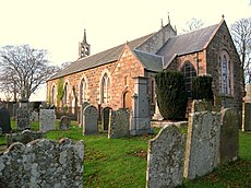
- St Peter's Church, Fyvie (11 F)
Media in category "Fyvie"
The following 95 files are in this category, out of 95 total.
-
Columbian silver fir at Fyvie Castle - geograph.org.uk - 691566.jpg 640 × 480; 116 KB
-
Fyvie Castle in early winter. - geograph.org.uk - 294690.jpg 640 × 471; 456 KB
-
JohnRichardWest4thEarldelaWarr.jpg 954 × 1,200; 143 KB
-
Ordnance Survey One-Inch Sheet 40 Inverurie & Ellon, Published 1929.jpg 12,108 × 9,393; 12.75 MB
-
Petty Farm - geograph.org.uk - 28569.jpg 640 × 480; 113 KB
-
Pig farming by Banks Farm. - geograph.org.uk - 308827.jpg 640 × 426; 110 KB
-
Rappla Standing Stone Aberdeenshire - geograph.org.uk - 757779.jpg 427 × 640; 42 KB
-
Rappla Standing Stone Aberdeenshire 2006 - geograph.org.uk - 757773.jpg 640 × 427; 107 KB
-
Rappla Standing Stone Aberdeenshire 2006 - geograph.org.uk - 757776.jpg 640 × 427; 111 KB
-
Rappla Woods Aberdeenshire 2006 - geograph.org.uk - 757782.jpg 640 × 427; 76 KB
-
Road at Den Wood - geograph.org.uk - 774298.jpg 640 × 480; 71 KB
-
Road to Fetterletter - geograph.org.uk - 774528.jpg 640 × 421; 57 KB
-
Seggat Farm Fields Cows - geograph.org.uk - 757769.jpg 640 × 427; 58 KB
-
View south at Greenmyre - geograph.org.uk - 774290.jpg 640 × 480; 86 KB
-
Woodside Croft Aberdeenshire 2006 - geograph.org.uk - 757767.jpg 640 × 427; 53 KB
-
A947 - geograph.org.uk - 562335.jpg 640 × 427; 250 KB
-
Airborne vermin assault the pig farmer. - geograph.org.uk - 308830.jpg 640 × 436; 109 KB
-
Autumn Loch Walk at Fyvie Castle - geograph.org.uk - 671675.jpg 640 × 480; 118 KB
-
Autumn view of the lake at Fyvie Castle - geograph.org.uk - 260505.jpg 640 × 480; 596 KB
-
Broadgreens Farm on the hilltop. - geograph.org.uk - 307127.jpg 640 × 426; 79 KB
-
Burnside of Gourdas Farm - geograph.org.uk - 688287.jpg 640 × 426; 88 KB
-
Cockersmyres Croft - geograph.org.uk - 765410.jpg 640 × 427; 105 KB
-
Cockhill Wood Aberdeenshire - geograph.org.uk - 765411.jpg 640 × 427; 89 KB
-
Cottage garden, Fyvie Castle - geograph.org.uk - 260501.jpg 640 × 480; 512 KB
-
Cottages at Blachrie - geograph.org.uk - 563205.jpg 640 × 427; 217 KB
-
Country road near Mill of Burns farm. - geograph.org.uk - 666209.jpg 640 × 426; 61 KB
-
Country road near Petty Farm - geograph.org.uk - 666206.jpg 640 × 426; 49 KB
-
Country road to Rothie Vale - geograph.org.uk - 666213.jpg 640 × 426; 115 KB
-
Country road to Rothie Vale - geograph.org.uk - 666214.jpg 640 × 426; 99 KB
-
Cranna farm - geograph.org.uk - 666211.jpg 640 × 426; 40 KB
-
Eastwards from South Crichie Lane. - geograph.org.uk - 308783.jpg 640 × 426; 82 KB
-
Farm road to Hill of Petty Farm - geograph.org.uk - 666208.jpg 640 × 426; 66 KB
-
Fishing Pond - geograph.org.uk - 562656.jpg 640 × 427; 265 KB
-
Fyvie Playpark - geograph.org.uk - 673051.jpg 640 × 480; 82 KB
-
Gourdas - geograph.org.uk - 562681.jpg 640 × 427; 286 KB
-
Gourdas - geograph.org.uk - 562693.jpg 640 × 427; 276 KB
-
Gourdas Farm - geograph.org.uk - 562689.jpg 640 × 367; 213 KB
-
In Den wood - geograph.org.uk - 774294.jpg 640 × 480; 143 KB
-
Inverythan - geograph.org.uk - 562631.jpg 640 × 427; 254 KB
-
Inverythan - geograph.org.uk - 562649.jpg 640 × 372; 186 KB
-
Ladenhar - geograph.org.uk - 666202.jpg 640 × 426; 82 KB
-
Little Gourdas - geograph.org.uk - 562695.jpg 640 × 427; 256 KB
-
Little Gourdas - geograph.org.uk - 562700.jpg 640 × 427; 236 KB
-
Little Gourdas - geograph.org.uk - 562704.jpg 640 × 427; 280 KB
-
Meikle Camaloun - geograph.org.uk - 562333.jpg 640 × 427; 267 KB
-
Meikle Camaloun - geograph.org.uk - 562338.jpg 640 × 427; 249 KB
-
Meikle Camaloun - geograph.org.uk - 562342.jpg 640 × 427; 241 KB
-
Mill of Burns Farm - geograph.org.uk - 666200.jpg 640 × 426; 55 KB
-
Mill of Burns Farm - geograph.org.uk - 666203.jpg 640 × 426; 85 KB
-
Minor road near Hill of Petty - geograph.org.uk - 666207.jpg 640 × 426; 52 KB
-
Minor road past Cowhill - geograph.org.uk - 666198.jpg 640 × 426; 62 KB
-
Minor road to Waulkmill - geograph.org.uk - 666210.jpg 640 × 426; 62 KB
-
North Blachrie - geograph.org.uk - 563177.jpg 640 × 427; 264 KB
-
North Blachrie - geograph.org.uk - 563182.jpg 640 × 427; 224 KB
-
North Flobbets Farm. - geograph.org.uk - 308768.jpg 640 × 426; 80 KB
-
North Steinmanhill - geograph.org.uk - 562673.jpg 640 × 427; 240 KB
-
North Steinmanhill - geograph.org.uk - 562675.jpg 640 × 427; 266 KB
-
Petty Farm - geograph.org.uk - 666204.jpg 640 × 426; 63 KB
-
Riffin - geograph.org.uk - 562669.jpg 640 × 427; 244 KB
-
Road past Waulkmill farm - geograph.org.uk - 666212.jpg 640 × 426; 75 KB
-
Rodshill towards Fyvie - geograph.org.uk - 672651.jpg 640 × 480; 37 KB
-
Rodshill towards Monkshill-Darnabo - geograph.org.uk - 672658.jpg 640 × 325; 26 KB
-
Sheep, pasture and gate at Fyvie Castle - geograph.org.uk - 691615.jpg 640 × 507; 173 KB
-
Slack o' Causeway - geograph.org.uk - 562662.jpg 427 × 640; 272 KB
-
South Crichie Farm straight ahead. - geograph.org.uk - 308776.jpg 640 × 426; 86 KB
-
Springleys - geograph.org.uk - 666199.jpg 640 × 426; 80 KB
-
Steinman Hill - geograph.org.uk - 562682.jpg 640 × 427; 242 KB
-
Steinman Hill at Blachrie - geograph.org.uk - 563198.jpg 640 × 427; 248 KB
-
Steinmanhill - geograph.org.uk - 562677.jpg 640 × 427; 259 KB
-
Sunset from Hillhead Fyvie - geograph.org.uk - 671944.jpg 640 × 630; 34 KB
-
The lane to Blackburn Croft. - geograph.org.uk - 308824.jpg 640 × 416; 85 KB
-
The lane to Nether Kirkton. - geograph.org.uk - 308759.jpg 640 × 426; 76 KB
-
The lane to South Flobbets. - geograph.org.uk - 308763.jpg 640 × 426; 125 KB
-
Track to Cairn Hill - geograph.org.uk - 666205.jpg 640 × 426; 77 KB
-
Vale Hotel - geograph.org.uk - 28566.jpg 640 × 480; 113 KB
-
£1m to preserve memory of Scotland's war dead (8383638758).jpg 1,920 × 1,080; 1.47 MB
-
£1m to preserve memory of Scotland's war dead (8383638896).jpg 1,920 × 1,080; 1.21 MB


