Category:Funtington
Jump to navigation
Jump to search
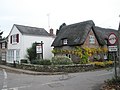
English: Funtington is a village and civil parish in the Chichester district of West Sussex, England. It lies on the B2146 Road 4.5 miles (7.2 km) west of Chichester. The parish also contains the villages of East and West Ashling, West Stoke and the Kingley Vale National Nature Reserve lies at its northern tip. There is a village store with a post office, a farm produce shop and a pub at the centre of the village. Funtington Primary School is in the village of West Ashling.
village in West Sussex, United Kingdom  | |||||
| Upload media | |||||
| Instance of | |||||
|---|---|---|---|---|---|
| Location | Chichester, West Sussex, South East England, England | ||||
| Population |
| ||||
| Area |
| ||||
 | |||||
Subcategories
This category has the following 8 subcategories, out of 8 total.
E
- East Ashling (15 F)
F
- Funtington Hall (4 F)
H
- Home Cottages The Forge (4 F)
S
- St Mary's Church, Sennicotts (12 F)
W
Media in category "Funtington"
The following 200 files are in this category, out of 370 total.
(previous page) (next page)-
 2016, a year on Geograph (Day 22) - geograph.org.uk - 4801475.jpg 640 × 480; 42 KB
-
 2016, a year on Geograph (Day 277) - geograph.org.uk - 5145183.jpg 640 × 480; 70 KB
-
 A fenced in West Ashling Road - geograph.org.uk - 3264135.jpg 4,000 × 3,000; 3.48 MB
-
 A field island of trees - geograph.org.uk - 3138301.jpg 640 × 480; 112 KB
-
 A swing in the woods - geograph.org.uk - 3733565.jpg 800 × 600; 254 KB
-
 A27 looking east - geograph.org.uk - 3120139.jpg 640 × 480; 95 KB
-
 A27, eastbound - geograph.org.uk - 3674037.jpg 640 × 430; 40 KB
-
 A27, eastbound - geograph.org.uk - 6538498.jpg 1,024 × 681; 78 KB
-
 A27, westbound - geograph.org.uk - 3180913.jpg 640 × 430; 37 KB
-
 Adsdean Farm - geograph.org.uk - 3733545.jpg 800 × 600; 163 KB
-
 Adsdean House - geograph.org.uk - 4125617.jpg 640 × 480; 119 KB
-
 Agriculture, Funtington - geograph.org.uk - 4125746.jpg 640 × 480; 148 KB
-
 Agriculture, Funtington - geograph.org.uk - 4125778.jpg 640 × 480; 135 KB
-
 Agriculture, Funtington - geograph.org.uk - 4125820.jpg 640 × 480; 122 KB
-

-
 Approaching Kingley Vale from the south - geograph.org.uk - 6699657.jpg 3,362 × 1,891; 991 KB
-

-
 Ash tree on parish boundary - geograph.org.uk - 3120192.jpg 640 × 480; 116 KB
-
 Ashling Lodge, Moutheys Lane - geograph.org.uk - 2812009.jpg 2,048 × 1,536; 706 KB
-
 Ashling Wood - geograph.org.uk - 3138444.jpg 640 × 480; 189 KB
-
 Ashling Wood - geograph.org.uk - 5363232.jpg 4,000 × 3,000; 4.89 MB
-
 Ashling Wood - geograph.org.uk - 5363235.jpg 4,000 × 3,000; 4.85 MB
-
 B2146 at Woodend junction - geograph.org.uk - 3120751.jpg 640 × 480; 65 KB
-
 B2146 Bridge, A27 - geograph.org.uk - 2862746.jpg 640 × 430; 40 KB
-
 B2146 east of Funtington - geograph.org.uk - 3120742.jpg 640 × 480; 62 KB
-
 B2178 (Old Broyle Road) - geograph.org.uk - 3971457.jpg 1,536 × 1,152; 1.31 MB
-
 B2178 near Oakwood Park - geograph.org.uk - 3120769.jpg 640 × 480; 117 KB
-
 B2178 near Sennicotts - geograph.org.uk - 3120778.jpg 640 × 480; 138 KB
-
 B2178-Lye Lane junction - geograph.org.uk - 3120764.jpg 640 × 480; 124 KB
-
 Beech trees in Hounsom Firs - geograph.org.uk - 3248709.jpg 4,000 × 3,000; 3.49 MB
-
 Bell tower on house on Downs Road - geograph.org.uk - 3263232.jpg 4,000 × 3,000; 3.44 MB
-
 Bend in bridleway - geograph.org.uk - 3732650.jpg 800 × 600; 148 KB
-

-
 Bend in Watery Lane - geograph.org.uk - 1045799.jpg 640 × 480; 70 KB
-
 Beware of electricity - geograph.org.uk - 2811990.jpg 2,048 × 1,536; 710 KB
-
 Bosham Stream - geograph.org.uk - 2811933.jpg 2,048 × 1,536; 692 KB
-

-
 Bosham Stream with egret and ducks - geograph.org.uk - 3733456.jpg 800 × 600; 158 KB
-
 Bridge carrying B1246 over A27 at Broadbridge - geograph.org.uk - 3570037.jpg 1,024 × 768; 155 KB
-

-
 Bridleway 468 - geograph.org.uk - 3138355.jpg 640 × 480; 137 KB
-
 Bridleway 483 joining the lane to Adsdean Farm - geograph.org.uk - 3249780.jpg 4,000 × 3,000; 3.39 MB
-
 Bridleway alongside Stoke Clump - geograph.org.uk - 5101727.jpg 1,024 × 730; 166 KB
-
 Bridleway approaching Stoke Clump - geograph.org.uk - 3248502.jpg 4,000 × 3,000; 3.44 MB
-
 Bridleway beside Kingley Vale NNR - geograph.org.uk - 3776847.jpg 800 × 600; 174 KB
-
 Bridleway bordering Kingley Vale Reserve - geograph.org.uk - 3248561.jpg 4,000 × 3,000; 3.41 MB
-
 Bridleway by Stoke Clump - geograph.org.uk - 3766326.jpg 800 × 600; 232 KB
-
 Bridleway descends towards sunshine - geograph.org.uk - 3733573.jpg 800 × 600; 238 KB
-
 Bridleway going north from Downs Road - geograph.org.uk - 3732618.jpg 800 × 781; 169 KB
-

-
 Bridleway going south from Common Road - geograph.org.uk - 2853641.jpg 1,024 × 768; 107 KB
-

-
 Bridleway near Stoke Clump - geograph.org.uk - 4999727.jpg 1,024 × 768; 241 KB
-
 Bridleway on East Plantation - geograph.org.uk - 3733562.jpg 800 × 600; 239 KB
-
 Bridleway reaches Downs Road - geograph.org.uk - 3732653.jpg 800 × 600; 136 KB
-
 Bridleway south off Hares Lane - geograph.org.uk - 3249789.jpg 4,000 × 3,000; 3.62 MB
-
 Bridleway south to West Ashling Road - geograph.org.uk - 3264099.jpg 4,000 × 3,000; 4.11 MB
-
 Bridleway through East Plantation - geograph.org.uk - 3733552.jpg 800 × 600; 209 KB
-

-
 Bridleway to Ashling Wood - geograph.org.uk - 3263400.jpg 4,000 × 3,000; 3.51 MB
-
 Bridleway to Welldown - geograph.org.uk - 4999719.jpg 1,024 × 768; 362 KB
-
 Bridleway to Welldown - geograph.org.uk - 5103084.jpg 1,024 × 768; 323 KB
-
 Bridleway to West Stoke - geograph.org.uk - 4999739.jpg 1,024 × 768; 210 KB
-
 Bridleways west of Kingley Vale NNR - geograph.org.uk - 3776839.jpg 800 × 600; 245 KB
-
 Brooks Lane leaving the B2146 - geograph.org.uk - 2853826.jpg 1,024 × 768; 199 KB
-
 Brownhill Lane (bridleway) - geograph.org.uk - 3263256.jpg 4,000 × 3,000; 3.69 MB
-
 Brownhill Lane passes through trees - geograph.org.uk - 3733437.jpg 800 × 600; 242 KB
-
 Byway at Well House - geograph.org.uk - 2812335.jpg 1,024 × 716; 292 KB
-

-
 Chalk Pit Barn - geograph.org.uk - 4125655.jpg 640 × 480; 114 KB
-
 Chapel Lane (track) - geograph.org.uk - 3266692.jpg 4,000 × 3,000; 3.42 MB
-
 Chapel Lane (track) near West Stoke Road - geograph.org.uk - 3266704.jpg 4,000 × 3,000; 3.56 MB
-
 Chichester District , West Sussex Scenery - geograph.org.uk - 3106929.jpg 3,216 × 2,136; 2.42 MB
-
 Chichester from Kingley Vale - geograph.org.uk - 1503632.jpg 640 × 457; 227 KB
-
 Church Lane in Funtington - geograph.org.uk - 2853651.jpg 1,024 × 768; 226 KB
-
 Clay Lane approaching its bridge over the A27 - geograph.org.uk - 3286657.jpg 4,000 × 3,000; 3.55 MB
-
 Clay Lane nearing Double Barn - geograph.org.uk - 3286673.jpg 4,000 × 3,000; 3.47 MB
-
 Common Road looking west - geograph.org.uk - 2853644.jpg 1,024 × 768; 187 KB
-
 Communications mast on Clay Lane - geograph.org.uk - 3286662.jpg 4,000 × 3,000; 3.48 MB
-
 Conifers by Downs Road - geograph.org.uk - 3263291.jpg 4,000 × 3,000; 3.53 MB
-
 Cottages on the B2146 at Funtington - geograph.org.uk - 3263425.jpg 4,000 × 3,000; 3.37 MB
-

-

-
 Dead tree near Salthill Road - geograph.org.uk - 3141092.jpg 640 × 480; 102 KB
-

-
 Direction Sign – Signpost - geograph.org.uk - 6539324.jpg 780 × 585; 252 KB
-
 Double Barn on Clay Lane - geograph.org.uk - 2754363.jpg 1,024 × 768; 159 KB
-
 Down Street approaching the B2146 in West Ashling - geograph.org.uk - 3265855.jpg 4,000 × 3,000; 3.56 MB
-
 Downhill on bridleway 483 - geograph.org.uk - 4125519.jpg 640 × 480; 162 KB
-
 Downhill on bridleway 483 - geograph.org.uk - 4125557.jpg 640 × 480; 186 KB
-
 Downs Road looking west from Woodend - geograph.org.uk - 3732657.jpg 800 × 600; 166 KB
-
 Drain near Bosham Brook - geograph.org.uk - 4756061.jpg 640 × 328; 33 KB
-
 Dropping into Kingley Vale - geograph.org.uk - 5101856.jpg 1,024 × 768; 201 KB
-
 Dwellings on Mill Road - geograph.org.uk - 2853692.jpg 1,024 × 768; 204 KB
-
 East Ashling - the Time Machine - geograph.org.uk - 3971416.jpg 1,536 × 1,152; 978 KB
-
 Edith Cottages on the edge of West Ashling - geograph.org.uk - 3264243.jpg 4,000 × 3,000; 3.47 MB
-
 Entrance to an orchard - geograph.org.uk - 5103047.jpg 1,024 × 768; 182 KB
-
 Entrance to Bowhill - geograph.org.uk - 4999703.jpg 1,024 × 768; 266 KB
-
 Entrance to MoD premises on Common Road - geograph.org.uk - 2853639.jpg 1,024 × 768; 155 KB
-
 Entrance to Stanes Farm on Hares lane - geograph.org.uk - 3249784.jpg 4,000 × 3,000; 3.57 MB
-
 Entrance to Stockers and Tumbledown Farms - geograph.org.uk - 658548.jpg 640 × 480; 136 KB
-
 Farm bridge over the Bosham Stream - geograph.org.uk - 3288061.jpg 4,000 × 3,000; 3.43 MB
-
 Farm land on the edge of Hounsom Firs - geograph.org.uk - 3248684.jpg 4,000 × 3,000; 3.51 MB
-
 Farmland by Newell's Lane - geograph.org.uk - 6560570.jpg 3,968 × 2,232; 1.76 MB
-
 Field and woods - geograph.org.uk - 4125442.jpg 640 × 480; 119 KB
-
 Field edge on Funtington Down - geograph.org.uk - 4125575.jpg 640 × 480; 121 KB
-
 Field entrance and boundary by bridleway - geograph.org.uk - 3732643.jpg 665 × 800; 201 KB
-
 Field near Stoke Clump - geograph.org.uk - 3765986.jpg 800 × 600; 112 KB
-
 Field of an unusual cereal crop - geograph.org.uk - 3120162.jpg 640 × 480; 148 KB
-
 Field of Millet - geograph.org.uk - 3121043.jpg 640 × 480; 163 KB
-
 Field on the edge of Funtington Plantation - geograph.org.uk - 3249687.jpg 4,000 × 3,000; 3.47 MB
-
 Field to the west of Lye Lane - geograph.org.uk - 3266678.jpg 4,000 × 3,000; 3.49 MB
-

-
 Field with stripes - geograph.org.uk - 4125404.jpg 640 × 480; 121 KB
-
 Field, wall and shed - geograph.org.uk - 4999710.jpg 1,024 × 768; 156 KB
-
 Fields south of Adsdean Farm - geograph.org.uk - 3733505.jpg 800 × 600; 200 KB
-

-
 Fishbourne Harbour, aerial 2017 - geograph.org.uk - 5441679.jpg 800 × 533; 71 KB
-
 Footpath 264 - geograph.org.uk - 2811906.jpg 2,048 × 1,536; 706 KB
-
 Footpath 266 - geograph.org.uk - 2811982.jpg 2,048 × 1,536; 700 KB
-
 Footpath 268 - geograph.org.uk - 2812832.jpg 2,048 × 1,536; 687 KB
-
 Footpath 268 adjacent to free range pig shelters - geograph.org.uk - 2813489.jpg 2,048 × 1,536; 670 KB
-
 Footpath from Funtington to West Ashling - geograph.org.uk - 4125911.jpg 640 × 480; 117 KB
-

-
 Footpath from West to East Ashling - geograph.org.uk - 4126217.jpg 640 × 480; 114 KB
-
 Footpath in Ashling Wood - geograph.org.uk - 5333765.jpg 1,600 × 1,200; 1.13 MB
-
 Footpath in Stoke Wood - geograph.org.uk - 5333769.jpg 1,600 × 1,200; 1.29 MB
-

-
 Footpath junction on Southbrook Road - geograph.org.uk - 3733468.jpg 800 × 600; 190 KB
-

-
 Footpath on Stoke Down - geograph.org.uk - 4624812.jpg 1,600 × 1,200; 1.37 MB
-
 Footpath to Kingley Vale from the car park - geograph.org.uk - 4624155.jpg 1,200 × 1,600; 1.82 MB
-
 Footpath to Southbrook Road - geograph.org.uk - 4126115.jpg 640 × 480; 158 KB
-
 Footpath to West Ashling - geograph.org.uk - 3138438.jpg 640 × 480; 126 KB
-
 Forestry track, West Copse woodland - geograph.org.uk - 4624171.jpg 1,200 × 1,600; 1.95 MB
-
 Fork in tracks on Stoke Down - geograph.org.uk - 4624229.jpg 1,600 × 1,200; 1.39 MB
-
 Former cartshed - geograph.org.uk - 5101709.jpg 1,024 × 768; 209 KB
-
 Former outbuildings, Woodend - geograph.org.uk - 5103077.jpg 1,024 × 768; 245 KB
-
 Free range pig farm - geograph.org.uk - 2813496.jpg 2,048 × 1,536; 674 KB
-
 Fungi at bridleway junction in the woods - geograph.org.uk - 3776825.jpg 800 × 600; 227 KB
-
 Funtington - Barn Belongingto The Grange To The North Of The House - 20220929185356.jpg 4,896 × 3,672; 8.97 MB
-
 Funtington - Funtington House - 20220929190503.jpg 4,896 × 3,672; 7.38 MB
-
 Funtington - geograph.org.uk - 1129278.jpg 640 × 480; 78 KB
-
 Funtington - Hallidays - 20220929190614.jpg 4,896 × 3,672; 8.3 MB
-
 Funtington - Rookery Farmhouse - 20220929185330.jpg 4,896 × 3,672; 7.68 MB
-
 Funtington - The Grange - 20220929185426.jpg 4,896 × 3,672; 5.8 MB
-
 Funtington - The Grange - 20220929185614.jpg 4,896 × 3,672; 8.8 MB
-
 Funtington - Yew Tree Cottage And Christmas Cottage - 20220929190308.jpg 4,896 × 3,672; 7.07 MB
-
 Funtington entrance sign - geograph.org.uk - 2448772.jpg 640 × 468; 56 KB
-
 Funtington Post Office - geograph.org.uk - 1045846.jpg 640 × 480; 47 KB
-
 Funtington starts here - geograph.org.uk - 1129267.jpg 640 × 470; 59 KB
-

-
 Gallops near Funtingdon - geograph.org.uk - 3263409.jpg 3,512 × 2,681; 2.35 MB
-
 Gate into West Copse - geograph.org.uk - 4125391.jpg 640 × 480; 194 KB
-
 Gateways at The Sun House on Lye Lane - geograph.org.uk - 2754422.jpg 1,024 × 768; 315 KB
-
 Green Field Lane - geograph.org.uk - 2853686.jpg 1,024 × 768; 309 KB
-
 Hall on the B2146 east of Funtington - geograph.org.uk - 1129287.jpg 640 × 480; 84 KB
-
 Hallidays Restaurant in Watery Lane - geograph.org.uk - 1045808.jpg 640 × 480; 67 KB
-
 Hallidays Restaurant on the B2146 - geograph.org.uk - 1045824.jpg 640 × 480; 48 KB
-
 Hambrook, aerial 2017 - geograph.org.uk - 5443396.jpg 800 × 533; 92 KB
-
 Hares Lane at Adsdean turn - geograph.org.uk - 3120728.jpg 640 × 480; 88 KB
-
 Hares Lane looking east - geograph.org.uk - 3120709.jpg 640 × 480; 137 KB
-
 Hares Lane, with turning to Adsdean - geograph.org.uk - 3983246.jpg 1,536 × 1,152; 985 KB
-

-

-
 Heavy duty tower on MOD property - geograph.org.uk - 3264157.jpg 4,000 × 3,000; 3.49 MB
-
 Hedge and Field towards West Copse - geograph.org.uk - 5333778.jpg 1,600 × 1,200; 929 KB
-
 Hedge laying on Downs Road - geograph.org.uk - 3263175.jpg 4,000 × 3,000; 3.41 MB
-
 Hide in West Copse - geograph.org.uk - 4125420.jpg 640 × 480; 181 KB
-
 Horse chestnut in flower, Funtington - geograph.org.uk - 3971380.jpg 1,536 × 1,152; 1.17 MB
-
 Horse chestnut near Coopersfield - geograph.org.uk - 3971401.jpg 1,536 × 1,152; 1.41 MB
-
 Hounsom Firs plantation south of Stoughton - geograph.org.uk - 6623219.jpg 1,067 × 1,600; 587 KB
-

-

-
 Junction of Downs Road and West Stoke Road - geograph.org.uk - 2754450.jpg 1,024 × 768; 203 KB
-

-
-

-

-
 Kissing gate on path at Kingley Vale - geograph.org.uk - 4626038.jpg 1,600 × 1,200; 1.79 MB
-
 Knapp Copse off Clay Lane - geograph.org.uk - 3286668.jpg 4,000 × 3,000; 3.37 MB
-
 Landfill Site, Adsdean Park - geograph.org.uk - 220722.jpg 640 × 479; 112 KB
-
 Lane called Woodend - geograph.org.uk - 3263310.jpg 4,000 × 3,000; 3.34 MB
-
 Lane to Chalk Pit Barn only - geograph.org.uk - 4125702.jpg 640 × 480; 182 KB
-
 Large field near Broadbridge - geograph.org.uk - 6488839.jpg 1,024 × 597; 78 KB
-
 Large Oak by the start of bridleway 260 - geograph.org.uk - 3355554.jpg 4,320 × 3,240; 4.71 MB
-

-
 Looking along Lye Lane - geograph.org.uk - 3766330.jpg 800 × 600; 160 KB
-
 Looking down Stoke Down - geograph.org.uk - 4624191.jpg 1,600 × 1,200; 1.29 MB
-
 Looking down Stoke Down to West Copse woods - geograph.org.uk - 4624179.jpg 1,600 × 1,200; 1.55 MB
-

-
 Looking northwards up Church Lane - geograph.org.uk - 1045780.jpg 480 × 640; 50 KB
-
 Looking northwards up Five Acres - geograph.org.uk - 1045837.jpg 640 × 480; 79 KB
-
 Looking south on Lye Lane - geograph.org.uk - 2754428.jpg 1,024 × 768; 251 KB
-

-
 Looking towards stile on footpath 268 - geograph.org.uk - 2813474.jpg 2,048 × 1,536; 696 KB
-

-
 Looking west on path 268 - geograph.org.uk - 2812860.jpg 2,048 × 1,536; 689 KB
-

-
 Looking west to bend on Southbrook Road - geograph.org.uk - 3733478.jpg 800 × 600; 125 KB
_-_geograph.org.uk_-_4801475.jpg)
_-_geograph.org.uk_-_5145183.jpg)


_-_geograph.org.uk_-_3971457.jpg)


_-_geograph.org.uk_-_3263256.jpg)


_-_geograph.org.uk_-_3266692.jpg)
_near_West_Stoke_Road_-_geograph.org.uk_-_3266704.jpg)


_and_West_Ashling_Road_-_geograph.org.uk_-_2852783.jpg)


