Category:Fulham
Jump to navigation
Jump to search
area in the London Borough of Hammersmith and Fulham | |||||
| Upload media | |||||
| Instance of | |||||
|---|---|---|---|---|---|
| Location |
| ||||
 | |||||
Subcategories
This category has the following 42 subcategories, out of 42 total.
A
- April Ashley (10 F)
B
- Brandenburgh House (5 F)
- Broom Villa, Fulham (8 F)
C
D
- Dwight House, Fulham (11 F)
F
- Fulham Fire Station (13 F)
- Fulham Railway Bridge (81 F)
- Fulham Refuge (1 F)
- Fulham Town Hall (12 F)
- Fulham War Memorial (51 F)
- St John's church, Fulham (17 F)
L
- Lady Margaret School (18 F)
M
N
P
- Putney Bridge Approach (5 F)
S
- South Park, Fulham (13 F)
- St Dionis Mission Hall (9 F)
- St Dionis Vicarage (4 F)
T
- The Glass House, Fulham (7 F)
- Townmead Road (15 F)
V
- Vine and Bell Cottage (9 F)
- The Vineyard, Fulham (8 F)
W
Media in category "Fulham"
The following 200 files are in this category, out of 334 total.
(previous page) (next page)-
14 Empress Place, Fulham, London SW6 1TT, known formerly as 12, Richmond Gardens, Fulham.jpg 2,708 × 2,031; 1.44 MB
-
17 Jerdan Place, Fulham, London - panoramio.jpg 3,648 × 2,048; 1.86 MB
-
Brayley(1820) p5.025 - Brandenburgh House and Theatre, Middlesex.jpg 2,192 × 1,400; 1.04 MB
-
Image taken from page 1124 of 'Old and New London, etc' (11187495526).jpg 1,892 × 1,593; 1.17 MB
-
Image taken from page 1131 of 'Old and New London, etc' (11188947125).jpg 1,892 × 2,817; 2 MB
-
2010-01-31 Fulham Wharf Urbex 01.jpg 4,189 × 2,759; 2.8 MB
-
2010-01-31 Fulham Wharf Urbex 02.jpg 1,936 × 3,438; 1.55 MB
-
2010-01-31 Fulham Wharf Urbex 03.jpg 2,248 × 4,737; 2.48 MB
-
2010-01-31 Fulham Wharf Urbex 04.jpg 3,928 × 2,667; 2.35 MB
-
2010-01-31 Fulham Wharf Urbex 05.jpg 3,624 × 1,985; 1.21 MB
-
2010-01-31 Fulham Wharf Urbex 06.jpg 4,770 × 3,178; 4.73 MB
-
2010-01-31 Fulham Wharf Urbex 07.jpg 3,380 × 3,178; 2.38 MB
-
2010-01-31 Fulham Wharf Urbex 08.jpg 3,178 × 4,770; 3.73 MB
-
2010-01-31 Fulham Wharf Urbex 09.jpg 2,975 × 3,773; 2.2 MB
-
2010-01-31 Fulham Wharf Urbex 10.jpg 4,770 × 3,178; 4.4 MB
-
2010-01-31 Fulham Wharf Urbex 11.jpg 4,091 × 3,178; 3.87 MB
-
2010-01-31 Fulham Wharf Urbex 12.jpg 4,770 × 3,178; 5.19 MB
-
5 Regal Centre, 402 North End Road Fulham - panoramio.jpg 3,648 × 2,048; 2.07 MB
-
562 King's Road Fulham (15212389496).jpg 1,280 × 908; 760 KB
-
A Fulham corner shop - geograph.org.uk - 2594696.jpg 640 × 480; 71 KB
-
A grand entrance.jpg 1,728 × 2,592; 1.13 MB
-
A217 - geograph.org.uk - 3522620.jpg 640 × 438; 85 KB
-
A3219, Fulham - geograph.org.uk - 3522641.jpg 640 × 408; 75 KB
-
A3219, Fulham - geograph.org.uk - 3522650.jpg 640 × 413; 52 KB
-
Albion Aquilifer Roman Gladius 2 (6094182150).jpg 3,072 × 2,048; 1.34 MB
-
Albion Augustus Roman Gladius 1 (6094195448).jpg 4,080 × 5,440; 6.29 MB
-
Albion Augustus Roman Gladius 2 (6094198768).jpg 5,440 × 4,080; 4.3 MB
-
Albion Auxilia Roman Spatha 1 (6094320620).jpg 4,080 × 5,440; 5.82 MB
-
Albion Auxilia Roman Spatha 2 (6094324144).jpg 5,440 × 4,080; 4.97 MB
-
Albion Pedite Roman Gladius 1 (6094245944).jpg 4,080 × 5,440; 6.37 MB
-
Albion Pedite Roman Gladius 2 (6093710695).jpg 5,440 × 4,080; 3.66 MB
-
Albion Pedite Roman Gladius 3 (6093714817).jpg 4,080 × 5,440; 6.19 MB
-
Albion Tiberius Roman Gladius 1 (6094258294).jpg 5,440 × 4,080; 4.2 MB
-
Albion Tiberius Roman Gladius 2 (6094267322).jpg 4,080 × 5,440; 8.55 MB
-
Albion Tiberius Roman Gladius 3 (6094272586).jpg 4,080 × 5,440; 7.45 MB
-
Albion Tiberius Roman Gladius 4 (6093739687).jpg 4,080 × 5,440; 6.83 MB
-
Albion Trajan Roman Gladius 1 (6092245739).jpg 4,080 × 5,440; 5.98 MB
-
Albion Trajan Roman Gladius 2 (6092788180).jpg 5,056 × 3,791; 6.79 MB
-
Albion Trajan Roman Gladius 3 (6092243141).jpg 5,270 × 3,952; 4.45 MB
-
Albion Trajan Roman Gladius 4 (6092780684).jpg 4,080 × 5,440; 4.38 MB
-
Albion Trajan Roman Gladius 5 (6092778712).jpg 4,080 × 5,440; 4.95 MB
-
Ambulance rushing Fulham.jpg 4,000 × 2,248; 5.59 MB
-
Apartment block, Fulham - geograph.org.uk - 2623103.jpg 680 × 1,024; 162 KB
-
Apartments at Fulham - geograph.org.uk - 2623102.jpg 680 × 1,024; 163 KB
-
Architect John Young's corner building in Richmond Place, Fulham 1868.jpg 7,459 × 11,112; 29.1 MB
-
Atalanta Road, Fulham - geograph.org.uk - 5966077.jpg 1,600 × 1,200; 277 KB
-
Atlas, Earls Court, SW6 (5307041598).jpg 2,736 × 3,648; 4.25 MB
-
Avalon Road, Fulham - geograph.org.uk - 4585544.jpg 2,272 × 1,704; 977 KB
-
Barclay Road, Fulham Broadway - geograph.org.uk - 3423986.jpg 4,288 × 3,216; 6.83 MB
-
Barn Elms Boathouse (geograph 2108959).jpg 640 × 430; 131 KB
-
Bishops Park Road, Fulham - geograph.org.uk - 3071857.jpg 640 × 480; 88 KB
-
Black Sheep Coffee Fulham Broadway (1).jpg 4,000 × 2,248; 4.73 MB
-
Black Sheep Coffee Fulham Broadway (2).jpg 4,000 × 2,248; 5.68 MB
-
Bowfell Road - geograph.org.uk - 4348159.jpg 683 × 1,024; 207 KB
-
Bowfell Road - geograph.org.uk - 4348160.jpg 1,024 × 768; 170 KB
-
Bramber Road - geograph.org.uk - 4466712.jpg 1,600 × 1,200; 865 KB
-
Bramber Road - geograph.org.uk - 4466713.jpg 1,600 × 1,200; 826 KB
-
Britannia Road, Fulham - geograph.org.uk - 4585538.jpg 2,272 × 1,704; 792 KB
-
Bronsart Road, Fulham - geograph.org.uk - 5964613.jpg 1,600 × 1,200; 313 KB
-
C S Rolls' car showroom, Lillie Hall, Fulham, London, 1903.jpg 500 × 386; 75 KB
-
Chelsea - panoramio (2).jpg 3,648 × 2,048; 2.05 MB
-
Chelsea Wall - panoramio (2).jpg 3,648 × 2,048; 2.15 MB
-
Chelsea Wall - panoramio.jpg 3,648 × 2,048; 2.13 MB
-
Chipstead Street, Fulham - geograph.org.uk - 4585564.jpg 2,272 × 1,704; 961 KB
-
Corbett & McClymontt's 1870 Wood Workshop, Seagrave Road Fulham.jpg 1,544 × 1,024; 325 KB
-
Cote Brasserie, Parsons Green, SW6 (5306892752).jpg 3,776 × 2,520; 3.24 MB
-
Dancer Road - geograph.org.uk - 4422797.jpg 1,440 × 1,080; 478 KB
-
Dawes Road, London SW6 - geograph.org.uk - 2509365.jpg 4,320 × 3,240; 4.22 MB
-
Eccentric cyclist Fulham.jpg 4,000 × 2,248; 5.32 MB
-
Eddiscombe Road, Fulham - geograph.org.uk - 4585589.jpg 2,272 × 1,704; 929 KB
-
Edenhurst Avenue - geograph.org.uk - 5276555.jpg 640 × 426; 83 KB
-
Ellerby Street - geograph.org.uk - 4374460.jpg 4,239 × 3,434; 1.78 MB
-
Empress Hall, Fulham 1937.jpg 100 × 78; 3 KB
-
Empress Place Fulham.jpg 1,544 × 1,024; 339 KB
-
Epple Road, Fulham - geograph.org.uk - 4585616.jpg 2,272 × 1,704; 822 KB
-
Epple Road, Fulham - geograph.org.uk - 4679941.jpg 4,000 × 2,664; 1.73 MB
-
Fiddes-Aldrige Stoking Machine, Fulham, Gas Light & Coke Co.PNG 720 × 530; 695 KB
-
Filling Fires.PNG 942 × 634; 967 KB
-
Filmer Road - geograph.org.uk - 5205975.jpg 3,000 × 4,000; 6.75 MB
-
Filmer Road junction - geograph.org.uk - 5205972.jpg 4,000 × 3,000; 4.01 MB
-
Filmer Road junction - geograph.org.uk - 5205974.jpg 4,000 × 3,000; 3.68 MB
-
Finlay Street at the junction of Stevenage Road - geograph.org.uk - 3819953.jpg 2,304 × 1,728; 822 KB
-
Finlay Street, Fulham, London - geograph.org.uk - 3173673.jpg 4,800 × 3,152; 7.28 MB
-
Forlorn-hope-p12.png 1,251 × 558; 411 KB
-
Fulham and the Thames from the air - geograph.org.uk - 2246841.jpg 568 × 640; 215 KB
-
Fulham from the air - geograph.org.uk - 4604526.jpg 640 × 480; 219 KB
-
Fulham Met. B Ward Map 1916.svg 833 × 946; 53 KB
-
Fulham, Clonmel Road, SW6 - geograph.org.uk - 864571.jpg 640 × 480; 103 KB
-
Gowan Avenue, Fulham - geograph.org.uk - 3820132.jpg 2,304 × 1,728; 832 KB
-
Greswell Street at the junction of Stevenage Road - geograph.org.uk - 3819949.jpg 2,304 × 1,728; 812 KB
-
Greswell Street, Fulham - geograph.org.uk - 1972667.jpg 640 × 480; 79 KB
-
Gunter's Lillie Bridge, 1826.jpg 653 × 490; 106 KB
-
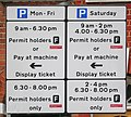
Hammersmith & Fulham roadside parking restriction notice.jpg 1,642 × 1,471; 1.47 MB
-
Hammersmith and Fulham London UK labelled ward map 2002.svg 797 × 1,266; 68 KB
-
Hannell Road - geograph.org.uk - 3951370.jpg 640 × 480; 85 KB
-
Holmead Road - geograph.org.uk - 4220028.jpg 640 × 480; 121 KB
-
Holmead Road, Fulham - geograph.org.uk - 4585259.jpg 2,272 × 1,704; 846 KB
-
Houses on Munster Road, Fulham - geograph.org.uk - 3820099.jpg 2,304 × 1,728; 867 KB
-
Hungry Turtle Fulham Road.jpg 4,000 × 2,248; 4.7 MB
-
Hurlingham Gardens - geograph.org.uk - 5276580.jpg 640 × 426; 94 KB
-
Hurlingham Rd - geograph.org.uk - 5276585.jpg 640 × 426; 68 KB
-
Hurlingham Rd - geograph.org.uk - 5276588.jpg 640 × 426; 80 KB
-
Hurlingham Road from Hurlingham Park - geograph.org.uk - 1810492.jpg 640 × 480; 125 KB
-
Hurlingham, Elizabethan School - geograph.org.uk - 3464642.jpg 4,320 × 3,240; 6.33 MB
-
Junction on Kingwood Road, Fulham - geograph.org.uk - 5964558.jpg 1,600 × 1,200; 288 KB
-
Junction, Fulham - geograph.org.uk - 3184632.jpg 640 × 480; 138 KB
-
Kingwood Road at the junction of Munster Road - geograph.org.uk - 3819887.jpg 2,304 × 1,728; 875 KB
-
Kingwood Road, Fulham - geograph.org.uk - 5964602.jpg 1,600 × 1,200; 228 KB
-
Kingwood Road, Fulham - geograph.org.uk - 5964616.jpg 1,600 × 1,200; 264 KB
-
Kingwood Road, Fulham - geograph.org.uk - 5964621.jpg 1,600 × 1,200; 370 KB
-
Kops Brewery, Fulham 01.JPG 4,608 × 3,456; 7.4 MB
-
Kops Brewery, Fulham 02.JPG 4,608 × 3,456; 8.2 MB
-
Lettice Street, Fulham - geograph.org.uk - 4585599.jpg 2,272 × 1,704; 735 KB
-
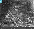
Lillie Bridge Depot and Earl's Court 1928-EPW024262.jpg 580 × 492; 61 KB
-
Lillie Bridge, eastwards into Lillie Road, 2016.jpg 2,535 × 1,715; 459 KB
-
Lillie Canal Bridge.jpg 3,072 × 2,304; 1.49 MB
-
Local hero Fulham Road.jpg 4,000 × 2,248; 4.99 MB
-
London , Hammersmith And Fulham - Chesilton Road - geograph.org.uk - 5058856.jpg 5,479 × 3,653; 5.45 MB
-
London , Hammersmith And Fulham - Radipole Road - geograph.org.uk - 5058854.jpg 6,000 × 4,000; 5.5 MB
-
Mablethorpe Road, Fulham - geograph.org.uk - 5964629.jpg 1,600 × 1,200; 333 KB
-
Maxwell Road, Fulham - geograph.org.uk - 4585526.jpg 2,272 × 1,704; 820 KB
-
Mimosa Street, Fulham - geograph.org.uk - 4585610.jpg 2,272 × 1,704; 664 KB
-
Munster Road - geograph.org.uk - 3955125.jpg 640 × 480; 82 KB
-
Munster Road - geograph.org.uk - 5205968.jpg 4,000 × 3,000; 4.55 MB
-
Munster Road - geograph.org.uk - 5205970.jpg 3,000 × 4,000; 3.53 MB
-
Munster Road at the junction of Dawes Road - geograph.org.uk - 3819877.jpg 2,304 × 1,728; 855 KB
-
Munster Road, Fulham - geograph.org.uk - 3819894.jpg 2,304 × 1,728; 887 KB
-
Munster Road, Fulham - geograph.org.uk - 3820109.jpg 2,304 × 1,728; 819 KB
-
Munster Road, Fulham - geograph.org.uk - 5964669.jpg 1,600 × 1,200; 274 KB
-
Napier Avenue - geograph.org.uk - 5276584.jpg 640 × 426; 72 KB
-
North End Road - panoramio.jpg 3,648 × 2,048; 1.8 MB
-
Perrymead Street, Fulham - geograph.org.uk - 4585562.jpg 2,272 × 1,704; 852 KB
-
Pollarded trees, A217 - geograph.org.uk - 3522607.jpg 640 × 430; 83 KB
-
Pollarded trees, A217 - geograph.org.uk - 3522618.jpg 640 × 430; 85 KB
-
Prince of Wales public house, Fulham.jpg 1,228 × 1,818; 416 KB
-
Printed Map Descriptive of London Poverty 1898-1899. Sheet 10. South West District (22128198814).jpg 11,597 × 6,651; 13.09 MB
-
Purser's Cross Road, Fulham - geograph.org.uk - 4585621.jpg 2,272 × 1,704; 826 KB


