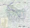
Category:Fryingpan River
Jump to navigation
Jump to search
river in Eagle and Pitkin counties in Colorado, United States | |||||
| Upload media | |||||
| Instance of | |||||
|---|---|---|---|---|---|
| Location |
| ||||
| Length |
| ||||
| Elevation above sea level |
| ||||
| Mouth of the watercourse | |||||
| Drainage basin | |||||
| Basin country | |||||
| Tributary |
| ||||
 | |||||
English: Media related to the Fryingpan River, an approximately 42-mile-long (68 km) river in Eagle and Pitkin counties in Colorado, United States, that is a tributary of the Roaring Fork River.
Media in category "Fryingpan River"
The following 7 files are in this category, out of 7 total.
-
Confluence of the Fryingpan and Roaring Fork rivers.JPG 4,480 × 2,818; 9.57 MB
-
Frying Pan river.jpg 1,280 × 945; 148 KB
-
Fryingpan River at Norrie, Colorado.JPG 5,032 × 4,000; 18.82 MB
-
Fryingpan river.jpg 600 × 477; 103 KB
-
Roaring Fork Colorado basin map.png 1,224 × 1,160; 2.22 MB
-
Rocky Fork Day Use area along the Fryingpan River.JPG 3,456 × 2,592; 3.13 MB
-
Ruedi Reservoir, dam and the Fryingpan River corridor near Basalt, Colo..JPG 2,136 × 3,216; 2.47 MB


