Category:French-language linguistic maps
Jump to navigation
Jump to search
Subcategories
This category has the following 4 subcategories, out of 4 total.
Media in category "French-language linguistic maps"
The following 29 files are in this category, out of 29 total.
-
 Aire de diffusion de la langue allemande en 1910.png 1,280 × 808; 574 KB
-
 Ancient greek dialects (-400)-es.svg 660 × 555; 893 KB
-
 Ancient greek dialects (-400)-fr.svg 660 × 555; 574 KB
-
 Biełarusy. Беларусы (1885).jpg 735 × 544; 414 KB
-
 Carte du Myanmar.Localisation des Karens.jpg 270 × 599; 80 KB
-
 CarteLangueRusse.png 704 × 473; 26 KB
-
 Czechoslovakia 1930 linguistic map - fr.svg 1,281 × 778; 749 KB
-
 Dialecto quebequés.png 393 × 306; 57 KB
-
 Languages-Lakevictoria-fr.png 2,130 × 1,868; 407 KB
-
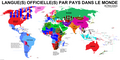
 Langue(s) officielle(s) par pays dans le monde*.png 2,650 × 1,336; 279 KB
-
 Langue(s) officielle(s) par pays dans le monde+.png 2,650 × 1,336; 279 KB
-
 Langue(s) officielle(s) par pays dans le monde-.png 2,650 × 1,336; 280 KB
-
 Langue(s) officielle(s) par pays dans le monde.png 2,650 × 1,336; 256 KB
-
 Langues Balto-Slaves, Balto-Slavic languages.png 1,062 × 1,156; 141 KB
-
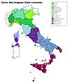 Langues Italo-romanes.jpg 1,632 × 1,970; 856 KB
-
 Langues kartveliennes Caucase.gif 1,415 × 905; 180 KB
-
 Langues officielles en Afrique.png 360 × 392; 22 KB
-
 Langues officielles en Afrique.svg 1,430 × 1,350; 1.44 MB
-
 Langues officielles légende - français.png 2,650 × 1,336; 293 KB
-
 Langues officielles légende.png 2,650 × 1,336; 292 KB
-
 Langues officielles par pays dans le monde.png 1,920 × 968; 574 KB
-
 Langues slaves carte linguistique.png 675 × 622; 83 KB
-
 Langues slaves méridionales historical.png 500 × 500; 89 KB
-
 Langues slaves méridionales.png 684 × 585; 117 KB
-
 Langues slaves.png 675 × 622; 79 KB
-
 Langues usuelles en Europe.jpg 1,251 × 1,024; 1.09 MB
-
 LanguesAfrique.jpg 1,800 × 2,056; 1.66 MB
-
 Map of French Flemish.jpg 4,349 × 2,951; 1.38 MB
-
 Map-Lusophone World-fr.png 1,357 × 628; 37 KB

-es.svg)
-fr.svg)
.jpg)


_officielle(s)_par_pays_dans_le_monde*.png)
_officielle(s)_par_pays_dans_le_monde%2B.png)
_officielle(s)_par_pays_dans_le_monde-.png)
_officielle(s)_par_pays_dans_le_monde.png)


