Category:Four-color maps
Appearance
Media in category "Four-color maps"
The following 26 files are in this category, out of 26 total.
-
4 couleurs Benelux.png 668 × 818; 46 KB
-
Carte 4 couleur.png 557 × 540; 73 KB
-
Five colors world map (Malawi and African Great Lakes problem).svg 940 × 415; 1.57 MB
-
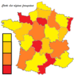
Four color theorem illustration looking at provinces of France.png 588 × 550; 70 KB
-
Four color world map.svg 940 × 415; 1.58 MB
-
Four-color map of the United States.png 572 × 371; 14 KB
-
Grafo ejemplo 5 países.png 310 × 280; 6 KB
-
IV postcode area map.png 927 × 1,000; 197 KB
-
Map of Russia (Four Colour).svg 1,025 × 600; 169 KB
-
Map of Ukraine Oblasts 4 colors.svg 550 × 380; 728 KB
-
Map of Ukraine Oblasts simple 4 colors.svg 700 × 480; 178 KB
-
Map of United States accessible colors shown.svg 548 × 349; 126 KB
-
Map of United States vivid colors shown.png 800 × 495; 187 KB
-
Map of United States vivid colors shown.svg 548 × 349; 215 KB
-
Map of USA with state and territory names 2.png 2,000 × 1,236; 398 KB
-
Obcine Slovenija 2007 4col.svg 2,613 × 1,705; 2.36 MB
-
Obcine Slovenija 2011 4col.svg 512 × 336; 4.34 MB
-
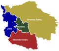
Obcine Slovenija 2011 Zrece Oplotnica SlKonjice SlBistrica.svg 512 × 438; 101 KB
-
Victory (Township) NYPL1583064.tiff 5,414 × 6,542; 101.34 MB
-
World map colored using the four color theorem including oceans.png 1,280 × 704; 195 KB
-
World map with four colours.svg 2,543 × 1,099; 1.01 MB
-
World using the four color theorem.png 1,487 × 766; 161 KB


