Category:Fossil distribution maps
Jump to navigation
Jump to search
Subcategories
This category has only the following subcategory.
W
Media in category "Fossil distribution maps"
The following 36 files are in this category, out of 36 total.
-
Alligatorellus-1.jpg 1,200 × 588; 164 KB
-
Approximate localities of fossil sites of Picea critchfieldii.png 1,149 × 1,000; 126 KB
-
Arabic-Snider-Pellegrini Wegener fossil map.png 577 × 443; 115 KB
-
Australasian fossils, a students' manual of palaeontology (1914) (19729013293).jpg 3,216 × 2,020; 2.01 MB
-
Australasian fossils, a students' manual of palaeontology (1914) (20350230605).jpg 4,192 × 3,196; 1.58 MB
-
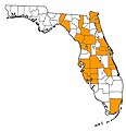
Dasypus-bellus-map.jpg 400 × 414; 36 KB
-
Dromaeosauridae Distribution PBDB.png 1,287 × 611; 148 KB
-
Euthecodon Range map.png 640 × 656; 92 KB
-
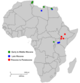
FBM Fossil lake.png 2,800 × 4,400; 152 KB
-
Fossil distribution of Macroscaphitidae.png 1,020 × 437; 46 KB
-
Glyptotherium (dark grey) vs Glyptodon (light grey) distributions map.jpg 2,083 × 2,629; 431 KB
-
Hanyusuchus range map.jpg 946 × 720; 193 KB
-
Hojapil-Ata mega-tracksite ; map showing 24 identified trackways.png 365 × 492; 69 KB
-
Karte Fossilfundstellen der Santa-Cruz-Formation.jpg 2,034 × 1,140; 394 KB
-
LesothosaurusFossilDiscoveriesMap.jpg 942 × 1,200; 367 KB
-
Location map where the holotype of Narambuenatitan palomoi was found.jpg 641 × 697; 151 KB
-
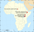
Map of the fossil sites of apes and earliest hominids HEB 01.svg 1,525 × 1,440; 780 KB
-
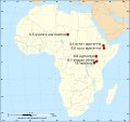
Map of the fossil sites of apes and earliest hominids HEB.svg 1,525 × 1,440; 778 KB
-
NPS florissant-fossil-beds-map.jpg 984 × 1,225; 222 KB
-
NPS florissant-fossil-beds-trail-map.gif 970 × 1,166; 62 KB
-
NPS florissant-fossil-beds-vegetation-map.gif 1,820 × 2,616; 434 KB
-
Panthera onca fossil map.png 693 × 833; 232 KB
-
Pterosaur Fossil Distribution Map (simplified).png 2,444 × 1,437; 13.4 MB
-
Pterosaur Fossil Distribution Map.png 2,444 × 1,437; 13.4 MB
-
Sagenodus locations.gif 473 × 366; 26 KB
-
Snider-Pellegrini Wegener fossil map-ja.svg 571 × 441; 44 KB
-
Snider-Pellegrini Wegener fossil map.gif 577 × 443; 46 KB
-
Total Primate Range with Eocene-Miocene Fossil Sites.jpg 1,920 × 1,080; 1.28 MB
-
Trinisaura Distribution map.JPG 606 × 619; 24 KB
-
Türkiye'de Pleistosen Dönemine Ait Omurgalı Fosil Buluntuları.JPG 671 × 476; 119 KB
-
Wegener fossils-mapped.png 2,742 × 1,628; 656 KB
-
Wegener fossils.png 1,020 × 591; 139 KB


