Category:Fosse Mitant (Valenciennes)
Jump to navigation
Jump to search
| Object location | | View all coordinates using: OpenStreetMap |
|---|

Français : La fosse Mitant de la Compagnie des mines d'Anzin était un charbonnage constitué d'un seul puits situé à Valenciennes, Nord, Nord-Pas-de-Calais, France. Une autre fosse Mitant a été ouverte antérieurement sur le territoire d'Anzin.
Media in category "Fosse Mitant (Valenciennes)"
The following 6 files are in this category, out of 6 total.
-
 Valenciennes - Fosse Mitant des mines d'Anzin (A).JPG 3,648 × 2,736; 3.98 MB
-
 Valenciennes - Fosse Mitant des mines d'Anzin (B).JPG 2,736 × 3,648; 3.44 MB
-
 Valenciennes - Fosse Mitant des mines d'Anzin (C).JPG 2,736 × 3,648; 3.46 MB
-
 Valenciennes - Fosse Mitant des mines d'Anzin (D).JPG 3,648 × 2,736; 4.21 MB
-
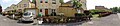 Valenciennes - Fosse Mitant des mines d'Anzin (E).JPG 4,912 × 1,080; 2.44 MB
-
 Valenciennes - Puits Mitant 1755-1781.jpg 2,736 × 3,648; 5.66 MB
.JPG)
.JPG)
.JPG)
.JPG)

.JPG)