Category:Formosa (Taiwan) City Plans
Jump to navigation
Jump to search
- This category was created for a specific series of military maps, not for all maps that depict city planning of Taiwan. Courtesy of the University of Texas Libraries, The University of Texas at Austin.
Media in category "Formosa (Taiwan) City Plans"
The following 30 files are in this category, out of 30 total.
-
 Chikunan 1 8000 1944.jpg 3,972 × 3,992; 3.13 MB
-
 City Plans Heito.jpg 5,151 × 3,966; 4.43 MB
-
 City Plans Hozan.jpg 5,106 × 7,560; 9.1 MB
-
 City Plans Kagi.jpg 5,970 × 4,760; 6.64 MB
-
 City Plans Okayama.jpg 5,506 × 4,736; 5.27 MB
-
 City Plans Taihoku-Matsuyama.jpg 5,947 × 4,860; 8.94 MB
-
 City Plans Takao.jpg 4,476 × 4,730; 5.82 MB
-
 City Plans Toko.jpg 3,966 × 3,578; 2.55 MB
-
 City Plans Toshien.jpg 4,767 × 4,460; 5.38 MB
-
 Giran 1 7500 1945.jpg 3,978 × 5,989; 4.6 MB
-
 Hokko 1 6000 1945.jpg 4,357 × 4,372; 4.05 MB
-
 Kagi 1 10000 1945.jpg 5,970 × 4,764; 6.74 MB
-
 Karenko 1 7500 1945.jpg 5,586 × 4,731; 5.57 MB
-
 Kato 1 10000 1944.jpg 4,358 × 3,988; 3.16 MB
-
 Kiirun 1 10000 1945.jpg 3,996 × 5,138; 5.83 MB
-
 Mako 1 8000 1945.jpg 4,350 × 4,752; 4.68 MB
-
 North Taihoku City in 1945 (Taihoku - Soren station).jpg 2,048 × 1,280; 961 KB
-
 Rato 1 6000 1944.jpg 4,352 × 3,972; 3.48 MB
-
 Rokko 1 6000 1944.jpg 4,362 × 3,982; 3.63 MB
-
 Seira 1 8000 1945.jpg 4,758 × 3,969; 4.67 MB
-
 Shinchiku 1 10000 1945.jpg 5,651 × 4,772; 7.69 MB
-
 Suo 1 10000 1944.jpg 3,964 × 4,388; 4.98 MB
-
 Taichung City Map by US Army.jpg 5,048 × 6,723; 7.9 MB
-
 Taito 1 10000 1945.jpg 4,365 × 5,571; 6.48 MB
-
 Tansui 1 8000 1945.jpg 3,178 × 3,972; 3.08 MB
-
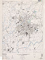
 Txu-oclc-6565942.jpg 4,762 × 7,948; 9.94 MB
-
 Txu-oclc-6594702.jpg 3,975 × 3,209; 3.05 MB
-
 Txu-oclc-6595095.jpg 3,967 × 5,194; 4.49 MB
-
 三爪子線圓窗嶺路段.png 1,616 × 920; 2.87 MB
-
 鳳山無線通信所平面圖.jpg 651 × 701; 170 KB


.jpg)


