Category:Former tram station, Mödling
Jump to navigation
Jump to search
| Object location | | View all coordinates using: OpenStreetMap |
|---|
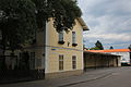
Deutsch: Die ehemalige Endstation der Linie 360 der de:Wiener Straßenbahn in Mödling (außerhalb von Wien)
Media in category "Former tram station, Mödling"
The following 7 files are in this category, out of 7 total.
-
 360er Gedenktafel Mödling 5417 (User Mö1997).jpg 3,456 × 5,184; 5.87 MB
-
 Mödling 0750.JPG 5,184 × 3,456; 5.54 MB
-
 Mödling 0751.JPG 5,184 × 3,456; 5.21 MB
-
 Mödling 0752.JPG 5,184 × 3,456; 5.59 MB
-
 Mödling 0754.JPG 5,184 × 3,456; 5.72 MB
-
 Mödling 0755.JPG 3,456 × 5,184; 6.57 MB
-
 Mödling 0756.JPG 5,184 × 3,456; 6.02 MB
.jpg)


