Category:Former town hall of Royer (Saône-et-Loire)
Jump to navigation
Jump to search
| Object location | | View all coordinates using: OpenStreetMap |
|---|
Media in category "Former town hall of Royer (Saône-et-Loire)"
The following 7 files are in this category, out of 7 total.
-
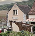 Ancienne Mairie - Royer (FR71) - 2022-10-29 - 1.jpg 3,024 × 3,155; 3.31 MB
-
 Ancienne Mairie - Royer (FR71) - 2022-10-29 - 2.jpg 3,024 × 3,566; 3.38 MB
-
 Ancienne Mairie - Royer (FR71) - 2022-10-29 - 3.jpg 3,433 × 2,514; 2.35 MB
-
 Ancienne Mairie - Royer (FR71) - 2022-10-29 - 4.jpg 4,032 × 3,024; 3.37 MB
-
 Ancienne Mairie - Royer (FR71) - 2022-10-29 - 5.jpg 5,549 × 6,188; 25.6 MB
-
 Ancienne Mairie - Royer (FR71) - 2022-10-29 - 6.jpg 4,032 × 3,024; 4.23 MB
-
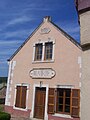 RoyerMairie.JPG 1,728 × 2,304; 545 KB
_-_2022-10-29_-_1.jpg)
_-_2022-10-29_-_2.jpg)
_-_2022-10-29_-_3.jpg)
_-_2022-10-29_-_4.jpg)
_-_2022-10-29_-_5.jpg)
_-_2022-10-29_-_6.jpg)
