Category:Former mills in West Yorkshire
Jump to navigation
Jump to search
Subcategories
This category has the following 12 subcategories, out of 12 total.
B
- Bean Ing Mill (1 F)
C
D
- Damart Mills, Bingley (10 F)
- Dudfleet Mill, Horbury (5 F)
F
H
- High Mill, Addingham (2 F)
L
- Low Mill, West Yorkshire (2 F)
M
- Marshall's Mill, Leeds (16 F)
O
- Old Lane Mill, Halifax (19 F)
S
- Scotland Mill, Adel (16 F)
T
- Titanic Mill (14 F)
Media in category "Former mills in West Yorkshire"
The following 56 files are in this category, out of 56 total.
-
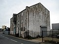
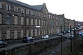
 102, 104 and 106 Thornton Road, Bradford.jpg 2,592 × 1,944; 1.62 MB
-
 Amblers Mill, East Ardsley. - geograph.org.uk - 58392.jpg 640 × 480; 79 KB
-
 An old mill on Potternewton Mount, Leeds - geograph.org.uk - 2646289.jpg 800 × 600; 211 KB
-
 Barkerend Mills (16157124384).jpg 2,523 × 2,523; 5.07 MB
-

-

-
 Brian Royd Mill, Greetland - geograph.org.uk - 1237465.jpg 640 × 427; 68 KB
-
 Building - Flanshaw Lane - geograph.org.uk - 993666.jpg 640 × 474; 210 KB
-
 Burdett Mill, Milnsbridge - geograph.org.uk - 843517.jpg 640 × 480; 84 KB
-
 Disused Mill - Coney Street - geograph.org.uk - 977210.jpg 640 × 499; 218 KB
-
 Entrance to Watermill Court, Goose Eye - geograph.org.uk - 807750.jpg 1,024 × 683; 186 KB
-
 Flats on Mill Road, Dewsbury (geograph 5743965).jpg 1,600 × 1,065; 466 KB
-
 Former mill at Streanor Bottom Farm - geograph.org.uk - 1268414.jpg 640 × 480; 75 KB
-

-
 Former Mill near Hallas Bridge - geograph.org.uk - 1377227.jpg 640 × 480; 171 KB
-
 Former mill, 21, Thornes Lane - geograph.org.uk - 1543038.jpg 480 × 640; 225 KB
-
 Former mill, 21, Thornes Lane - geograph.org.uk - 1543045.jpg 640 × 480; 91 KB
-
 Former Mill, Addingham.jpg 2,448 × 3,264; 2.3 MB
-
 Former Mill, Mill Bank.jpg 2,000 × 1,500; 861 KB
-
 Former Victoria Mills, Hunslet.jpg 1,024 × 768; 163 KB
-
 Former Warehouse, Douglas Mill, Bradford.jpg 1,600 × 1,200; 396 KB
-
 Former Woodlands Mill, Steeton.jpg 640 × 480; 73 KB
-
 Former Workshops, Stonebridge Mill.jpg 1,024 × 768; 223 KB
-
 Gate Head, Stainland - geograph.org.uk - 1235890.jpg 640 × 427; 107 KB
-
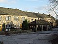
 Hebden Bridge Mill - geograph.org.uk - 1080130.jpg 640 × 480; 70 KB
-
 High Mill, Addingham - geograph.org.uk - 91815.jpg 640 × 480; 116 KB
-
 Jamia-E-Islamia - Cross Lane - geograph.org.uk - 1084131.jpg 640 × 455; 205 KB
-

-
 Lodge's Mill - Silver Royd Hill - geograph.org.uk - 622134.jpg 640 × 472; 26 KB
-
 Lord's Mill, Magdale.jpg 1,600 × 1,200; 827 KB
-
 Low Bridge Mill, Keighley.jpg 1,024 × 768; 153 KB
-
 Low Mill, Keighley.jpg 640 × 427; 80 KB
-
 Low Westwood Mill.jpg 640 × 427; 76 KB
-
 Marshalls Mill - Dean Clough - geograph.org.uk - 613263.jpg 640 × 514; 36 KB
-
 Mill, Hellas Bridge.jpg 3,264 × 2,448; 1.6 MB
-
 Newmillerdam, the former Dam Mill (2) - geograph.org.uk - 2174346.jpg 1,024 × 768; 605 KB
-
 Old Town Mill, Chiserley.jpg 3,834 × 2,606; 2.36 MB
-
 Part of Crank Mills, Station Road, Morley - geograph.org.uk - 1903145.jpg 2,000 × 1,500; 834 KB
-
 Part of Washpit Mills, Cartworth - geograph.org.uk - 1603659.jpg 640 × 480; 111 KB
-
 Ponden Cotton Mill.jpg 2,592 × 1,944; 1.64 MB
-
 Remains of Smithy Place Mills, Brockholes - geograph.org.uk - 717469.jpg 640 × 427; 110 KB
-
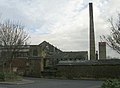
 Rutland Mills, Wakefield.jpg 1,024 × 768; 630 KB
-
 Stone warehouse - geograph.org.uk - 1531528.jpg 480 × 640; 91 KB
-
 Sunnybank Mills hit the dust. - geograph.org.uk - 1046832.jpg 421 × 640; 53 KB
-
 Sunnybank Mills, Longwood - geograph.org.uk - 1046789.jpg 640 × 427; 75 KB
-

-

-
 Try Mills, Bradford.jpg 657 × 1,024; 168 KB
-
 Union and Burdett Mills (geograph 2194774).jpg 640 × 414; 70 KB
-
 Union Mill,Milnsbridge - geograph.org.uk - 843452.jpg 640 × 480; 82 KB
-
 Victoria Mills, Leeds.jpg 1,076 × 1,280; 331 KB
-
 Victoria mills, Shipley - geograph.org.uk - 757586.jpg 640 × 427; 55 KB
-
 Watermill Court, Goose Eye - geograph.org.uk - 807738.jpg 1,024 × 683; 187 KB
-
 Wood Bottom Mill.jpg 1,024 × 754; 119 KB
-
-
 Rag Mill at Goose Eye. - geograph.org.uk - 268890.jpg 640 × 480; 188 KB


.jpg)


.jpg)


_-_geograph.org.uk_-_2174346.jpg)


.jpg)


