Category:Forests in Cheshire
Jump to navigation
Jump to search
Ceremonial counties of England: Bedfordshire · Berkshire · Buckinghamshire · Cambridgeshire · Cheshire · Cornwall · Cumbria · Derbyshire · Devon · Dorset · Durham · East Riding of Yorkshire · East Sussex · Essex · Gloucestershire · Greater London · Greater Manchester · Hampshire · Herefordshire · Hertfordshire · Kent · Lancashire · Leicestershire · Lincolnshire · Merseyside · Norfolk · North Yorkshire · Northamptonshire · Northumberland · Nottinghamshire · Oxfordshire · Rutland · Shropshire · Somerset · South Yorkshire · Staffordshire · Suffolk · Surrey · Warwickshire · West Midlands · West Sussex · West Yorkshire · Wiltshire · Worcestershire
City-counties: Bristol ·
Former historic counties:
Other former counties:
City-counties: Bristol ·
Former historic counties:
Other former counties:
Subcategories
This category has the following 4 subcategories, out of 4 total.
Media in category "Forests in Cheshire"
The following 132 files are in this category, out of 132 total.
-
 "Pickmere Rough" - geograph.org.uk - 87843.jpg 640 × 480; 158 KB
-
 "The Mosses" Birch Wood - geograph.org.uk - 35820.jpg 640 × 480; 172 KB
-
 Alder Wood, Mottram St Andrew - geograph.org.uk - 158299.jpg 640 × 433; 76 KB
-
 Alderley Edge (17498592429).jpg 2,523 × 1,593; 3.13 MB
-
 Alderley Edge (17498592559).jpg 2,566 × 1,606; 2.91 MB
-
 Alderley Edge (17506595618).jpg 2,456 × 1,532; 2.64 MB
-
 Alderley Edge (17506595718).jpg 2,350 × 1,474; 1.22 MB
-
 Alderley Edge (17658792856).jpg 2,568 × 1,602; 1.69 MB
-
 Alderley Edge (17658792986).jpg 2,622 × 1,661; 2.42 MB
-
 Alderley Edge (17658793126).jpg 2,566 × 1,599; 3.04 MB
-
 Alderley Edge - geograph.org.uk - 12990.jpg 640 × 480; 163 KB
-
 Ash Brook & Primrose Hill Woods - geograph.org.uk - 2694913.jpg 3,072 × 2,304; 4.51 MB
-
 Band of woodland and stream, Bradley Lane - geograph.org.uk - 330175.jpg 509 × 640; 175 KB
-
 Beeston - Pennsylvania Wood - geograph.org.uk - 804837.jpg 640 × 480; 292 KB
-
 Big Wood - geograph.org.uk - 49137.jpg 640 × 480; 97 KB
-
 Birch woods on Bickerton Hill - geograph.org.uk - 185343.jpg 640 × 480; 130 KB
-
 Booth Boundary^ - geograph.org.uk - 3672478.jpg 424 × 640; 112 KB
-
 Bridleway to Freegreen Farm - geograph.org.uk - 328564.jpg 640 × 463; 80 KB
-

-
 Clough woodland near Belleair - geograph.org.uk - 250852.jpg 640 × 480; 322 KB
-
 Cows grazing in birch woods at Bickerton - geograph.org.uk - 715766.jpg 640 × 427; 180 KB
-
 Delamere - track down from Pale Heights - geograph.org.uk - 207830.jpg 640 × 480; 108 KB
-
 Flickr - ronsaunders47 - BARE TREES. BIRCHWOOD WARRINGTON UK..jpg 3,008 × 2,000; 3.29 MB
-
 Flickr - ronsaunders47 - BIRCHWOOD FOREST WALK..jpg 2,804 × 1,864; 2.07 MB
-
 Flickr - ronsaunders47 - Birchwood Paths. Warrington Cheshire UK..jpg 3,648 × 2,736; 4 MB
-
 Flickr - ronsaunders47 - CAN'T SEE THE WOOD FOR THE TREES...jpg 3,008 × 2,000; 2.18 MB
-
 Flickr - ronsaunders47 - FOREST WALKWAY. WARRINGTON UK..jpg 2,592 × 1,944; 2.1 MB
-
 Flickr - ronsaunders47 - WOODLAND PATHS. 2.jpg 2,804 × 1,864; 2.05 MB
-
 Forest below Beeston Castle (5293).jpg 4,288 × 2,848; 6.31 MB
-
 Forest below Beeston Castle (5355).jpg 4,288 × 2,848; 6.14 MB
-
 Forest below Beeston Castle (5371).jpg 4,288 × 2,848; 6.26 MB
-
 Forest below Beeston Castle (5377).jpg 4,288 × 2,848; 6.22 MB
-
 Forest below Beeston Castle (5379).jpg 4,288 × 2,848; 6.19 MB
-
 Forest below Beeston Castle (5380).jpg 4,288 × 2,848; 6.56 MB
-
 Forest below Beeston Castle (5381).jpg 4,288 × 2,848; 6.24 MB
-
 Forest of the Future - geograph.org.uk - 1563237.jpg 640 × 480; 171 KB
-
 Hale from Lady Pool Bridge - geograph.org.uk - 311481.jpg 640 × 480; 87 KB
-
 Hether Wood Bickerton.jpg 1,200 × 900; 612 KB
-
 Hoofield Covert - geograph.org.uk - 386575.jpg 640 × 480; 179 KB
-
 Hoofield Covert - geograph.org.uk - 386584.jpg 640 × 480; 258 KB
-
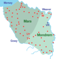 Mara and Mondrem.png 800 × 804; 100 KB
-
 Middlewood, High Lane c.1910.jpg 660 × 404; 116 KB
-

-
 Over Alderley, Daniel Hill Wood - geograph.org.uk - 263014.jpg 640 × 480; 266 KB
-

-
 Path near Vale Royal Abbey - geograph.org.uk - 289247.jpg 640 × 480; 210 KB
-
 Peckforton Castle (5337).jpg 4,288 × 2,848; 6.05 MB
-
 Poole Gorse.jpg 1,200 × 800; 545 KB
-
 Primrosehill Wood - geograph.org.uk - 282730.jpg 640 × 480; 178 KB
-
 Red sandstone outcrop, Hether Wood - geograph.org.uk - 184891.jpg 1,200 × 900; 600 KB
-
 Sandstone Trail, Bulkeley Hill.jpg 627 × 356; 161 KB
-
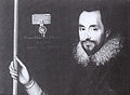 Sir John Done.jpg 600 × 440; 155 KB
-
 Sound Heath pond.jpg 1,200 × 800; 583 KB
-
 Sound Heath2.jpg 1,200 × 858; 495 KB
-
 Stile and field - geograph.org.uk - 107236.jpg 640 × 480; 103 KB
-
 Stream and Valley - geograph.org.uk - 334472.jpg 640 × 428; 100 KB
-
 The Path to Long Lane - geograph.org.uk - 334230.jpg 640 × 601; 99 KB
-
 The Path to Peover Hall - geograph.org.uk - 328551.jpg 640 × 457; 65 KB
-
 View of Acton's Rough - geograph.org.uk - 461490.jpg 640 × 480; 55 KB
-
 View towards Coronation Wood - geograph.org.uk - 711307.jpg 640 × 427; 153 KB
-
 Winter woodland - geograph.org.uk - 1703372.jpg 2,048 × 1,536; 1.31 MB
-

-
 Wood beside Ash Lane - geograph.org.uk - 369646.jpg 498 × 640; 158 KB
-
 Woodland - geograph.org.uk - 334225.jpg 640 × 428; 94 KB
-
 Woodland - geograph.org.uk - 64161.jpg 480 × 640; 116 KB
-
 Woodland by Brassey's Contract Road - geograph.org.uk - 393404.jpg 427 × 640; 191 KB
-
 Woodland by embankment - geograph.org.uk - 394002.jpg 443 × 640; 179 KB
-
 Woodland Footpath - geograph.org.uk - 334474.jpg 640 × 428; 91 KB
-
 Woodland in winter, Stanner Nab - geograph.org.uk - 719636.jpg 640 × 460; 178 KB
-
 Woodland near Wistaston Brook - geograph.org.uk - 365619.jpg 480 × 640; 168 KB
-
 Woodland path at Alderley Edge.jpg 1,600 × 1,200; 1.72 MB
-
 Autumn farmland in morning light - geograph.org.uk - 309998.jpg 640 × 395; 126 KB
-
 Big Boar's Wood - geograph.org.uk - 42560.jpg 640 × 480; 148 KB
-
 Big Wood - geograph.org.uk - 498555.jpg 640 × 480; 163 KB
-
 Birch woods in autumn - geograph.org.uk - 313167.jpg 488 × 640; 188 KB
-
 Birches in Twemlows Big Wood - geograph.org.uk - 792822.jpg 640 × 427; 193 KB
-
 Birkin Brook At The Tatton Park Boundary - geograph.org.uk - 1494646.jpg 640 × 480; 232 KB
-
 Bullocks in woodland - geograph.org.uk - 386196.jpg 640 × 445; 166 KB
-
 Chapel Wood - geograph.org.uk - 244194.jpg 480 × 640; 180 KB
-
 Chipnall Wood south of Tag Lane - geograph.org.uk - 574712.jpg 640 × 480; 103 KB
-

-
 Crossing Basford Brook - geograph.org.uk - 201168.jpg 560 × 420; 346 KB
-
 Drakelow Gorse - geograph.org.uk - 382858.jpg 640 × 457; 91 KB
-
 Gradbach Wood - geograph.org.uk - 56502.jpg 640 × 480; 137 KB
-

-
 Hadley Covert, Marbury - geograph.org.uk - 213693.jpg 640 × 480; 137 KB
-
 Hewitt's Moss - geograph.org.uk - 186114.jpg 640 × 462; 89 KB
-
 Holford Moss near Plumley - geograph.org.uk - 157715.jpg 640 × 480; 72 KB
-
 Hook's Brook - geograph.org.uk - 144335.jpg 640 × 480; 150 KB
-
 Hunsterson Road at Chapel Wood - geograph.org.uk - 243898.jpg 480 × 640; 192 KB
-
 Iscoyd Wood and bridge over Iscoyd Brook - geograph.org.uk - 337589.jpg 640 × 480; 164 KB
-
 Ladyacre Wood , Calveley - geograph.org.uk - 394079.jpg 640 × 427; 148 KB
-
 Leafy path at Queens Drive Meadows - geograph.org.uk - 256880.jpg 543 × 640; 253 KB
-
 Lees Wood, Weston - geograph.org.uk - 201167.jpg 640 × 426; 116 KB
-
 Leonard's Wood from Linnards lane - geograph.org.uk - 87326.jpg 640 × 480; 104 KB
-
 Lowcross Gorse, near Lowcross Hill - geograph.org.uk - 405468.jpg 640 × 438; 135 KB
-
 Macclesfield Forest - geograph.org.uk - 60820.jpg 640 × 480; 98 KB
-
 Middle Walk, below Helsby Crag - geograph.org.uk - 175809.jpg 640 × 480; 151 KB
-
 Mill Covert - geograph.org.uk - 249672.jpg 480 × 640; 221 KB
-
 Moss Wood, Seven Sisters Lane (Looking S) - geograph.org.uk - 83901.jpg 640 × 480; 184 KB
-
 Norley - Delamere Forest - geograph.org.uk - 207806.jpg 640 × 480; 86 KB
-
 Oak Tree and Woodland - geograph.org.uk - 334983.jpg 640 × 480; 266 KB
-
 Old and new woodland - geograph.org.uk - 385527.jpg 640 × 448; 125 KB
-
 Owley Wood - geograph.org.uk - 17732.jpg 640 × 480; 87 KB
-
 Paradise Wood - geograph.org.uk - 532512.jpg 640 × 359; 62 KB
-
 Pasture south of Park Farm - geograph.org.uk - 389666.jpg 640 × 450; 134 KB
-
 Pastureland by Bull's Wood - geograph.org.uk - 260237.jpg 640 × 468; 177 KB
-
 Primrosehill Wood near Tirley Hollow - geograph.org.uk - 152815.jpg 640 × 480; 61 KB
-
 Roadside woodland - geograph.org.uk - 401103.jpg 540 × 405; 123 KB
-
 Small wood near Withymoor Cottage - geograph.org.uk - 218721.jpg 640 × 418; 115 KB
-
 Small Woods - geograph.org.uk - 391671.jpg 640 × 278; 32 KB
-
 Small woods near Thorneypits - geograph.org.uk - 391733.jpg 640 × 349; 41 KB
-
 Smoker Wood ,Tabley - geograph.org.uk - 87314.jpg 640 × 480; 133 KB
-
 Spinners Wood, Ravensmoor - geograph.org.uk - 344569.jpg 640 × 504; 163 KB
-
 Sweetcorn field by Chapel Wood - geograph.org.uk - 244183.jpg 640 × 462; 151 KB
-
 The Oaks, Rainow - geograph.org.uk - 60847.jpg 640 × 480; 95 KB
-
 Trees bordering the field - geograph.org.uk - 126388.jpg 640 × 480; 77 KB
-
 View towards Blakenhall Moss - geograph.org.uk - 249666.jpg 640 × 480; 140 KB
-
 Walled Garden, Birchwood - geograph.org.uk - 107477.jpg 640 × 480; 162 KB
-
 Waulkmill Wood - Inglesley Vale - geograph.org.uk - 358045.jpg 640 × 497; 189 KB
-
 Wilkesley Covert - geograph.org.uk - 218728.jpg 640 × 480; 125 KB
-
 Windmill Wood - geograph.org.uk - 83899.jpg 640 × 480; 103 KB
-
 Winnington Wood - geograph.org.uk - 87343.jpg 640 × 480; 66 KB
-

-
 Woodland beside the road - geograph.org.uk - 183727.jpg 640 × 480; 178 KB
-
 Woodland by Rookery Hall - geograph.org.uk - 389597.jpg 640 × 463; 198 KB
-
 Woodland near Marshfield Bridge - geograph.org.uk - 365490.jpg 525 × 640; 168 KB
-
 Woodland Path - geograph.org.uk - 49111.jpg 480 × 640; 120 KB
-
 Woodland path near Tirley Farm, Utkinton. - geograph.org.uk - 173234.jpg 479 × 640; 159 KB
-
 Woods - geograph.org.uk - 345035.jpg 640 × 480; 98 KB
-
 Woods at Mere - geograph.org.uk - 79541.jpg 640 × 480; 117 KB
-
 Woods, Lawton Hall - geograph.org.uk - 161856.jpg 640 × 480; 176 KB


.jpg)
.jpg)
.jpg)
.jpg)
.jpg)
.jpg)
.jpg)


.jpg)
.jpg)
.jpg)
.jpg)
.jpg)
.jpg)
.jpg)


.jpg)


_-_geograph.org.uk_-_83901.jpg)


