Category:Forestry roads in the Scottish Borders
Jump to navigation
Jump to search
Council areas (municipalities) of Scotland: Aberdeenshire · Argyll and Bute · Dumfries and Galloway · East Ayrshire · Highland · Perth and Kinross · Scottish Borders · Stirling ·
Media in category "Forestry roads in the Scottish Borders"
The following 51 files are in this category, out of 51 total.
-
 Forest road, Howcleugh Forest - geograph.org.uk - 686336.jpg 640 × 480; 249 KB
-
 Forestry road - geograph.org.uk - 569477.jpg 640 × 480; 113 KB
-
 Forestry road in Kershope Forest - geograph.org.uk - 569593.jpg 640 × 480; 138 KB
-
 Forestry road in Stonedge Forest - geograph.org.uk - 540203.jpg 640 × 480; 103 KB
-
 Forestry road, Errickstane Hill - geograph.org.uk - 686366.jpg 640 × 480; 222 KB
-
 Forestry road, Howcleuch Forest - geograph.org.uk - 686403.jpg 640 × 480; 243 KB
-
 Forestry road, The Rig - geograph.org.uk - 686406.jpg 640 × 480; 231 KB
-
 New road, Thornielee - geograph.org.uk - 997547.jpg 640 × 480; 132 KB
-
 New road, Thornielee - geograph.org.uk - 998607.jpg 640 × 359; 103 KB
-
 New road, Thornylee Craigs - geograph.org.uk - 997556.jpg 640 × 359; 103 KB
-
 A forestry road in Wauchope Forest - geograph.org.uk - 924910.jpg 427 × 640; 126 KB
-
 A forestry road north of Stennishope - geograph.org.uk - 511464.jpg 640 × 480; 121 KB
-
 Conifer Plantation - geograph.org.uk - 336527.jpg 640 × 480; 58 KB
-
 Conifer Plantation - geograph.org.uk - 336531.jpg 480 × 640; 45 KB
-
 Forestry road - geograph.org.uk - 352787.jpg 640 × 472; 124 KB
-
 Forestry Road - geograph.org.uk - 392540.jpg 640 × 480; 111 KB
-
 Forestry Road - geograph.org.uk - 392545.jpg 640 × 480; 116 KB
-
 Forestry Road - geograph.org.uk - 461422.jpg 640 × 480; 112 KB
-
 Forestry road - geograph.org.uk - 462176.jpg 640 × 480; 103 KB
-
 Forestry road - geograph.org.uk - 494680.jpg 640 × 480; 133 KB
-
 Forestry road - geograph.org.uk - 520600.jpg 640 × 480; 101 KB
-
 Forestry road - geograph.org.uk - 527561.jpg 640 × 480; 111 KB
-
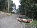
 Forestry road and logs - geograph.org.uk - 394056.jpg 640 × 471; 116 KB
-

-
 Forestry road at Butter Bog - geograph.org.uk - 528286.jpg 640 × 480; 105 KB
-
 Forestry road at Crooked Braes - geograph.org.uk - 535273.jpg 480 × 640; 122 KB
-

-
 Forestry road at Hyndlee - geograph.org.uk - 531271.jpg 640 × 480; 135 KB
-
 Forestry road at Lamblair Edge - geograph.org.uk - 534391.jpg 640 × 480; 120 KB
-
 Forestry road at Needs Law - geograph.org.uk - 543518.jpg 640 × 480; 128 KB
-
 Forestry road at Rams Cleuch - geograph.org.uk - 535231.jpg 640 × 480; 99 KB
-
 Forestry road at Ravenburn - geograph.org.uk - 530440.jpg 640 × 480; 124 KB
-
 Forestry road at Shankend - geograph.org.uk - 351387.jpg 640 × 471; 127 KB
-
 Forestry road at Wheelrig Head - geograph.org.uk - 543492.jpg 480 × 640; 139 KB
-
 Forestry road in Burns Plantation - geograph.org.uk - 527576.jpg 480 × 640; 117 KB
-
 Forestry road in Cloich Hills - geograph.org.uk - 84560.jpg 640 × 427; 101 KB
-
 Forestry road in Dykeraw Plantation - geograph.org.uk - 530420.jpg 480 × 640; 126 KB
-
 Forestry road in Leithope Forest - geograph.org.uk - 543424.jpg 640 × 480; 114 KB
-
 Forestry road in Letham Plantation - geograph.org.uk - 528307.jpg 640 × 480; 117 KB
-
 Forestry road in Staney Hill Forest - geograph.org.uk - 548816.jpg 640 × 480; 129 KB
-
 Forestry road in Wauchope Forest - geograph.org.uk - 461420.jpg 640 × 480; 102 KB
-
 Forestry road in Wellcleuch Plantation - geograph.org.uk - 530429.jpg 640 × 480; 126 KB
-
 Forestry road near Burns Bothy - geograph.org.uk - 529197.jpg 640 × 480; 99 KB
-
 Forestry road near Wooplaw - geograph.org.uk - 543402.jpg 640 × 480; 109 KB
-
 Forestry road on Minchmoor Rig - geograph.org.uk - 540850.jpg 640 × 480; 127 KB
-
 Forestry roads on Pernassie Hill - geograph.org.uk - 463649.jpg 640 × 480; 128 KB
-
 Forestry track by Bold Rig - geograph.org.uk - 295210.jpg 480 × 640; 89 KB
-
 Forestry track east of the Bold Burn - geograph.org.uk - 295258.jpg 480 × 640; 142 KB
-
 Forestry track near Skelton Pike - geograph.org.uk - 570187.jpg 640 × 480; 131 KB
-
 Foulshotlaw Plantation - geograph.org.uk - 191061.jpg 640 × 480; 144 KB
-


