Category:Forden with Leighton and Trelystan
Jump to navigation
Jump to search

community in Powys, Wales, UK | |||||
| Upload media | |||||
| Pronunciation audio | |||||
|---|---|---|---|---|---|
| Instance of | |||||
| Location | Powys, Wales | ||||
| Population |
| ||||
 | |||||
Subcategories
This category has the following 5 subcategories, out of 5 total.
Media in category "Forden with Leighton and Trelystan"
The following 200 files are in this category, out of 373 total.
(previous page) (next page)-
 A490 near Rhyd-y-groes - geograph.org.uk - 3580993.jpg 1,600 × 1,071; 390 KB
-
 Across Offa's Pool - geograph.org.uk - 986538.jpg 480 × 640; 152 KB
-

-

-
 Approaching Cwm-dugan entrance - geograph.org.uk - 4598274.jpg 640 × 373; 55 KB
-

-

-
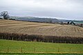
 Arable fields in the Camlad valley - geograph.org.uk - 3724892.jpg 640 × 480; 100 KB
-
 B4381 across the River Severn - geograph.org.uk - 2093359.jpg 640 × 480; 96 KB
-
 B4388 at Leighton - geograph.org.uk - 2093409.jpg 640 × 480; 62 KB
-
 Badnage Wood - geograph.org.uk - 5870167.jpg 1,024 × 576; 319 KB
-

-
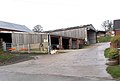
 Barns, Leighton Farm Buildings - geograph.org.uk - 4263001.jpg 1,600 × 928; 296 KB
-
 Beacon Ring above Welshpool - geograph.org.uk - 4912674.jpg 640 × 480; 61 KB
-
 Beside Philips's Gorse - geograph.org.uk - 4912661.jpg 640 × 480; 72 KB
-
 Bird hide at Dolydd Hafren - geograph.org.uk - 2605500.jpg 480 × 640; 138 KB
-
 Bird hide at Dolydd Hafren Nature Reserve - geograph.org.uk - 2756470.jpg 1,600 × 1,275; 758 KB
-
 Bird hide at the Dolydd Hafren Nature Reserve - geograph.org.uk - 2756462.jpg 1,150 × 1,600; 1,021 KB
-
 Brick channel near Offa's Pool - geograph.org.uk - 986582.jpg 640 × 480; 159 KB
-
 Bridge over Afon Hafren - geograph.org.uk - 6586889.jpg 1,024 × 768; 541 KB
-
 Brook entering Offa's Pool - geograph.org.uk - 986483.jpg 480 × 640; 161 KB
-

-
 Camlad from Shiregrove Bridge - geograph.org.uk - 660211.jpg 640 × 480; 104 KB
-
 Camlad Valley in flood - geograph.org.uk - 3844711.jpg 1,280 × 851; 329 KB
-

-
 Carpark at Dolydd Hafren Nature Reserve - geograph.org.uk - 2756455.jpg 1,600 × 1,200; 809 KB
-
 Church Close Leighton - geograph.org.uk - 1321293.jpg 640 × 426; 65 KB
-
 Church Hall at Forden - geograph.org.uk - 5538615.jpg 640 × 480; 57 KB
-
 Church Hall, Forden - geograph.org.uk - 4241478.jpg 1,600 × 779; 249 KB
-

-

-

-

-

-

-

-

-
-

-

-

-

-

-

-

-
-

-
 Cilcewydd - geograph.org.uk - 6154099.jpg 3,533 × 2,434; 2.85 MB
-

-
 Coed Parc Leighton Park Woods - geograph.org.uk - 4522608.jpg 640 × 454; 94 KB
-
 Corndon Hill from A490 between Forden and Chirbury, 1951 - geograph.org.uk - 4235063.jpg 2,413 × 1,400; 1.3 MB
-
 Corner of the dam on Offa's Pool - geograph.org.uk - 986509.jpg 480 × 640; 123 KB
-
 Cottage in the woods - geograph.org.uk - 4918348.jpg 640 × 480; 84 KB
-
 Court House, Ffordun - geograph.org.uk - 6236658.jpg 1,024 × 768; 694 KB
-
 Cows in the Severn Valley - geograph.org.uk - 3155570.jpg 3,872 × 2,592; 3.02 MB
-
 Crossing Gates, Fron Bank - geograph.org.uk - 575714.jpg 640 × 425; 98 KB
-
 Culvert over the brook - geograph.org.uk - 986324.jpg 480 × 640; 135 KB
-
 Distant view of Long Mountain - geograph.org.uk - 1156214.jpg 640 × 377; 52 KB
-
 Ditch on Hem Moor - geograph.org.uk - 2193310.jpg 640 × 480; 75 KB
-
 Dolydd Hafren Nature Reserve carpark - geograph.org.uk - 2756451.jpg 1,600 × 1,200; 707 KB
-
 Double bends near Gunley Hall - geograph.org.uk - 3681435.jpg 640 × 431; 80 KB
-
 Downhill from Pant-y-Bwch - geograph.org.uk - 1321307.jpg 640 × 426; 80 KB
-
 Drive to Gravel Lodge - geograph.org.uk - 4917318.jpg 640 × 480; 76 KB
-

-
 Edderton Hall, 1993 - geograph.org.uk - 4448435.jpg 2,315 × 1,337; 2.87 MB
-
 Electricity substation near Forden - geograph.org.uk - 2193159.jpg 640 × 480; 78 KB
-

-
 Entering Forden - geograph.org.uk - 6154090.jpg 3,487 × 2,170; 2.38 MB
-
 Entrance gates near Church House - geograph.org.uk - 1512316.jpg 640 × 480; 136 KB
-
 Entrance to Upper Hem Farm - geograph.org.uk - 3808449.jpg 640 × 431; 56 KB
-
 Farm at Lower Leighton - geograph.org.uk - 811558.jpg 640 × 480; 36 KB
-
 Farm near Edderton Hall - geograph.org.uk - 1515231.jpg 640 × 480; 72 KB
-
 Farm track in the Severn Valley - geograph.org.uk - 3155516.jpg 3,872 × 2,592; 4.01 MB
-
 Farmland near Fflos - geograph.org.uk - 4441934.jpg 640 × 426; 62 KB
-
 Farmland, Severn Valley - geograph.org.uk - 4629003.jpg 640 × 426; 37 KB
-
 Farmland, Severnside - geograph.org.uk - 4441929.jpg 640 × 426; 52 KB
-
 Farmland, Upper Munlyn - geograph.org.uk - 4441933.jpg 640 × 426; 54 KB
-
 Farmyard, Leighton Farm Buildings - geograph.org.uk - 4262989.jpg 1,600 × 934; 245 KB
-
 Field boundary near Forden - geograph.org.uk - 4074417.jpg 640 × 480; 101 KB
-
 Field next to the A490 - geograph.org.uk - 3581003.jpg 1,600 × 1,071; 485 KB
-
 Field of Barley near Hem Farm - geograph.org.uk - 5966637.jpg 1,024 × 768; 274 KB
-
 Field of Barley near Hem Farm - geograph.org.uk - 5966640.jpg 1,024 × 768; 249 KB
-
 Field of Barley near Hem Farm - geograph.org.uk - 5966652.jpg 1,024 × 768; 311 KB
-
 Field of maize at Leighton - geograph.org.uk - 3155380.jpg 3,872 × 2,592; 2.49 MB
-
 Field opposite the church, Forden - geograph.org.uk - 5967331.jpg 1,024 × 768; 231 KB
-
 Field opposite the church, Forden - geograph.org.uk - 5967334.jpg 1,024 × 768; 215 KB
-
 Fields above River Severn - geograph.org.uk - 1398024.jpg 640 × 480; 72 KB
-

-
 Flooded fields near Welshpool - geograph.org.uk - 3155304.jpg 3,872 × 2,592; 2.86 MB
-
 Flooding at Rhydwhyman - geograph.org.uk - 3843965.jpg 1,280 × 851; 446 KB
-

-
 Footbridge crossing the Camlad - geograph.org.uk - 6236464.jpg 1,024 × 768; 914 KB
-
 Footpath through Leighton Estate - geograph.org.uk - 1321301.jpg 640 × 426; 75 KB
-
 Footpath to Trelystan - geograph.org.uk - 1512321.jpg 640 × 480; 94 KB
-
 Footpath^ - geograph.org.uk - 5966856.jpg 1,024 × 768; 332 KB
-
 Forden - geograph.org.uk - 6154095.jpg 3,151 × 1,821; 2.08 MB
-
 Forden entrance sign - geograph.org.uk - 2404611.jpg 640 × 480; 68 KB
-
 Forden, The Cock Hotel - geograph.org.uk - 4074413.jpg 640 × 457; 66 KB
-
 Forest track, Leighton Park woods - geograph.org.uk - 987109.jpg 640 × 480; 122 KB
-
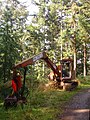 Forestry tractor - geograph.org.uk - 986262.jpg 479 × 640; 151 KB
-
 Forestry, Leighton Estate, 1988 - geograph.org.uk - 5770705.jpg 1,024 × 683; 230 KB
-
 Fron Farm - geograph.org.uk - 488987.jpg 640 × 426; 85 KB
-
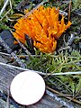 Fungus by the lower pool - geograph.org.uk - 987104.jpg 481 × 640; 104 KB
-
 Fungus in the wood - geograph.org.uk - 986744.jpg 640 × 482; 88 KB
-
 Fungus on a tree stump - geograph.org.uk - 986468.jpg 480 × 640; 125 KB
-
 Gate and track across fields - geograph.org.uk - 1398027.jpg 640 × 480; 110 KB
-
 Gates to Leighton Hall - geograph.org.uk - 2570546.jpg 1,024 × 680; 262 KB
-
 Ger Ffordun - Near Forden - geograph.org.uk - 4522585.jpg 640 × 441; 53 KB
-
 Green Wood - geograph.org.uk - 827074.jpg 640 × 480; 137 KB
-
 Greenwood Lodge, Leighton Estate.jpg 4,000 × 3,000; 5.11 MB
-
 Grid Service - geograph.org.uk - 2164779.jpg 2,272 × 1,704; 899 KB
-
 Gunley - geograph.org.uk - 5868753.jpg 1,024 × 576; 375 KB
-
 Hedgeline - geograph.org.uk - 4628995.jpg 640 × 426; 38 KB
-
 Hedging along main road - geograph.org.uk - 1515228.jpg 640 × 480; 66 KB
-
 Hem Crest and Hem Bank - geograph.org.uk - 2193368.jpg 640 × 480; 63 KB
-
 Hem Farm - geograph.org.uk - 5966761.jpg 1,024 × 768; 312 KB
-
 Hem farms - geograph.org.uk - 2193327.jpg 640 × 480; 52 KB
-
 High Bridge, Leighton - geograph.org.uk - 4308939.jpg 640 × 439; 154 KB
-
 High Oaks Lodge - geograph.org.uk - 2193378.jpg 640 × 480; 71 KB
-
 Holy Trinity church, Leighton - geograph.org.uk - 5244190.jpg 749 × 1,024; 88 KB
-

-
 Houses near Leighton - geograph.org.uk - 1426472.jpg 640 × 517; 178 KB
-

-
 Inside the hide - geograph.org.uk - 2756477.jpg 1,600 × 1,185; 340 KB
-
 It can't possibly get any drier - geograph.org.uk - 5869715.jpg 1,024 × 576; 245 KB
-
 It can't possibly get any wetter - geograph.org.uk - 4074438.jpg 640 × 480; 41 KB
-
 Junction on the A490 - geograph.org.uk - 6152349.jpg 3,605 × 1,803; 2.93 MB
-
 Lake or pool on the Leighton Park Estate - geograph.org.uk - 4918312.jpg 640 × 480; 114 KB
-
 Lane approaching Hem farms - geograph.org.uk - 3808448.jpg 640 × 360; 48 KB
-
 Lane through Hem - geograph.org.uk - 1515224.jpg 640 × 480; 68 KB
-
 Lane through the woods - geograph.org.uk - 1512324.jpg 640 × 480; 130 KB
-
 Lane to B4388 - geograph.org.uk - 826737.jpg 640 × 480; 119 KB
-
 Lane to Long Mountain - geograph.org.uk - 827061.jpg 640 × 480; 107 KB
-
 Lane to Marton - geograph.org.uk - 3844691.jpg 1,280 × 851; 408 KB
-
 Lane to Mulsop Farm - geograph.org.uk - 4598287.jpg 640 × 480; 66 KB
-
 Leighton - geograph.org.uk - 5870199.jpg 1,024 × 576; 302 KB
-
 Leighton Bridge - geograph.org.uk - 3155290.jpg 3,872 × 2,592; 3.39 MB
-
 Leighton estate - no entry - geograph.org.uk - 1512319.jpg 640 × 480; 122 KB
-
 Leighton Estate gates to the forest - geograph.org.uk - 4074441.jpg 640 × 480; 63 KB
-
 Leighton Farm Buildings - geograph.org.uk - 4271858.jpg 1,493 × 1,116; 380 KB
-
 Leighton Farm Buildings - geograph.org.uk - 4271859.jpg 1,600 × 1,011; 301 KB
-
 Leighton Farm Buildings - geograph.org.uk - 4271862.jpg 1,600 × 871; 295 KB
-
 Leighton Hall gateway - geograph.org.uk - 1398030.jpg 640 × 480; 104 KB
-
 Leighton Hall Summerhouse - geograph.org.uk - 3374424.jpg 640 × 432; 116 KB
-

-
 Leighton, the telephone box - geograph.org.uk - 5719092.jpg 480 × 640; 110 KB
-
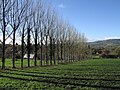 Line of trees at Leighton - geograph.org.uk - 2164310.jpg 1,600 × 1,200; 805 KB
-
 Lively young cattle at Leighton - geograph.org.uk - 3155386.jpg 3,872 × 2,592; 3.31 MB
-
 Llyn bach - Small lake - geograph.org.uk - 4522637.jpg 640 × 451; 94 KB
-
 Long Mountain - Beacon Ring - geograph.org.uk - 3346329.jpg 1,600 × 1,200; 1.18 MB
-

-
 Longhorn cattle, Gunley - geograph.org.uk - 5868759.jpg 1,024 × 576; 266 KB
-
 Looking across the field - geograph.org.uk - 5966878.jpg 1,024 × 768; 320 KB
-
 Looking down the Camlad from the railway - geograph.org.uk - 5025534.jpg 1,600 × 975; 172 KB
-

-

-

-

-
 Lower Leighton Farm - geograph.org.uk - 3155343.jpg 3,872 × 2,592; 1.88 MB
-
 Lower Leighton Farm - geograph.org.uk - 4598331.jpg 640 × 345; 47 KB
-
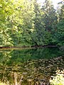 Lower pool in Leighton Park woods - geograph.org.uk - 986852.jpg 480 × 640; 145 KB
-
 Lower pool in Leighton Park woods - geograph.org.uk - 986889.jpg 480 × 640; 154 KB
-

-
 Marton road from Sevenwells entrance - geograph.org.uk - 4598341.jpg 640 × 315; 65 KB
-
 Meadow at Dolydd Hafren - geograph.org.uk - 1512336.jpg 640 × 480; 75 KB
-
 Memorial stone at Beacon Ring - geograph.org.uk - 2164298.jpg 2,739 × 2,051; 3.86 MB
-
 Mixed species plantation - geograph.org.uk - 643952.jpg 640 × 428; 62 KB
-

-
 Muddy fields at Lower Leighton - geograph.org.uk - 3155331.jpg 3,872 × 2,592; 2.24 MB
-
 No view from Pant-y-Bwch - geograph.org.uk - 985744.jpg 640 × 480; 81 KB
-

-
 ODP in Forden - geograph.org.uk - 4372233.jpg 640 × 360; 83 KB
-
 Offa's Dyke embankment S of Forden - geograph.org.uk - 6013945.jpg 5,184 × 2,920; 6.41 MB
-
 Offa's Dyke National Trail - geograph.org.uk - 4074450.jpg 640 × 480; 85 KB
-

-
 Offa's Dyke path - geograph.org.uk - 1512326.jpg 640 × 480; 130 KB
-
 Offa's Dyke Path approaches Montgomery - geograph.org.uk - 2060332.jpg 640 × 480; 126 KB
-

-

-
 Offa's Dyke path in Leighton Park woods - geograph.org.uk - 986252.jpg 480 × 640; 151 KB
-
-
 Offa's Dyke Path near Forden - geograph.org.uk - 4909142.jpg 640 × 480; 78 KB
-
 Offa's Dyke Path passes a hillfort - geograph.org.uk - 4169279.jpg 427 × 640; 92 KB
-
 Offa's Dyke path sign - geograph.org.uk - 1512330.jpg 640 × 480; 133 KB
-
 Offa's Dyke Path, E of Offa's View near Forden - geograph.org.uk - 6013951.jpg 5,184 × 2,920; 6.12 MB
-
 Offa's Pool - geograph.org.uk - 827709.jpg 640 × 480; 116 KB
-
 Old barn in Forden - geograph.org.uk - 2939284.jpg 640 × 480; 52 KB
-
 Old Milestone by the A490, south of Cilcewydd - geograph.org.uk - 6048615.jpg 791 × 1,194; 291 KB
-
-

-
 On Offa's Dyke Path in Forden - geograph.org.uk - 4372227.jpg 640 × 360; 64 KB
-

-

-

-
-

-

-

-
 On Offa's Dyke Path near Camlad crossing, Montgomery - geograph.org.uk - 6013956.jpg 5,184 × 2,920; 6.36 MB
-
 On Offa's Dyke Path near Pound House - geograph.org.uk - 4372183.jpg 640 × 360; 93 KB


