Category:Ford Island
Jump to navigation
Jump to search
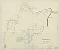
English: Ford Island, located in the middle of Pearl Harbor, Hawaii
islet at Pearl Harbor, Oahu, Hawaii, USA | |||||
| Upload media | |||||
| Instance of | |||||
|---|---|---|---|---|---|
| Part of | |||||
| Location | Honolulu County, Hawaii | ||||
| Located in or next to body of water | |||||
| Width |
| ||||
| Length |
| ||||
| Population |
| ||||
| Area |
| ||||
 | |||||
Subcategories
This category has the following 22 subcategories, out of 22 total.
A
F
- Ford Island Control Tower (131 F)
- Ford Island Heritage Run (9 F)
H
- Halawa Landing, Ford Island (12 F)
- Hangar 6, Pearl Harbor (22 F)
M
N
O
P
S
Media in category "Ford Island"
The following 200 files are in this category, out of 394 total.
(previous page) (next page)-
110531-D-XH843-011 (5804030191).jpg 3,828 × 2,552; 4.45 MB
-
121206-N-WF272-014 (8262233874).jpg 2,176 × 3,000; 1.52 MB
-
160324-N-PO203-110 (29259322741).jpg 4,928 × 3,280; 2.52 MB
-
1918-12-16 Luke Field.jpg 1,463 × 1,152; 163 KB
-
1918-8-15 Martin GMB 01.jpg 1,512 × 1,073; 87 KB
-
1919-1921 Luke Field.jpg 1,463 × 1,152; 291 KB
-
2.11 aerial 1 (8101039594).jpg 2,272 × 1,704; 586 KB
-
2.11 aerial 2 (8101025775).jpg 2,272 × 1,704; 489 KB
-
2H8A1299 (14789728068).jpg 2,048 × 1,366; 332 KB
-
6th Aero Squadron Curtiss HS-2L.jpg 770 × 459; 70 KB
-
6th Aero Squadron Dayton-Wright DH-4 2.jpg 432 × 459; 64 KB
-
6th Aero Squadron Dayton-Wright DH-4 3.jpg 413 × 547; 66 KB
-
6th Aero Squadron Dayton-Wright DH-4.jpg 719 × 416; 79 KB
-
6th Aero Squadron JN-4 Jennies.jpg 794 × 468; 94 KB
-
6th Aero Squadron JN-6s.jpg 576 × 384; 60 KB
-
6th Aero Squadron Luke Field.jpg 621 × 757; 129 KB
-
6th Aero Squadron motorcycle.jpg 758 × 560; 93 KB
-
6th Aero Squadron truck.jpg 768 × 570; 116 KB
-
80-G-451050 (22592549810).jpg 2,104 × 2,216; 437 KB
-
80-G-451051 (22791727701).jpg 3,004 × 2,360; 665 KB
-
80-G-451055 (22780510095).jpg 3,043 × 2,368; 634 KB
-
80-G-451056 (22766987142).jpg 2,988 × 2,388; 640 KB
-
80-G-451200 (29708245542).jpg 1,907 × 2,104; 3.34 MB
-
80-G-463877 (29528372910).jpg 2,972 × 2,284; 5.21 MB
-
80-G-463878 (29528371850).jpg 2,908 × 2,244; 5.04 MB
-
80-G-463880 (29528370370).jpg 2,896 × 2,292; 5.35 MB
-
Aerial photo of Ford Island c1941.jpg 1,598 × 1,174; 950 KB
-
Aerial view of Ford Island Pearl Harbor 2013.JPG 3,000 × 1,619; 814 KB
-
Aerial view of Pearl Harbor in June 1941.jpg 5,503 × 4,234; 9.72 MB
-
Aerial view of Pearl Harbor on 3 May 1940.jpg 5,670 × 4,424; 8.81 MB
-
Aerial view of Pearl Harbor on 8 March 2016.JPG 6,695 × 2,886; 2.02 MB
-
Albert-Haynesworth-Feb-4-09-090204-N-9758L-030.jpg 187 × 280; 48 KB
-
Battery Boyd Ford Island Hawaii.JPG 4,760 × 3,507; 2.53 MB
-
Battleship Missouri Memorial aerial view in March 2014.JPG 3,000 × 1,720; 1.06 MB
-
E50G4730 s (11228767696).jpg 2,500 × 1,667; 1.18 MB
-
E50G4739 s (11228450436).jpg 1,250 × 833; 335 KB
-
E50G4748 s (11229627335).jpg 2,500 × 1,667; 1.59 MB
-
Ford Island - panoramio.jpg 2,816 × 2,112; 2.9 MB
-
Ford Island 2016 K.jpg 6,000 × 4,000; 15.51 MB
-
Ford Island 2016 L.jpg 6,000 × 4,000; 17.07 MB
-
Ford Island 2016 M.jpg 6,000 × 4,000; 15.82 MB
-
Ford Island 2016 N.jpg 6,000 × 4,000; 15.12 MB
-
Ford Island 2016 T.jpg 3,776 × 5,832; 10.78 MB
-
Ford Island 2016 U.jpg 4,000 × 6,000; 10.77 MB
-
Ford Island 2016 V.jpg 6,000 × 4,000; 13.72 MB
-
Ford Island 2016 W.jpg 6,000 × 4,000; 14.64 MB
-
Ford Island 2016 X.jpg 6,000 × 4,000; 15.53 MB
-
Ford Island 2016 XY.jpg 6,000 × 4,000; 15.06 MB
-
Ford Island 2016 Y.jpg 6,000 × 4,000; 12.95 MB
-
Ford Island 2016 Z.jpg 6,000 × 4,000; 13.42 MB
-
Ford Island 2016 ZZ.jpg 6,000 × 4,000; 13.63 MB
-
Ford Island 2016 ZZZ.jpg 6,000 × 4,000; 14.87 MB
-
Ford Island aerial photo RIMPAC 1986.JPEG 3,000 × 2,400; 4.77 MB
-
Ford Island Hawaii space photo 2009.jpg 1,039 × 638; 120 KB
-
Ford Island in Pearl Harbor ^ Eric Tessmer - panoramio.jpg 5,954 × 3,930; 8.49 MB
-
Ford Island Pearl Harbor aerial photo 1986.JPEG 3,000 × 2,001; 1.41 MB
-
Ford Island photovoltaic panels concept.png 635 × 386; 512 KB
-
Honolulu, HI, USA - panoramio (8).jpg 2,976 × 3,968; 7.11 MB
-
Map of Ford's Island, Oahu, H. T. - NARA - 77-WDMC Hawaii-82.jpg 9,618 × 8,167; 31.35 MB
-
Map of Ford's Island, Oahu, H. T. - NARA - 77-WDMC Hawaii-82.TIF 9,618 × 8,167; 224.75 MB
-
Memorial Day at Ford Island 140526-N-IU636-001.jpg 3,000 × 1,996; 1.38 MB
-
Memorial to the USS Utah wreck, Ford Island, Hawaii.jpg 4,000 × 3,000; 3.13 MB
-
Moku'ume'ume.png 664 × 474; 170 KB
-
New GRB Antenna at NOAA Inouye Regional Center (24899676230).jpg 960 × 1,280; 330 KB
-
NOAA Pearl Harbor Approach Map.jpg 5,291 × 7,123; 3.78 MB
-
Overhead view of Ford Island in 1941.jpg 5,313 × 4,143; 10.9 MB
-
Overhead view of Ford Island in June 1941.jpg 5,515 × 4,275; 8.75 MB
-
Pearl Harbor aerial photo 1983.JPEG 3,000 × 2,388; 2.51 MB
-
Stearman N2S - E50G4782 s (11228434314).jpg 1,250 × 833; 488 KB
-
Stearman N2S - E50G4783 s (11228423615).jpg 1,250 × 833; 409 KB


