Category:Footpaths in South Lanarkshire
Jump to navigation
Jump to search
Subcategories
This category has the following 5 subcategories, out of 5 total.
Media in category "Footpaths in South Lanarkshire"
The following 26 files are in this category, out of 26 total.
-
 A path during Snow time - panoramio.jpg 1,280 × 1,024; 745 KB
-
 Avon Walkway - geograph.org.uk - 849193.jpg 640 × 480; 175 KB
-
 Chatelherault deer park (geograph 6992262).jpg 2,579 × 2,537; 1.75 MB
-

-
 Cherry Hill - geograph.org.uk - 844807.jpg 640 × 480; 82 KB
-
 Croftfoot railway station (geograph 5409067).jpg 480 × 640; 173 KB
-
 Cuningar Loop Woodland Park (geograph 6884364).jpg 3,000 × 2,000; 6.78 MB
-
 Cycle path at Ballantrae Road, Blantyre (geograph 6803197).jpg 1,024 × 683; 210 KB
-
 Erosion on the Duncan Gill track - geograph.org.uk - 1354572.jpg 480 × 640; 140 KB
-
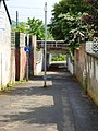
 Foot path under Bridge over Calder Water - geograph.org.uk - 919373.jpg 480 × 640; 461 KB
-
 Footpath in Drumsargad (geograph 7206668).jpg 1,024 × 768; 286 KB
-
 NCR75 passing Westburn Grid substation (geograph 7228155).jpg 1,024 × 768; 225 KB
-
 New bridge over an old railway track (geograph 6803163).jpg 1,024 × 768; 362 KB
-
 Old Bridge on Arrotshole Road, East Kilbride (geograph 3722662).jpg 640 × 480; 154 KB
-
 Old railway by Threepwood Moss - geograph.org.uk - 629510.jpg 640 × 480; 170 KB
-
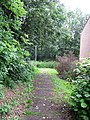
 Path Beside Kittoch Water - geograph.org.uk - 1036868.jpg 640 × 480; 252 KB
-
 Path by Stonelaw High School - geograph.org.uk - 2485075.jpg 640 × 480; 332 KB
-
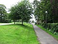
 Path in the park (geograph 5202152).jpg 640 × 427; 407 KB
-
 Path off Landemer Drive - geograph.org.uk - 2485088.jpg 480 × 640; 377 KB
-
 Path to Quarter - geograph.org.uk - 1722759.jpg 640 × 480; 94 KB
-
 River Nethan path - geograph.org.uk - 682933.jpg 640 × 480; 188 KB
-
 Slip road from M74 at junction 6 joining the A723 (geograph 6611917).jpg 1,024 × 768; 265 KB
-
 Strathclyde Park to Chatelherault path - geograph.org.uk - 928279.jpg 640 × 480; 155 KB
-
 The path to Quarter - geograph.org.uk - 1722891.jpg 640 × 480; 123 KB
-
 Underpass under High Common Road (geograph 2989984).jpg 640 × 480; 310 KB
-
 Path by the River Clyde at Abington - geograph.org.uk - 409418.jpg 640 × 480; 137 KB


.jpg)


.jpg)
.jpg)
.jpg)


.jpg)
.jpg)
.jpg)
.jpg)


.jpg)


.jpg)


.jpg)
