Category:Fochriw
Jump to navigation
Jump to search
village in United Kingdom  | |||||
| Upload media | |||||
| Instance of | |||||
|---|---|---|---|---|---|
| Location | Caerphilly County Borough, Wales | ||||
 | |||||
Cymraeg: Pentref yng nghymuned Cwm Darran ym Mwrdeisdref Sirol Caerffili yw Fochriw. Saif yn rhan uchaf Cwm Darran, neu Bargoed Fach, ychydig i'r gorllewin o'r briffordd A469 ac i'r de-orllewin o dref Rhymni.
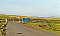
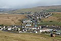
English: Fochriw is a village located in Caerphilly County Borough, Wales. It was well known for its neighbouring collieries, which employed nearly the entire local population in the early 20th century. It lies within the historic county boundaries of Glamorgan. The village appears as the backdrop on the BBC Wales sitcom High Hopes credits.
Media in category "Fochriw"
The following 166 files are in this category, out of 166 total.
-
 A View of Fochriw Pond - geograph.org.uk - 5091894.jpg 1,200 × 1,600; 633 KB
-
 A watery grave - geograph.org.uk - 737930.jpg 638 × 475; 117 KB
-
 Access road to Llwyn Iago Farm, Fochriw - geograph.org.uk - 5862045.jpg 936 × 1,024; 224 KB
-
 Alcohol Control Zone notice, Cae Glas Newydd, Fochriw - geograph.org.uk - 5866467.jpg 1,001 × 1,024; 153 KB
-

-
 Bend in Heol Iago, Fochriw - geograph.org.uk - 5862635.jpg 1,024 × 732; 159 KB
-
 Brook Row houses, Fochriw - geograph.org.uk - 5863746.jpg 1,024 × 660; 169 KB
-
 Bryn Nant bungalows, Fochriw - geograph.org.uk - 5862367.jpg 1,024 × 867; 144 KB
-
 Brynteg Terrace, Fochriw - geograph.org.uk - 5862066.jpg 1,024 × 823; 210 KB
-

-
 Buildings Above Fochriw - geograph.org.uk - 5091890.jpg 1,600 × 1,200; 517 KB
-

-
 Cae Glas houses, Fochriw - geograph.org.uk - 5863776.jpg 1,024 × 894; 173 KB
-
 Cattle Grid, Fochriw - geograph.org.uk - 534213.jpg 640 × 306; 74 KB
-
 CCTV camera on a Fochriw corner - geograph.org.uk - 5866450.jpg 1,024 × 873; 164 KB
-
 Children's playground in Fochriw - geograph.org.uk - 5862621.jpg 1,024 × 661; 164 KB
-
 Corner house in Fochriw - geograph.org.uk - 5863796.jpg 1,024 × 742; 139 KB
-
 Coronation Crescent, Fochriw - geograph.org.uk - 5862656.jpg 1,024 × 647; 111 KB
-

-

-
 Cwm Bargoed station site geograph-3360380-by-Ben-Brooksbank.jpg 2,394 × 1,443; 3.19 MB
-
 Dead-end part of Heol Iago, Fochriw - geograph.org.uk - 5871006.jpg 1,024 × 587; 103 KB
-
 Derelict building near Fochriw - geograph.org.uk - 5204069.jpg 4,000 × 3,000; 2.96 MB
-
 Dismantled Railway Fochriw - geograph.org.uk - 1127509.jpg 640 × 427; 49 KB
-

-
 Down Cwm Darran above Fochriw, 1990 - geograph.org.uk - 4304339.jpg 2,396 × 1,445; 3.79 MB
-
 Down Heol Iago, Fochriw - geograph.org.uk - 5870999.jpg 1,024 × 907; 221 KB
-

-
 Edwardian part of Fochriw Primary School, Fochriw - geograph.org.uk - 5866353.jpg 1,019 × 1,024; 248 KB
-
 Entering Fochriw. - geograph.org.uk - 5291237.jpg 1,600 × 1,060; 561 KB
-
 Entrance to Fochriw Primary School, Fochriw - geograph.org.uk - 5866319.jpg 1,024 × 816; 171 KB
-
 Evening view over Fochriw (geograph 3125213).jpg 640 × 480; 135 KB
-

-
 Fochrhiw Village and school - geograph.org.uk - 87984.jpg 640 × 480; 136 KB
-
 Fochriw - geograph.org.uk - 5291246.jpg 1,600 × 1,060; 568 KB
-
 Fochriw - geograph.org.uk - 5291252.jpg 1,600 × 1,060; 531 KB
-
 Fochriw - geograph.org.uk - 5291270.jpg 1,600 × 1,060; 422 KB
-

-
 Fochriw and the Darran Valley - geograph.org.uk - 2021348.jpg 640 × 480; 90 KB
-
 Fochriw Clinic, Fochriw - geograph.org.uk - 5862058.jpg 1,024 × 891; 191 KB
-
 Fochriw Colliery production.webp 1,000 × 600; 33 KB
-
 Fochriw Community Centre - geograph.org.uk - 3044086.jpg 640 × 480; 116 KB
-
 Fochriw Community Centre - geograph.org.uk - 5291273.jpg 1,600 × 1,060; 316 KB
-
 Fochriw Community Centre - geograph.org.uk - 5862366.jpg 1,024 × 751; 147 KB
-
 Fochriw Feeder Pond - geograph.org.uk - 5204071.jpg 4,000 × 3,000; 3.56 MB
-
 Fochriw Football Ground - geograph.org.uk - 5866519.jpg 1,024 × 538; 143 KB
-
 Fochriw multi-use games court - geograph.org.uk - 5866381.jpg 1,024 × 553; 137 KB
-

-
 Fochriw Pentecostal Mission - geograph.org.uk - 3255142.jpg 640 × 480; 108 KB
-
 Fochriw Pentecostal Mission - geograph.org.uk - 3255166.jpg 640 × 480; 90 KB
-
 Fochriw Pentecostal Mission.jpg 1,024 × 771; 110 KB
-
 Fochriw Pond - geograph.org.uk - 3648144.jpg 640 × 480; 67 KB
-
 Fochriw Primary School, Fochriw - geograph.org.uk - 5866331.jpg 1,024 × 678; 145 KB
-
 Fochriw Social Club (geograph 5861993).jpg 1,024 × 687; 157 KB
-
 Fochriw Village - geograph.org.uk - 1121510.jpg 640 × 427; 75 KB
-
 Fochriw. - geograph.org.uk - 5291262.jpg 1,600 × 1,060; 428 KB
-
 FochriwPrimary.jpg 604 × 455; 62 KB
-
 Former mine railway - geograph.org.uk - 625359.jpg 640 × 477; 82 KB
-
 Former railway line, Fochriw (geograph 3248505).jpg 640 × 480; 115 KB
-
 Former Rising Sun pub, Station Terrace, Fochriw (geograph 5863787).jpg 1,024 × 850; 169 KB
-

-
 Glan-y-nant bus stop, Fochriw - geograph.org.uk - 5870172.jpg 878 × 1,024; 198 KB
-
 Glan-y-nant semis, Fochriw - geograph.org.uk - 5870256.jpg 1,024 × 825; 159 KB
-
 Glenview Terrace, Pentwyn. Fochriw - geograph.org.uk - 3249578.jpg 640 × 480; 98 KB
-
 Glyn Terrace, Fochriw (geograph 5861978).jpg 1,024 × 736; 132 KB
-
 Green lockup garages, Heol Iago, Fochriw - geograph.org.uk - 5862802.jpg 1,024 × 724; 126 KB
-
 Grid across Railway Terrace, Fochriw (geograph 5863715).jpg 1,024 × 818; 181 KB
-

-

-
 Heol Iago bus stop and shelter, Fochriw - geograph.org.uk - 5862818.jpg 1,007 × 1,024; 206 KB
-

-
 Heol Iago semis, Fochriw - geograph.org.uk - 5862672.jpg 1,024 × 613; 106 KB
-
 Heol-y-bryn houses, Fochriw - geograph.org.uk - 5862400.jpg 1,022 × 995; 116 KB
-
 Hillside above Fochriw, Darran Valley - geograph.org.uk - 5723347.jpg 5,184 × 3,456; 7.42 MB
-
 Industrial remains above Fochriw - geograph.org.uk - 5204078.jpg 4,000 × 3,000; 3.77 MB
-

-

-

-

-
 Large shed near Fochriw - geograph.org.uk - 5204074.jpg 3,916 × 2,937; 4.21 MB
-
 Long row of houses, Aelybryn Street, Fochriw - geograph.org.uk - 5862612.jpg 1,024 × 938; 162 KB
-
 Looking sheepish in Fochriw (geograph 5871034).jpg 987 × 1,024; 211 KB
-

-
 Main road through Fochriw - geograph.org.uk - 5866531.jpg 1,024 × 814; 159 KB
-
 Minor upland road near Fochriw - geograph.org.uk - 4776666.jpg 4,000 × 3,000; 2.53 MB
-
 Moorland Above Fochriw - geograph.org.uk - 5422389.jpg 1,600 × 1,200; 391 KB
-
 Moorland at the edge of Fochriw - geograph.org.uk - 5866420.jpg 1,024 × 479; 110 KB
-
 Mount Pleasant Inn, Pentwyn, Fochriw - geograph.org.uk - 3249607.jpg 640 × 480; 105 KB
-
 Mural commemorating the former railway, Fochriw (geograph 3248555).jpg 640 × 480; 122 KB
-
 New dry stone wall above Fochriw - geograph.org.uk - 1997842.jpg 640 × 480; 44 KB
-
 New dry stone wall at Fochriw (geograph 1997822).jpg 640 × 480; 73 KB
-
 No Entry signs, Glan-y-nant, Fochriw - geograph.org.uk - 5870044.jpg 1,024 × 695; 130 KB
-
 No parking in Heol Iago, Fochriw - geograph.org.uk - 5870193.jpg 1,024 × 796; 164 KB
-
 North side of Plantation Terrace, Fochriw - geograph.org.uk - 5862068.jpg 1,024 × 771; 143 KB
-

-
 On-street parking, Glan-y-nant, Fochriw - geograph.org.uk - 5862825.jpg 1,024 × 783; 114 KB
-
 On-street parking, Glan-y-nant, Fochriw - geograph.org.uk - 5870175.jpg 1,024 × 688; 140 KB
-

-
 Playground bus stop, Heol Iago, Fochriw - geograph.org.uk - 5862630.jpg 1,024 × 691; 182 KB
-
 Pleasant View houses, Fochriw - geograph.org.uk - 5862603.jpg 1,024 × 884; 163 KB
-
 Pond between Fochriw and Pontlottyn - geograph.org.uk - 5902199.jpg 640 × 600; 105 KB
-
 Pontlottyn Road bus stops, Fochriw - geograph.org.uk - 5866405.jpg 1,024 × 720; 146 KB
-
 Pontlottyn Road semis, Fochriw - geograph.org.uk - 5866390.jpg 1,024 × 550; 130 KB
-
 Pontlottyn Road speed bumps, Fochriw - geograph.org.uk - 5866316.jpg 1,024 × 876; 170 KB
-

-

-
 Railway Terrace, Fochriw (geograph 5863800).jpg 1,024 × 804; 117 KB
-
 Recreation area in Fochriw - geograph.org.uk - 5866560.jpg 1,024 × 812; 222 KB
-
 Rhodfa Ganol, Fochriw - geograph.org.uk - 5862792.jpg 1,024 × 749; 144 KB
-

-
 Road ascending away from Fochriw - geograph.org.uk - 5861917.jpg 1,024 × 815; 138 KB
-
 Road ascending away from the centre of Fochriw - geograph.org.uk - 5879754.jpg 1,024 × 742; 161 KB
-
 Road bridge and footbridge over a brook, Fochriw - geograph.org.uk - 5862379.jpg 1,024 × 794; 183 KB
-
 Road grid at the southern edge of Fochriw - geograph.org.uk - 5880045.jpg 1,024 × 627; 120 KB
-
 Road through moorland near Fochriw - geograph.org.uk - 5862422.jpg 1,024 × 748; 157 KB
-

-
 Roadside horses near Fochriw (geograph 7304384).jpg 5,184 × 3,888; 5.05 MB
-
 Scarred hillside near Fochriw - geograph.org.uk - 5922942.jpg 1,024 × 510; 121 KB
-
 Sheep crossing Heol Iago, Fochriw (geograph 5862796).jpg 1,024 × 833; 183 KB
-
 Sheep grazing on a Fochriw hillside - geograph.org.uk - 5880048.jpg 1,024 × 650; 165 KB
-
 Sheep out for a stroll in Fochriw - geograph.org.uk - 5870266.jpg 1,024 × 754; 169 KB
-
 Six houses, Heol Iago, Fochriw - geograph.org.uk - 5862627.jpg 1,024 × 628; 123 KB
-
 Southern boundary of Fochriw (geograph 5861901).jpg 1,024 × 641; 137 KB
-

-

-
 Station Terrace bus stop sign, Fochriw (geograph 5879739).jpg 999 × 1,024; 181 KB
-
 Station Terrace houses, Fochriw (geograph 5863779).jpg 1,024 × 741; 160 KB
-
 Steep ascent away from Fochriw - geograph.org.uk - 5863781.jpg 1,024 × 770; 142 KB
-
 The Villas, Aelybryn Street, Fochriw - geograph.org.uk - 5862608.jpg 984 × 1,024; 183 KB
-
 Towards a bend in Fochriw Road - geograph.org.uk - 5902209.jpg 1,024 × 945; 179 KB
-
 Towards the Village Store & Newsagents, Fochriw (geograph 5866556).jpg 939 × 1,024; 257 KB
-
 Towards the western end of Guest Street, Fochriw - geograph.org.uk - 5863720.jpg 1,024 × 943; 183 KB
-
 Traffic calming on Pontlottyn Road, Fochriw - geograph.org.uk - 5866347.jpg 1,024 × 904; 170 KB
-
 Trig point at Pen Carnbugail - geograph.org.uk - 77711.jpg 640 × 480; 133 KB
-
 Unclassified road from Fochriw towards Bargoed - geograph.org.uk - 5861939.jpg 1,024 × 696; 118 KB
-
 Unclassified road from Pentwyn towards Fochriw - geograph.org.uk - 5922917.jpg 1,024 × 996; 171 KB
-
 Unnamed side road in Fochriw (geograph 5862072).jpg 1,024 × 980; 268 KB
-
 Upland pond near Fochriw - geograph.org.uk - 4776661.jpg 4,000 × 3,000; 1.91 MB
-
 Upland pond near Fochriw - geograph.org.uk - 4776662.jpg 4,000 × 3,000; 2.8 MB
-
 Upstream along Nant Bargod Rhymni, Fochriw - geograph.org.uk - 5862381.jpg 983 × 1,024; 258 KB
-
 View across Fochriw (geograph 3640258).jpg 640 × 480; 97 KB
-
 View over Fochriw (geograph 2425161).jpg 2,816 × 2,112; 1.62 MB
-
 View over Fochriw - geograph.org.uk - 3255175.jpg 640 × 480; 124 KB
-
 Village Fish Bar, Station Terrace, Fochriw (geograph 5862081).jpg 1,024 × 853; 168 KB
-
 Village Store ^ Newsagents, Fochriw - geograph.org.uk - 5862371.jpg 1,024 × 928; 176 KB
-
 War and Colliery Memorial, Fochriw - geograph.org.uk - 5862377.jpg 1,011 × 874; 210 KB
-
 Waste ground below Fochriw Pentecostal Mission - geograph.org.uk - 5863710.jpg 1,024 × 930; 187 KB
-
 Welsh Water building in Fochriw - geograph.org.uk - 5879747.jpg 1,024 × 686; 174 KB
-
 West along Guest Street, Fochriw - geograph.org.uk - 5863693.jpg 1,024 × 921; 193 KB
-
 West side of Glyn Terrace, Fochriw - geograph.org.uk - 5862075.jpg 899 × 1,024; 144 KB
-

-
 Yellow grit box and a view across Fochriw - geograph.org.uk - 5863728.jpg 1,024 × 582; 108 KB
-
 Hail, Caesar - geograph.org.uk - 625733.jpg 640 × 477; 87 KB
-

-
 Looking down on Deri - geograph.org.uk - 625368.jpg 640 × 477; 89 KB
-
 Manhole on the common - geograph.org.uk - 625530.jpg 640 × 477; 107 KB
-
 Nant Bargod Rhymni - geograph.org.uk - 625483.jpg 640 × 477; 143 KB
-
 Nant Bargod Rhymni - geograph.org.uk - 625490.jpg 640 × 477; 135 KB
-
 Old and wizened trees - geograph.org.uk - 625741.jpg 640 × 477; 139 KB
-
 Pant Ffos-yr-hebog - geograph.org.uk - 624700.jpg 640 × 477; 92 KB
-
 Pasture above Darren valley - geograph.org.uk - 625370.jpg 640 × 477; 84 KB
-
 Pen-y-garreg farm - geograph.org.uk - 625354.jpg 640 × 477; 80 KB
-
 Pencaedrain - geograph.org.uk - 625494.jpg 640 × 477; 45 KB
-

-
 Rhaslas Pond - geograph.org.uk - 484274.jpg 640 × 480; 75 KB
-
 Road junction at the edge of Fochriw - geograph.org.uk - 653445.jpg 640 × 479; 109 KB


.jpg)


_-_geograph.org.uk_-_5863652.jpg)


.jpg)


.jpg)
.jpg)


.jpg)

.jpg)


.jpg)


.jpg)

.jpg)


.jpg)


.jpg)

.jpg)


.jpg)


.jpg)
.jpg)


.jpg)


.jpg)


.jpg)
.jpg)

.jpg)


