Category:Floor of the Valley Road
Jump to navigation
Jump to search
scenic drive in Zion Canyon in Zion National Park in Washington County, Utah, United States | |||||
| Upload media | |||||
| Instance of | |||||
|---|---|---|---|---|---|
| Located in protected area | |||||
| Location | Washington County, Utah | ||||
| Architect |
| ||||
| Maintained by | |||||
| Heritage designation |
| ||||
| Length |
| ||||
| Terminus | |||||
 | |||||
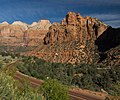
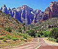
English: Media related to the Floor of the Valley Road, a 6.3163-mile (10.1651 km) scenic drive in the middle part of Zion Canyon in southern Zion National Park in northwestern Washington County, Utah, United States, that connects the Zion-Mount Carmel Highway (Utah State Route 9) with the Temple of Sinawava and was built by the Civilian Conservation Corps (CCC). The road is also known as Zion Canyon Scenic Drive and the Floor of the Valley Highway.
|
This is a category about a place or building that is listed on the National Register of Historic Places in the United States of America. Its reference number is 96000048. |
Subcategories
This category has the following 2 subcategories, out of 2 total.
C
- Cable Creek Bridge (12 F)
Media in category "Floor of the Valley Road"
The following 98 files are in this category, out of 98 total.
-
Above the Angels - Flickr - brewbooks.jpg 4,288 × 3,216; 3.83 MB
-
Alcove Above Road, Zion N.P. 5-1-14b (14361199745).jpg 1,960 × 1,904; 2.5 MB
-
Angel's view 5 (15699339653).jpg 3,264 × 2,448; 2.51 MB
-
Angels Landing 16 (4210351499).jpg 4,000 × 3,000; 8.14 MB
-
Angels Landing 42 (4210414703).jpg 4,000 × 3,000; 8.92 MB
-
Bee Hive, The Sentinel, Mount Spry.jpg 3,205 × 2,680; 1.88 MB
-
Deer on Floor of the Valley Rd, Oct 16.jpg 2,592 × 1,944; 2.42 MB
-
Fork in the Road, Zion N.P. 4-14 (23029261244).jpg 2,450 × 1,885; 2.29 MB
-
From the Peak at Angels Landing (Zion National Park) (3443199935).jpg 2,784 × 1,856; 1.45 MB
-
From the Peak at Angels Landing (Zion National Park) (3444015262).jpg 2,396 × 1,597; 940 KB
-
Grotto Shuttle Stop, Zion Canyon, Zion National Park, Utah (1026359358).jpg 1,600 × 1,200; 537 KB
-
Into the Canyon, Zion N.P. 4-14 (17027969117).jpg 2,450 × 2,054; 2.58 MB
-
Looking down from Angel's Landing trail, Zion NP - panoramio.jpg 1,280 × 960; 296 KB
-
Map Zion Canyon.jpg 746 × 1,773; 945 KB
-
Mt. Zion from Canyon floor. - NARA - 520338.jpg 2,268 × 3,000; 1.84 MB
-
MtZionMt2.jpg 923 × 692; 80 KB
-
Observation point hike 2.jpg 1,117 × 791; 767 KB
-
Observation point hike 3.jpg 1,082 × 810; 703 KB
-
Observation point hike 4.jpg 1,044 × 781; 608 KB
-
Observation point hike.jpg 1,121 × 800; 733 KB
-
Off the edge at Angels Landing (Zion National Park) (3444016716).jpg 2,784 × 1,856; 1.55 MB
-
Off the edge; Climbing up to Angels Landing (Zion National Park) (3443202891).jpg 2,784 × 1,856; 1.07 MB
-
On the way up to Angels Landing, Zion National Park (3444012582).jpg 2,784 × 1,856; 1.54 MB
-
Road through Zion Canyon 5-14 (17224332488).jpg 2,450 × 2,391; 1.35 MB
-
Shuttle bus stop at Zion Canyon National Park.jpg 2,272 × 1,704; 1.4 MB
-
Sunrise, Canyon Junction, Zion 5-14 (15293147598).jpg 2,450 × 1,608; 2.05 MB
-
Turkey run (6381228857).jpg 1,280 × 720; 398 KB
-
Twin Brothers Peak - panoramio.jpg 2,800 × 2,100; 1.88 MB
-
Utah State Highway 9 - 9078916989.jpg 3,072 × 2,304; 1.19 MB
-
Utah State Highway 9 - 9081145104.jpg 3,072 × 2,304; 960 KB
-
View from Angel's Landing (5309048170).jpg 1,948 × 2,656; 1.39 MB
-
View on the Climb up to Angels Landing (Zion National Park) (3444017948).jpg 2,662 × 1,775; 1.26 MB
-
View up Zion Canyon from main road on hill. Angel Landing, center. - NARA - 520371.jpg 3,000 × 2,120; 1.72 MB
-
Washington County, UT, USA - panoramio (48).jpg 3,264 × 2,448; 3.09 MB
-
West Entrance, Zion National Park, Utah (2147530952).jpg 1,600 × 1,200; 239 KB
-
Zion canyon - panoramio.jpg 1,800 × 1,200; 475 KB
-
Zion Canyon in Zion National Park - panoramio.jpg 1,600 × 710; 261 KB
-
Zion Canyon Scenic Drive, Road 5-1-14a (14167725268).jpg 1,960 × 1,916; 2.14 MB
-
Zion Canyon Scenic Drive, Zion National Park, Utah (1028836764).jpg 1,600 × 1,200; 465 KB
-
Zion Canyon, Zion National Park, Utah (1025210507).jpg 1,200 × 1,600; 286 KB
-
Zion Lodge, Springdale, United States (Unsplash).jpg 6,000 × 4,000; 14.96 MB
-
Zion N.P., Entrance 4-29-14e (13938435838).jpg 2,170 × 1,654; 1.51 MB
-
Zion N.P., Entrance 4-29-14f (14121752051).jpg 2,170 × 1,514; 1.85 MB
-
Zion National Park near Observation Point 2005 08 21.jpg 1,536 × 2,048; 1.33 MB
-
Zion National Park P4200583.jpg 4,350 × 3,255; 8.61 MB
-
Zion National Park, Vigin River, Watchman.jpg 3,264 × 2,448; 3.54 MB
-
Zion NP, Grotto Trail View 5-1-14l (14383697632).jpg 2,260 × 1,821; 2.29 MB
-
Zion NP, Stone Bridge 5-1-14a (14352796572).jpg 2,060 × 1,600; 2.74 MB
-
Zion NP, Sunrise on Inner Canyon Road 5-1-14i (14160763757).jpg 1,818 × 1,960; 1.59 MB
-
Zion NP, Zion Canyon - panoramio - Frans-Banja Mulder (4).jpg 858 × 643; 795 KB
-
Zion NP11.jpg 1,680 × 2,520; 4.88 MB
-
Zion NP18.jpg 2,520 × 1,680; 3.72 MB
-
Zion Park Drove 5-1-14 (14376326915).jpg 1,898 × 2,060; 2.13 MB
-
Zion View from Angels Landing - panoramio.jpg 4,608 × 3,456; 3.21 MB
-
Zion-Mount Carmel Highway, East End of Zion National Park, Utah (2146730567).jpg 1,600 × 1,200; 251 KB
Categories:
- Roads in Utah
- Roads in Zion National Park
- Roads in Washington County, Utah
- National Register of Historic Places in Zion National Park
- Roads on the National Register of Historic Places in Utah
- Scenic drives in Utah
- Zion Canyon
- Structures by the Civilian Conservation Corps
- Locations along Utah State Route 9 in Washington County, Utah
- Locations along Utah State Route 15 (1912-1977) in Washington County, Utah
- Locations along the Zion-Mount Carmel Highway in Washington County, Utah


