Category:Flood level signs in Saône-et-Loire
Jump to navigation
Jump to search
Departments of Metropolitan France: Ain [01] · Aisne [02] · Allier [03] · Ardennes [08] · Aube [10] · Aude [11] · Aveyron [12] · Bouches-du-Rhône [13] · Cher [18] · Creuse [23] · Dordogne [24] · Doubs [25] · Drôme [26] · Gard [30] · Haute-Garonne [31] · Gironde [33] · Hérault [34] · Ille-et-Vilaine [35] · Indre-et-Loire [37] · Isère [38] · Landes [40] · Loire [42] · Loire-Atlantique [44] · Loiret [45] · Lot [46] · Lot-et-Garonne [47] · Maine-et-Loire [49] · Mayenne [53] · Meurthe-et-Moselle [54] · Morbihan [56] · Moselle [57] · Nièvre [58] · Pas-de-Calais [62] · Pyrénées-Atlantiques [64] · Hautes-Pyrénées [65] · Bas-Rhin [67] · departmental district of the Rhône [69] · Saône-et-Loire [71] · Paris [75] · Seine-et-Marne [77] · Yvelines [78] · Vaucluse [84] · Essonne [91] · Hauts-de-Seine [92] · Val-de-Marne [94]
Media in category "Flood level signs in Saône-et-Loire"
The following 12 files are in this category, out of 12 total.
-

-

-
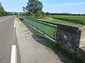 Levées de Lacrost à Tournus.jpg 2,816 × 2,112; 2.6 MB
-
 Maison à la Truchère avec marque de niveau d'inondation 2.jpg 2,816 × 2,112; 2.61 MB
-

-
 Saône - échelle des inondations à Ecuelles.JPG 1,495 × 1,575; 906 KB
-
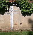
 1840 flood level sign in Tournus.jpg 2,112 × 2,816; 1.49 MB
-
 1955 flood level sign in Tournus.jpg 2,816 × 2,112; 2.44 MB
-
 Marque d'inondation de 1840 à Tournus.jpg 2,816 × 2,112; 2.19 MB
-
 Échelle inondations près Mairie St Symphorien Ancelles 1.jpg 3,456 × 5,184; 7.98 MB
-
 Échelle inondations près Mairie St Symphorien Ancelles 2.jpg 5,184 × 3,456; 6.26 MB
-
 Échelle inondations près Mairie St Symphorien Ancelles 3.jpg 3,456 × 5,184; 6.01 MB
_-_2024-03-19_-_1.jpg)
_-_2024-03-19_-_2.jpg)


_-_2024-03-19_-_1.jpg)


