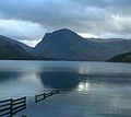
Category:Fleetwith Pike
Jump to navigation
Jump to search
mountain in England | |||||
| Upload media | |||||
| Instance of | |||||
|---|---|---|---|---|---|
| Location | Cumbria, North West England, England | ||||
| Mountain range | |||||
| Topographic prominence |
| ||||
| Elevation above sea level |
| ||||
| Parent peak | |||||
 | |||||
Media in category "Fleetwith Pike"
The following 75 files are in this category, out of 75 total.
-
Above Honister Pass - geograph.org.uk - 145014.jpg 480 × 640; 66 KB
-
Across Buttermere and Fleetwith Pike.jpg 1,572 × 1,175; 1.35 MB
-
B 5289 - geograph.org.uk - 881743.jpg 640 × 480; 108 KB
-
Bridleway to Gatesgarth - geograph.org.uk - 946758.jpg 640 × 426; 79 KB
-
Burnt Scarth - geograph.org.uk - 1706165.jpg 480 × 640; 71 KB
-
Buttermere - geograph.org.uk - 1768.jpg 640 × 481; 56 KB
-
Buttermere - geograph.org.uk - 288161.jpg 640 × 489; 77 KB
-
Buttermere - geograph.org.uk - 947175.jpg 640 × 426; 32 KB
-
BUTTERMERE AND FLEETWITH PIKE (4).JPG 1,633 × 1,459; 79 KB
-
Buttermere and Fleetwith Pike - geograph.org.uk - 1373725.jpg 640 × 392; 66 KB
-
Buttermere and Fleetwith Pike - geograph.org.uk - 1659698.jpg 640 × 439; 140 KB
-
Buttermere and Fleetwith Pike - geograph.org.uk - 1726185.jpg 640 × 480; 77 KB
-
Buttermere and Fleetwith Pike - geograph.org.uk - 265592.jpg 640 × 480; 99 KB
-
Buttermere and Fleetwith Pike.jpg 2,100 × 1,575; 104 KB
-
Buttermere and Sour Milk Gill - geograph.org.uk - 1659682.jpg 640 × 425; 167 KB
-
Buttermere Dubbs - geograph.org.uk - 255794.jpg 480 × 640; 57 KB
-
Buttermere Dubs - geograph.org.uk - 1659677.jpg 640 × 425; 155 KB
-
Buttermere from Fleetwith Pike - geograph.org.uk - 265604.jpg 640 × 480; 59 KB
-
Buttermere from Fleetwith Pike.jpg 1,697 × 1,116; 92 KB
-
Buttermere from its foot.jpg 4,608 × 3,456; 4.51 MB
-
Buttermere from its foot.JPG 4,608 × 3,456; 4.38 MB
-
Buttermere off Fleetwith Pike - geograph.org.uk - 275305.jpg 640 × 480; 117 KB
-
Buttermere with Fleetwith Pike.jpg 4,608 × 3,456; 4.57 MB
-
Crummock Water - geograph.org.uk - 1053091.jpg 640 × 475; 79 KB
-
Fleetwith Edge beyond Gatesgarth Farm - geograph.org.uk - 3210883.jpg 3,456 × 4,608; 3.23 MB
-
Fleetwith Pike - geograph.org.uk - 1259028.jpg 640 × 426; 62 KB
-
Fleetwith Pike - geograph.org.uk - 946754.jpg 426 × 640; 81 KB
-
Fleetwith Pike from Buttermere.jpg 1,600 × 1,200; 771 KB
-
Fleetwith Pike from Combe Gill.jpg 678 × 506; 73 KB
-
Fleetwith Pike from The Honister Pass - geograph.org.uk - 3210081.jpg 3,106 × 4,039; 2.25 MB
-
Fleetwith Pike.jpg 3,089 × 1,737; 2.02 MB
-
Footpath to Buttermere - geograph.org.uk - 1509831.jpg 640 × 480; 87 KB
-
From Fleetwith Pike - geograph.org.uk - 882195.jpg 640 × 480; 50 KB
-
Gatesgarth Farm - geograph.org.uk - 947151.jpg 640 × 426; 75 KB
-
Green Crag - geograph.org.uk - 1746539.jpg 640 × 480; 88 KB
-
Haystacks - geograph.org.uk - 882812.jpg 640 × 480; 81 KB
-
Lower part of Fleetwith Edge - geograph.org.uk - 1373654.jpg 640 × 393; 63 KB
-
Loweswater en centraal Fleetwith Pike 23-06-2015 16-20-50.JPG 3,216 × 1,810; 5.02 MB
-
Memorial, Fleetwith Pike - geograph.org.uk - 189424.jpg 683 × 1,024; 221 KB
-
North-west ridge Fleetwith Pike - geograph.org.uk - 1007641.jpg 442 × 640; 107 KB
-
On Fleetwith Pike - geograph.org.uk - 1706161.jpg 640 × 480; 85 KB
-
On High Crag - geograph.org.uk - 1464454.jpg 480 × 640; 71 KB
-
On High Stile, The Lake District - geograph.org.uk - 1584993.jpg 640 × 421; 71 KB
-
On Low Raven Crag - geograph.org.uk - 882179.jpg 640 × 480; 73 KB
-
Path off Fleetwith Pike to Gatesgarth - geograph.org.uk - 1334469.jpg 640 × 479; 105 KB
-
Rannerdale Knotts (4) - geograph.org.uk - 694080.jpg 480 × 633; 213 KB
-
Solitary Sunbeam on Fleetwith Pike - geograph.org.uk - 973441.jpg 640 × 480; 35 KB
-
Stream feeding into Buttermere - geograph.org.uk - 975650.jpg 640 × 480; 111 KB
-
Summit cairn on Fleetwith Pike - geograph.org.uk - 1334443.jpg 640 × 479; 87 KB
-
Summit cairn, Fleetwith Pike - geograph.org.uk - 1274738.jpg 640 × 486; 129 KB
-
Sunbeams on Fleetwith Pike - geograph.org.uk - 974000.jpg 640 × 480; 32 KB
-
Tarn, High Snockrigg - geograph.org.uk - 1407749.jpg 640 × 480; 49 KB
-
The steep path on Fleetwith Pike - geograph.org.uk - 899362.jpg 640 × 480; 125 KB
-
The White Cross - geograph.org.uk - 1274732.jpg 465 × 640; 169 KB
-
Tree reflections on flooded farmland - geograph.org.uk - 1726181.jpg 640 × 480; 87 KB
-
View towards Haystacks and Pillar from Fleetwith Pike summit.jpg 498 × 224; 22 KB
-
Walker On Mellbreak - geograph.org.uk - 690532.jpg 640 × 427; 205 KB
-
Warnscale Bottom towards Buttermere - geograph.org.uk - 138430.jpg 640 × 429; 73 KB
-
Ascending Fleetwith Pike - geograph.org.uk - 265602.jpg 640 × 480; 67 KB
-
Buttermere Lakeside Footpath. - geograph.org.uk - 272962.jpg 640 × 480; 97 KB
-
Frozen Tarn Haystacks - geograph.org.uk - 126556.jpg 640 × 480; 120 KB
-
Honister Hause - geograph.org.uk - 622086.jpg 640 × 426; 91 KB
-
Hut Fleetwith Pike - geograph.org.uk - 145017.jpg 640 × 480; 91 KB
-
Lower Gatesgarth - geograph.org.uk - 565748.jpg 640 × 480; 78 KB
-
Summit Cairn, Fleetwith Pike - geograph.org.uk - 189392.jpg 1,024 × 683; 180 KB
-
Summit Fleetwith Pike - geograph.org.uk - 157235.jpg 640 × 480; 70 KB
-
View from Old Burtness - geograph.org.uk - 225956.jpg 480 × 640; 52 KB


