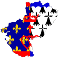
Category:Flag maps of regions of France
Jump to navigation
Jump to search
Subcategories
This category has the following 11 subcategories, out of 11 total.
B
- Flag maps of Bretagne (19 F)
F
G
- Flag maps of Guadeloupe (5 F)
M
- Flag maps of Mayotte (4 F)
N
R
- Flag maps of Réunion (10 F)
Media in category "Flag maps of regions of France"
The following 18 files are in this category, out of 18 total.
-
Aquitaine-carte-drapeau.png 550 × 650; 27 KB
-
Auvergne-carte-drapeau.png 1,274 × 1,540; 41 KB
-
Corsica EU.svg 1,816 × 4,053; 21 KB
-
Corsica-Flagmap.svg 560 × 1,238; 2 MB
-
Flag map of Alsace Lorraine Soviet Republic (November 10th November 22nd 1918).png 1,629 × 2,048; 102 KB
-
Flag map of Clipperton Island (French flag).png 1,569 × 1,569; 89 KB
-
Flag map of Clipperton Island (unofficial flag).png 1,569 × 1,569; 100 KB
-
Flag-map Dauphiné.png 577 × 577; 60 KB
-
Flag-map of Corsica.svg 794 × 1,768; 121 KB
-
Flag-map of Dauphiné.png 1,148 × 1,162; 167 KB
-
Flag-map of Wallis-et-Futuna.svg 512 × 302; 13 KB
-
Limousin stub.svg 498 × 544; 57 KB
-
Flag-map of Lorraine.png 740 × 672; 14 KB
-
Normandy Flag Map.svg 585 × 371; 14 KB
-
Paca-carte-drapeau.png 763 × 658; 18 KB
-
Flag Map of Paris.png 1,613 × 1,305; 16 KB
-
Flag Map of Paris (With Shield).png 1,616 × 1,335; 341 KB
-
Pays-de-la-loire-carte-drapeau.png 750 × 735; 35 KB


