Category:Flag maps of South Africa
Jump to navigation
Jump to search
Subcategories
This category has only the following subcategory.
S
Media in category "Flag maps of South Africa"
The following 21 files are in this category, out of 21 total.
-
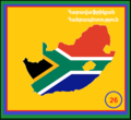
26. ՀԱՀ.png 349 × 320; 10 KB
-
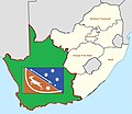
Flag map of South Africa (1928–1982, with South West Africa)2.svg 604 × 596; 19 KB
-
Flag map of the Western Cape.svg 3,680 × 3,000; 46 KB
-
Flag-map of South Africa (1910–1912).png 2,010 × 1,645; 110 KB
-
Flag-map of South Africa (1912–1928).png 2,010 × 1,645; 101 KB
-
Map Flag of Republic of Transvaal.png 1,000 × 827; 108 KB
-
Mpumalanga.png 570 × 538; 38 KB
-
Flag map of Pretoria.png 1,850 × 2,073; 30 KB
-
South Africa Flag Map 1915 - 1928 (South West Africa).png 1,507 × 1,266; 79 KB
-
Flag map of South Africa with Walvis Bay Exclave (1990-1994).png 2,217 × 1,645; 53 KB
-
Flag map of South African Colonies (Pre 1910 Union).png 2,000 × 1,753; 305 KB
-
Flag map of South Africa 1928-1994 (Bantustan Homelands).png 2,000 × 1,849; 138 KB
-
Flag map of Greater South Africa.png 2,692 × 2,324; 153 KB
-
Flag map of South Africa (Netherlands).png 2,008 × 1,639; 27 KB
-
Flag map of South Africa (Prinsevlag).png 2,010 × 1,646; 28 KB
-
Flag map of South Africa (United Kingdom).png 2,167 × 1,772; 43 KB
-
Flag map of South Africa (Voortrekker).png 2,000 × 1,635; 51 KB
-
SouthAfricanStub.png 1,145 × 828; 17 KB
-
WikiProject RSA logo (cropped).svg 1,167 × 967; 52 KB
-
WikiProject RSA logo.svg 1,095 × 1,250; 51 KB
-
^47EFF355A0B08BAD643716A20C8BC432B4FF0D776BAD52AE76^pimgpsh fullsize distr.jpg 1,277 × 1,110; 78 KB


