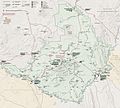
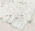
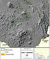
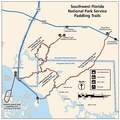
Category:Files from the National Park Service uploaded by RKBot
Jump to navigation
Jump to search
English: These files have been uploaded by RKBot from http://npmaps.com/wp-content/uploads/ - see Commons:Batch uploading/NPS Maps
Media in category "Files from the National Park Service uploaded by RKBot"
The following 200 files are in this category, out of 1,950 total.
(previous page) (next page)-
Heinrich Berann NPS North Cascades.jpg 1,844 × 1,409; 838 KB
-
Mori-Point-trail-map 2016.pdf 1,650 × 1,275; 1.87 MB
-
NPS acadia-bedrock-geology-map.jpg 3,244 × 3,700; 1.31 MB
-
NPS acadia-carriage-road-map.gif 2,199 × 3,399; 736 KB
-
NPS acadia-carriage-road-map.pdf 1,650 × 2,550, 2 pages; 783 KB
-
NPS acadia-context-map.jpg 2,105 × 973; 207 KB
-
NPS acadia-context-map.pdf 1,262 × 583; 907 KB
-
NPS acadia-east-topo-map.jpg 3,010 × 3,760; 2.06 MB
-
NPS acadia-east-topo-map.pdf 3,225 × 4,029; 16 MB
-
NPS acadia-hiking-info.gif 2,799 × 1,699; 427 KB
-
NPS acadia-hiking-info.pdf 2,100 × 1,275; 53 KB
-
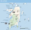
NPS acadia-isle-au-haut-map.jpg 1,011 × 971; 112 KB
-
NPS acadia-isle-au-haut-map.pdf 606 × 581; 578 KB
-
NPS acadia-isle-au-haut-trail-map.gif 1,265 × 1,955; 226 KB
-
NPS acadia-map.jpg 2,940 × 2,660; 840 KB
-
NPS acadia-map.pdf 2,518 × 2,279; 15.16 MB
-
NPS acadia-named-features-map.jpg 1,179 × 1,679; 427 KB
-
NPS acadia-named-water-features-map.jpg 833 × 1,191; 263 KB
-
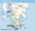
NPS acadia-schoodic-map.jpg 1,091 × 974; 114 KB
-
NPS acadia-schoodic-map.pdf 654 × 583; 537 KB
-
NPS acadia-schoodic-trail-map.gif 1,265 × 1,955; 174 KB
-
NPS acadia-schoodic-trail-map.pdf 1,650 × 2,550; 154 KB
-
NPS acadia-ski-map.jpg 1,195 × 1,924; 286 KB
-
NPS acadia-ski-map.pdf 1,025 × 1,650; 205 KB
-
NPS acadia-surficial-geology-map.jpg 3,253 × 3,703; 1.57 MB
-
NPS acadia-topo-map.jpg 6,633 × 4,132; 9.49 MB
-
NPS acadia-vegetation-map.jpg 4,994 × 3,232; 3.26 MB
-
NPS acadia-west-topo-map.jpg 3,010 × 3,720; 2.67 MB
-
NPS acadia-west-topo-map.pdf 3,225 × 3,985; 14.74 MB
-
NPS acadia-winter-use-map.gif 1,404 × 1,632; 271 KB
-
NPS alcatraz-1910-map.gif 3,094 × 1,752; 1.05 MB
-
NPS alcatraz-1910-military-prison-map.gif 3,222 × 1,948; 526 KB
-
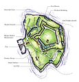
NPS alcatraz-island-map.jpg 1,849 × 834; 384 KB
-
NPS alcatraz-map-1867.gif 3,090 × 1,916; 564 KB
-
NPS alcatraz-map-1977.gif 3,222 × 1,876; 524 KB
-
NPS alcatraz-map.jpg 1,324 × 940; 201 KB
-
NPS american-samoa-context-map.jpg 471 × 471; 40 KB
-
NPS american-samoa-geologic-map.jpg 3,402 × 2,226; 1,002 KB
-
NPS american-samoa-manua-islands-map.jpg 1,493 × 1,027; 106 KB
-
NPS american-samoa-manua-islands-map.pdf 1,243 × 856; 151 KB
-
NPS american-samoa-map.jpg 1,502 × 1,027; 237 KB
-
NPS american-samoa-map.pdf 1,250 × 856; 290 KB
-
NPS american-samoa-regional-map.jpg 925 × 516; 62 KB
-
NPS american-samoa-regional-map.pdf 770 × 429; 53 KB
-
NPS anacapa-island-map.jpg 1,984 × 772; 188 KB
-
NPS apostle-islands-basswood-island-map.gif 1,360 × 976; 44 KB
-
NPS apostle-islands-camping-map.gif 1,320 × 1,020; 60 KB
-
NPS apostle-islands-geologic-map.jpg 2,315 × 3,351; 1.13 MB
-
NPS apostle-islands-julian-bay-trail-map.gif 798 × 804; 29 KB
-
NPS apostle-islands-long-island-map.gif 1,548 × 620; 35 KB
-
NPS apostle-islands-map.jpg 2,464 × 1,776; 474 KB
-
NPS apostle-islands-oak-island-map.gif 1,598 × 814; 91 KB
-
NPS apostle-islands-sand-island-map.gif 1,528 × 910; 49 KB
-
NPS apostle-islands-stockton-island-map.gif 1,615 × 942; 53 KB
-
NPS apostle-islands-surficial-geologic-map.jpg 2,794 × 4,236; 1.45 MB
-
NPS apostle-islands-vegetation-map.gif 4,741 × 3,419; 1.04 MB
-
NPS appalachian-trail-map.gif 2,115 × 11,014; 2.81 MB
-
NPS appalachian-trail-map.pdf 1,320 × 6,883; 1.93 MB
-
NPS arches-backpacking-map-2017.jpg 1,003 × 1,293; 247 KB
-
NPS arches-backpacking-map.jpg 668 × 916; 73 KB
-
NPS arches-camping-map.jpg 1,592 × 1,892; 516 KB
-
NPS arches-delicate-arch-map.jpg 920 × 319; 100 KB
-
NPS arches-devils-garden-map.gif 2,416 × 762; 132 KB
-
NPS arches-devils-garden-map.jpg 789 × 531; 122 KB
-
NPS arches-devils-garden-topographic-map.jpg 2,834 × 3,474; 2.02 MB
-
NPS arches-devils-garden-topographic-map.pdf 3,268 × 4,008; 9.73 MB
-
NPS arches-map.jpg 2,739 × 3,439; 1.18 MB
-
NPS arches-map.pdf 1,641 × 2,062; 2.55 MB
-
NPS arches-national-park-map.jpg 2,245 × 2,968; 1.56 MB
-
NPS arches-national-park-map.pdf 1,683 × 2,225; 10.21 MB
-
NPS arches-national-park-vegetation-map.jpg 2,008 × 2,520; 818 KB
-
NPS arches-park-avenue-map.jpg 708 × 383; 95 KB
-
NPS arches-simple-map.gif 1,564 × 2,086; 204 KB
-
NPS arches-windows-map.jpg 526 × 418; 71 KB
-
NPS arches-windows-topographic-map.jpg 2,853 × 3,485; 2.46 MB
-
NPS arches-windows-topographic-map.pdf 3,291 × 4,020; 11.77 MB
-
NPS assateague-island-backcountry-camping-map.jpg 1,190 × 1,960; 291 KB
-
NPS assateague-island-campground-map.jpg 2,660 × 1,615; 449 KB
-
NPS assateague-island-geologic-map.jpg 4,126 × 5,762; 5.69 MB
-
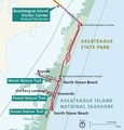
NPS assateague-island-inset-map.jpg 752 × 784; 95 KB
-
NPS assateague-island-inset-map.pdf 752 × 783; 296 KB
-
NPS assateague-island-map.jpg 2,107 × 2,199; 443 KB
-
NPS assateague-island-map.pdf 2,431 × 2,535; 1.46 MB
-
NPS assateague-island-OSV-map.jpg 825 × 1,329; 72 KB
-
NPS assateague-map-landscape.jpg 2,193 × 1,023; 400 KB
-
NPS assateague-map-landscape.pdf 2,531 × 1,181; 479 KB
-
NPS badlands-bike-map-northeast-loop.gif 1,020 × 1,320; 142 KB
-
NPS badlands-bike-map-sage-creek-loop.gif 1,173 × 1,308; 62 KB
-
NPS badlands-cedar-pass-campground-map.gif 603 × 903; 125 KB
-
NPS badlands-cedar-pass-detail-map.gif 1,317 × 616; 65 KB
-
NPS badlands-cedar-pass-detail-map.pdf 789 × 368; 58 KB
-
NPS badlands-geologic-map-east.jpg 4,282 × 2,812; 3.37 MB
-
NPS badlands-geologic-map-south.jpg 4,262 × 2,864; 2.21 MB
-
NPS badlands-geologic-map-west.jpg 3,320 × 2,280; 1.66 MB
-
NPS badlands-map.jpg 2,818 × 1,939; 902 KB
-
NPS badlands-map.pdf 2,514 × 1,731; 360 KB
-
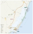
NPS badlands-regional-map.jpg 1,161 × 721; 198 KB
-
NPS badlands-regional-map.pdf 581 × 360; 71 KB
-
NPS badlands-vegetation-map.gif 4,000 × 4,960; 2.36 MB
-
NPS bandelier-detail-map.jpg 694 × 1,807; 234 KB
-
NPS bandelier-detail-map.pdf 654 × 1,704; 1.46 MB
-
NPS bandelier-geologic-map.jpg 4,582 × 2,767; 4.58 MB
-
NPS bandelier-juniper-campground-map.jpg 1,960 × 1,190; 223 KB
-
NPS bandelier-juniper-campground-map.pdf 2,100 × 1,275; 78 KB
-
NPS bandelier-main-loop-trail-map.jpg 1,353 × 918; 240 KB
-
NPS bandelier-main-loop-trail-map.pdf 1,650 × 1,275; 1.32 MB
-
NPS bandelier-map.jpg 1,705 × 1,588; 474 KB
-
NPS bandelier-map.pdf 1,827 × 1,702; 3.03 MB
-
NPS bandelier-regional-map.jpg 1,190 × 1,540; 209 KB
-
NPS bandelier-regional-map.pdf 1,275 × 1,650, 2 pages; 305 KB
-
NPS bandelier-trail-map.gif 1,105 × 1,430; 101 KB
-
NPS bandelier-vegetation-map.jpg 5,148 × 3,546; 4.18 MB
-
NPS bear-lake-area-topo-map.jpg 4,383 × 5,340; 6.35 MB
-
NPS big-bend-1944-map.jpg 1,392 × 969; 234 KB
-
NPS big-bend-chisos-basin-campground-map.gif 1,574 × 1,079; 109 KB
-
NPS big-bend-chisos-basin-detail-map.gif 1,160 × 741; 75 KB
-
NPS big-bend-chisos-mountains-trail-map.jpg 1,486 × 1,982; 794 KB
-
NPS big-bend-chisos-mountains-vegetation-map.jpg 1,088 × 1,260; 373 KB
-
NPS big-bend-detail-maps.pdf 1,200 × 1,556; 622 KB
-
NPS big-bend-fire-history-map.jpg 1,092 × 1,268; 264 KB
-
NPS big-bend-map.jpg 3,289 × 2,956; 1.39 MB
-
NPS big-bend-map.pdf 2,479 × 2,227; 7.46 MB
-
NPS big-bend-national-park-map.jpg 2,985 × 2,662; 1.06 MB
-
NPS big-bend-national-park-map.pdf 2,487 × 2,218; 6.83 MB
-
NPS big-bend-night-sky-map.jpg 887 × 885; 144 KB
-
NPS big-bend-regional-map.jpg 735 × 533; 92 KB
-
NPS big-bend-regional-map.pdf 366 × 266; 201 KB
-
NPS big-bend-rio-grande-village-campground-map.gif 2,014 × 1,046; 223 KB
-
NPS big-bend-rio-grande-village-detail-map.gif 1,158 × 774; 104 KB
-
NPS big-bend-simple-map.gif 1,795 × 1,289; 272 KB
-
NPS big-bend-simple-map.pdf 1,795 × 1,289; 458 KB
-
NPS big-bend-topography-map.jpg 1,012 × 1,209; 368 KB
-
NPS big-bend-vegetation-map.jpg 1,088 × 1,264; 280 KB
-
NPS big-cypress-bear-island-orv-map.jpg 1,931 × 925; 220 KB
-
NPS big-cypress-burns-lake-campground-map.gif 2,066 × 2,953; 504 KB
-
NPS big-cypress-canoe-trails.gif 1,500 × 1,500; 228 KB
-
NPS big-cypress-canoe-trails.pdf 1,800 × 1,800; 604 KB
-
NPS big-cypress-corn-dance-orv-map.gif 1,669 × 2,499; 326 KB
-
NPS big-cypress-geologic-map.gif 2,468 × 2,844; 776 KB
-
NPS big-cypress-loop-road-map.jpg 1,369 × 1,062; 189 KB
-
NPS big-cypress-map.jpg 3,337 × 2,841; 1.06 MB
-
NPS big-cypress-map.pdf 2,502 × 2,129; 5.03 MB
-
NPS big-cypress-national-preserve-map (cropped).jpg 3,203 × 2,628; 1.56 MB
-
NPS big-cypress-national-preserve-map.jpg 3,203 × 2,920; 1.54 MB
-
NPS big-cypress-national-preserve-map.pdf 2,529 × 2,389; 759 KB
-
NPS big-cypress-stairstep-orv-map.gif 2,570 × 1,814; 276 KB
-
NPS big-cypress-turner-river-orv-map.gif 1,703 × 2,499; 449 KB
-
NPS big-cypress-unit-map.jpg 2,378 × 2,838; 614 KB
-
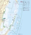
NPS biscayne-lobster-sanctuary-map.gif 1,052 × 1,406; 192 KB
-
NPS biscayne-map.jpg 3,220 × 3,658; 1.2 MB
-
NPS biscayne-map.pdf 2,541 × 2,887; 1.81 MB
-
NPS biscayne-regional-map.jpg 939 × 550; 88 KB
-
NPS biscayne-regional-map.pdf 593 × 347; 451 KB
-
NPS biscayne-south-florida-regional-map.gif 1,685 × 2,187; 314 KB
-
NPS black-canyon-east-portal-campground-map.gif 4,712 × 1,065; 351 KB
-
NPS black-canyon-gunnison-vegetation-map.jpg 5,846 × 3,655; 3.5 MB
-
NPS black-canyon-of-the-gunnison-map.jpg 3,805 × 2,823; 1.34 MB
-
NPS black-canyon-of-the-gunnison-map.pdf 3,356 × 2,489; 7.1 MB
-
NPS black-canyon-of-the-gunnison-regional-map.jpg 810 × 603; 94 KB
-
NPS black-canyon-of-the-gunnison-regional-map.pdf 606 × 452; 194 KB
-
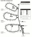
NPS black-canyon-south-rim-campground-map.gif 1,490 × 1,696; 179 KB
-
NPS black-canyon-trail-map.gif 2,746 × 1,472; 469 KB
-
NPS blue-ridge-crabtree-falls-campground-map.jpg 1,753 × 1,269; 509 KB
-
NPS blue-ridge-music-center-trail-map.jpg 1,038 × 770; 94 KB
-
NPS blue-ridge-parkway-doughton-park-campgound-map.jpg 1,190 × 1,540; 246 KB
-
NPS blue-ridge-parkway-julian-price-campground-map.jpg 984 × 1,287; 178 KB
-
NPS blue-ridge-parkway-linville-falls-campground-map.jpg 999 × 1,272; 136 KB
-
NPS blue-ridge-parkway-map.jpg 1,388 × 7,316; 1.76 MB
-
NPS blue-ridge-parkway-map.pdf 1,300 × 6,858; 15.01 MB
-
NPS blue-ridge-parkway-mt-pisgah-campground-map.jpg 1,002 × 1,302; 171 KB
-
NPS blue-ridge-parkway-otter-creek-campground-map.jpg 1,047 × 1,350; 138 KB
-
NPS blue-ridge-parkway-peaks-of-otter-campground-map.jpg 1,025 × 1,343; 174 KB
-
NPS blue-ridge-parkway-rocky-knob-campground-map.jpg 975 × 1,098; 142 KB
-
NPS boston-harbor-islands-chart.jpg 5,472 × 4,208; 5.16 MB
-
NPS boston-harbor-islands-chart.pdf 6,839 × 5,260; 7.89 MB
-
NPS boston-harbor-islands-map-bumpkin-island.jpg 788 × 489; 72 KB
-
NPS boston-harbor-islands-map-georges-island.jpg 891 × 930; 184 KB
-
NPS boston-harbor-islands-map-lovells-island.jpg 774 × 726; 86 KB
-
NPS boston-harbor-islands-map-peddocks-island.jpg 1,032 × 1,071; 167 KB
-
NPS boston-harbor-islands-map-thompson-island.jpg 981 × 996; 193 KB
-
NPS boston-harbor-islands-map.jpg 2,315 × 1,795; 528 KB
-
NPS breezy-point-fishing-map.jpg 1,983 × 1,305; 307 KB
-
NPS bryce-canyon-amphitheater-alternate-map.jpg 1,199 × 1,999; 490 KB
-
NPS bryce-canyon-amphitheater-alternate-map.pdf 900 × 1,500; 223 KB
-
NPS bryce-canyon-amphitheater-map.jpg 790 × 1,106; 197 KB
-
NPS bryce-canyon-amphitheater-map.pdf 591 × 829; 1.56 MB
-
NPS bryce-canyon-backcountry-trail-map.jpg 1,139 × 2,375; 608 KB
-
NPS bryce-canyon-backcountry-trail-map.pdf 1,650 × 2,550, 2 pages; 658 KB
-
NPS bryce-canyon-geologic-map.jpg 3,262 × 4,054; 2.17 MB
-
NPS bryce-canyon-map.jpg 1,383 × 3,641; 1,004 KB
-
NPS bryce-canyon-map.pdf 1,220 × 3,212; 3.12 MB
-
NPS bryce-canyon-national-park-detail-map.jpg 1,752 × 3,137; 874 KB
-
NPS bryce-canyon-national-park-detail-map.pdf 1,050 × 1,881; 4.94 MB
-
NPS bryce-canyon-national-park-map.jpg 1,508 × 3,920; 1.31 MB
-
NPS bryce-canyon-national-park-map.pdf 904 × 2,352; 6.99 MB
-
NPS bryce-canyon-north-campground-map.gif 1,105 × 1,399; 210 KB
-
NPS bryce-canyon-regional-map.gif 1,551 × 1,576; 283 KB
-
NPS bryce-canyon-regional-map.pdf 1,275 × 1,650; 245 KB
-
NPS bryce-canyon-sunset-campground-map.gif 1,105 × 1,388; 195 KB
-
NPS bryce-canyon-vegetation-map.jpg 5,528 × 6,272; 5.45 MB


