Category:Files by User:Keith D
Jump to navigation
Jump to search
Media in category "Files by User:Keith D"
The following 200 files are in this category, out of 456 total.
(previous page) (next page)-
 18-20 North Bar Within, Beverley.JPG 1,704 × 2,272; 924 KB
-
 19 North Bar Within, Beverley.JPG 1,704 × 2,272; 871 KB
-
 26, 28 Eastgate, Beverley.JPG 2,272 × 1,704; 1.06 MB
-
 42 and 44 High Street Bridlington.JPG 1,704 × 2,272; 922 KB
-
 48 North Bar Without, Beverley.JPG 2,272 × 1,704; 1.1 MB
-
 5 Ladygate, Beverley.JPG 2,272 × 1,704; 1.16 MB
-
 54, 56 Toll Gavel, Beverley.JPG 2,272 × 1,704; 1,002 KB
-
 56 North Bar Without, Beverley.JPG 2,272 × 1,704; 1.45 MB
-
 67 High Street.JPG 1,704 × 2,272; 1.06 MB
-
 Ainderby Miers with Holtby UK parish locator map.svg 1,425 × 1,037; 4.3 MB
-
 Airmyn UK parish locator map.svg 1,425 × 1,107; 1.68 MB
-
 Aislaby, Scarborough UK parish locator map.svg 1,425 × 1,037; 4.3 MB
-
 Aldbrough, East Riding of Yorkshire UK parish locator map.svg 1,425 × 1,107; 1.68 MB
-
 All Saints Church Bedworth.JPG 2,272 × 1,704; 1.06 MB
-
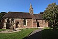
 All Saints Church Brough.jpg 2,272 × 1,704; 1.28 MB
-
 All Saints Church Driffield 1.jpg 1,704 × 2,272; 816 KB
-
 All Saints Church Driffield 2.jpg 1,704 × 2,272; 1.17 MB
-
 All Saints Church Easington.JPG 1,704 × 2,272; 1.18 MB
-
 All Saints Square.JPG 2,272 × 1,704; 965 KB
-
 Allerthorpe UK parish locator map.svg 1,425 × 1,107; 1.68 MB
-
 Arram Village.JPG 2,272 × 1,704; 1.04 MB
-
 Asselby UK parish locator map.svg 1,425 × 1,107; 1.68 MB
-
 Astley Castle 1.JPG 2,272 × 1,704; 1.01 MB
-
 Atwick UK parish locator map.svg 1,425 × 1,107; 1.68 MB
-
 Aunsby and Dembleby UK parish locator map.svg 1,086 × 1,305; 3.7 MB
-
 Avenue Kingston upon Hull UK ward map 2010.svg 1,319 × 1,305; 179 KB
-
 Avenue Kingston upon Hull UK ward map 2018.svg 1,319 × 1,305; 195 KB
-
 Bainton, East Riding of Yorkshire UK parish locator map.svg 1,425 × 1,107; 1.68 MB
-
 Barford - Church of St Peter - 20230908143318.jpg 5,184 × 3,456; 7.42 MB
-
 Barmby Moor UK parish locator map.svg 1,425 × 1,107; 1.68 MB
-
 Barmby on the Marsh UK parish locator map.svg 1,425 × 1,107; 1.68 MB
-
 Barmston and Fraisthorpe UK parish locator map.svg 1,425 × 1,107; 1.68 MB
-
 Barnby, North Yorkshire UK parish locator map.svg 1,425 × 1,037; 4.3 MB
-
 Bedworth All Saints from NW.JPG 2,272 × 1,704; 690 KB
-
 Beeford UK parish locator map.svg 1,425 × 1,107; 1.68 MB
-
 Bempton railway station.JPG 2,272 × 1,704; 1.12 MB
-
 Bempton UK parish locator map.svg 1,425 × 1,107; 1.68 MB
-
 Beswick, East Riding of Yorkshire UK parish locator map.svg 1,425 × 1,107; 1.68 MB
-
 Beverley and Newland Kingston upon Hull UK ward map 2018.svg 1,319 × 1,305; 195 KB
-
 Beverley Kingston upon Hull UK ward map 2010.svg 1,319 × 1,305; 179 KB
-
 Beverley Rural East Riding of Yorkshire ward map 2010.svg 1,425 × 1,107; 1.05 MB
-
 Beverley UK parish locator map.svg 1,425 × 1,107; 1.68 MB
-
 Beverley.JPG 1,704 × 2,272; 882 KB
-
 Bewholme UK parish locator map.svg 1,425 × 1,107; 1.68 MB
-
 Bielby UK parish locator map.svg 1,425 × 1,107; 1.68 MB
-
 Bilton, East Riding of Yorkshire UK parish locator map.svg 1,425 × 1,107; 1.68 MB
-
 Bishop Burton UK parish locator map.svg 1,425 × 1,107; 1.68 MB
-
 Bishop Mark Davies (Middleton).jpg 480 × 609; 33 KB
-
 Bishop Wilton UK parish locator map.svg 1,425 × 1,107; 1.68 MB
-
 Blacktoft UK parish locator map.svg 1,425 × 1,107; 1.68 MB
-
 Blaydes House.jpg 1,704 × 2,272; 902 KB
-
 Boothferry Kingston upon Hull UK ward map 2010.svg 1,319 × 1,305; 179 KB
-
 Boothferry Kingston upon Hull UK ward map 2018.svg 1,319 × 1,305; 195 KB
-
 Borrowby, Scarborough UK parish locator map.svg 1,425 × 1,037; 4.3 MB
-
 Boynton, East Riding of Yorkshire UK parish locator map.svg 1,425 × 1,107; 1.68 MB
-
 Brandesburton UK parish locator map.svg 1,425 × 1,107; 1.68 MB
-
 Bransholme East Kingston upon Hull UK ward map 2010.svg 1,319 × 1,305; 179 KB
-
 Bransholme West Kingston upon Hull UK ward map 2010.svg 1,319 × 1,305; 179 KB
-
 Brantingham UK parish locator map.svg 1,425 × 1,107; 1.68 MB
-
 Bricknell Kingston upon Hull UK ward map 2010.svg 1,319 × 1,305; 179 KB
-
 Bricknell Kingston upon Hull UK ward map 2018.svg 1,319 × 1,305; 195 KB
-
 Bridlington Central and Old Town East Riding of Yorkshire ward map 2010.svg 1,425 × 1,107; 1.05 MB
-
 Bridlington North East Riding of Yorkshire ward map 2010.svg 1,425 × 1,107; 1.05 MB
-
 Bridlington South East Riding of Yorkshire ward map 2010.svg 1,425 × 1,107; 1.05 MB
-
 Bridlington UK parish locator map.svg 1,425 × 1,107; 1.68 MB
-
 Brompton, Scarborough UK parish locator map.svg 1,425 × 1,037; 4.3 MB
-
 Broomfleet UK parish locator map.svg 1,425 × 1,107; 1.68 MB
-
 Broxa-cum-Troutsdale UK parish locator map.svg 1,425 × 1,037; 4.3 MB
-
 Bubwith UK parish locator map.svg 1,425 × 1,107; 1.68 MB
-
 Bugthorpe UK parish locator map.svg 1,425 × 1,107; 1.68 MB
-
 Burniston UK parish locator map.svg 1,425 × 1,037; 4.3 MB
-
 Burstwick UK parish locator map.svg 1,425 × 1,107; 1.68 MB
-
 Burton Agnes UK parish locator map.svg 1,425 × 1,107; 1.68 MB
-
 Burton Constable Hall.JPG 2,272 × 1,704; 1.28 MB
-
 Burton Constable UK parish locator map.svg 1,425 × 1,107; 1.68 MB
-
 Burton Fleming UK parish locator map.svg 1,425 × 1,107; 1.68 MB
-
 Burton Pidsea Primary School.JPG 2,272 × 1,704; 1.44 MB
-
 Burton Pidsea UK parish locator map.svg 1,425 × 1,107; 1.68 MB
-
 Burton-cum-Walden UK parish locator map.svg 1,425 × 1,037; 4.3 MB
-
 Carnaby UK parish locator map.svg 1,425 × 1,107; 1.68 MB
-
 Catton, East Riding of Yorkshire UK parish locator map.svg 1,425 × 1,107; 1.68 MB
-
 Catwick UK parish locator map.svg 1,425 × 1,107; 1.68 MB
-
 Cayton UK parish locator map.svg 1,425 × 1,037; 4.3 MB
-
 Central Kingston upon Hull UK ward map 2018.svg 1,319 × 1,305; 195 KB
-
 Cherry Burton UK parish locator map.svg 1,425 × 1,107; 1.68 MB
-
 Church of St John the Baptist Baginton.jpg 5,184 × 3,456; 4.86 MB
-
 Clapham cum Newby UK parish locator map.svg 1,425 × 1,037; 4.3 MB
-
 Cloughton UK parish locator map.svg 1,425 × 1,037; 4.3 MB
-
 Common to Fylingdales and Hawsker-cum-Stainsacre UK parish locator map.svg 1,425 × 1,037; 4.3 MB
-
 Commondale UK parish locator map.svg 1,425 × 1,037; 4.3 MB
-
 Coniston, East Riding of Yorkshire UK parish locator map.svg 1,425 × 1,107; 1.68 MB
-
 Cottam, East Riding of Yorkshire UK parish locator map.svg 1,425 × 1,107; 1.68 MB
-
 Cottingham North East Riding of Yorkshire ward map 2010.svg 1,425 × 1,107; 1.05 MB
-
 Cottingham Railway Station.JPG 2,272 × 1,704; 1.03 MB
-
 Cottingham South East Riding of Yorkshire ward map 2010.svg 1,425 × 1,107; 1.05 MB
-
 Cottingham, East Riding of Yorkshire UK parish locator map.svg 1,425 × 1,107; 1.68 MB
-
 Cottingwith UK parish locator map.svg 1,425 × 1,107; 1.68 MB
-
 Coventry Arena railway station under construction.jpg 5,184 × 3,456; 7.5 MB
-
 Coventry Way Waymarker.jpg 1,704 × 2,272; 656 KB
-
 Dale East Riding of Yorkshire ward map 2010.svg 1,425 × 1,107; 1.05 MB
-
 Dalton Holme UK parish locator map.svg 1,425 × 1,107; 1.68 MB
-
 Danby, North Yorkshire UK parish locator map.svg 1,425 × 1,037; 4.3 MB
-
 Darncombe-cum-Langdale End UK parish locator map.svg 1,425 × 1,037; 4.3 MB
-
 Derringham Kingston upon Hull UK ward map 2010.svg 1,319 × 1,305; 179 KB
-
 Derringham Kingston upon Hull UK ward map 2018.svg 1,319 × 1,305; 195 KB
-
 Driffield and Rural East Riding of Yorkshire ward map 2010.svg 1,425 × 1,107; 1.05 MB
-
 Driffield CofE VC Primary School 1.jpg 2,272 × 1,704; 880 KB
-
 Driffield CofE VC Primary School 2.jpg 2,272 × 1,704; 783 KB
-
 Driffield Methodist Church.jpg 2,272 × 1,704; 738 KB
-
 Driffield Railway Station.JPG 2,272 × 1,704; 1.53 MB
-
 Driffield UK parish locator map.svg 1,425 × 1,107; 1.68 MB
-
 Drypool Kingston upon Hull UK ward map 2010.svg 1,319 × 1,305; 179 KB
-
 Drypool Kingston upon Hull UK ward map 2018.svg 1,319 × 1,305; 195 KB
-
 Easington, East Riding of Yorkshire UK parish locator map.svg 1,425 × 1,107; 1.68 MB
-
 East Ayton UK parish locator map.svg 1,425 × 1,037; 4.3 MB
-
 East Garton UK parish locator map.svg 1,425 × 1,107; 1.68 MB
-
 East Riding of Yorkshire Council UK ward map 2010 annotated.svg 1,425 × 1,107; 1.06 MB
-
 East Wolds and Coastal East Riding of Yorkshire ward map 2010.svg 1,425 × 1,107; 1.05 MB
-
 Eastfield, Scarborough UK parish locator map.svg 1,425 × 1,037; 4.3 MB
-
 Eastrington UK parish locator map.svg 1,425 × 1,107; 1.68 MB
-
 Edenham Grimsthorpe Elsthorpe & Scottlethorpe UK parish locator map.svg 1,086 × 1,305; 3.7 MB
-
 Egton UK parish locator map.svg 1,425 × 1,037; 4.3 MB
-
 Eldmire with Crakehill UK parish locator map.svg 1,425 × 1,037; 4.3 MB
-
 Ellerby, East Riding of Yorkshire UK parish locator map.svg 1,425 × 1,107; 1.68 MB
-
 Ellerby, North Yorkshire UK parish locator map.svg 1,425 × 1,037; 4.3 MB
-
 Ellerker UK parish locator map.svg 1,425 × 1,107; 1.68 MB
-
 Ellerton and Aughton UK parish locator map.svg 1,425 × 1,107; 1.68 MB
-
 Elloughton-cum-Brough UK parish locator map.svg 1,425 × 1,107; 1.68 MB
-
 Elstronwick UK parish locator map.svg 1,425 × 1,107; 1.68 MB
-
 Embsay with Eastby UK parish map.svg 1,425 × 1,037; 4.3 MB
-
 Englands Smallest Window Hull.jpg 2,272 × 1,704; 874 KB
-
 Eskdaleside cum Ugglebarnby UK parish locator map.svg 1,425 × 1,037; 4.3 MB
-
 Eske.JPG 2,272 × 1,704; 1.32 MB
-
 Etton, East Riding of Yorkshire UK parish locator map.svg 1,425 × 1,107; 1.68 MB
-
 Everingham UK parish locator map.svg 1,425 × 1,107; 1.68 MB
-
 Exelby, Leeming and Londonderry UK parish locator map.svg 1,425 × 1,037; 4.3 MB
-
 Fangfoss with Bolton UK parish locator map.svg 1,425 × 1,107; 1.68 MB
-
 Ferens Art Gallery.jpg 2,272 × 1,704; 747 KB
-
 Filey UK parish locator map.svg 1,425 × 1,037; 4.3 MB
-
 Fimber UK parish locator map.svg 1,425 × 1,107; 1.68 MB
-
 Flamborough Lighthouse.JPG 1,704 × 2,272; 628 KB
-
 Flamborough UK parish locator map.svg 1,425 × 1,107; 1.68 MB
-
 Foggathorpe UK parish locator map.svg 1,425 × 1,107; 1.68 MB
-
 Folkton UK parish locator map.svg 1,425 × 1,037; 4.3 MB
-
 Fort Paull Entrance.JPG 2,272 × 1,704; 1.07 MB
-
 Foston on the Wolds UK parish locator map.svg 1,425 × 1,107; 1.68 MB
-
 Fridaythorpe UK parish locator map.svg 1,425 × 1,107; 1.68 MB
-
 Full Sutton UK parish locator map.svg 1,425 × 1,107; 1.68 MB
-
 Fylingdales plus common UK parish locator map.svg 1,425 × 1,037; 4.3 MB
-
 Fylingdales UK parish locator map.svg 1,425 × 1,037; 4.3 MB
-
 Garton on the Wolds UK parish locator map.svg 1,425 × 1,107; 1.68 MB
-
 Gilberdyke UK parish locator map.svg 1,425 × 1,107; 1.68 MB
-
 Glaisdale UK parish locator map.svg 1,425 × 1,037; 4.3 MB
-
 Goathland UK parish locator map.svg 1,425 × 1,037; 4.3 MB
-
 Godiva Statue Coventry 1.JPG 1,704 × 2,272; 870 KB
-
 Godiva Statue Coventry 2.JPG 1,704 × 2,272; 755 KB
-
 Goodmanham UK parish locator map.svg 1,425 × 1,107; 1.68 MB
-
 Goole Fields UK parish locator map.svg 1,425 × 1,107; 1.68 MB
-
 Goole North East Riding of Yorkshire ward map 2010.svg 1,425 × 1,107; 1.05 MB
-
 Goole South East Riding of Yorkshire ward map 2010.svg 1,425 × 1,107; 1.05 MB
-
 Goole UK parish locator map.svg 1,425 × 1,107; 1.68 MB
-
 Gowdall UK parish locator map.svg 1,425 × 1,107; 1.68 MB
-
 Grindale UK parish locator map.svg 1,425 × 1,107; 1.68 MB
-
 Gristhorpe UK parish locator map.svg 1,425 × 1,037; 4.3 MB
-
 Grosmont UK parish locator map.svg 1,425 × 1,037; 4.3 MB
-
 Grovehill Lock.JPG 2,272 × 1,704; 1.27 MB
-
 Hackness UK parish locator map.svg 1,425 × 1,037; 4.3 MB
-
 Halsham UK parish locator map.svg 1,425 × 1,107; 1.68 MB
-
 Harpham UK parish locator map.svg 1,425 × 1,107; 1.68 MB
-
 Harwood Dale UK parish locator map.svg 1,425 × 1,037; 4.3 MB
-
 Hatfield, East Riding of Yorkshire UK parish locator map.svg 1,425 × 1,107; 1.68 MB
-
 Hawsker-cum-Stainsacre plus common UK parish locator map.svg 1,425 × 1,037; 4.3 MB
-
 Hawsker-cum-Stainsacre UK parish locator map.svg 1,425 × 1,037; 4.3 MB
-
 Hayton and Burnby UK parish locator map.svg 1,425 × 1,107; 1.68 MB
-
 Hazlewood with Storiths UK parish locator map.svg 1,425 × 1,037; 4.3 MB
-
 Hedon UK parish locator map.svg 1,425 × 1,107; 1.68 MB
-
 Hessle East Riding of Yorkshire ward map 2010.svg 1,425 × 1,107; 1.05 MB
-
 Hessle UK parish locator map.svg 1,425 × 1,107; 1.68 MB
-
 High Altar and Sutherland Tapestry Coventry Cathedral.jpg 3,287 × 5,078; 5.94 MB
-
 Hinderwell UK parish locator map.svg 1,425 × 1,037; 4.3 MB
-
 HMP Hull.JPG 2,272 × 1,704; 1.25 MB
-
 Holderness Kingston upon Hull UK ward map 2010.svg 1,319 × 1,305; 179 KB
-
 Holderness Kingston upon Hull UK ward map 2018.svg 1,319 × 1,305; 195 KB
-
 Hollym, East Riding of Yorkshire UK parish locator map.svg 1,425 × 1,107; 1.68 MB
-
 Holme-on-Spalding-Moor UK parish locator map.svg 1,425 × 1,107; 1.68 MB
-
 Holmpton UK parish locator map.svg 1,425 × 1,107; 1.68 MB
-
 Hook, East Riding of Yorkshire UK parish locator map.svg 1,425 × 1,107; 1.68 MB
-
 Hornsea UK parish locator map.svg 1,425 × 1,107; 1.68 MB
-
 Hotham, East Riding of Yorkshire UK parish locator map.svg 1,425 × 1,107; 1.68 MB
-
 Houses in Danthorpe.JPG 2,272 × 1,704; 1.1 MB
-
 Howden East Riding of Yorkshire ward map 2010.svg 1,425 × 1,107; 1.05 MB
-
 Howden UK parish locator map.svg 1,425 × 1,107; 1.68 MB
-
 Howdenshire East Riding of Yorkshire ward map 2010.svg 1,425 × 1,107; 1.05 MB
-
 Huggate UK parish locator map.svg 1,425 × 1,107; 1.68 MB
-
 Hull Bridge.JPG 2,272 × 1,704; 1.11 MB
-
 Hull New Theatre.jpg 2,272 × 1,704; 1.04 MB
-
 Hull Paragon Railway Station1.JPG 2,272 × 1,704; 1.18 MB
-
 Hull Paragon Railway Station2.JPG 2,272 × 1,704; 1.03 MB
-
 Hull Truck Theatre.JPG 2,272 × 1,704; 824 KB
-
 Hull Wards.PNG 625 × 554; 13 KB


.jpg)


