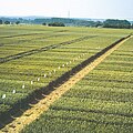
Category:Fields in Hesse
Jump to navigation
Jump to search
Federal states of Germany:
Subcategories
This category has the following 26 subcategories, out of 26 total.
Media in category "Fields in Hesse"
The following 41 files are in this category, out of 41 total.
-
Cold Air (141005805).jpeg 2,048 × 1,365; 1.08 MB
-
Cornflowers in field, Ehrenbach, towards Hochtaunus.jpg 4,000 × 3,000; 4.79 MB
-
Ehrenbach valley to west, storm building.jpg 4,000 × 3,000; 3.18 MB
-
Field above Niederlibbach.jpg 4,000 × 3,000; 3.74 MB
-
Field, Ehrenbach, storm building.jpg 4,000 × 3,000; 3.29 MB
-
Fields and meadows east of Idstein.jpg 3,573 × 2,680; 3 MB
-
Fliegender Berg VI.jpg 5,184 × 3,456; 5.2 MB
-
Frostiger Morgen Tromm Hessen 2011.JPG 2,736 × 3,648; 4.5 MB
-
Fulda countryside.jpg 1,600 × 1,200; 527 KB
-
Gladiolen bei Brensbach.jpg 4,368 × 2,912; 1.71 MB
-
Gladiolenfeld bei Brensbach.jpg 2,912 × 4,368; 1.41 MB
-
Kamillenfeld mit Mohn vor der Veste Otzberg edit.jpg 4,368 × 2,912; 8.01 MB
-
Kamillenfeld mit Mohn vor der Veste Otzberg Perspective.jpg 4,230 × 2,724; 6.89 MB
-
Kellerwald Bad Zwesten.jpg 1,122 × 509; 353 KB
-
Kirsche am Eichelberg (Blofeld) 14.JPG 2,592 × 1,944; 2.69 MB
-
Kopfsteine 1.jpg 1,000 × 667; 96 KB
-
Main-Taunus-Kreis - Grassy Field & Pylons - geo.hlipp.de - 27500.jpg 640 × 425; 56 KB
-
Motzküppel (02).jpg 3,888 × 2,592; 4.39 MB
-
Motzküppel (03).jpg 3,888 × 2,592; 4.31 MB
-
Motzküppel.jpg 3,888 × 2,592; 3.92 MB
-
Oberlibbach fields.jpg 3,549 × 2,662; 2.36 MB
-
Peter Stehlik 2009.07.11 B.jpg 3,888 × 2,592; 4.66 MB
-
Pink clouds and moon, Ehrenbach.jpg 4,000 × 3,000; 2.8 MB
-
Pink clouds, Ehrenbach, across field.jpg 4,000 × 3,000; 2.75 MB
-
Reflexion an Spinnweben III.jpg 5,184 × 3,456; 8.79 MB
-
Reflexion an Spinnweben.jpg 5,184 × 3,456; 7.68 MB
-
Schwalmpforte Kerstenhausen, Buntsandsteinboden.jpg 768 × 531; 375 KB
-
Seckbach-lohrberg001.jpg 982 × 666; 478 KB
-
Streuobstwiese Niederlistingen im Herbst.JPG 3,648 × 2,736; 4.62 MB
-
Truskawkowe pole - Oberach - panoramio.jpg 2,560 × 1,920; 1.84 MB
-
Versuchsfeld Ober Erlenbach.jpg 780 × 780; 210 KB
-
View across Niederlibbach valley.jpg 4,000 × 3,000; 3.74 MB
-
View to Steckenroth from southwest.jpg 3,581 × 2,686; 1.94 MB
-
VM Weg, Ehrenbach.jpg 4,000 × 3,000; 4.27 MB
-
Wambach fields, view south.jpg 4,000 × 3,000; 2.91 MB
-
Watzhahn fields, view south-west.jpg 3,705 × 2,779; 2.06 MB
-
Weilbach landwirtschaft fg01.jpg 800 × 532; 169 KB
-
Welferode.jpg 5,064 × 2,849; 3.07 MB
-
Windkraft Tannenkopf.JPG 3,264 × 2,448; 2.59 MB
-
Windkraftanlagen Tannenkopf hochkant.JPG 2,448 × 3,264; 2.22 MB
-
Überblick Langenhain-Ziegenberg.jpg 4,128 × 2,322; 2.21 MB


