Category:Fernhill, South Lanarkshire
Jump to navigation
Jump to search
area of Rutherglen, in South Lanarkshire, Scotland, UK .jpg) | |||||
| Upload media | |||||
| Instance of | |||||
|---|---|---|---|---|---|
| Location | South Lanarkshire, Scotland | ||||
 | |||||
Images for the Fernhill district in Rutherglen, South Lanarkshire, Scotland.
Media in category "Fernhill, South Lanarkshire"
The following 35 files are in this category, out of 35 total.
-
 Boy Wonder - geograph.org.uk - 5093014.jpg 1,600 × 900; 215 KB
-
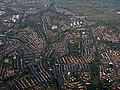
 Cambuslang from the air (geograph 4517259) (burnside).jpg 347 × 260; 88 KB
-
 Cambuslang from the air (geograph 4517259) (rglen sth).jpg 483 × 362; 149 KB
-
 Cambuslang from the air (geograph 4517259).jpg 640 × 480; 221 KB
-
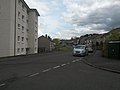 Castlefern Road (geograph 5093468).jpg 1,600 × 1,200; 224 KB
-
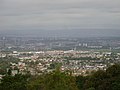
 Castlemilk and Cathkin Braes from the air (geograph 4517246).jpg 640 × 480; 209 KB
-
 Church, Burnside (geograph 2977510).jpg 640 × 480; 270 KB
-
 Colvend Drive 2005 (geograph 5093417).jpg 1,280 × 960; 327 KB
-
 Fernhill 2005 (geograph 5093013).jpg 2,011 × 418; 151 KB
-
 Fernhill and Cathkin Church - geograph.org.uk - 123309.jpg 640 × 480; 140 KB
-
 Fernhill Community Centre (geograph 5093008).jpg 1,600 × 1,200; 359 KB
-
 Fernhill Community Centre - geograph.org.uk - 4121387.jpg 5,184 × 3,456; 5.17 MB
-
 Fernhill from footpath (geograph 5093464).jpg 1,280 × 960; 315 KB
-
 Fernhill gardens (geograph 5093429).jpg 1,024 × 768; 192 KB
-
 Fernhill welcome wall (geograph 5093404).jpg 1,600 × 900; 436 KB
-
 Gap site at Fernhill shops (geograph 5093453).jpg 1,600 × 1,200; 224 KB
-
 King of the Castle (detail) - geograph.org.uk - 948690.jpg 480 × 640; 63 KB
-
 King of the Castle (geograph 3721172).jpg 640 × 480; 91 KB
-
 King of the Castle - geograph.org.uk - 948674.jpg 480 × 640; 89 KB
-
 King of the Castle, Fernhill Road - geograph.org.uk - 4121399.jpg 3,456 × 5,184; 6.49 MB
-
 Map of Lanarkshire Sheet 010, Ordnance Survey, 1863-1865.jpg 10,680 × 7,158; 7.6 MB
-
 Map of Lanarkshire Sheet 010, Ordnance Survey, 1863-1865.tiff 10,680 × 7,158; 218.72 MB
-
 Metal deer sculpture at Fernbrae Meadows.jpg 5,712 × 4,284; 7.16 MB
-
 New Playpark, Fernhill (geograph 5093010).jpg 1,024 × 768; 110 KB
-
 Path downhill to Fernbrae Meadows (geograph 7761327).jpg 3,264 × 2,448; 2.71 MB
-
 St Mark Church in Fernhill - geograph.org.uk - 119814.jpg 640 × 480; 108 KB
-
 St Mark's Church, Fernhill Road, Rutherglen (geograph 4121427).jpg 3,456 × 5,184; 7.47 MB
-
 Stone sculptures at Fernbrae Meadows.jpg 4,032 × 3,024; 4.25 MB
-
 Street Soccer (14096637608).jpg 5,014 × 3,314; 12.85 MB
-
 Street Soccer (14282814954).jpg 5,083 × 3,273; 7.6 MB
-
 To Burnside from Fernhill Park (geograph 5093461).jpg 1,280 × 960; 321 KB
-
 Towards Neilvaig Drive (geograph 5093440) (cropped).jpg 3,264 × 1,702; 1.08 MB
-
 Towards Neilvaig Drive (geograph 5093440).jpg 3,264 × 2,448; 1.35 MB
-
-
 What the boy sees (geograph 5093015).jpg 1,600 × 900; 285 KB

_(burnside).jpg)
_(rglen_sth).jpg)
.jpg)
.jpg)
.jpg)
.jpg)
.jpg)


.jpg)
.jpg)
.jpg)
.jpg)
_-_geograph.org.uk_-_948690.jpg)
.jpg)


.jpg)
.jpg)

.jpg)

.jpg)
.jpg)
.jpg)
_(cropped).jpg)
.jpg)

.jpg)
.jpg)