Category:Felbridge
Jump to navigation
Jump to search
English: Felbridge is a village and civil parish in the Tandridge district of Surrey. The village forms a continuous settlement with East Grinstead.
village in Surrey, England  | |||||
| Upload media | |||||
| Instance of | |||||
|---|---|---|---|---|---|
| Location | Tandridge, Surrey, South East England, England | ||||
| Population |
| ||||
| Area |
| ||||
| Said to be the same as | Felbridge (Wikimedia duplicated page, civil parish) | ||||
 | |||||
Media in category "Felbridge"
The following 200 files are in this category, out of 247 total.
(previous page) (next page)-
 A pylon - geograph.org.uk - 6833431.jpg 684 × 1,024; 253 KB
-
 A small enclosed spring - geograph.org.uk - 5274917.jpg 640 × 426; 115 KB
-
 A small pylon - geograph.org.uk - 5277805.jpg 425 × 640; 88 KB
-
 A welcome on Snow Hill - geograph.org.uk - 5150489.jpg 800 × 600; 189 KB
-
 A22 - geograph.org.uk - 5274962.jpg 640 × 426; 99 KB
-
 A22 - geograph.org.uk - 5274964.jpg 640 × 426; 86 KB
-
 A22 Eastbourne Road - geograph.org.uk - 6809568.jpg 1,024 × 684; 460 KB
-
 A22 Woodcock Hill - geograph.org.uk - 6809563.jpg 1,024 × 684; 520 KB
-
 A246 at Snow Hill - geograph.org.uk - 3970987.jpg 1,920 × 1,440; 705 KB
-
 A264 - geograph.org.uk - 2947772.jpg 640 × 398; 72 KB
-
 A264 - geograph.org.uk - 5277876.jpg 640 × 426; 100 KB
-
 A264, Copthorne Rd - geograph.org.uk - 2947770.jpg 640 × 430; 85 KB
-
 A264, Copthorne Road - geograph.org.uk - 6809482.jpg 1,024 × 684; 397 KB
-
 A264, Copthorne Road - geograph.org.uk - 6809484.jpg 1,024 × 684; 474 KB
-
 Abandoned milk float, Effingham Park Golf Course - geograph.org.uk - 5983479.jpg 4,288 × 2,848; 1.92 MB
-
 Approaching Eastbourne Rd - geograph.org.uk - 6838327.jpg 1,024 × 684; 178 KB
-
 Approaching Roundabout, B2028 - geograph.org.uk - 4475154.jpg 640 × 426; 88 KB
-
 B2028 - geograph.org.uk - 4475149.jpg 640 × 426; 94 KB
-
 B2028 - geograph.org.uk - 4475150.jpg 640 × 426; 97 KB
-
 B2028 - geograph.org.uk - 4475158.jpg 640 × 426; 95 KB
-
 B2028 at Effingham Park - geograph.org.uk - 5983254.jpg 2,848 × 4,015; 2 MB
-
 B2037 near Snow Hill - geograph.org.uk - 4494192.jpg 2,687 × 1,789; 774 KB
-
 Barn, Ward's Farm - geograph.org.uk - 5274966.jpg 640 × 426; 73 KB
-
 Barrell House and McKenzie House - geograph.org.uk - 2261654.jpg 640 × 480; 108 KB
-
 Beaver Farm - geograph.org.uk - 6838310.jpg 1,024 × 778; 199 KB
-
 Bend in the Lane - geograph.org.uk - 6758853.jpg 4,160 × 3,120; 1,015 KB
-
 Bridleway, footpath junction by Green Wood - geograph.org.uk - 6838369.jpg 1,024 × 684; 264 KB
-
 By Judge's Corner - geograph.org.uk - 5871581.jpg 4,288 × 2,848; 2.41 MB
-
 Car park, Copthorne Hotel Effingham Park - geograph.org.uk - 5983036.jpg 4,288 × 2,456; 1.86 MB
-
 Chapel Lane - geograph.org.uk - 5983068.jpg 2,848 × 4,288; 2.72 MB
-

-
 Clump of trees - geograph.org.uk - 6838271.jpg 1,024 × 684; 132 KB
-
 Copthorne Hotel Effingham Gatwick - geograph.org.uk - 5515878.jpg 1,000 × 662; 897 KB
-
 Copthorne Hotel Effingham Park - geograph.org.uk - 5983031.jpg 1,806 × 2,547; 262 KB
-
 Copthorne Hotel Effingham Park - geograph.org.uk - 5983051.jpg 4,288 × 2,848; 1.42 MB
-
 Copthorne Rd - geograph.org.uk - 6838141.jpg 1,024 × 684; 254 KB
-
 Copthorne Rd - geograph.org.uk - 6838143.jpg 1,024 × 684; 272 KB
-
 Copthorne Rd - geograph.org.uk - 6838146.jpg 1,024 × 684; 277 KB
-
 Copthorne Rd - geograph.org.uk - 6838148.jpg 1,024 × 684; 244 KB
-
 Copthorne Rd, A264 - geograph.org.uk - 2947771.jpg 640 × 430; 95 KB
-
 Copthorne Road - geograph.org.uk - 5637107.jpg 1,017 × 1,024; 387 KB
-
 Crawley Down Rd off A264 - geograph.org.uk - 2947765.jpg 640 × 421; 59 KB
-
 Crawley Down Road - geograph.org.uk - 4348622.jpg 3,264 × 2,448; 2.86 MB
-
 Crawley Mariners Yacht Club - geograph.org.uk - 5636899.jpg 1,024 × 624; 276 KB
-
 Cultivated Fields - geograph.org.uk - 6758837.jpg 4,160 × 3,120; 1.52 MB
-
 Deerpark - geograph.org.uk - 6838137.jpg 1,024 × 684; 193 KB
-
 Drive, Copthorne Hotel Effingham Park - geograph.org.uk - 5983313.jpg 1,832 × 3,264; 1.17 MB
-
 Drive, Copthorne Hotel Effingham Park - geograph.org.uk - 5983316.jpg 1,832 × 3,264; 1.53 MB
-
 East Surrey pasture - geograph.org.uk - 6838277.jpg 1,024 × 684; 150 KB
-
 Eastbourne Rd - geograph.org.uk - 6838329.jpg 1,024 × 684; 231 KB
-
 Eastbourne Rd - geograph.org.uk - 6838336.jpg 1,024 × 684; 186 KB
-
 Eden Brook - geograph.org.uk - 6838360.jpg 1,024 × 684; 331 KB
-
 Effingham Park golf course - geograph.org.uk - 5515884.jpg 1,000 × 662; 831 KB
-
 Effingham Park golf course - geograph.org.uk - 5515887.jpg 1,000 × 662; 771 KB
-
 Effingham Park Golf Course - geograph.org.uk - 5983072.jpg 4,076 × 2,663; 1.51 MB
-
 Effingham Park Golf Course - geograph.org.uk - 5983081.jpg 3,722 × 2,630; 1.78 MB
-
 Effingham Park Golf Course - geograph.org.uk - 5983197.jpg 4,109 × 2,758; 1.59 MB
-
 Effingham Park Golf Course - geograph.org.uk - 5983218.jpg 4,072 × 2,388; 1.59 MB
-
 Effingham Park Golf Course - geograph.org.uk - 5983467.jpg 4,288 × 2,848; 1.08 MB
-
 Entrance drive, Copthorne Hotel Effingham Park - geograph.org.uk - 5983214.jpg 2,848 × 4,288; 1.45 MB
-
 Entrance to Barong Conservatories, Felbridge - geograph.org.uk - 2259054.jpg 4,320 × 3,240; 4.81 MB
-
 Entrance to Felbridge Showground - geograph.org.uk - 1204886.jpg 640 × 351; 119 KB
-
 Felbridge churchyard - geograph.org.uk - 4037126.jpg 758 × 1,024; 216 KB
-
 Felbridge Parish Council Noticeboard - geograph.org.uk - 6758809.jpg 4,160 × 3,120; 1.78 MB
-
 Felbridge Primary School - geograph.org.uk - 4348626.jpg 3,264 × 2,448; 2.4 MB
-
 Felbridge showground - geograph.org.uk - 6838135.jpg 1,024 × 684; 101 KB
-
 Field edge footpath - geograph.org.uk - 6838362.jpg 1,024 × 684; 270 KB
-
 Fields overlooking Camping Site - geograph.org.uk - 6758838.jpg 4,160 × 3,120; 1.11 MB
-
 Fields surrounded by trees - geograph.org.uk - 6758815.jpg 4,160 × 3,120; 2.01 MB
-
 Five Gates Wood - geograph.org.uk - 5274911.jpg 640 × 426; 67 KB
-
 Five Gates Wood - geograph.org.uk - 6833432.jpg 1,024 × 684; 137 KB
-
 Footbridge over Eden Brook, Wire Mill Lake - geograph.org.uk - 6838358.jpg 1,024 × 684; 348 KB
-
 Footpath - geograph.org.uk - 226204.jpg 640 × 480; 72 KB
-
 Footpath - geograph.org.uk - 6838273.jpg 684 × 1,024; 265 KB
-
 Footpath along field edge - geograph.org.uk - 6838364.jpg 684 × 1,024; 257 KB
-
 Footpath by fence - geograph.org.uk - 6838279.jpg 1,024 × 684; 288 KB
-
 Footpath by Green Wood - geograph.org.uk - 6838370.jpg 1,024 × 684; 302 KB
-
 Footpath close to Sewage works - geograph.org.uk - 6838282.jpg 1,024 × 684; 353 KB
-

-
 Footpath off Mill Lane - geograph.org.uk - 6838263.jpg 1,024 × 684; 304 KB
-
 Footpath passing sewage works - geograph.org.uk - 6838293.jpg 684 × 1,024; 343 KB
-
 Footpath passing sewage works - geograph.org.uk - 6838294.jpg 1,024 × 684; 264 KB
-
 Footpath through the woods - geograph.org.uk - 6838342.jpg 1,024 × 684; 353 KB
-
 Footpath, Beaver Farm - geograph.org.uk - 6838318.jpg 1,024 × 684; 188 KB
-
 Garthfield Farm - geograph.org.uk - 5274921.jpg 640 × 426; 83 KB
-
 Garthfield Farm - geograph.org.uk - 5274923.jpg 640 × 426; 90 KB
-
 Garthfield Farm - geograph.org.uk - 6833435.jpg 1,024 × 684; 145 KB
-
 Gates by Copthorne Rd - geograph.org.uk - 5274982.jpg 640 × 426; 111 KB
-
 Gates to Stonewall - geograph.org.uk - 5274969.jpg 640 × 426; 89 KB
-
 Greenhouses, Beaver Farm - geograph.org.uk - 6838320.jpg 1,024 × 684; 212 KB
-
 Grounds of Oakcroft Cattery - geograph.org.uk - 875646.jpg 640 × 480; 96 KB
-
 Gulliver's Rest Café - geograph.org.uk - 1405190.jpg 640 × 480; 108 KB
-
 Haskins Garden Centre - geograph.org.uk - 5517041.jpg 1,000 × 662; 1,005 KB
-
 Haskins Garden Centre - geograph.org.uk - 5517058.jpg 1,000 × 662; 832 KB
-
 Haskins Garden Centre - geograph.org.uk - 5517073.jpg 1,000 × 662; 704 KB
-
 Haskins Garden Centre - geograph.org.uk - 5983154.jpg 4,288 × 2,848; 1.04 MB
-
 Haskins Snowhill Garden Centre - geograph.org.uk - 5254467.jpg 2,304 × 1,728; 851 KB
-
 Heading towards Felbridge - geograph.org.uk - 5637074.jpg 1,024 × 1,022; 366 KB
-
 Hedgecourt Lake - geograph.org.uk - 1536699.jpg 640 × 427; 50 KB
-
 Hedgecourt Lake - geograph.org.uk - 5636905.jpg 1,024 × 664; 260 KB
-
 Hedgecourt Lake - geograph.org.uk - 5992132.jpg 5,472 × 3,648; 3.68 MB
-
 Hedgecourt Lake - geograph.org.uk - 6838236.jpg 1,024 × 684; 105 KB
-
 Hedgecourt Lake - geograph.org.uk - 6838239.jpg 1,024 × 684; 113 KB
-
 Hedgecourt Lake - geograph.org.uk - 6838245.jpg 1,024 × 598; 100 KB
-
 Hedgecourt Lake - geograph.org.uk - 6838255.jpg 1,024 × 684; 95 KB
-
 Hedgecourt Lake - geograph.org.uk - 796082.jpg 640 × 480; 91 KB
-
 Hedgecourt Lake - geograph.org.uk - 875895.jpg 640 × 480; 95 KB
-
 Hedgecourt Lake and Swans - geograph.org.uk - 5637028.jpg 1,024 × 693; 184 KB
-
 High Wood - geograph.org.uk - 6838365.jpg 1,024 × 684; 146 KB
-
 High Wood - geograph.org.uk - 6838371.jpg 1,024 × 684; 140 KB
-
 Horse pasture, Felbridge - geograph.org.uk - 4571178.jpg 640 × 480; 136 KB
-
 House visible beyond Field - geograph.org.uk - 6758851.jpg 4,160 × 3,120; 2.48 MB
-

-
 Imberhorne Lane bridge - geograph.org.uk - 44011.jpg 479 × 640; 167 KB
-
 Jeff's Lake, Beaver Fishery, Surrey - geograph.org.uk - 210154.jpg 640 × 480; 101 KB
-
 Judge's Corner - geograph.org.uk - 5516042.jpg 1,000 × 662; 751 KB
-
 Judge's Corner - geograph.org.uk - 5983177.jpg 4,110 × 2,566; 1.08 MB
-
 Judge's Corner - geograph.org.uk - 5983191.jpg 4,288 × 2,848; 1.26 MB
-
 Junction of London Road and Copthorne Road, Felbridge - geograph.org.uk - 2515918.jpg 1,600 × 1,200; 505 KB
-
 London Rd - geograph.org.uk - 6833445.jpg 1,024 × 684; 247 KB
-
 London Rd - geograph.org.uk - 6833446.jpg 1,024 × 684; 199 KB
-

-
 Longwall, Felbridge - geograph.org.uk - 4892756.jpg 2,304 × 1,728; 864 KB
-
 Looking toward High Wood - geograph.org.uk - 6758848.jpg 4,160 × 3,120; 1.89 MB
-
 Mill Lane - geograph.org.uk - 5992142.jpg 5,472 × 3,648; 4.15 MB
-
 Mill Lane - geograph.org.uk - 6838151.jpg 1,024 × 684; 270 KB
-
 Mill Lane - geograph.org.uk - 6838219.jpg 1,024 × 684; 240 KB
-
 Mill Lane - geograph.org.uk - 6838220.jpg 1,024 × 684; 277 KB
-
 Mill Lane - geograph.org.uk - 6838225.jpg 1,024 × 684; 231 KB
-
 Mill Lane - geograph.org.uk - 6838228.jpg 1,024 × 684; 315 KB
-
 Mill Lane - geograph.org.uk - 6838257.jpg 1,024 × 684; 287 KB
-
 Mill Lane - geograph.org.uk - 6838262.jpg 1,024 × 684; 298 KB
-
 Mill Lane by Hedgecourt Lake - geograph.org.uk - 6838247.jpg 1,024 × 665; 201 KB
-
 Muddy Path alongside the Weir - geograph.org.uk - 6758828.jpg 4,160 × 3,120; 2.78 MB
-
 New houses on The Glebe - geograph.org.uk - 2261647.jpg 640 × 480; 119 KB
-
 Newchapel from the air, 2000 - geograph.org.uk - 5560996.jpg 580 × 896; 88 KB
-
 North porch of St John's church - geograph.org.uk - 2261663.jpg 480 × 640; 190 KB
-
 Not the most picturesque of paths^ - geograph.org.uk - 6838286.jpg 1,024 × 684; 311 KB
-
 Oakcroft residential cattery, Surrey - geograph.org.uk - 210162.jpg 640 × 480; 94 KB
-
 Paddock - geograph.org.uk - 6759040.jpg 4,160 × 3,120; 3.62 MB
-

-
 Pasture by Tandridge Border Path - geograph.org.uk - 6833437.jpg 1,024 × 684; 150 KB
-
 Path along Field edge - geograph.org.uk - 6758846.jpg 4,058 × 3,043; 1.68 MB
-
 Path Junction on the Border Path - geograph.org.uk - 5636890.jpg 1,024 × 569; 235 KB
-
 Peacock Lodge - geograph.org.uk - 6838337.jpg 1,024 × 684; 223 KB
-
 Pine, Effingham Park - geograph.org.uk - 5983258.jpg 1,832 × 3,264; 1.26 MB
-
 Pines, Copthorne Hotel Effingham Park - geograph.org.uk - 5983318.jpg 1,832 × 3,264; 2.07 MB
-
 Pond in Chartham Wood - geograph.org.uk - 5274910.jpg 640 × 426; 119 KB
-
 Powerline, gate and fields - geograph.org.uk - 6759020.jpg 4,160 × 3,120; 1.81 MB
-
 Premier Inn - geograph.org.uk - 5277879.jpg 640 × 426; 98 KB
-
 Premier Inn - geograph.org.uk - 5470743.jpg 1,600 × 1,212; 320 KB
-
 Pylon - geograph.org.uk - 5274908.jpg 640 × 426; 73 KB
-
 Pylon - geograph.org.uk - 6833428.jpg 1,024 × 684; 167 KB
-
 Redundant stile - geograph.org.uk - 6838289.jpg 1,024 × 684; 277 KB
-
 Road junction, A264 - geograph.org.uk - 5274984.jpg 640 × 426; 85 KB
-
 Rowplatt Lane, Felbridge - geograph.org.uk - 6400793.jpg 1,024 × 685; 448 KB
-
 Sailing club, Hedgecourt Lake - geograph.org.uk - 6838243.jpg 1,024 × 684; 143 KB
-
 Signpost at Garthfield Farm - geograph.org.uk - 5274924.jpg 640 × 426; 115 KB
-
 Signpost, Felbridge - geograph.org.uk - 5274983.jpg 640 × 426; 97 KB
-
 Snow Hill - geograph.org.uk - 5983086.jpg 4,288 × 2,848; 1.29 MB
-
 Snowhill Business Centre on the B2037 - geograph.org.uk - 5150558.jpg 800 × 600; 132 KB
-
 Snowhill Lane - geograph.org.uk - 5983090.jpg 4,288 × 2,848; 1.33 MB
-
 Snowhill Lane - geograph.org.uk - 5983127.jpg 1,832 × 3,264; 1,009 KB
-
 Snowhill Lane meets Snow Hill - geograph.org.uk - 5983153.jpg 4,109 × 2,523; 974 KB
-
 South porch of St John's church - geograph.org.uk - 2261660.jpg 480 × 640; 208 KB
-
 Southbound bridleway - geograph.org.uk - 6838366.jpg 1,024 × 684; 231 KB
-

-

-

-
-
-
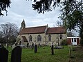
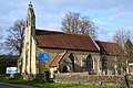
 St John's, Felbridge - geograph.org.uk - 4037112.jpg 1,024 × 799; 212 KB
-
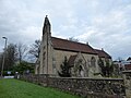
 StJohnsFelbridgeExteriorMarch2021.jpg 1,920 × 1,280; 2.39 MB
-
 Stone Cottage - geograph.org.uk - 6833442.jpg 1,024 × 684; 219 KB
-
 Tandridge Border Path - geograph.org.uk - 5274912.jpg 640 × 426; 87 KB
-
 Tandridge Border Path - geograph.org.uk - 5274914.jpg 640 × 426; 106 KB
-
 Tandridge Border Path - geograph.org.uk - 5274920.jpg 640 × 426; 115 KB
-
 Tandridge Border Path - geograph.org.uk - 5274959.jpg 640 × 426; 107 KB
-
 Tandridge Border Path - geograph.org.uk - 5274968.jpg 640 × 426; 94 KB
-
 Tandridge Border Path - geograph.org.uk - 5274970.jpg 640 × 426; 109 KB
-
 Tandridge Border Path - geograph.org.uk - 5274973.jpg 640 × 426; 114 KB
-
 Tandridge Border Path - geograph.org.uk - 5274974.jpg 640 × 426; 125 KB
-
 Tandridge Border Path - geograph.org.uk - 5274976.jpg 640 × 426; 97 KB
-
 Tandridge Border Path - geograph.org.uk - 5274977.jpg 640 × 426; 123 KB
-
 Tandridge Border Path - geograph.org.uk - 5274980.jpg 640 × 426; 99 KB
-
 Tandridge Border Path - geograph.org.uk - 5274981.jpg 640 × 426; 97 KB
-
 Tandridge Border Path - geograph.org.uk - 5636886.jpg 1,012 × 1,024; 391 KB
-
 Tandridge Border Path - geograph.org.uk - 6833433.jpg 1,024 × 684; 287 KB
-
 Tandridge Border Path - geograph.org.uk - 6838128.jpg 1,024 × 684; 265 KB
-
 Tandridge Border Path - geograph.org.uk - 6838131.jpg 1,024 × 684; 255 KB
-
 Tandridge Border Path - geograph.org.uk - 6838133.jpg 684 × 1,024; 320 KB
-
 Tandridge Border Path - geograph.org.uk - 6838139.jpg 1,024 × 684; 267 KB
-
 The B2028 - geograph.org.uk - 4475175.jpg 640 × 426; 87 KB
-
 The end of Snowhill Lane - geograph.org.uk - 1659043.jpg 640 × 428; 116 KB
-
 The Mill House - geograph.org.uk - 5992138.jpg 5,472 × 3,648; 3.21 MB
-
 The Mill House - geograph.org.uk - 6838230.jpg 1,024 × 684; 233 KB
-
 The Peacock Lodge on Eastbourne Road - geograph.org.uk - 3690890.jpg 800 × 532; 172 KB
-

-
 The Star Inn - geograph.org.uk - 5277883.jpg 640 × 426; 56 KB
-
 The Star Inn - geograph.org.uk - 5277886.jpg 640 × 426; 54 KB


_-_geograph.org.uk_-_4774930.jpg)
_-_geograph.org.uk_-_4774932.jpg)
_-_geograph.org.uk_-_4774933.jpg)
_-_geograph.org.uk_-_4774934.jpg)


