Category:February 2007 in County Londonderry
Jump to navigation
Jump to search
English: Images taken in County Londonderry, Northern Ireland in this month of 2007 (not the date of the upload).
| Jan | Feb | Mar | Apr | May | Jun | Jul | Aug | Sep | Oct | Nov | Dec | ||
| ← | 6 | 34 | 9 | 37 | 85 | 8 | 60 | 56 | 82 | 98 | 6 | 3 | → |
|---|
Media in category "February 2007 in County Londonderry"
The following 34 files are in this category, out of 34 total.
-
 Aughrim Gospel Hall - geograph.org.uk - 339005.jpg 640 × 268; 24 KB
-
 Aughrim Orange Hall - geograph.org.uk - 339014.jpg 640 × 479; 38 KB
-
 Aughrim Townland - geograph.org.uk - 339012.jpg 640 × 289; 37 KB
-
 Ballymaguigan - geograph.org.uk - 338839.jpg 640 × 298; 40 KB
-
 Ballymaguigan Townland - geograph.org.uk - 338831.jpg 640 × 479; 45 KB
-
 Ballymaguigan Townland - geograph.org.uk - 338841.jpg 640 × 479; 90 KB
-
 Ballymaguigan Townland - geograph.org.uk - 338850.jpg 640 × 479; 61 KB
-
 Ballymulligan Road - geograph.org.uk - 338227.jpg 640 × 479; 79 KB
-
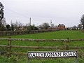 Ballyronan Road - geograph.org.uk - 338856.jpg 640 × 479; 53 KB
-
 Bellarena Primary School - geograph.org.uk - 342139.jpg 640 × 301; 32 KB
-
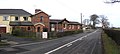 Bellarena Railway Station - geograph.org.uk - 342143.jpg 640 × 289; 29 KB
-
 Carraloan Road - geograph.org.uk - 338781.jpg 640 × 479; 66 KB
-
 Church Hall at Aughrim - geograph.org.uk - 339008.jpg 640 × 479; 44 KB
-
 Clady, County Derry-Londonderry - geograph.org.uk - 342202.jpg 640 × 479; 49 KB
-
 Countryside at Barnett's Crossroads - geograph.org.uk - 338225.jpg 640 × 479; 55 KB
-
 Countryside at Barnett's Crossroads - geograph.org.uk - 338226.jpg 640 × 479; 74 KB
-
 Derrygarve - geograph.org.uk - 338863.jpg 640 × 286; 28 KB
-
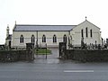 Derrygarve RC Church - geograph.org.uk - 338997.jpg 640 × 479; 36 KB
-
 Derrygarve Townland - geograph.org.uk - 338862.jpg 640 × 308; 47 KB
-
 Derrygarve Townland - geograph.org.uk - 338865.jpg 640 × 479; 57 KB
-
 Derrygarve Townland - geograph.org.uk - 338998.jpg 640 × 479; 45 KB
-
 Drumenagh AOH Hall - geograph.org.uk - 338829.jpg 640 × 479; 40 KB
-
 Former Waterside station building - 2007 (geograph 3582009).jpg 975 × 732; 448 KB
-

-
 Knockloughrim Windmill - geograph.org.uk - 345232.jpg 622 × 640; 80 KB
-
 Lough Road - geograph.org.uk - 338835.jpg 640 × 479; 70 KB
-
 Magherafelt - geograph.org.uk - 339019.jpg 640 × 296; 24 KB
-
 Magherafelt, County Londonderry - geograph.org.uk - 339021.jpg 640 × 479; 68 KB
-
 Moss Road - geograph.org.uk - 338843.jpg 640 × 286; 33 KB
-
 Road at Aughrim - geograph.org.uk - 339001.jpg 640 × 478; 56 KB
-
 Road at Ballymaguigan - geograph.org.uk - 338833.jpg 640 × 479; 48 KB
-
 Road at Derrygarve - geograph.org.uk - 338853.jpg 640 × 302; 30 KB
-
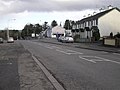
 Road at Magherafelt - geograph.org.uk - 339023.jpg 640 × 297; 36 KB
-
 The Grove, Magherafelt - geograph.org.uk - 338784.jpg 640 × 287; 35 KB


.jpg)
.jpg)


