Category:Farrmheall
Jump to navigation
Jump to search
Media in category "Farrmheall"
The following 17 files are in this category, out of 17 total.
-
 Electricity across the moor - geograph.org.uk - 850813.jpg 640 × 427; 93 KB
-
 Eroded track, Farrmheall - geograph.org.uk - 892693.jpg 359 × 640; 86 KB
-
 Farmheall Cairn - geograph.org.uk - 935041.jpg 640 × 360; 56 KB
-
 Farrmeall Summit - geograph.org.uk - 1265549.jpg 640 × 480; 93 KB
-
 Farrmeall summit - geograph.org.uk - 892701.jpg 640 × 359; 73 KB
-
 Farrmheall - geograph.org.uk - 887757.jpg 640 × 430; 62 KB
-
 Farrmheall - geograph.org.uk - 887772.jpg 640 × 359; 73 KB
-
 Farrmheall - geograph.org.uk - 935053.jpg 640 × 360; 65 KB
-
 Farrmheall Slopes - geograph.org.uk - 935048.jpg 640 × 360; 64 KB
-
 Northeast ridge of Farrmheall - geograph.org.uk - 887777.jpg 638 × 310; 60 KB
-
 Northern slopes of Farrmheall - geograph.org.uk - 887774.jpg 640 × 413; 57 KB
-
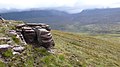 Sandstone outcrop, Farrmheall - geograph.org.uk - 935061.jpg 640 × 360; 68 KB
-
 South ridge of Farrmheall - geograph.org.uk - 887763.jpg 640 × 359; 63 KB
-
 South ridge of Farrmheall - geograph.org.uk - 887779.jpg 640 × 359; 51 KB
-
 Strath Dionard - geograph.org.uk - 1515759.jpg 640 × 480; 65 KB
-
 Vehicle track, Farrmheall - geograph.org.uk - 935068.jpg 640 × 360; 81 KB
-
 View towards Farrmheall - geograph.org.uk - 754907.jpg 640 × 480; 87 KB


