Category:Farms in Maryland
Jump to navigation
Jump to search
States of the United States: Alabama · Alaska · Arizona · Arkansas · California · Colorado · Connecticut · Delaware · Florida · Georgia · Hawaii · Idaho · Illinois · Indiana · Iowa · Kansas · Kentucky · Louisiana · Maine · Maryland · Massachusetts · Michigan · Minnesota · Mississippi · Missouri · Montana · Nebraska · Nevada · New Hampshire · New Jersey · New Mexico · New York · North Carolina · North Dakota · Ohio · Oklahoma · Oregon · Pennsylvania · Rhode Island · South Carolina · South Dakota · Tennessee · Texas · Utah · Vermont · Virginia · Washington · West Virginia · Wisconsin · Wyoming
Puerto Rico
Puerto Rico
Wikimedia category | |||||
| Upload media | |||||
| Instance of | |||||
|---|---|---|---|---|---|
| Category combines topics | |||||
| Category contains | |||||
| |||||
Subcategories
This category has the following 21 subcategories, out of 21 total.
A
C
- Clagett Farm (70 F)
- Clark's Elioak Farm (4 F)
D
- Dairy farms in Maryland (2 F)
F
- Fields in Maryland (10 F)
H
M
P
- Perrier Farm (1 F)
- Piper Farm (1 F)
- Joseph Poffenberger Farm (105 F)
- Pry Farm (11 F)
S
- Second Chances Farm (6 F)
- Sherrick Farm (13 F)
Media in category "Farms in Maryland"
The following 182 files are in this category, out of 182 total.
-
10, Deer Park, MD, USA - panoramio.jpg 3,614 × 2,033; 2.03 MB
-
19th Century Drawing of Thomas Farm (78748d73-b438-9cb6-a8e0-a5831ab528a5).jpg 1,200 × 800; 277 KB
-
2006 11 07 - View from MD 121 in Boyds-Clarksburg.JPG 2,589 × 973; 491 KB
-
20111110-OC-AMW-0009 - Flickr - USDAgov.jpg 3,860 × 2,644; 5.6 MB
-
412 DSP SkyClouds 039 - DPLA - a38ad8ed9ba9a37b1a5c993dd61bf599.jpg 4,288 × 2,848; 1.02 MB
-
Baker Farm Building Cluster (455e657e-92fd-7de4-542d-0d8d5cdae3b3).JPG 872 × 525; 150 KB
-
Beallsville MD farm 2019a.jpg 4,032 × 3,024; 4.71 MB
-
Blacks Mill Road - panoramio.jpg 3,210 × 2,262; 1.47 MB
-
Bloomfield Road view - panoramio.jpg 3,537 × 2,426; 2.52 MB
-
Bloomfield Road, January 12, 2013 - panoramio.jpg 3,307 × 1,973; 1.63 MB
-
Bloomfield Road, ready to plant - panoramio.jpg 3,496 × 2,430; 1.71 MB
-
Boundary of Araby Property (def100f8-d352-5fbb-90ed-7ea688ab11ac).jpg 800 × 874; 208 KB
-
Brick-End Barn and Yard at Woods Hill Farm - panoramio.jpg 3,648 × 2,736; 2.93 MB
-
Buildings at Worthington Farm (def49415-0c5d-b057-9b63-6f2520c736ef).jpg 720 × 996; 210 KB
-
CarrollCountyMD.jpg 325 × 220; 26 KB
-
Catoctin Mountain and farm MD1.jpg 7,580 × 4,476; 27.15 MB
-
Catoctin Mountain and farm MD2.jpg 8,363 × 5,318; 47.46 MB
-
Charles County Farm.JPG 3,264 × 2,176; 3.21 MB
-
Christina's Compilation - panoramio.jpg 1,745 × 1,121; 544 KB
-
Clouds over tilled field - panoramio.jpg 3,648 × 2,736; 1.42 MB
-
Cool Cows in the Shade - panoramio (1).jpg 3,648 × 2,736; 3.47 MB
-
Cool Cows in the Shade - panoramio.jpg 3,497 × 2,451; 2.59 MB
-
Cow Family - panoramio.jpg 3,648 × 2,736; 2.76 MB
-
Cows in the meadow - panoramio.jpg 2,102 × 1,469; 678 KB
-
Crops adjacent to tree lined lane - panoramio.jpg 3,648 × 2,736; 3.65 MB
-
Crouse Mill Road - panoramio.jpg 3,165 × 2,554; 2.13 MB
-
Dairy Farm on Bartgis Road - panoramio.jpg 1,600 × 1,169; 324 KB
-
Dairy Farm on Lenhart Rd. - panoramio.jpg 1,600 × 1,153; 277 KB
-
Dairy farm.jpg 1,746 × 2,506; 1.72 MB
-
DSCF0460 - Flickr - USDAgov.jpg 2,816 × 2,112; 3.08 MB
-
End of Harvest - panoramio.jpg 3,648 × 2,736; 3.49 MB
-
Fall View of Farm - panoramio.jpg 2,621 × 1,904; 1.23 MB
-
Farm - Baltimore to Philadelphia (3325867340).jpg 2,592 × 1,944; 1.66 MB
-
Farm at Putman and Bethel - panoramio.jpg 3,236 × 2,282; 1.88 MB
-
Farm House, Mowed Field - panoramio.jpg 1,600 × 1,200; 483 KB
-
Farm near Fair Hill MD.jpeg 4,032 × 3,024; 3.48 MB
-
Farm on Utica Rd - panoramio.jpg 1,263 × 856; 270 KB
-
Farm where Harriet Tubman was a slave - panoramio.jpg 3,648 × 2,736; 2.83 MB
-
Farm? - Baltimore to Philadelphia (3325026739).jpg 2,592 × 1,944; 1.73 MB
-
Farmer and team near Frederick, Maryland 8b14542v.jpg 1,024 × 768; 177 KB
-
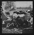
Farmer feeding the pigs8d23212v.jpg 1,008 × 1,024; 281 KB
-
Farmer house at Havre de Grace MD - panoramio.jpg 2,304 × 1,728; 942 KB
-
Farmers feeding his pigs 8d23210v.jpg 1,008 × 1,024; 275 KB
-
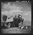
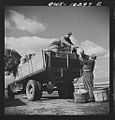
Farmers sharing a car on market day 8d23194v.jpg 982 × 1,024; 244 KB
-
Farmers sharing a truck on market day8d23199v.jpg 982 × 1,024; 263 KB
-
Farmers sharing a truck on market day8d23203v.jpg 982 × 1,024; 248 KB
-
Farmers sharing a truck on market day8d23204v.jpg 982 × 1,024; 252 KB
-
Farms - Baltimore to Philadelphia (3325022551).jpg 2,592 × 1,944; 1.71 MB
-
Farms - Baltimore to Philadelphia (3325025457).jpg 2,592 × 1,944; 1.82 MB
-
Farms - Baltimore to Philadelphia (3325029251).jpg 2,592 × 1,944; 1.41 MB
-
Farms - Baltimore to Philadelphia (3325859804).jpg 2,592 × 1,944; 1.66 MB
-
Farms - Baltimore to Philadelphia (3325860238).jpg 2,592 × 1,944; 1.72 MB
-
Farms - Baltimore to Philadelphia (3325864050).jpg 2,592 × 1,944; 1.58 MB
-
Farms - Baltimore to Philadelphia (3325864964).jpg 2,592 × 1,944; 1.66 MB
-
Farms and Small Airfield - Baltimore to Philadelphia (3325864540).jpg 2,592 × 1,944; 1.75 MB
-
Fences - panoramio.jpg 3,072 × 2,334; 1.21 MB
-
Field and Sycamore Tree (78722f9c-ec0c-953b-1515-701d54cb2f2a).jpg 720 × 480; 207 KB
-
Field Awaiting - panoramio.jpg 3,648 × 2,736; 2.66 MB
-
Field of Soybeans on Bloomfield - panoramio.jpg 1,600 × 1,200; 423 KB
-
Ford Road Two - panoramio.jpg 2,048 × 1,536; 1.25 MB
-
FrederickCountyMD.jpg 324 × 220; 28 KB
-
FrederickMD.jpg 220 × 325; 19 KB
-
Freshly Turned Earth - panoramio.jpg 3,579 × 2,640; 3.62 MB
-
Grain - panoramio (1).jpg 3,648 × 2,736; 3.34 MB
-
Grain - panoramio (2).jpg 4,000 × 3,000; 3.93 MB
-
Green-Walled Countryside on Tour de Frederick - panoramio.jpg 3,468 × 2,479; 1.62 MB
-
Harvested Wheat 1 (3727629107).jpg 896 × 597; 344 KB
-
High Corn - panoramio.jpg 3,560 × 2,601; 1.65 MB
-
High Grain - Worton (Betterton) MD - panoramio.jpg 3,490 × 2,242; 2.67 MB
-
High Grain on Detour Road - panoramio.jpg 3,648 × 2,736; 2.88 MB
-
Hopkins Game Farm - Baltimore to Philadelphia (3325028847).jpg 2,592 × 1,944; 1.59 MB
-
Horse Farm near Loys - panoramio.jpg 1,372 × 1,003; 420 KB
-
John Coblentz Farm and Middletown Valley MD1.jpg 5,472 × 3,648; 14.75 MB
-
John Coblentz Farm MD1.jpg 5,052 × 3,347; 17.37 MB
-
John Coblentz Farm MD2.jpg 8,522 × 4,932; 27.41 MB
-
John Coblentz Farm MD3.jpg 8,635 × 5,367; 29.14 MB
-
Journey Through Hallowed Ground Byway - View of South Mountain - NARA - 7719716.jpg 1,936 × 1,296; 660 KB
-
Kayam Farm.jpg 2,592 × 1,944; 935 KB
-
KentCountyMD.jpg 640 × 424; 273 KB
-
Kinderfarmpark md.jpg 3,000 × 1,688; 2.94 MB
-
Linwood Historic District, Franz Farm (21416099389).jpg 3,888 × 2,592; 3.58 MB
-
Llama, Alpaca and Steer on Slidell Rd - panoramio.jpg 3,537 × 2,505; 2.59 MB
-
Make Hay While Sun Shines - panoramio.jpg 4,000 × 3,000; 3.98 MB
-
Meadows Farms Nurseries and Landscaping, Clarksburg, United States (Unsplash).jpg 5,184 × 3,456; 8.65 MB
-
Mervin Horst In Mauganville, Maryland (7408268744).jpg 375 × 577; 170 KB
-
Mixed Crops row by row - panoramio.jpg 3,584 × 2,443; 1.93 MB
-
Mooo are you - panoramio.jpg 2,499 × 1,824; 1 MB
-
Mumma Farm - panoramio.jpg 2,098 × 1,399; 1.42 MB
-
Mumma Farm Panaramic - panoramio.jpg 2,256 × 432; 560 KB
-
Nice Farmstead on Utica Road - panoramio.jpg 3,648 × 2,736; 2.29 MB
-
Old Farm - Young Corn - panoramio.jpg 3,648 × 2,066; 2.52 MB
-
Old Farm House - panoramio.jpg 1,572 × 1,150; 493 KB
-
Old Farm on Opossumtown Pike - panoramio.jpg 3,648 × 2,736; 2.79 MB
-
Old Farmhouse - panoramio.jpg 3,648 × 2,736; 2.46 MB
-
Old Farmhouse with horses - panoramio.jpg 1,600 × 1,200; 594 KB
-
Old Fashioned Fence - panoramio.jpg 2,021 × 1,348; 1.66 MB
-
Old House - panoramio (20).jpg 3,648 × 2,207; 2.88 MB
-
Old Stone Farmhouse - panoramio.jpg 1,600 × 1,200; 761 KB
-
Peter of P. Grossnickel Fam MD1.jpg 3,888 × 2,292; 5.74 MB
-
Polish berry pickers.jpg 4,654 × 3,297; 1.86 MB
-
Quiet Peaceful Country - panoramio.jpg 2,032 × 1,355; 2.09 MB
-
Replica cannons at Allstadt Farm (8ba11d05-1dd8-b71b-0bbc-83af8e328a68).JPG 3,088 × 2,056; 4.17 MB
-
RICELAND FARM, WESTMINSTER, CARROLL COUNTY MD.jpg 2,784 × 1,848; 1.05 MB
-
Silver Silo (4136709271).jpg 3,860 × 2,573; 4.17 MB
-
Site Plan Detail of Worthington Farm (df122406-be6f-99e5-6178-ff769dcb436a).jpg 1,250 × 800; 219 KB
-
Snow Geese on a Snowy Farm (4227396114).jpg 3,382 × 2,255; 4.1 MB
-
Soy Ready for Harvest - panoramio.jpg 1,600 × 1,200; 392 KB
-
Soybean Harvested, Farm on Bloomfield - panoramio.jpg 1,600 × 1,200; 383 KB
-
Soybeans Glowing Gold on Bloomfield Road - panoramio.jpg 1,600 × 1,200; 436 KB
-
Soybeans standing tall - panoramio.jpg 1,501 × 939; 506 KB
-
Spring Greening of Bloomfield Hill - panoramio.jpg 3,648 × 2,736; 3.31 MB
-
Springfield Dairy Farm Thurmont MD1.jpg 6,906 × 4,786; 35.24 MB
-
SrA Dennis Sloan, USAF (4) (14510555342).jpg 6,380 × 2,182; 8.49 MB
-
SrA Dennis Sloan, USAF (5) (14510289954).jpg 3,244 × 2,280; 3.75 MB
-
SrA Dennis Sloan, USAF (7) (14325003450).jpg 6,111 × 4,359; 9.85 MB
-
SrA Dennis Sloan, USAF (8) (14510539682).jpg 6,702 × 4,614; 9.47 MB
-
SrA Dennis Sloan, USAF (9) (14510275614).jpg 3,511 × 2,480; 4.65 MB
-
SrA Rusty Frank, USAF (10) (14322906018).jpg 2,400 × 1,462; 1.28 MB
-
SrA Rusty Frank, USAF (5) (14322893918).jpg 3,600 × 2,106; 4.38 MB
-
SrA Rusty Frank, USAF (6) (14529599433).jpg 3,600 × 2,390; 4.34 MB
-
SrA Rusty Frank, USAF (8) (14529605353).jpg 3,600 × 2,369; 3.8 MB
-
SrA Rusty Frank, USAF (9) (14323052157).jpg 2,392 × 3,600; 3.68 MB
-
Stored Straw (3829416665).jpg 3,872 × 2,178; 6.24 MB
-
Two Crops side by side - panoramio.jpg 3,552 × 2,124; 1.56 MB
-
US Route 1 - Maryland (4132199348).jpg 1,024 × 768; 305 KB
-
Vastness of Sky and Harvest - panoramio.jpg 1,600 × 1,200; 397 KB
-
WHITE HOUSE FARM, CHESTERTOWN, KENT COUNTY, MD.jpg 2,784 × 1,848; 686 KB
-
Worthington Farm and Monocacy Location Map (df10cf2b-f0f4-c026-5dc6-e8ec1f0a15d6).jpg 1,169 × 1,800; 229 KB


