Category:Fannyside Muir
Jump to navigation
Jump to search
Subcategories
This category has the following 8 subcategories, out of 8 total.
Media in category "Fannyside Muir"
The following 37 files are in this category, out of 37 total.
-
 Ancient Dyke, Fannyside Muir - geograph.org.uk - 1618037.jpg 640 × 480; 99 KB
-
 Approaching Easter Fannyside Farm - geograph.org.uk - 1750628.jpg 968 × 648; 219 KB
-
 Avon Water - geograph.org.uk - 147288.jpg 480 × 640; 148 KB
-
 Bing on the Moor, West Fannyside - geograph.org.uk - 1618065.jpg 640 × 480; 56 KB
-

-
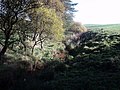 Burn from Fannyside Muir - geograph.org.uk - 1538058.jpg 640 × 480; 110 KB
-
 Burn heading west, Fannyside Muir - geograph.org.uk - 1618028.jpg 640 × 480; 92 KB
-
 Burn, Glenhead - geograph.org.uk - 1589292.jpg 640 × 359; 73 KB
-
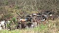
 Cattle at West Fannyside Farm - geograph.org.uk - 988573.jpg 640 × 480; 47 KB
-
 Dumped rubbish, Forest Wood - geograph.org.uk - 1589285.jpg 640 × 359; 117 KB
-
 Easter Fannyside - geograph.org.uk - 988580.jpg 640 × 480; 75 KB
-
 Easter Fannyside Cottages (ruin) - geograph.org.uk - 1750650.jpg 865 × 579; 182 KB
-
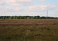
 Eastern part of Fannyside Muir - geograph.org.uk - 1509553.jpg 640 × 480; 63 KB
-
 Entrance to West Fannyside Farm - geograph.org.uk - 988570.jpg 640 × 480; 45 KB
-
 Fannyside Muir - geograph.org.uk - 1544672.jpg 640 × 453; 49 KB
-
 Fannyside Muir - geograph.org.uk - 1567003.jpg 640 × 480; 99 KB
-
 Fannyside Muir - geograph.org.uk - 1567009.jpg 640 × 480; 95 KB
-
 Fannyside Muir - geograph.org.uk - 1567019.jpg 640 × 359; 55 KB
-
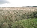
 Fannyside Muir - geograph.org.uk - 1589271.jpg 640 × 359; 72 KB
-
 Fannyside Muir - geograph.org.uk - 1589277.jpg 640 × 349; 90 KB
-
 Fannyside Muir - geograph.org.uk - 1603829.jpg 640 × 480; 78 KB
-
 Fannyside Muir track - geograph.org.uk - 1528439.jpg 640 × 480; 66 KB
-
 Fannyside Muir with Forth Valley coming into view - geograph.org.uk - 1722054.jpg 3,264 × 2,448; 2.56 MB
-
 Fannyside Muir with Ochils in the Distance - geograph.org.uk - 1722047.jpg 3,264 × 2,448; 3.24 MB
-

-
 Glenvale Cottage (ruin) near Fannyside - geograph.org.uk - 1530135.jpg 640 × 480; 112 KB
-

-
 Mine seepage in burn, Fannyside Muir - geograph.org.uk - 1618013.jpg 640 × 480; 107 KB
-
 Old Coal Pit near Fannyside - geograph.org.uk - 1530150.jpg 640 × 303; 54 KB
-
 Pond on Fannyside Muir - geograph.org.uk - 1528432.jpg 640 × 480; 106 KB
-
 Pylons crossing Fannyside Muir near Cumbernauld - geograph.org.uk - 1722060.jpg 3,264 × 2,448; 3.09 MB
-
 Road to Grangeneuk - geograph.org.uk - 1592691.jpg 640 × 359; 76 KB
-
 Scar Hill - geograph.org.uk - 1509591.jpg 640 × 480; 67 KB
-

-

-
 The road above the Fannyside Lochs - geograph.org.uk - 988579.jpg 640 × 480; 58 KB
-
 Track to Palacerigg - geograph.org.uk - 1746166.jpg 845 × 634; 229 KB


_-_geograph.org.uk_-_1750650.jpg)


_near_Fannyside_-_geograph.org.uk_-_1530135.jpg)


