Category:Fan Gyhirych
Jump to navigation
Jump to search

mountain (725m) in Powys  | |||||
| Upload media | |||||
| Instance of | |||||
|---|---|---|---|---|---|
| Location | Powys, Wales | ||||
| Mountain range | |||||
| Topographic prominence |
| ||||
| Elevation above sea level |
| ||||
| Parent peak | |||||
 | |||||
Media in category "Fan Gyhirych"
The following 50 files are in this category, out of 50 total.
-
 Ancient cairn on Fan Gyhirych - geograph.org.uk - 694057.jpg 640 × 480; 112 KB
-
 Boulder field on Fan Gyhirych - geograph.org.uk - 694095.jpg 640 × 480; 113 KB
-
 Byfre Fechan valley - geograph.org.uk - 293435.jpg 640 × 480; 95 KB
-
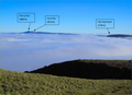
 Cloud forming on Fan Gyhirych - geograph.org.uk - 270162.jpg 640 × 480; 48 KB
-
 Cray reservoir seen from Fan Gyhirych - geograph.org.uk - 257642.jpg 640 × 480; 71 KB
-
 Cwm Nant Lloi - geograph.org.uk - 1715730.jpg 640 × 480; 125 KB
-
 Eastern slopes of Fan Gyhirych - geograph.org.uk - 293440.jpg 640 × 480; 80 KB
-
 Erratic block again - geograph.org.uk - 1003596.jpg 640 × 480; 129 KB
-
 Heol Gwrang-Fryn - geograph.org.uk - 1075997.jpg 640 × 479; 68 KB
-
 Llyn y Fan Fawr - geograph.org.uk - 981768.jpg 640 × 480; 136 KB
-
 Minor road to Ton-Pyrddin - geograph.org.uk - 880567.jpg 640 × 480; 82 KB
-
 Moel Penderyn trig pillar - geograph.org.uk - 453527.jpg 640 × 480; 91 KB
-
 Nant Tywynni valley - geograph.org.uk - 917602.jpg 640 × 480; 131 KB
-
 On Bryn Melyn - geograph.org.uk - 1381501.jpg 640 × 427; 47 KB
-
 Pen y Fan, Fan Gyhirych, Corn Du.png 729 × 530; 533 KB
-
 Pool at Waun Fignen Felen - geograph.org.uk - 1331034.jpg 640 × 480; 109 KB
-
 Pool on Fforest Fach - geograph.org.uk - 907763.jpg 640 × 480; 87 KB
-
 Pwll Byfre - geograph.org.uk - 604702.jpg 640 × 480; 73 KB
-
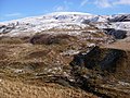
 Rocky ground and view to Fan Gyhirych - geograph.org.uk - 3210396.jpg 4,000 × 3,000; 3.87 MB
-
 Rocky ground and view to Fan Gyhirych - geograph.org.uk - 3210397.jpg 4,000 × 3,000; 3.44 MB
-
 Ruined wall on the Cefn Cul - geograph.org.uk - 918965.jpg 640 × 480; 83 KB
-
 Saith Maen - Pump - geograph.org.uk - 913452.jpg 480 × 640; 114 KB
-
 Silica Sand Tramroad - geograph.org.uk - 694103.jpg 640 × 480; 92 KB
-
 South-western slopes of Fan Gyhirych - geograph.org.uk - 914552.jpg 640 × 480; 88 KB
-
 Summit of Fan Fraith - geograph.org.uk - 257645.jpg 640 × 480; 92 KB
-
 Tawe Valley (geograph 7187866).jpg 4,032 × 3,024; 3.04 MB
-
 The River Tawe at Pontardawe - geograph.org.uk - 133412.jpg 640 × 469; 102 KB
-
 Tower southwest of Cray reservoir - geograph.org.uk - 257639.jpg 640 × 480; 51 KB
-
 Trig on an unnamed hill - geograph.org.uk - 923037.jpg 640 × 480; 87 KB
-
 Trig pillar on Fan Gyhirych - geograph.org.uk - 257640.jpg 640 × 480; 64 KB
-
 Trig point on Fan Nedd - geograph.org.uk - 694020.jpg 640 × 480; 103 KB
-
 Vehicle track on Fan Gyhirych - geograph.org.uk - 293446.jpg 640 × 480; 113 KB
-
 View east over Bwlch Bryn-rhudd - geograph.org.uk - 918993.jpg 640 × 480; 79 KB
-
 View from Ashfield - geograph.org.uk - 521005.jpg 640 × 480; 100 KB
-
 View from Dan yr Ogof (9128).jpg 4,288 × 2,848; 6.12 MB
-
 View over Cwm Haffes towards Fan Gyhirych - geograph.org.uk - 3210394.jpg 4,000 × 3,000; 3.58 MB
-

-
 View towards Fan Gyhirych - geograph.org.uk - 3210258.jpg 4,000 × 3,000; 3.28 MB
-
 View towards Fan Gyhirych - geograph.org.uk - 3210380.jpg 4,000 × 3,000; 3.65 MB
-
 View towards Fan Gyhirych - geograph.org.uk - 3210392.jpg 4,000 × 3,000; 3.55 MB
-
 View towards Fan Gyhirych from Castell y Geifr - geograph.org.uk - 3210262.jpg 4,000 × 3,000; 2.46 MB
-
 Wall on the Cefn Cul - geograph.org.uk - 918956.jpg 640 × 480; 90 KB
-
 Wall to the road - geograph.org.uk - 919015.jpg 640 × 480; 81 KB
-

-
 Yr Allt - geograph.org.uk - 70396.jpg 640 × 466; 40 KB
-
 Fan Gyhirych - geograph.org.uk - 537014.jpg 640 × 480; 87 KB
-
 Fan Gyhirych - geograph.org.uk - 769637.jpg 640 × 480; 36 KB
-
 Nant Byfre - geograph.org.uk - 416484.jpg 640 × 480; 94 KB
-
 Towards Bwlch y Duwynt - geograph.org.uk - 694045.jpg 640 × 480; 109 KB
-
 Upper northwest face of Fan Gyhirych - geograph.org.uk - 257643.jpg 639 × 385; 54 KB


.jpg)


.jpg)


.jpg)


