Category:Famartin's October 2012 photos
Jump to navigation
Jump to search
Media in category "Famartin's October 2012 photos"
The following 200 files are in this category, out of 337 total.
(previous page) (next page)-
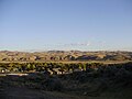 2012-10-08 View of Calin in Nevada from Interstate 80.jpg 3,264 × 2,448; 1.97 MB
-
 2012-10-08 View of Carlin in Nevada from the south side of the Humboldt River.jpg 3,248 × 1,628; 923 KB
-
 2012-10-08 View of downtown Ely in Nevada from the lower slopes of Ward Mountain.jpg 3,264 × 2,448; 2.03 MB
-
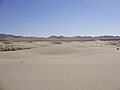
 2012-10-14 01 Winnemucca Sand Dunes viewed from a distance north of Winnemucca, Nevada.jpg 3,264 × 2,448; 2.03 MB
-
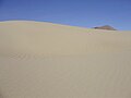
 2012-10-14 02 Winnemucca Sand Dunes, north of Winnemucca Nevada.jpg 3,264 × 2,448; 2.02 MB
-
 2012-10-14 03 Winnemucca Sand Dunes, north of Winnemucca Nevada.jpg 3,264 × 2,448; 1.93 MB
-
 2012-10-14 04 Footprints across the Winnemucca Sand Dunes north of Winnemucca, Nevada.jpg 3,264 × 2,448; 1.95 MB
-
 2012-10-14 05 Winnemucca Sand Dunes, north of Winnemucca Nevada.jpg 3,264 × 2,448; 2 MB
-
 2012-10-14 06 Winnemucca Sand Dunes, north of Winnemucca Nevada.jpg 3,264 × 2,448; 2.03 MB
-
 2012-10-14 07 Winnemucca Sand Dunes, north of Winnemucca Nevada.jpg 3,264 × 2,448; 1.9 MB
-
 2012-10-14 08 Winnemucca Sand Dunes, north of Winnemucca Nevada.jpg 3,264 × 2,448; 1.95 MB
-
 2012-10-14 09 Winnemucca Sand Dunes, north of Winnemucca Nevada.jpg 3,264 × 2,448; 1.89 MB
-
 2012-10-14 10 Winnemucca Sand Dunes, north of Winnemucca Nevada.jpg 3,264 × 2,448; 1.79 MB
-
 2012-10-14 11 Winnemucca Sand Dunes, north of Winnemucca Nevada.jpg 3,264 × 2,448; 1.97 MB
-
 2012-10-14 12 Winnemucca Sand Dunes, north of Winnemucca Nevada.jpg 3,264 × 2,448; 1.98 MB
-
 2012-10-14 13 Winnemucca Sand Dunes, north of Winnemucca Nevada.jpg 3,264 × 2,448; 1.91 MB
-
 2012-10-14 14 Winnemucca Sand Dunes, north of Winnemucca in Nevada.jpg 3,264 × 2,448; 1.97 MB
-
 2012-10-14 15 Winnemucca Sand Dunes, north of Winnemucca Nevada.jpg 3,264 × 2,448; 1.95 MB
-
 2012-10-14 16 Winnemucca Sand Dunes, north of Winnemucca Nevada.jpg 3,264 × 2,448; 1.96 MB
-
 2012-10-14 17 Winnemucca Sand Dunes, north of Winnemucca Nevada.jpg 3,264 × 2,448; 1.95 MB
-
 2012-10-14 18 Winnemucca Sand Dunes, north of Winnemucca Nevada.jpg 3,264 × 2,448; 1.84 MB
-
 2012-10-14 19 Winnemucca Sand Dunes, north of Winnemucca Nevada.jpg 3,264 × 2,448; 1.88 MB
-
 2012-10-14 20 Winnemucca Sand Dunes, north of Winnemucca Nevada.jpg 3,264 × 2,448; 1.96 MB
-
 2012-10-14 21 Winnemucca Sand Dunes, north of Winnemucca Nevada.jpg 3,264 × 2,448; 1.83 MB
-
 2012-10-14 22 Winnemucca Sand Dunes, north of Winnemucca Nevada.jpg 3,264 × 2,448; 1.95 MB
-
 2012-10-14 23 Winnemucca Sand Dunes, north of Winnemucca Nevada.jpg 3,264 × 2,448; 2.01 MB
-
 2012-10-14 24 Winnemucca Sand Dunes, north of Winnemucca Nevada.jpg 3,264 × 2,448; 2 MB
-
 2012-10-14 25 Winnemucca Sand Dunes, north of Winnemucca Nevada.jpg 3,264 × 2,448; 1.96 MB
-
 2012-10-14 26 Winnemucca Sand Dunes, north of Winnemucca Nevada.jpg 3,264 × 2,448; 1.82 MB
-
 2012-10-14 27 Winnemucca Sand Dunes, north of Winnemucca Nevada.jpg 3,264 × 2,448; 1.8 MB
-
 2012-10-14 28 Winnemucca Sand Dunes, north of Winnemucca Nevada.jpg 3,264 × 2,448; 1.94 MB
-
 2012-10-14 29 Winnemucca Sand Dunes, north of Winnemucca Nevada.jpg 3,264 × 2,448; 1.97 MB
-
 2012-10-14 30 Winnemucca Sand Dunes, north of Winnemucca Nevada.jpg 3,264 × 2,448; 2.03 MB
-
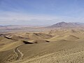
 2012-10-14 31 View south-southeast from Winnemucca Mountain Nevada.jpg 3,264 × 2,448; 1.97 MB
-
 2012-10-14 32 View south-southwest from Winnemucca Mountain Nevada.jpg 3,264 × 2,448; 2 MB
-
 2012-10-14 33 View west-southwest from Winnemucca Mountain Nevada.jpg 3,264 × 2,448; 2.05 MB
-
 2012-10-14 34 View west-northwest from Winnemucca Mountain Nevada.jpg 3,264 × 2,448; 2.03 MB
-
 2012-10-14 35 View north-northwest from Winnemucca Mountain Nevada.jpg 3,264 × 2,448; 2.01 MB
-
 2012-10-14 36 View north-northeast from Winnemucca Mountain Nevada.jpg 3,264 × 2,448; 1.99 MB
-
 2012-10-14 37 View northeast from Winnemucca Mountain Nevada.jpg 3,264 × 2,448; 1.84 MB
-
 2012-10-14 38 View east from Winnemucca Mountain Nevada.jpg 3,264 × 2,448; 1.97 MB
-
 2012-10-14 39 View southeast from Winnemucca Mountain Nevada with view of Winnemucca.jpg 3,264 × 2,448; 2.01 MB
-
 2012-10-14 40 Partial zoom-in of Winnemucca from Winnemucca Mountain Nevada.jpg 3,264 × 2,448; 2.02 MB
-
 2012-10-14 41 Downtown Winnemucca in Nevada viewed from Winnemucca Mountain.jpg 3,264 × 2,448; 1.99 MB
-
 2012-10-14 42 View from Winnemucca Mountain towards the Winnemucca Sand Dunes.jpg 3,264 × 2,448; 1.95 MB
-
 2012-10-14 43 View from Winnemucca Mountain towards the Winnemucca Sand Dunes.jpg 3,264 × 2,448; 1.95 MB
-

-

-

-
-

-

-

-

-

-

-

-

-

-

-

-

-

-
-

-

-

-

-

-

-

-

-

-

-

-

-

-

-

-

-

-
-

-

-

-

-

-

-

-

-

-

-

-

-

-

-

-

-

-

-

-
 2012-10-17 201 View southwest along Elko County Route 703 (Fort Halleck Road).jpg 3,264 × 2,448; 1.99 MB
-
 2012-10-17 202 View southwest along Elko County Route 703 (Fort Halleck Road).jpg 3,264 × 2,448; 2.01 MB
-
 2012-10-17 203 View southwest along Elko County Route 703 (Fort Halleck Road).jpg 3,264 × 2,448; 1.99 MB
-
 2012-10-17 204 View southwest along Elko County Route 703 (Fort Halleck Road).jpg 3,264 × 2,448; 1.98 MB
-
 2012-10-17 205 View southwest along Elko County Route 703 (Fort Halleck Road).jpg 3,264 × 2,448; 1.96 MB
-
 2012-10-17 206 View southwest along Elko County Route 703 (Fort Halleck Road).jpg 3,264 × 2,448; 1.98 MB
-
 2012-10-17 207 View southwest along Elko County Route 703 (Fort Halleck Road).jpg 3,264 × 2,448; 2.01 MB
-
 2012-10-17 208 View southwest along Elko County Route 703 (Fort Halleck Road).jpg 3,264 × 2,448; 2.07 MB
-

-
 2012-10-17 210 View southwest along Elko County Route 703 (Fort Halleck Road).jpg 3,264 × 2,448; 2.02 MB
-
 2012-10-17 211 View southwest along Elko County Route 703 (Fort Halleck Road).jpg 3,264 × 2,448; 2.01 MB
-
 2012-10-17 301 View southwest along Elko County Route 704 (Clobine Road).jpg 3,264 × 2,448; 2.01 MB
-
 2012-10-17 302 View southwest along Elko County Route 704 (Clobine Road).jpg 3,264 × 2,448; 2.01 MB
-
 2012-10-17 303 View southwest along Elko County Route 704 (Clobine Road).jpg 3,264 × 2,448; 2 MB
-
 2012-10-17 304 View southwest along Elko County Route 704 (Clobine Road).jpg 3,264 × 2,448; 2 MB
-
 2012-10-17 401 East end of Nevada State Route 227.jpg 3,264 × 2,448; 2 MB
-
 2012-10-17 501 Aspens in Lamoille Canyon.jpg 3,264 × 2,448; 1.99 MB
-
 2012-10-17 502 Aspens in Lamoille Canyon.jpg 2,448 × 3,264; 1.94 MB
-
 2012-10-17 503 Aspens in Lamoille Canyon.jpg 3,264 × 2,448; 2.03 MB
-
 2012-10-17 504 Aspens in Lamoille Canyon.jpg 3,264 × 2,448; 1.97 MB
-
 2012-10-17 505 Aspens in Lamoille Canyon.jpg 3,264 × 2,448; 2 MB
-
 2012-10-17 506 Aspens in Lamoille Canyon.jpg 2,448 × 3,264; 1.93 MB
-
 2012-10-17 507 Aspens in Lamoille Canyon.jpg 3,264 × 2,448; 1.98 MB
-
 2012-10-17 508 Aspens in Lamoille Canyon.jpg 3,264 × 2,448; 2.01 MB
-
 2012-10-17 509 Aspens in Lamoille Canyon.jpg 3,264 × 2,448; 1.99 MB
-
 2012-10-17 510 Aspens in Lamoille Canyon.jpg 3,264 × 2,448; 2.01 MB
-

-

-

-

-

-

-

-
 2012-10-17 P1010101 Cottonwoods along Secret Creek north of Secret Pass, Nevada.JPG 3,264 × 2,448; 2.04 MB
-
 2012-10-17 P1010103 Cottonwoods along Secret Creek north of Secret Pass, Nevada.JPG 3,264 × 2,448; 2.03 MB
-

-
 2012-10-17 P1010108 View up Secret Creek north of Secret Pass, Nevada.JPG 3,264 × 2,448; 2 MB
-
 2012-10-17 P1010109 View of Secret Peak from the north side of Secret Pass, Nevada.JPG 3,264 × 2,448; 1.98 MB
-
 2012-10-17 P1010112 View up Secret Creek north of Secret Pass, Nevada.JPG 3,264 × 2,448; 2.05 MB
-
 2012-10-17 P1010113 Grove of Aspens north of Secret Pass, Nevada.JPG 3,264 × 2,448; 2.04 MB
-
 2012-10-17 P1010114 Closeup of a grove of Aspens north of Secret Pass, Nevada.JPG 3,264 × 2,448; 2.02 MB
-

-

-

-

-

-

-

-

-

-
 2012-10-17 P1010136 View from Nevada State Route 229 west towards the Ruby Mountains.JPG 3,264 × 2,448; 2.01 MB
-
 2012-10-17 P1010137 View from Nevada State Route 229 west towards the Ruby Mountains.JPG 3,264 × 2,448; 2.05 MB
-
 2012-10-17 P1010139 View from Nevada State Route 229 west towards the Ruby Mountains.JPG 3,264 × 2,448; 1.98 MB
-

-

-
 2012-10-17 P1010142 View from Nevada State Route 229 southeast towards Spruce Mountain.JPG 3,264 × 2,448; 1.98 MB
-
 2012-10-17 P1010143 View from Nevada State Route 229 south down Ruby Valley.JPG 3,264 × 2,448; 1.99 MB
-
 2012-10-17 P1010147 View from Nevada State Route 229 west towards the Ruby Mountains.JPG 3,264 × 2,448; 2.01 MB
-
 2012-10-17 P1010149 View from Nevada State Route 229 west towards the Ruby Mountains.JPG 3,264 × 2,448; 2.01 MB
-

-
 2012-10-17 P1010152 View from Nevada State Route 229 southeast across Ruby Valley.JPG 3,264 × 2,448; 2.01 MB
-
 2012-10-17 P1010153 View from Nevada State Route 229 towards trees along the road.JPG 2,448 × 3,264; 1.95 MB
-

-
 2012-10-17 P1010155 View from Nevada State Route 229 towards some trees along the road.JPG 3,264 × 2,448; 2.03 MB
-

-

-
-

-
 2012-10-17 P1010161 View from Nevada State Route 229 south across Ruby Valley.JPG 3,264 × 2,448; 2.01 MB
-

-

-
 2012-10-17 P1010174 View from Nevada State Route 229 south down Ruby Valley.JPG 3,264 × 2,448; 1.99 MB
-
 2012-10-17 P1010176 View from Nevada State Route 229 south down Ruby Valley.JPG 3,264 × 2,448; 1.99 MB
-

-

-

-

-

-

-

-
 2012-10-17 P1010191 View from Nevada State Route 229 west towards the Ruby Mountains.JPG 3,264 × 2,448; 1.97 MB
-

-

-

-

-
 2012-10-17 P1010201 View from Nevada State Route 229 northwest down Secret Creek.JPG 3,264 × 2,448; 2.05 MB
-
 2012-10-17 P1010203 View from Nevada State Route 229 northwest down Secret Creek.JPG 3,264 × 2,448; 1.99 MB
-

-
 2012-10-17 P1010206 View from Nevada State Route 229 west down Secret Creek.JPG 3,264 × 2,448; 2 MB
-
 2012-10-17 P1010209 View from Nevada State Route 229 west down Secret Creek.JPG 3,264 × 2,448; 2.02 MB
-

-

-

-

-
 2012-10-17 P1010234 Lombardy Poplar along Clubine Road in Lamoille Valley.JPG 2,448 × 3,264; 1.94 MB
-
 2012-10-17 P1010235 Lombardy Poplar along Clubine Road in Lamoille Valley.JPG 2,448 × 3,264; 1.95 MB
-
 2012-10-17 P1010238 Cattle and Aspens along Clubine Road in Lamoille Valley.JPG 3,264 × 2,448; 2.01 MB
-
 2012-10-17 P1010239 Aspen along Clubine Road in Lamoille Valley.JPG 2,448 × 3,264; 1.93 MB
-
 2012-10-17 P1010242 Aspens along Clubine Road in Lamoille Valley.JPG 2,448 × 3,264; 1.95 MB


_1.2_miles_from_Interstate_80_in_Elko_County,_Nevada.jpg)
_3.2_miles_from_Interstate_80_in_Elko_County,_Nevada.jpg)
_4.4_miles_from_Interstate_80_in_Elko_County,_Nevada.jpg)
_about_4.4_miles_from_Interstate_80_in_Elko_County_in_Nevada.jpg)
_5.9_miles_from_Interstate_80_in_Elko_County,_Nevada.jpg)
_9.5_miles_from_Interstate_80_in_Elko_County,_Nevada.jpg)
_10.2_miles_from_Interstate_80_in_Elko_County,_Nevada.jpg)
_11.0_miles_from_Interstate_80_in_Elko_County,_Nevada.jpg)
_11.7_miles_from_Interstate_80_in_Elko_County,_Nevada.jpg)
_12.4_miles_from_Interstate_80_in_Elko_County,_Nevada.jpg)
_13.2_miles_from_Interstate_80_in_Elko_County,_Nevada.jpg)
_13.9_miles_from_Interstate_80_in_Elko_County,_Nevada.jpg)
_16.6_miles_from_Interstate_80_in_Elko_County,_Nevada.jpg)
_16.8_miles_from_Interstate_80_in_Elko_County,_Nevada.jpg)
_17.3_miles_from_Interstate_80_in_Elko_County,_Nevada.jpg)
_18.4_miles_from_Interstate_80_in_Elko_County,_Nevada.jpg)
_19.7_miles_from_Interstate_80_in_Elko_County,_Nevada.jpg)
_20.9_miles_from_Interstate_80_in_Elko_County,_Nevada.jpg)
_22.0_miles_from_Interstate_80_in_Elko_County,_Nevada.jpg)
_22.4_miles_from_Interstate_80_in_Elko_County,_Nevada.jpg)
_22.7_miles_from_Interstate_80_in_Elko_County,_Nevada.jpg)
_24.6_miles_from_Interstate_80_in_Elko_County,_Nevada.jpg)
_25.2_miles_from_Interstate_80_in_Elko_County,_Nevada.jpg)
_26.5_miles_from_Interstate_80_in_Elko_County,_Nevada.jpg)
_27.7_miles_from_Interstate_80_in_Elko_County,_Nevada.jpg)
_30.5_miles_from_Interstate_80_in_Elko_County,_Nevada.jpg)
_32.6_miles_from_Interstate_80_in_Elko_County,_Nevada.jpg)
_33.9_miles_from_Interstate_80_in_Elko_County,_Nevada.jpg)
_35.1_miles_from_Interstate_80_in_Elko_County,_Nevada.jpg)
_36.2_miles_from_Interstate_80_in_Elko_County,_Nevada.jpg)
_46.8_miles_from_Interstate_80_in_Elko_County,_Nevada.jpg)
_48.2_miles_from_Interstate_80_in_Elko_County,_Nevada.jpg)
_49.9_miles_from_Interstate_80_at_U.S._Route_93_in_Elko_County,_Nevada.jpg)
_45.0_miles_from_Interstate_80_in_Elko_County,_Nevada.jpg)
_44.3_miles_from_Interstate_80_in_Elko_County,_Nevada.jpg)
_about_44.3_miles_from_Interstate_80_in_Elko_County_in_Nevada.jpg)
_38.2_miles_from_Interstate_80_in_Elko_County,_Nevada.jpg)
_35.8_miles_from_Interstate_80_in_Ruby_Valley,_Nevada.jpg)
_35.5_miles_from_Interstate_80_in_Elko_County,_Nevada.jpg)
_34.4_miles_from_Interstate_80_in_Elko_County,_Nevada.jpg)
_32.2_miles_from_Interstate_80_in_Elko_County,_Nevada.jpg)
_31.4_miles_from_Interstate_80_in_Elko_County,_Nevada.jpg)
_23.7_miles_from_Interstate_80_in_Elko_County,_Nevada.jpg)
_23.3_miles_from_Interstate_80_in_Elko_County,_Nevada.jpg)
_20.8_miles_from_Interstate_80_in_Elko_County,_Nevada.jpg)
_19.2_miles_from_Interstate_80_in_Elko_County,_Nevada.jpg)
_18.7_miles_from_Interstate_80_in_Elko_County,_Nevada.jpg)
_16.8_miles_from_Interstate_80_in_Elko_County,_Nevada.jpg)
_16.4_miles_from_Interstate_80_in_Elko_County,_Nevada.jpg)
_15.4_miles_from_Interstate_80_in_Elko_County,_Nevada.jpg)
_14.8_miles_from_Interstate_80_in_Elko_County,_Nevada.jpg)
_13.7_miles_from_Interstate_80_in_Elko_County,_Nevada.jpg)
_12.4_miles_from_Interstate_80_in_Elko_County,_Nevada.jpg)
_11.5_miles_from_Interstate_80_in_Elko_County,_Nevada.jpg)
_8.9_miles_from_Interstate_80_in_Elko_County,_Nevada.jpg)
.jpg)
.jpg)
.jpg)
.jpg)
.jpg)
.jpg)
.jpg)
.jpg)
.jpg)
.jpg)
.jpg)
.jpg)
.jpg)
.jpg)
.jpg)


_from_Nevada_State_Route_229_(Secret_Pass_Road)_towards_Secret_Pass_in_Elko_County,_Nevada.jpg)


