Category:Faceby
Jump to navigation
Jump to search
village in the United Kingdom  | |||||
| Upload media | |||||
| Instance of | |||||
|---|---|---|---|---|---|
| Location | Hambleton, North Yorkshire, Yorkshire and the Humber, England | ||||
| Population |
| ||||
| Area |
| ||||
 | |||||
English: Faceby is a village and civil parish in Hambleton, North Yorkshire, UK
Subcategories
This category has only the following subcategory.
S
Media in category "Faceby"
The following 88 files are in this category, out of 88 total.
-
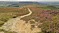
 A field above Faceby - geograph.org.uk - 4500403.jpg 6,000 × 4,000; 5.07 MB
-
 A172 - Gold Hill loop road, east end - geograph.org.uk - 2647556.jpg 640 × 428; 68 KB
-
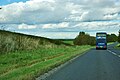 A172 heading north - geograph.org.uk - 4812575.jpg 640 × 428; 102 KB
-
 Above Faceby Bank on Cleveland Way - geograph.org.uk - 4137366.jpg 4,000 × 2,248; 4.34 MB
-
 Bank Lane - geograph.org.uk - 1703180.jpg 640 × 427; 317 KB
-
 Bank Lane - geograph.org.uk - 5340720.jpg 1,499 × 943; 1.14 MB
-
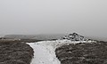
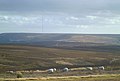
 Bilsdale West Moor - geograph.org.uk - 1158725.jpg 640 × 427; 92 KB
-
 Boundary stone on Cleveland Way path looking up Gold Hill - geograph.org.uk - 4137404.jpg 4,000 × 2,248; 6.92 MB
-
 Boundary stone on Cleveland Way path with Live Moor to left - geograph.org.uk - 4137392.jpg 4,000 × 2,248; 5.85 MB
-
 Bridleway in Faceby - geograph.org.uk - 6710119.jpg 3,888 × 5,184; 3.7 MB
-
 Burnt heather on Gold Hill - geograph.org.uk - 4495560.jpg 6,000 × 4,000; 6.29 MB
-
 Cairn on Live Moor - geograph.org.uk - 3835619.jpg 4,304 × 2,451; 1.33 MB
-
 Cairn on Live Moor - geograph.org.uk - 5931732.jpg 1,024 × 768; 647 KB
-
 Cairn on Live Moor - geograph.org.uk - 6086396.jpg 1,024 × 768; 145 KB
-
 Cairn on Live Moor alongside Cleveland Way path - geograph.org.uk - 4137407.jpg 4,000 × 2,248; 5.26 MB
-
 Cairn on Live moor. - geograph.org.uk - 4316869.jpg 640 × 386; 36 KB
-
 Cairn, Live Moor - geograph.org.uk - 1703285.jpg 640 × 427; 297 KB
-
 Choice of footpaths near Faceby - geograph.org.uk - 4499586.jpg 6,000 × 4,000; 5.47 MB
-
 Cleveland Way at Live Moor - geograph.org.uk - 3835612.jpg 3,824 × 2,455; 1.51 MB
-
 Descending Carlton Bank - geograph.org.uk - 938358.jpg 427 × 640; 291 KB
-
 Dry ford - geograph.org.uk - 3598624.jpg 640 × 480; 182 KB
-
 End of the 30 limit, Faceby - geograph.org.uk - 6710114.jpg 3,888 × 5,184; 6.27 MB
-
 Entrance to Raven Hill farm - geograph.org.uk - 1005368.jpg 640 × 480; 44 KB
-
 Faceby Manor.jpg 2,048 × 1,536; 857 KB
-
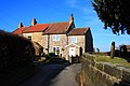
 Faceby Village Hall - geograph.org.uk - 1718712.jpg 1,280 × 853; 329 KB
-
 Faceby, North Yorkshire.jpg 640 × 480; 93 KB
-
 Fallen Tree - geograph.org.uk - 4894569.jpg 640 × 384; 106 KB
-
 Fishing ponds near Bank Lane - geograph.org.uk - 1718702.jpg 1,280 × 853; 449 KB
-
 Footpath to Faceby - geograph.org.uk - 4499636.jpg 6,000 × 4,000; 5.51 MB
-
 Ford at Faceby Mill - geograph.org.uk - 4211848.jpg 3,872 × 2,592; 4.83 MB
-
 Glorious winter sunshine - geograph.org.uk - 6387227.jpg 640 × 480; 85 KB
-
 Gold Hill Lane junction - geograph.org.uk - 6710147.jpg 5,184 × 3,888; 3.03 MB
-
 Gold Hill Summerhouse - geograph.org.uk - 4878802.jpg 640 × 480; 138 KB
-
 Gold Hill Summerhouse - Ruined Enclosure - geograph.org.uk - 4878807.jpg 640 × 480; 114 KB
-

-
 Goulton Lane towards Potto - geograph.org.uk - 3534111.jpg 1,024 × 768; 199 KB
-
 Goulton Lane towards Potto - geograph.org.uk - 3534153.jpg 1,024 × 768; 225 KB
-
 Grouse butt on Live Moor - geograph.org.uk - 4495554.jpg 6,000 × 4,000; 4.77 MB
-
 Heather Cutting - geograph.org.uk - 4878814.jpg 640 × 480; 123 KB
-
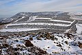
 Heather moorland near Faceby Bank - geograph.org.uk - 4495573.jpg 6,000 × 4,000; 5.13 MB
-
 Heather moorland on Faceby Bank - geograph.org.uk - 4495591.jpg 6,000 × 4,000; 5.24 MB
-
 High Farm, Faceby - geograph.org.uk - 1718706.jpg 1,280 × 853; 339 KB
-
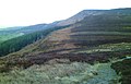
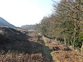
 Holloway, Faceby Plantation - geograph.org.uk - 5992273.jpg 640 × 427; 194 KB
-
 Live Moor - geograph.org.uk - 4641904.jpg 640 × 480; 120 KB
-
 Looking towards Carlton Moor - geograph.org.uk - 4036917.jpg 1,600 × 1,200; 672 KB
-
 Mixed farming near Potto - geograph.org.uk - 2436089.jpg 640 × 482; 86 KB
-
 Moorland alongside Cleveland Way - geograph.org.uk - 5341964.jpg 1,499 × 837; 1,023 KB
-
 Mossy Oak - geograph.org.uk - 6055209.jpg 640 × 427; 185 KB
-
-

-
 Old Boundary Marker on Faceby Bank - geograph.org.uk - 6083752.jpg 785 × 833; 383 KB
-

-
 Old Boundary Marker on Live Moor, Faceby parish - geograph.org.uk - 6072035.jpg 728 × 1,106; 395 KB
-

-
 Old chapel converted to a garage - geograph.org.uk - 6710130.jpg 4,309 × 3,257; 3.2 MB
-
 On Carlton Moor - geograph.org.uk - 1158671.jpg 640 × 427; 85 KB
-
 On Cleveland Way above Faceby Bank - geograph.org.uk - 4137355.jpg 3,996 × 2,240; 6.46 MB
-
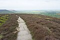
 Path on Faceby Bank - geograph.org.uk - 5931735.jpg 1,024 × 768; 816 KB
-
 Path on Faceby Bank - geograph.org.uk - 6086398.jpg 1,024 × 768; 175 KB
-
 Path on Live Moor - geograph.org.uk - 4495541.jpg 6,000 × 4,000; 3.9 MB
-
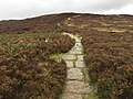
 Paved way of Cleveland Way - geograph.org.uk - 5341396.jpg 1,500 × 825; 977 KB
-
 Postbox on the Sutton Arms - geograph.org.uk - 3598655.jpg 2,788 × 3,717; 3.57 MB
-
 Raven Hill Farm road off Goulton Lane - geograph.org.uk - 3534150.jpg 1,024 × 768; 198 KB
-
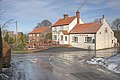
 Road junction at Faceby - geograph.org.uk - 594560.jpg 640 × 480; 96 KB
-
 Roadside weather station - geograph.org.uk - 3598682.jpg 640 × 480; 157 KB
-
 Sheep near Faceby - geograph.org.uk - 4499648.jpg 6,000 × 4,000; 4.49 MB
-
 Sheep near Faceby Manor - geograph.org.uk - 4499624.jpg 6,000 × 4,000; 4.12 MB
-
 Slyvan Cottage, Faceby - geograph.org.uk - 1718629.jpg 1,280 × 853; 329 KB
-
 Su ton Arms - geograph.org.uk - 3598638.jpg 640 × 480; 180 KB
-
 Sutton Arms - geograph.org.uk - 1703244.jpg 640 × 427; 259 KB
-
 Sutton Arms Faceby - geograph.org.uk - 6710138.jpg 5,156 × 3,507; 2.91 MB
-
 The Cleveland Way on Faceby Bank - geograph.org.uk - 4495579.jpg 6,000 × 4,000; 5.05 MB
-
 The Cleveland Way on Live Moor - geograph.org.uk - 2095479.jpg 2,048 × 1,536; 875 KB
-
 Top of Carlton Bank looking west - geograph.org.uk - 4107684.jpg 3,936 × 2,128; 6.42 MB
-
 Track to Faceby Mill - geograph.org.uk - 6086407.jpg 1,024 × 768; 272 KB
-
 Ventilated sheds at Whorl Hill Farm - geograph.org.uk - 594546.jpg 640 × 480; 66 KB
-
 View from the moor edge - geograph.org.uk - 3834729.jpg 4,320 × 3,240; 1.9 MB
-
 Walkers' Cairn, Gold Hill - geograph.org.uk - 5641507.jpg 640 × 427; 109 KB
-
 Whorl Hill Wood - geograph.org.uk - 677224.jpg 640 × 427; 77 KB
-
 Whorlton Moor - geograph.org.uk - 3835606.jpg 4,320 × 2,910; 1.45 MB
-
 A boundary stone on the Cleveland Way - geograph.org.uk - 203227.jpg 640 × 480; 119 KB
-
 Ailesbury Ironstone Mine - geograph.org.uk - 849353.jpg 640 × 427; 279 KB
-
 Ailesbury Ironstone Mine - geograph.org.uk - 849359.jpg 640 × 427; 263 KB
-
 Barker's Crags at Sunset - geograph.org.uk - 588532.jpg 640 × 427; 50 KB
-
 Cleveland Way near Faceby Bank - geograph.org.uk - 594682.jpg 640 × 480; 101 KB
-
 Faceby Village Hall - geograph.org.uk - 55030.jpg 640 × 480; 71 KB
-
 Farm buildings at Whorl Hill Farm - geograph.org.uk - 594552.jpg 640 × 480; 81 KB
-
 Track at the bottom of Live Moor - geograph.org.uk - 693450.jpg 640 × 480; 110 KB


