
Category:Eythorne
English: Eythorne is a civil parish and small village of about 1000 homes, located 6.3 miles NNW of Dover in Kent. There are currently about 2500 residents. Eythorne holds many historical attributes. Situated a few miles away from Dover beach, it offers many articles of evidence of the war. It is in close in touch with neighbouring village Shepherdswell, together they provide a historical trip that presents the region under the influence of the war. Eythorne has never had any coal mines the nearest one was at Tilmanstone - and that closed and was filled in at least 20 years ago (it is now 2009)
Nederlands: Eythorne is een plaats en civil parish in het bestuurlijke gebied Dover, in het Engelse graafschap Kent. De plaats telt 2493 inwoners.
village and civil parish in Kent, UK | |||||
| Upload media | |||||
| Instance of | |||||
|---|---|---|---|---|---|
| Location | Dover, Kent, South East England, England | ||||
| Population |
| ||||
 | |||||
Subcategories
This category has the following 6 subcategories, out of 6 total.
Media in category "Eythorne"
The following 200 files are in this category, out of 389 total.
(previous page) (next page)-
 1, Kennel Hill - geograph.org.uk - 6569155.jpg 2,444 × 2,338; 1.47 MB
-
 10.09.17 Eythorne 08799 (36975943702).jpg 5,940 × 3,583; 14.2 MB
-
 39, Adelaide Road - geograph.org.uk - 6057895.jpg 2,410 × 2,720; 2.2 MB
-
 A clear path - geograph.org.uk - 5212826.jpg 640 × 426; 84 KB
-
 A crop of Legumes - geograph.org.uk - 5222657.jpg 640 × 426; 97 KB
-
 A spot of fly tipping - geograph.org.uk - 5224300.jpg 640 × 426; 86 KB
-
 An arable landscape - geograph.org.uk - 5222658.jpg 640 × 426; 56 KB
-
 Baptist Church - geograph.org.uk - 5219532.jpg 640 × 426; 97 KB
-
 Baptist Church - geograph.org.uk - 5219535.jpg 640 × 426; 60 KB
-
 Baptist Church - geograph.org.uk - 5219538.jpg 640 × 426; 111 KB
-
 Bare ground by Barfrestone Rd - geograph.org.uk - 5222663.jpg 640 × 426; 73 KB
-
 Barfreston 12th century church - geograph.org.uk - 7101737.jpg 2,355 × 1,683; 1.8 MB
-
 Barfreston 12th century church - geograph.org.uk - 7101743.jpg 3,384 × 2,538; 1.85 MB
-
 Barfreston Road junction - geograph.org.uk - 3027617.jpg 4,320 × 3,240; 4.44 MB
-
 Barfreston south doorway - geograph.org.uk - 7101760.jpg 3,798 × 2,849; 5.96 MB
-
 Barfrestone 12th century church - geograph.org.uk - 7101734.jpg 2,328 × 1,552; 1.53 MB
-
 Barfrestone Church - geograph.org.uk - 7324366.jpg 1,200 × 1,600; 499 KB
-
 Barfrestone Court Farm - geograph.org.uk - 1970223.jpg 1,024 × 768; 192 KB
-
 Barfrestone Court Farm - geograph.org.uk - 5222715.jpg 640 × 426; 96 KB
-
 Barfrestone Rd - geograph.org.uk - 5219841.jpg 640 × 426; 94 KB
-
 Barfrestone Rd - geograph.org.uk - 5219843.jpg 640 × 426; 79 KB
-
 Barfrestone Rd - geograph.org.uk - 5219847.jpg 640 × 426; 82 KB
-
 Barfrestone Rd - geograph.org.uk - 5219849.jpg 640 × 426; 105 KB
-
 Barfrestone Rd - geograph.org.uk - 5219851.jpg 640 × 426; 78 KB
-
 Barfrestone Rd - geograph.org.uk - 5222655.jpg 640 × 426; 70 KB
-
 Barfrestone Rd - geograph.org.uk - 5222660.jpg 640 × 426; 65 KB
-
 Barfrestone Rd - geograph.org.uk - 5222664.jpg 640 × 426; 92 KB
-
 Barfrestone Rd - geograph.org.uk - 5222665.jpg 640 × 426; 85 KB
-
 Barfrestone Rd - geograph.org.uk - 5222671.jpg 640 × 426; 79 KB
-
 Barfrestone Rd - geograph.org.uk - 5222693.jpg 640 × 426; 71 KB
-
 Barfrestone Rd - geograph.org.uk - 5222701.jpg 640 × 426; 99 KB
-
 Barfrestone Rd - geograph.org.uk - 5222702.jpg 640 × 426; 102 KB
-
 Barfrestone Rd - geograph.org.uk - 5224260.jpg 640 × 426; 105 KB
-
 Barfrestone Rd - geograph.org.uk - 5224273.jpg 640 × 426; 81 KB
-
 Barfrestone Road - geograph.org.uk - 2219545.jpg 3,072 × 2,304; 2.48 MB
-
 Barfrestone Road - geograph.org.uk - 2219570.jpg 3,072 × 2,304; 1.53 MB
-
 Barfrestone Road - geograph.org.uk - 6183438.jpg 1,024 × 684; 250 KB
-
 Barfrestone Road, Barfrestone - geograph.org.uk - 4535987.jpg 2,272 × 1,704; 826 KB
-
 Barfrestone Road, Barfrestone - geograph.org.uk - 4535996.jpg 2,272 × 1,704; 811 KB
-
 Barfrestone Road, Barfrestone - geograph.org.uk - 4536001.jpg 2,272 × 1,704; 929 KB
-
 Barfrestone Road, Barfrestone - geograph.org.uk - 4536004.jpg 2,272 × 1,704; 676 KB
-
 Barfrestone Road, Barfrestone - geograph.org.uk - 4536007.jpg 2,272 × 1,704; 1.36 MB
-
 Barfrestone Road, Barfrestone - geograph.org.uk - 4536015.jpg 2,272 × 1,704; 1.14 MB
-
 Barfrestone Road, Barfrestone - geograph.org.uk - 4536054.jpg 2,272 × 1,704; 822 KB
-
 Barfrestone Road, Barfrestone - geograph.org.uk - 4536059.jpg 2,272 × 1,704; 801 KB
-
 Barfrestone Road, Barfrestone - geograph.org.uk - 4536061.jpg 2,272 × 1,704; 687 KB
-
 Barfrestone village sign - geograph.org.uk - 4536046.jpg 2,272 × 1,704; 1.09 MB
-
 Barfrestone, Detached house - geograph.org.uk - 6942726.jpg 6,193 × 4,129; 7.66 MB
-
 Barfrestone, Public telephone box - geograph.org.uk - 6942728.jpg 5,584 × 3,722; 5.75 MB
-

-

-

-

-

-

-
 Barfrestone, St. Nicholas Church, North chancel corbel table - geograph.org.uk - 6942900.jpg 6,661 × 4,440; 6.94 MB
-

-

-
 Barville Road - geograph.org.uk - 2428205.jpg 3,072 × 2,304; 1.92 MB
-
 Beer Flag at Eythorne - geograph.org.uk - 2586904.jpg 1,600 × 1,165; 393 KB
-
 Bridleway junction on Flax Court Lane - geograph.org.uk - 2219718.jpg 3,072 × 2,304; 2.79 MB
-
 Bridleway to Beeches Farm - geograph.org.uk - 2220825.jpg 3,072 × 2,304; 1.97 MB
-
 Bridleway to Beeches Farm - geograph.org.uk - 2428163.jpg 3,072 × 2,304; 2.46 MB
-
 Bridleway to Malmains Farm - geograph.org.uk - 2428319.jpg 3,072 × 2,304; 2.31 MB
-
 Bridleway to Pike Road - geograph.org.uk - 2219970.jpg 3,072 × 2,304; 2.87 MB
-
 Brimsdale Barn - geograph.org.uk - 2219713.jpg 3,072 × 2,304; 2.44 MB
-
 Burgess Hill (2) - geograph.org.uk - 2219844.jpg 3,072 × 2,304; 3.44 MB
-
 Burgess Hill (3) - geograph.org.uk - 2219853.jpg 3,072 × 2,304; 4.24 MB
-
 Burgess Hill - geograph.org.uk - 2219829.jpg 3,072 × 2,304; 1.94 MB
-
 Byway and track junction near Golgotha - geograph.org.uk - 2219640.jpg 3,072 × 2,304; 3.57 MB
-
 Byway off Barfrestone Rd - geograph.org.uk - 5222662.jpg 640 × 426; 76 KB
-
 Byway to Golgotha (2) - geograph.org.uk - 2219615.jpg 3,072 × 2,304; 3.41 MB
-
 Byway to Golgotha (2) - geograph.org.uk - 2219632.jpg 3,072 × 2,304; 1.92 MB
-
 Byway to Golgotha - geograph.org.uk - 2219591.jpg 3,072 × 2,304; 1.91 MB
-
 Byway to Golgotha - geograph.org.uk - 2219603.jpg 2,304 × 3,072; 3.58 MB
-
 Byway to Golgotha - geograph.org.uk - 2219623.jpg 3,072 × 2,304; 1.8 MB
-
 Carved heads, Barfrestone Church - geograph.org.uk - 7324395.jpg 1,600 × 1,069; 418 KB
-
 Carved heads, Barfrestone Church - geograph.org.uk - 7324398.jpg 1,600 × 899; 348 KB
-
 Carved heads, Barfrestone Church - geograph.org.uk - 7324402.jpg 1,600 × 899; 320 KB
-
 Carved heads, Barfrestone Church - geograph.org.uk - 7324405.jpg 1,600 × 899; 404 KB
-
 Catholic church on Church Hill, Eythorne - geograph.org.uk - 1532472.jpg 640 × 480; 174 KB
-
 Cattle grazing - geograph.org.uk - 5222705.jpg 640 × 426; 58 KB
-
 Chapel - geograph.org.uk - 244581.jpg 640 × 480; 75 KB
-
 Chapel Hill - geograph.org.uk - 5212883.jpg 640 × 426; 77 KB
-
 Chapel Hill - geograph.org.uk - 5219509.jpg 640 × 426; 102 KB
-
 Chapel Hill - geograph.org.uk - 5219544.jpg 640 × 426; 99 KB
-
 Church Farm - geograph.org.uk - 5224261.jpg 640 × 426; 73 KB
-
 Church Farmhouse - geograph.org.uk - 5224264.jpg 640 × 426; 79 KB
-
 Church Farmhouse - geograph.org.uk - 5224266.jpg 640 × 426; 89 KB
-
 Church of St Nicholas - chest tomb - geograph.org.uk - 5224254.jpg 640 × 426; 117 KB
-
 Church of St Nicholas - font - geograph.org.uk - 5222747.jpg 426 × 640; 54 KB
-
 Church of St Nicholas - geograph.org.uk - 5222722.jpg 640 × 426; 101 KB
-
 Church of St Nicholas - geograph.org.uk - 5222745.jpg 640 × 426; 74 KB
-
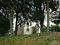
 Church of St Nicholas - war memorial - geograph.org.uk - 5222751.jpg 640 × 434; 36 KB
-
 Church of St Nicholas - windows - geograph.org.uk - 5222749.jpg 640 × 426; 46 KB
-
 Clare Cottage - geograph.org.uk - 5212877.jpg 640 × 426; 103 KB
-
 Coldred Rd - geograph.org.uk - 5212821.jpg 640 × 426; 71 KB
-
 Coldred Rd - geograph.org.uk - 5212827.jpg 640 × 426; 85 KB
-
 Coldred Rd - geograph.org.uk - 5212868.jpg 640 × 426; 96 KB
-
 Colliery headstock at Eythorne station - geograph.org.uk - 7165264.jpg 1,920 × 1,440; 1.29 MB
-
 Copse and pylon, west of Eythorne - geograph.org.uk - 3556653.jpg 1,024 × 768; 129 KB
-
 Crop Field at Elvington - geograph.org.uk - 1970211.jpg 1,024 × 768; 238 KB
-
 Crop of Legumes (Lupins^) - geograph.org.uk - 5224298.jpg 640 × 426; 59 KB
-
 Crops growing - geograph.org.uk - 5222697.jpg 640 × 426; 80 KB
-
 Crossroads on Wigmore Lane, Eythorne - geograph.org.uk - 1527020.jpg 640 × 480; 134 KB
-
 Cutting on East Kent Railway, 1992 - geograph.org.uk - 4847469.jpg 640 × 427; 192 KB
-
 Different crops - geograph.org.uk - 5222674.jpg 640 × 426; 98 KB
-
 Disused (but mapped) farm track level crossing - geograph.org.uk - 3556435.jpg 1,024 × 768; 150 KB
-
 Disused gate, disused level crossing - geograph.org.uk - 3556662.jpg 1,024 × 768; 186 KB
-
 Duplex capstan, Tilmanstone Colliery - geograph.org.uk - 5331279.jpg 640 × 423; 85 KB
-
 Early summer flowers, Eythorne - geograph.org.uk - 1532448.jpg 640 × 480; 142 KB
-
 East Kent Railway - Eythorne Station - geograph.org.uk - 2285625.jpg 2,272 × 1,704; 1.01 MB
-
 East Kent Railway - geograph.org.uk - 4024371.jpg 640 × 480; 166 KB
-
 East Kent Railway - geograph.org.uk - 5219770.jpg 640 × 426; 115 KB
-
 East Kent Railway - geograph.org.uk - 6476077.jpg 1,024 × 768; 491 KB
-
 East Kent Railway to Eythorne Station - geograph.org.uk - 2219691.jpg 3,072 × 2,304; 2.73 MB
-
 East Kent Railway, Eythorne - geograph.org.uk - 6476085.jpg 1,024 × 768; 493 KB
-
 East Kent Railway, Golgotha Tunnel - geograph.org.uk - 2614223.jpg 3,648 × 2,736; 1.17 MB
-
 East Kent Railway, Golgotha Tunnel - geograph.org.uk - 2614233.jpg 3,648 × 2,736; 2.73 MB
-
 East Kent Railway, Golgotha Tunnel - geograph.org.uk - 2614239.jpg 3,648 × 2,736; 2.19 MB
-
 East Kent Railway, Golgotha Tunnel - geograph.org.uk - 2620649.jpg 3,648 × 2,736; 2.53 MB
-
 East Kent Railway, Golgotha Tunnel - geograph.org.uk - 2620665.jpg 3,648 × 2,736; 1.3 MB
-
 Elvington - geograph.org.uk - 5222650.jpg 640 × 426; 82 KB
-
 Elvington across a crop of Legumes - geograph.org.uk - 5222653.jpg 640 × 426; 85 KB
-
 Elvington across a crop of Legumes - geograph.org.uk - 5222661.jpg 640 × 426; 81 KB
-
 Entering Barfrestone - geograph.org.uk - 5224278.jpg 640 × 426; 138 KB
-
 Entering Eythorne - geograph.org.uk - 5212832.jpg 640 × 426; 112 KB
-
 Entrance to Brimsdale Farm - geograph.org.uk - 3567567.jpg 946 × 709; 211 KB
-
 Eythorne - 2015 - geograph.org.uk - 4646760.jpg 3,648 × 2,736; 2.08 MB
-
 Eythorne - 2015 - geograph.org.uk - 4646763.jpg 3,648 × 2,736; 3.72 MB
-
 Eythorne - 2015 - geograph.org.uk - 4647520.jpg 3,648 × 2,736; 1.78 MB
-
 Eythorne - 2015 - geograph.org.uk - 4647521.jpg 3,648 × 2,736; 2.33 MB
-
 Eythorne - 2015 - geograph.org.uk - 4647522.jpg 3,648 × 2,736; 1.36 MB
-
 Eythorne - 2015 - geograph.org.uk - 4647523.jpg 3,648 × 2,736; 1.92 MB
-
 Eythorne - 2015 - geograph.org.uk - 4647525.jpg 3,648 × 2,736; 2.25 MB
-
 Eythorne - 2015 - geograph.org.uk - 4647528.jpg 3,648 × 2,736; 1.57 MB
-
 Eythorne - 2015 - geograph.org.uk - 4647529.jpg 3,648 × 2,736; 1.5 MB
-
 Eythorne - 2015 - geograph.org.uk - 4647535.jpg 3,648 × 2,736; 1.37 MB
-
 Eythorne - 2015 - geograph.org.uk - 4647540.jpg 3,648 × 2,736; 2.5 MB
-
 Eythorne - 2015 - geograph.org.uk - 4647541.jpg 3,648 × 2,736; 2.64 MB
-
 Eythorne - 2015 - geograph.org.uk - 4647542.jpg 3,648 × 2,736; 2.5 MB
-
 Eythorne - 2015 - geograph.org.uk - 4647543.jpg 3,648 × 2,736; 2.26 MB
-
 Eythorne - 2015 - geograph.org.uk - 4647544.jpg 3,648 × 2,736; 1.41 MB
-
 Eythorne House - geograph.org.uk - 5212871.jpg 640 × 426; 108 KB
-
 Eythorne village hall - geograph.org.uk - 1527804.jpg 640 × 480; 154 KB
-

-
 Eythorne Village Store - geograph.org.uk - 5212888.jpg 640 × 426; 69 KB
-
 Eythorne War Memorial - geograph.org.uk - 5212885.jpg 640 × 426; 78 KB
-
 Eythorne ^ Old Sleepers - geograph.org.uk - 3282930.jpg 3,264 × 2,520; 2.21 MB
-
 Eythorne, Chapel Hill - geograph.org.uk - 2616745.jpg 3,648 × 2,736; 1.74 MB
-
 Eythorne, Chapel Hill - geograph.org.uk - 2616754.jpg 3,648 × 2,736; 1.67 MB
-
 Eythorne, East Kent Railway - geograph.org.uk - 2614900.jpg 3,648 × 2,736; 2.58 MB
-
 Eythorne, East Kent Railway - geograph.org.uk - 2614903.jpg 3,648 × 2,736; 2.14 MB
-
 Eythorne, East Kent Railway - geograph.org.uk - 2614906.jpg 3,648 × 2,736; 1.55 MB
-
 Eythorne, East Kent Railway - geograph.org.uk - 2614911.jpg 3,648 × 2,736; 3.13 MB
-
 Eythorne, East Kent Railway - geograph.org.uk - 2614919.jpg 3,648 × 2,736; 2.68 MB
-
 Eythorne, East Kent Railway - geograph.org.uk - 2614926.jpg 3,648 × 2,736; 3.91 MB
-
 Eythorne, East Kent Railway - geograph.org.uk - 2620625.jpg 3,648 × 2,736; 4.08 MB
-
 Eythorne, Shooters Hill - geograph.org.uk - 2616788.jpg 3,648 × 2,736; 2.49 MB
-
 Eythorne, Shooters Hill - geograph.org.uk - 2616810.jpg 3,648 × 2,736; 3.29 MB
-
 Eythorne, Shooters Hill - geograph.org.uk - 2616851.jpg 3,648 × 2,736; 3.01 MB
-
 Eythorne, Shooters Hill - geograph.org.uk - 2616887.jpg 3,648 × 2,736; 3.06 MB
-
 Eythorne, Shooters Hill - geograph.org.uk - 2616921.jpg 3,648 × 2,736; 3.03 MB
-
 Eythorne, Shooters Hill - geograph.org.uk - 2620276.jpg 3,648 × 2,736; 3.49 MB
-
 Eythorne, Shooters Hill, East Kent Railway - geograph.org.uk - 2615121.jpg 3,648 × 2,736; 2.3 MB
-
 Eythorne, Shooters Hill, East Kent Railway - geograph.org.uk - 2615155.jpg 3,648 × 2,736; 3.6 MB
-
 Farm track to Barville Road - geograph.org.uk - 2428208.jpg 3,072 × 2,304; 2.6 MB
-
 Farmland and hedges - geograph.org.uk - 5224311.jpg 640 × 426; 57 KB
-
 Farmland east of Eythorne Court - geograph.org.uk - 3556447.jpg 1,024 × 768; 136 KB
-
 Farmland west of Eythorne Court - geograph.org.uk - 3556445.jpg 1,024 × 768; 137 KB
-
 Farmland west of Lower Eythorne - geograph.org.uk - 3556431.jpg 1,024 × 768; 156 KB
-
 Farmland, woodland boundary - geograph.org.uk - 5224287.jpg 640 × 426; 62 KB
-
 Field behind Eythorne village hall - geograph.org.uk - 1527802.jpg 640 × 480; 139 KB
-
 Field beside Monkton Court Lane - geograph.org.uk - 4368458.jpg 3,264 × 2,448; 3.77 MB
-
 Field off Barville Road - geograph.org.uk - 1970189.jpg 1,024 × 768; 199 KB
-
 Flax Court Lane - geograph.org.uk - 2219729.jpg 3,072 × 2,304; 2.67 MB
-
 Flax Court Lane - geograph.org.uk - 5212881.jpg 640 × 426; 89 KB
-
 Footpath and bridleway junction near Eythorne - geograph.org.uk - 2428246.jpg 3,072 × 2,304; 2.9 MB
-
 Footpath junction near Craythorne Firs - geograph.org.uk - 2428200.jpg 3,072 × 2,304; 2.51 MB
-
 Footpath junction on Burgess Hill - geograph.org.uk - 2219869.jpg 3,072 × 2,304; 3.06 MB
-
 Footpath near Brimsdale Barn - geograph.org.uk - 2219703.jpg 3,072 × 2,304; 2.15 MB
-
 Footpath off Barfrestone Rd - geograph.org.uk - 5222706.jpg 640 × 426; 129 KB
-
 Footpath off Coldred Rd - geograph.org.uk - 5212825.jpg 640 × 426; 67 KB
-
 Footpath off Sandwich Lane - geograph.org.uk - 5224304.jpg 640 × 426; 63 KB
-
 Footpath off Sandwich Lane - geograph.org.uk - 5224305.jpg 640 × 426; 58 KB
-
 Footpath on Long Lane - geograph.org.uk - 2219653.jpg 3,072 × 2,304; 2.42 MB
-
 Footpath through a field of winter wheat - geograph.org.uk - 3568689.jpg 816 × 612; 135 KB
-
 Footpath to Barfrestone - geograph.org.uk - 2219527.jpg 3,072 × 2,304; 2.25 MB
-
 Footpath to Barville Road - geograph.org.uk - 2428235.jpg 3,072 × 2,304; 2.32 MB
-
 Footpath to Elvington - geograph.org.uk - 2219925.jpg 3,072 × 2,304; 2.21 MB
-
 Footpath to Eythorne - geograph.org.uk - 2219685.jpg 3,072 × 2,304; 2.03 MB
-
 Footpath to Eythorne - geograph.org.uk - 2428212.jpg 3,072 × 2,304; 2.58 MB
-
 Footpath to Eythorne - geograph.org.uk - 2428225.jpg 3,072 × 2,304; 2.31 MB
-
 Footpath to Pie Factory Road - geograph.org.uk - 2219537.jpg 3,072 × 2,304; 1.97 MB
-
 Footpath to Pike Road - geograph.org.uk - 2219878.jpg 3,072 × 2,304; 3.6 MB
-
 Footpath towards Barfrestone - geograph.org.uk - 2141840.jpg 3,072 × 2,304; 1.75 MB
-
 Footpath towards Eythorne - geograph.org.uk - 2219674.jpg 3,072 × 2,304; 2.03 MB
-
 Footpath towards Long Lane - geograph.org.uk - 2219681.jpg 3,072 × 2,304; 2.04 MB
-
 Former access route - geograph.org.uk - 4384376.jpg 946 × 709; 303 KB
-
 Former access route - geograph.org.uk - 4384383.jpg 913 × 684; 306 KB

.jpg)


_1_-_geograph.org.uk_-_6942872.jpg)
_4_-_geograph.org.uk_-_6942880.jpg)
_7_-_geograph.org.uk_-_6942892.jpg)

_-_geograph.org.uk_-_6942849.jpg)


_1_-_geograph.org.uk_-_6942896.jpg)
_6_-_geograph.org.uk_-_6942826.jpg)


_-_geograph.org.uk_-_2219844.jpg)
_-_geograph.org.uk_-_2219853.jpg)


_-_geograph.org.uk_-_2219615.jpg)
_-_geograph.org.uk_-_2219632.jpg)


_-_geograph.org.uk_-_5224298.jpg)


_farm_track_level_crossing_-_geograph.org.uk_-_3556435.jpg)


