Category:Extra-Ptolemaic maps of the Atlantic Ocean
Jump to navigation
Jump to search
Media in category "Extra-Ptolemaic maps of the Atlantic Ocean"
The following 13 files are in this category, out of 13 total.
-
1513 Admiral's Map by Martin Waldseemüller.jpg 12,573 × 10,605; 19.61 MB
-
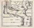
1513 Tabula Terre Nove.jpg 11,791 × 9,953; 19.19 MB
-
Fries-Waldseemuller Tabula Terra Nova 1513 (1541) UTA.jpg 3,145 × 2,173; 1.26 MB
-
Tabula Terre Nove (NYPL Hades-118522-54646).tif 5,086 × 4,201; 61.14 MB
-
Tabula Terre Nove by Martin Waldseemüller.jpg 7,242 × 5,274; 6.98 MB
-
Tabula Terre Nove.jpg 2,000 × 1,743; 2.2 MB
-
Oceani occidetalis Seu Terre Noue Tabula Christophorus Columbus natione Italus, patria Genuensis.jpg 10,856 × 8,274; 17.65 MB
-
1535 Admiralty's map by Lorenz Fries.jpg 12,045 × 8,224; 18.32 MB
-
Oceanus occidentalis - (Ptolémée) - btv1b8595839z.jpg 8,028 × 5,761; 7.53 MB
-
Oceanus occidentalis - (Ptolémée) - btv1b8595840m (1 of 2).jpg 7,954 × 5,847; 7.48 MB


