Category:Euxton
Jump to navigation
Jump to search
English: Euxton is a village and civil parish of the Borough of Chorley, in Lancashire, England. The village is pronounced "Exton") and is situated just to the south of Leyland, and to the west of Chorley. (→Euxton)
Nederlands: Euxton is een plaats en civil parish in het bestuurlijke gebied Chorley, in het Engelse graafschap Lancashire met 8.318 inwoners. (→Euxton)
Polski: Euxton – wieś w Anglii, w hrabstwie Lancashire, w dystrykcie Chorley. Leży 37 km na północny zachód od miasta Manchester i 295 km na północny zachód od Londynu. W 2001 miejscowość liczyła 8318 mieszkańców. (→Euxton)
village and civil parish of the Borough of Chorley, in Lancashire, England  | |||||
| Upload media | |||||
| Instance of | |||||
|---|---|---|---|---|---|
| Location | Chorley, Lancashire, North West England, England | ||||
| Population |
| ||||
| Said to be the same as | Euxton (Wikimedia duplicated page, civil parish) | ||||
 | |||||
Subcategories
This category has the following 4 subcategories, out of 4 total.
Media in category "Euxton"
The following 200 files are in this category, out of 285 total.
(previous page) (next page)-
 "Polite Notice" - geograph.org.uk - 631529.jpg 640 × 480; 189 KB
-
 30 mile per hour speed limit on Runshaw Lane - geograph.org.uk - 2067534.jpg 1,898 × 1,394; 688 KB
-
 A bend on the A581 - geograph.org.uk - 3089382.jpg 4,592 × 3,056; 6.43 MB
-
 A gated private road off Dawber's Lane - geograph.org.uk - 3089390.jpg 4,584 × 3,050; 7.97 MB
-
 A new development of Barratt homes - geograph.org.uk - 3293157.jpg 4,592 × 2,500; 5.01 MB
-
 A roundabout - the turn for Astley Village - geograph.org.uk - 3293127.jpg 4,592 × 3,056; 5.33 MB
-
 A49 Wigan Road-School Lane junction - geograph.org.uk - 3502563.jpg 640 × 480; 98 KB
-

-

-
 Altcar Lane - geograph.org.uk - 2280635.jpg 640 × 480; 89 KB
-
 Altcar Lane - geograph.org.uk - 2280637.jpg 640 × 480; 151 KB
-
 An entrance into Runshaw College - geograph.org.uk - 2006311.jpg 2,705 × 1,975; 1.07 MB
-
 Apple Tree - geograph.org.uk - 35053.jpg 640 × 480; 94 KB
-
 Approaching a bend on Runshaw Lane - geograph.org.uk - 2018555.jpg 2,026 × 1,505; 715 KB
-
 Approaching a roundabout on Euxton Lane - geograph.org.uk - 2006318.jpg 1,846 × 1,352; 703 KB
-
 B5252 Balshaw Lane - geograph.org.uk - 4685909.jpg 640 × 480; 74 KB
-
 B5252 Euxton Lane - geograph.org.uk - 4685894.jpg 640 × 481; 58 KB
-
 B5252 heading into Chorley - geograph.org.uk - 2006333.jpg 2,148 × 1,500; 832 KB
-
 B5252 West Way - geograph.org.uk - 4685901.jpg 640 × 480; 60 KB
-
 Baling - geograph.org.uk - 3076966.jpg 4,592 × 3,056; 5.84 MB
-
 Baling - geograph.org.uk - 3085673.jpg 4,387 × 1,895; 4.69 MB
-
 Balshaw House Farm.jpg 4,032 × 2,268; 3.06 MB
-
 Balshaw Lane (A581) - geograph.org.uk - 4201560.jpg 640 × 480; 63 KB
-
 Balshaw Lane (A581) - geograph.org.uk - 4201562.jpg 640 × 480; 80 KB
-
 Balshaw Lane (A581) - geograph.org.uk - 4201570.jpg 640 × 480; 79 KB
-
 Balshaw Lane - geograph.org.uk - 1536046.jpg 640 × 429; 60 KB
-
 Barn and Farmhouse beside the A581 - geograph.org.uk - 118537.jpg 640 × 426; 88 KB
-
 Bolton Green Hall - geograph.org.uk - 118540.jpg 640 × 426; 163 KB
-
 Briar Avenue, Euxton - geograph.org.uk - 2664595.jpg 640 × 480; 80 KB
-
 Bridge over River Yarrow at Pincocck - geograph.org.uk - 4259359.jpg 640 × 482; 356 KB
-
 Bridge over Shaw Brook on A49 - geograph.org.uk - 2067587.jpg 2,213 × 1,734; 923 KB
-
 Bridge over the M6 - geograph.org.uk - 2664696.jpg 640 × 480; 88 KB
-
 Bridge over the M6 - geograph.org.uk - 2781997.jpg 3,585 × 2,124; 2.64 MB
-
 Bridge over the M6 - geograph.org.uk - 2782913.jpg 2,318 × 2,178; 1.84 MB
-
 Bridge over the M6 on Runshaw Lane - geograph.org.uk - 2018550.jpg 2,461 × 1,779; 780 KB
-
 Buckshaw Lane - geograph.org.uk - 4025079.jpg 640 × 480; 252 KB
-
 Buckshaw Parkway - geograph.org.uk - 4025067.jpg 640 × 480; 309 KB
-
 Buckshaw Parkway - geograph.org.uk - 5751694.jpg 1,280 × 883; 883 KB
-
 Buckshaw Parkway Station - geograph.org.uk - 4025100.jpg 640 × 480; 230 KB
-
 Buckshaw Parkway Station - geograph.org.uk - 5323538.jpg 1,600 × 1,161; 308 KB
-
 Buckshaw Tesco - geograph.org.uk - 4025090.jpg 640 × 480; 291 KB
-
 Buckshaw Village, Central Avenue - geograph.org.uk - 4025050.jpg 640 × 480; 262 KB
-
 Buildings at Buckshaw Hall - geograph.org.uk - 1097103.jpg 640 × 480; 64 KB
-
 Bus Stop on Balshaw Lane (A581) - geograph.org.uk - 4024822.jpg 640 × 480; 349 KB
-
 Bus stop on Wigan Road, Euxton - geograph.org.uk - 2064750.jpg 2,020 × 1,496; 720 KB
-

-
 Chancery Road leading to Astley Village - geograph.org.uk - 2006347.jpg 2,785 × 2,014; 1.66 MB
-
 Children's play area at the Travellers Rest - geograph.org.uk - 3089369.jpg 4,503 × 2,837; 7.59 MB
-
 Class 90 90018 DB Schenker JP Euxton 14 Oct 16.jpg 1,500 × 1,097; 1.41 MB
-
 College car park, Euxton - geograph.org.uk - 3381838.jpg 1,024 × 595; 119 KB
-
 Cottages - Old Shaw Green - geograph.org.uk - 3726051.jpg 3,024 × 1,754; 1.17 MB
-
 Crossroads in Euxton - geograph.org.uk - 2006230.jpg 2,026 × 1,505; 764 KB
-
 Dawber's Lane - Euxton - geograph.org.uk - 1950452.jpg 4,224 × 2,816; 5.61 MB
-
 Dawber's Lane Bridge, M6 - geograph.org.uk - 4510629.jpg 640 × 358; 29 KB
-
 Derelict riverside cottage at Pincock - geograph.org.uk - 1156578.jpg 640 × 479; 136 KB
-
 Double Railway bridge on German lane - geograph.org.uk - 1156557.jpg 640 × 479; 112 KB
-
 Elephant Bar Restaurant - geograph.org.uk - 4201599.jpg 640 × 480; 65 KB
-
 End of the speed limit, Runshaw Lane - geograph.org.uk - 2018546.jpg 2,399 × 1,692; 768 KB
-
 End of the speed limit, Runshaw Lane - geograph.org.uk - 2036475.jpg 1,981 × 1,443; 543 KB
-
 Entrance to Euxton Villa football ground - geograph.org.uk - 2067519.jpg 1,693 × 1,308; 702 KB
-

-
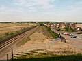
 Euxton , M6 Motorway - geograph.org.uk - 6300386.jpg 6,000 × 4,000; 5.06 MB
-
 Euxton , M6 Motorway - geograph.org.uk - 6300387.jpg 6,000 × 4,000; 5.76 MB
-
 Euxton , M6 Motorway - geograph.org.uk - 6300393.jpg 6,000 × 4,000; 5.03 MB
-
 Euxton - geograph.org.uk - 1536068.jpg 640 × 419; 46 KB
-

-
 Euxton Balshaw Lane Railway Station - geograph.org.uk - 4403605.jpg 1,024 × 770; 366 KB
-
 Euxton Balshaw Lane railway station, Lancashire - geograph.org.uk - 4247689.jpg 1,024 × 768; 218 KB
-
 Euxton Community Centre - geograph.org.uk - 4201572.jpg 640 × 480; 76 KB
-
 Euxton Community Centre, Wigan Road - geograph.org.uk - 4249908.jpg 640 × 480; 254 KB
-
 Euxton Crematorium - geograph.org.uk - 1536130.jpg 640 × 395; 62 KB
-
 Euxton Crematorium - geograph.org.uk - 1536133.jpg 640 × 389; 54 KB
-
 Euxton Cricket Club - Pavilion - geograph.org.uk - 2423786.jpg 1,600 × 1,200; 210 KB
-
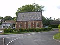
 Euxton Hall - geograph.org.uk - 1399049.jpg 640 × 480; 74 KB
-
 Euxton Hall, Building - geograph.org.uk - 1399050.jpg 640 × 480; 67 KB
-
 Euxton Lane - geograph.org.uk - 2009253.jpg 2,616 × 1,879; 991 KB
-
 Euxton Lane Bridge - geograph.org.uk - 1536085.jpg 640 × 451; 66 KB
-
 Euxton Lane, passing Runshaw College - geograph.org.uk - 2009260.jpg 2,048 × 1,536; 599 KB
-
 Euxton Library - geograph.org.uk - 4201578.jpg 640 × 480; 95 KB
-
 Euxton Methodist Church, Daisy Hill - geograph.org.uk - 4259712.jpg 640 × 427; 275 KB
-
 Euxton Mills - geograph.org.uk - 1536029.jpg 640 × 425; 63 KB
-
 Euxton Mills - geograph.org.uk - 1536036.jpg 640 × 402; 64 KB
-
 Euxton Mills - geograph.org.uk - 4259304.jpg 640 × 480; 289 KB
-
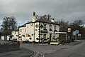
 Euxton Mills public house - geograph.org.uk - 2061032.jpg 2,521 × 1,915; 723 KB
-
 Euxton Railway Station (Looking North) - geograph.org.uk - 4248605.jpg 640 × 481; 331 KB
-
 Euxton War Memorial and Roll of Honour - geograph.org.uk - 5864403.jpg 600 × 800; 634 KB
-
 Euxton, Entrance to Ransnap Woods - geograph.org.uk - 4249894.jpg 640 × 480; 441 KB
-
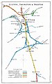 Euxton, Farington & Preston RJD 62.jpg 1,668 × 2,664; 585 KB
-
 Euxton, near Chorley, Lancashire - geograph.org.uk - 3769761.jpg 4,000 × 3,000; 3.57 MB
-
 Euxton-rof.jpg 640 × 480; 153 KB
-
 Farmhouse ^ Barn - geograph.org.uk - 1950460.jpg 4,224 × 2,816; 4.98 MB
-
 Fir Tree Farm, Dawber's lane - geograph.org.uk - 4259720.jpg 640 × 480; 284 KB
-
 Fire hydrant - geograph.org.uk - 483819.jpg 480 × 640; 172 KB
-
 Flag Lane End Farm - geograph.org.uk - 3726012.jpg 4,234 × 2,667; 1.45 MB
-
 Flag Lane End farm, Runshaw Lane - geograph.org.uk - 2036477.jpg 1,748 × 1,243; 593 KB
-
 Footbridge over Hollin's Brook - geograph.org.uk - 2954401.jpg 4,000 × 3,000; 7 MB
-
 Footbridge over stream near Chapel Brook, Euxton - geograph.org.uk - 4403175.jpg 1,024 × 821; 623 KB
-
 Footbridge over the M6 - geograph.org.uk - 4510632.jpg 640 × 426; 44 KB
-
 Footbridge, M6 - geograph.org.uk - 4510634.jpg 640 × 387; 33 KB
-
 Footpath and stile - geograph.org.uk - 3077051.jpg 4,261 × 2,984; 7.64 MB
-

-
 Gable Mews - Buckshaw Village - geograph.org.uk - 5561345.jpg 2,591 × 1,661; 1.39 MB
-
 Garden Centre - geograph.org.uk - 279612.jpg 640 × 480; 77 KB
-
 German Brook at Pear Tree Lane, Euxton - geograph.org.uk - 4403088.jpg 1,024 × 768; 508 KB
-
 German Brook near Pear Tree Lane, Euxton - geograph.org.uk - 4403112.jpg 768 × 1,024; 596 KB
-
 Graffiti on the railway - geograph.org.uk - 5460390.jpg 1,280 × 960; 1.26 MB
-
 Grazing off Balshaw Lane (A581) - geograph.org.uk - 4201559.jpg 640 × 480; 75 KB
-
 Grazing off Runshaw Lane - geograph.org.uk - 4201581.jpg 640 × 480; 68 KB
-
 Grazing off Runshaw Lane - geograph.org.uk - 4201594.jpg 640 × 480; 81 KB
-
 Grazing, Runshaw Moor - geograph.org.uk - 4201590.jpg 640 × 480; 60 KB
-
 Harvest time, a tractor baling - geograph.org.uk - 3078386.jpg 4,592 × 3,056; 5.97 MB
-
 Heading for the Mountains - geograph.org.uk - 3310455.jpg 1,024 × 683; 698 KB
-
 House at Shaw Green - geograph.org.uk - 2954376.jpg 4,000 × 3,000; 5.61 MB
-
 House by Pincock Bridge - geograph.org.uk - 1536117.jpg 429 × 640; 118 KB
-

-
 Houses off Mile Stone Meadow - geograph.org.uk - 3381840.jpg 640 × 499; 99 KB
-
 Houses on Euxton Lane (B5252) - geograph.org.uk - 4022935.jpg 640 × 480; 287 KB
-
 Investment House - geograph.org.uk - 404072.jpg 630 × 464; 77 KB
-
 Italian Restaurant, Euxton - geograph.org.uk - 4201573.jpg 640 × 480; 53 KB
-
 Junction of Euxton Lane and the A49 - geograph.org.uk - 2009284.jpg 2,048 × 1,536; 743 KB
-
 Junction of Runshaw Lane and Flag Lane - geograph.org.uk - 2036480.jpg 2,048 × 1,536; 854 KB
-
 Junction of Runshaw Lane and Runshaw Hall Lane - geograph.org.uk - 2018561.jpg 2,636 × 1,889; 1.09 MB
-
 Junction of Runshaw Lane and Wigan Road (A49) - geograph.org.uk - 2067559.jpg 2,468 × 1,861; 1,024 KB
-
 Junction of Wigan Road and Euxton Hall Gardens - geograph.org.uk - 2064685.jpg 2,693 × 1,986; 1.32 MB
-
 Kart track, Euxton - geograph.org.uk - 3381836.jpg 1,024 × 582; 119 KB
-
 Leaving the 30 limit, Euxton Lane - geograph.org.uk - 2006259.jpg 2,455 × 1,678; 974 KB
-
 LEPCO Danger High Pressure Cable - geograph.org.uk - 4403565.jpg 768 × 1,024; 524 KB
-
 Lest We Forget, Euxton War Memorial - geograph.org.uk - 5864409.jpg 800 × 600; 617 KB
-
 M6 - geograph.org.uk - 631525.jpg 640 × 480; 237 KB
-
 M6 looking north - geograph.org.uk - 2664702.jpg 640 × 480; 57 KB
-
 M6 Motorway near Euxton - geograph.org.uk - 5148732.jpg 640 × 480; 430 KB
-
 M6 near Euxton - geograph.org.uk - 4259719.jpg 640 × 480; 281 KB
-
 M6 north passes under the A581 - geograph.org.uk - 2717117.jpg 640 × 481; 37 KB
-
 M6 north, west of Euxton - geograph.org.uk - 2717126.jpg 640 × 480; 35 KB
-
 M6 northbound - geograph.org.uk - 2717139.jpg 640 × 480; 38 KB
-
 M6 South West of Euxton - geograph.org.uk - 4457889.jpg 640 × 480; 256 KB
-
 M6 Southbound - geograph.org.uk - 4259716.jpg 640 × 480; 262 KB
-
 M6 southbound near Euxton - geograph.org.uk - 2655254.jpg 640 × 481; 43 KB
-
 M6 southbound near Euxton - geograph.org.uk - 4201584.jpg 640 × 480; 55 KB
-
 M6 Southbound, Dawber's Lane Bridge - geograph.org.uk - 4457894.jpg 640 × 480; 255 KB
-
 Memorial Garden - geograph.org.uk - 1536143.jpg 640 × 429; 105 KB
-
 Memorial Garden - geograph.org.uk - 1536147.jpg 640 × 428; 75 KB
-
 Memorial Garden Pond - geograph.org.uk - 1536139.jpg 640 × 434; 92 KB
-
 Metropolitan Borough of Chorley , The M6 Motorway - geograph.org.uk - 4935373.jpg 6,000 × 4,000; 6.91 MB
-
 Metropolitan Borough of Chorley , The M6 Motorway - geograph.org.uk - 4935376.jpg 6,000 × 4,000; 7.02 MB
-
 Metropolitan Borough of Chorley , The M6 Motorway - geograph.org.uk - 4935377.jpg 6,000 × 4,000; 7.02 MB
-
 Millennium Green, Euxton - geograph.org.uk - 4403580.jpg 1,024 × 768; 413 KB
-

-

-
 Mini-roundabout by the Euxton Mills public house - geograph.org.uk - 2064675.jpg 2,467 × 1,767; 1.14 MB
-
 New homes at Whittle-le-Park - geograph.org.uk - 3293177.jpg 4,430 × 2,948; 7.35 MB
-
 New Housing at Buckshaw Village - geograph.org.uk - 4025072.jpg 640 × 480; 338 KB
-
 New housing development site, Buckshaw Village - geograph.org.uk - 5434993.jpg 1,600 × 924; 253 KB
-
 New Housing Development, Ordnance Road - geograph.org.uk - 4025086.jpg 640 × 484; 265 KB
-

-
 New industrial units in Buckshaw Village - geograph.org.uk - 809911.jpg 640 × 480; 162 KB
-
 Office Block - geograph.org.uk - 415480.jpg 640 × 480; 101 KB
-
 Offices to let at Buckshaw - geograph.org.uk - 3725996.jpg 2,821 × 1,914; 1,013 KB
-

-
 Pack Saddle Bridge on A49 - geograph.org.uk - 2067580.jpg 1,868 × 1,355; 748 KB
-
 Pack Saddle Bridge on the A49 - geograph.org.uk - 2006206.jpg 2,906 × 2,146; 1.44 MB
-
 Papa Luigi's - geograph.org.uk - 4249906.jpg 640 × 480; 245 KB
-
 Passing Tesco's - geograph.org.uk - 2009245.jpg 2,547 × 1,857; 1.12 MB
-
 Passing the Railway Inn on the A49 - geograph.org.uk - 2006210.jpg 2,711 × 2,009; 1.11 MB
-

-
 Path in Ransnap Woods, Euxton - geograph.org.uk - 4249903.jpg 640 × 480; 458 KB
-
 Pear Tree Farm, Euxton - geograph.org.uk - 4403125.jpg 1,024 × 821; 460 KB
-
 Pedestrian crossing on Euxton Lane - geograph.org.uk - 2009265.jpg 2,736 × 2,009; 823 KB
-
 Pincock Bridge - geograph.org.uk - 3076909.jpg 2,909 × 2,417; 6.13 MB
-
 Pincock Bridge Euxton - geograph.org.uk - 1536113.jpg 640 × 412; 76 KB
-
 Pincock Bridge over the River Yarrow - geograph.org.uk - 2038565.jpg 2,020 × 1,496; 864 KB
-
 Pincock Brow - geograph.org.uk - 1536103.jpg 640 × 428; 81 KB
-

-
 Plough Inn, Runshaw Lane - geograph.org.uk - 2036513.jpg 2,048 × 1,536; 646 KB
-
 Polish HGV Parked near Buckshaw Parkway - geograph.org.uk - 4025127.jpg 640 × 481; 277 KB
-
 Pond by Runshaw Lane - geograph.org.uk - 2954414.jpg 4,000 × 3,000; 6.61 MB
-
 Pond in a meadow - geograph.org.uk - 2954395.jpg 1,024 × 768; 1,001 KB
-
 Pond off Runshaw Hall Lane - geograph.org.uk - 4201585.jpg 640 × 480; 152 KB
-
 Post Office and stores, Euxton - geograph.org.uk - 4201566.jpg 640 × 480; 56 KB
-
 Post Office and stores, Euxton - geograph.org.uk - 4201580.jpg 640 × 480; 68 KB
-
 Railway bridge on Euxton Lane - geograph.org.uk - 2009279.jpg 1,052 × 729; 288 KB
-

-

-
 River Yarrow - geograph.org.uk - 1536124.jpg 429 × 640; 114 KB
-
 River Yarrow at Pincock - geograph.org.uk - 4259360.jpg 640 × 480; 369 KB
-
 River Yarrow, Euxton - geograph.org.uk - 4259305.jpg 640 × 481; 360 KB
-
 Roman Catholic Church of St Mary, Euxton - geograph.org.uk - 4249832.jpg 640 × 480; 331 KB
-
 Roundabout on Euxton Lane - geograph.org.uk - 3725993.jpg 3,514 × 2,112; 1.06 MB
-
 Roundabout on Euxton Lane - geograph.org.uk - 4022944.jpg 640 × 480; 325 KB
-
 Roundabout on the B5252 - geograph.org.uk - 2006327.jpg 2,283 × 1,616; 752 KB
-
 Row of Shops at Euxton - geograph.org.uk - 3726002.jpg 3,607 × 2,128; 1.87 MB
-
 Runshaw College - geograph.org.uk - 3293202.jpg 3,944 × 2,497; 5.45 MB
-
 Runshaw College - geograph.org.uk - 4025058.jpg 640 × 482; 261 KB
-
 Runshaw Hall (geograph 3308701).jpg 640 × 427; 68 KB
-
 Runshaw Hall Lane - geograph.org.uk - 2018570.jpg 2,022 × 1,536; 895 KB
-
 Runshaw Hall Lane - geograph.org.uk - 4201586.jpg 640 × 480; 106 KB
-
 Runshaw Lane - geograph.org.uk - 4201582.jpg 640 × 480; 77 KB
-
 Runshaw Lane - geograph.org.uk - 4201592.jpg 640 × 480; 71 KB
-
 Runshaw Lane - geograph.org.uk - 4201596.jpg 640 × 480; 71 KB
-
 Runshaw Lane - geograph.org.uk - 4259865.jpg 640 × 480; 323 KB


_-_geograph.org.uk_-_4201560.jpg)
_-_geograph.org.uk_-_4201562.jpg)
_-_geograph.org.uk_-_4201570.jpg)


_-_geograph.org.uk_-_4024822.jpg)


_-_geograph.org.uk_-_4024826.jpg)


_-_geograph.org.uk_-_4248604.jpg)


_-_geograph.org.uk_-_4248605.jpg)


_-_geograph.org.uk_-_4201559.jpg)


_-_geograph.org.uk_-_4022935.jpg)


_-_geograph.org.uk_-_2067559.jpg)


.jpg)


