Category:Esha Ness
Jump to navigation
Jump to search
peninsula in Northmavine, North Mainland, Shetland Islands, Scotland, UK  | |||||
| Upload media | |||||
| Instance of | |||||
|---|---|---|---|---|---|
| Location | Shetland Islands, Scotland | ||||
| Located in or next to body of water |
| ||||
 | |||||
Subcategories
This category has the following 5 subcategories, out of 5 total.
C
- Calder's Geo (29 F)
D
- Drid Geo (14 F)
L
- Esha Ness Lighthouse (39 F)
- Loch of Houlland (9 F)
- Lochs of Dridgeo (9 F)
Media in category "Esha Ness"
The following 111 files are in this category, out of 111 total.
-
 A rough wet morning at Esha Ness - geograph.org.uk - 972865.jpg 640 × 480; 33 KB
-
 B9078, Esha Ness - geograph.org.uk - 3832925.jpg 640 × 360; 204 KB
-
 Beach at Hamnavoe, Eshaness - geograph.org.uk - 3887387.jpg 1,024 × 682; 147 KB
-
 Bikers at Eshaness - geograph.org.uk - 3010332.jpg 800 × 533; 234 KB
-
 Boulders, Esha Ness - geograph.org.uk - 3828733.jpg 640 × 480; 259 KB
-
 Cliff at Eshaness - geograph.org.uk - 3010328.jpg 800 × 533; 197 KB
-
 Cliffs at Eshaness - geograph.org.uk - 3010325.jpg 800 × 533; 175 KB
-
 Cliffs, Eshaness - geograph.org.uk - 4658438.jpg 2,560 × 1,920; 973 KB
-
 Clifftop, Esha Ness - geograph.org.uk - 3480260.jpg 640 × 480; 36 KB
-
 Coast, Esha Ness - geograph.org.uk - 3832920.jpg 640 × 360; 232 KB
-
 Coastal scenery, Esha Ness - geograph.org.uk - 3829493.jpg 640 × 480; 245 KB
-
 Coastline at Eshaness - geograph.org.uk - 2030794.jpg 2,560 × 1,920; 1.79 MB
-
 Coastline at Eshaness - geograph.org.uk - 3010379.jpg 800 × 533; 141 KB
-
 Coastline at Eshaness - geograph.org.uk - 3929947.jpg 1,400 × 1,050; 522 KB
-

-
 Common Cranes (Grus grus), Eshaness - geograph.org.uk - 2293683.jpg 800 × 541; 65 KB
-
 Crags, Esha Ness - geograph.org.uk - 3558282.jpg 640 × 360; 239 KB
-
 Cratch, Esha Ness - geograph.org.uk - 3558295.jpg 640 × 360; 232 KB
-
 Cross Kirk, Esha Ness - geograph.org.uk - 2030768.jpg 2,560 × 1,920; 1.94 MB
-

-
 Entering Eshaness - geograph.org.uk - 534815.jpg 640 × 480; 66 KB
-
 Esha Ness - cliff top at Calder's Geo - geograph.org.uk - 972881.jpg 640 × 480; 79 KB
-
 Esha Ness - geograph.org.uk - 1192399.jpg 601 × 640; 118 KB
-
 Esha Ness - geograph.org.uk - 1307879.jpg 640 × 481; 125 KB
-
 Esha Ness - geograph.org.uk - 2575288.jpg 1,024 × 768; 150 KB
-
 Esha Ness - geograph.org.uk - 3586409.jpg 640 × 477; 306 KB
-
 Esha Ness - geograph.org.uk - 95329.jpg 431 × 640; 71 KB
-

-
 Esha Ness - Shetland.jpg 2,048 × 1,536; 448 KB
-
 Esha Ness 01.jpg 3,977 × 2,970; 4.14 MB
-
 Esha Ness 02.jpg 4,007 × 2,953; 4.83 MB
-
 Esha Ness 05.jpg 3,833 × 2,691; 3.38 MB
-
 Esha Ness 06.jpg 4,080 × 3,072; 3.87 MB
-
 Esha Ness 07.jpg 3,986 × 2,966; 4.38 MB
-
 Esha Ness 09.jpg 4,003 × 2,712; 2.96 MB
-
 Esha Ness as the storm approaches - geograph.org.uk - 1524855.jpg 640 × 427; 102 KB
-
 Esha Ness Cliffs at Calder's Geo - geograph.org.uk - 5924195.jpg 800 × 600; 708 KB
-
 Esha Ness cliffs at Calders Geo - geograph.org.uk - 6029872.jpg 1,600 × 1,045; 493 KB
-
 Esha Ness Coastline - geograph.org.uk - 5924136.jpg 800 × 600; 649 KB
-
 Esha Ness Field - geograph.org.uk - 3545550.jpg 2,560 × 1,920; 3 MB
-
 Esha Ness grazings - geograph.org.uk - 3557661.jpg 640 × 480; 296 KB
-
 Esha Ness Spectacular - geograph.org.uk - 2032053.jpg 2,560 × 1,920; 1.95 MB
-
 Esha Ness triangulation pillar - geograph.org.uk - 3829562.jpg 640 × 360; 252 KB
-
 Eshaness Cliffs (7159719829).jpg 4,016 × 3,016; 5.55 MB
-
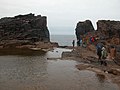
 Eshaness Coast - geograph.org.uk - 5274903.jpg 1,280 × 851; 243 KB
-
 Eshaness Coast - geograph.org.uk - 5274915.jpg 1,280 × 851; 269 KB
-
 Eshaness IMG 4465 (21900285448).jpg 4,264 × 2,361; 4.11 MB
-
 Eshaness IMG 4468 (21465325134).jpg 4,248 × 2,520; 5.04 MB
-
 Eshaness, a long, thin geo - geograph.org.uk - 3723746.jpg 480 × 640; 84 KB
-

-
 Eshaness, along the Holes of Scraada - geograph.org.uk - 3723800.jpg 480 × 640; 94 KB
-

-
 Eshaness, Braewick Loch - geograph.org.uk - 2742169.jpg 640 × 480; 43 KB
-
 Eshaness, caves in the cliffs - geograph.org.uk - 3723743.jpg 640 × 480; 61 KB
-

-
 Eshaness, cliffs and rocks - geograph.org.uk - 2741850.jpg 640 × 480; 62 KB
-
 Eshaness, crossing a wall - geograph.org.uk - 3723761.jpg 640 × 480; 57 KB
-
 Eshaness, distant view of the Ossas - geograph.org.uk - 2741866.jpg 640 × 480; 31 KB
-
 Eshaness, Dore Holm - geograph.org.uk - 2741841.jpg 640 × 480; 50 KB
-
 Eshaness, Isle of Stenness - geograph.org.uk - 2741863.jpg 640 × 480; 54 KB
-
 Eshaness, monument and Dore Holm - geograph.org.uk - 2741826.jpg 640 × 480; 62 KB
-

-
 Eshaness, postbox № ZE2 91 - geograph.org.uk - 2742163.jpg 640 × 480; 95 KB
-
 Eshaness, remains of Cross Kirk - geograph.org.uk - 2741959.jpg 640 × 480; 54 KB
-

-
 Eshaness, Stenness beach and bay - geograph.org.uk - 2741846.jpg 640 × 480; 63 KB
-
-
 Eshaness, the Holes of Scraada - geograph.org.uk - 3723794.jpg 480 × 640; 89 KB
-
 Eshaness, the last road junction - geograph.org.uk - 2741860.jpg 640 × 480; 49 KB
-
 Eshaness, the post office - geograph.org.uk - 2719174.jpg 640 × 480; 48 KB
-
 Eshaness, the telephone box - geograph.org.uk - 3726976.jpg 640 × 480; 67 KB
-
 Eshaness, the trig point - geograph.org.uk - 2741858.jpg 640 × 480; 57 KB
-
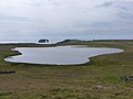
 Eshaness, view across Gerdie Loch - geograph.org.uk - 2741853.jpg 640 × 480; 41 KB
-
 Eshaness, West Loch - geograph.org.uk - 2719190.jpg 640 × 480; 49 KB
-
 Eyshaness.jpg 2,592 × 1,944; 1.64 MB
-
 Fulmar (Fulmarus glacialis), Braewick, Eshaness - geograph.org.uk - 3887223.jpg 1,024 × 682; 255 KB
-
 Fulmar at Esha Ness - geograph.org.uk - 3480280.jpg 640 × 480; 77 KB
-
 Giants Stones Eshaness - geograph.org.uk - 436568.jpg 431 × 640; 64 KB
-
 Grind of Navir - geograph.org.uk - 4658425.jpg 2,560 × 1,920; 448 KB
-
 Grind of the Navir - geograph.org.uk - 2854.jpg 529 × 347; 152 KB
-
 Grind of the Navir - geograph.org.uk - 3010402.jpg 800 × 533; 136 KB
-
 Grind of the Navir - geograph.org.uk - 3010415.jpg 800 × 532; 167 KB
-
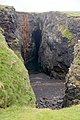
 Hole of Scraada, Eshaness - geograph.org.uk - 1654520.jpg 640 × 429; 100 KB
-
 Holes of Scraada - geograph.org.uk - 2032438.jpg 1,920 × 2,560; 1.75 MB
-
 Holes of Scraada - geograph.org.uk - 3829499.jpg 640 × 853; 562 KB
-
 Holes of Scraada, Esha Ness - geograph.org.uk - 99981.jpg 480 × 640; 117 KB
-
 Holes of Scraada, Eshaness - geograph.org.uk - 3010427.jpg 800 × 532; 200 KB
-
 Holes of Scraada, Eshaness - geograph.org.uk - 3010432.jpg 532 × 800; 194 KB
-
 Hols o' Scraada - geograph.org.uk - 2856.jpg 347 × 529; 155 KB
-
 Klippen bei Eshaness1 5833.JPG 2,048 × 1,536; 626 KB
-
 Klippen bei Eshaness2 5834.JPG 2,048 × 1,536; 665 KB
-
 Klippen bei Eshaness3 5845.JPG 2,048 × 1,536; 606 KB
-
 Lichens and mosses on the Eshaness cliffs - geograph.org.uk - 3929954.jpg 1,400 × 1,048; 599 KB
-
 Loch of Stow - geograph.org.uk - 3829457.jpg 640 × 480; 283 KB
-
 Rocks, Esha Ness - geograph.org.uk - 3829459.jpg 640 × 480; 273 KB
-
 Sae Breck, Esha Ness - geograph.org.uk - 6262.jpg 640 × 479; 81 KB
-
 Seat made from driftwood in Esha Ness - geograph.org.uk - 1571664.jpg 640 × 480; 103 KB
-
 Shetland Stile.jpg 3,556 × 2,304; 6.35 MB
-
 Skerries at Drid Geo - geograph.org.uk - 2031915.jpg 2,560 × 1,920; 1.78 MB
-
 Skerry at Grind of the Navir - geograph.org.uk - 3010395.jpg 800 × 532; 143 KB
-
 Stenness Fishing Station Böd.jpg 1,600 × 1,200; 1.87 MB
-
 Swabie Stane - geograph.org.uk - 3829462.jpg 640 × 480; 245 KB
-
 Swell meets Esha Ness - geograph.org.uk - 3558280.jpg 640 × 480; 307 KB
-
 The "classic" view of the cliffs at Eshaness - geograph.org.uk - 3929929.jpg 1,400 × 1,050; 586 KB
-
 The cliffs of Esha Ness - geograph.org.uk - 3480275.jpg 480 × 640; 68 KB
-

-
 The Spectacular Cliffs at Esha Ness - geograph.org.uk - 5924142.jpg 800 × 600; 664 KB
-
 Triangulation pillar, Esha Ness - geograph.org.uk - 3829577.jpg 640 × 480; 277 KB
-
 Trig Point, Esha Ness, Shetland - geograph.org.uk - 2055623.jpg 720 × 480; 147 KB
-

-
 Volcanic Coast - geograph.org.uk - 2032046.jpg 2,560 × 1,920; 1.88 MB


,_Eshaness_-_geograph.org.uk_-_2293683.jpg)


.jpg)


.jpg)
.jpg)


,_Braewick,_Eshaness_-_geograph.org.uk_-_3887223.jpg)


