Category:Ermin Street
Jump to navigation
Jump to search
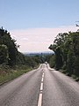
English: Ermin Street or Ermin Way is one of the great Roman roads of Britain. It runs from Gloucester (Glevum) via Cirencester (Corinium) to Silchester (Calleva Atrebatum). Much of it is now covered by the modern A417, A419 and B4000 roads. It should not be confused with Ermine Street, the road from London to York, via Lincoln.
Roman road that ran from Silchester to Gloucester Sep2005.jpg) | |||||
| Upload media | |||||
| Instance of | |||||
|---|---|---|---|---|---|
| Part of | |||||
| Location |
| ||||
 | |||||
Media in category "Ermin Street"
The following 42 files are in this category, out of 42 total.
-
 Baydon, Red Lion - geograph.org.uk - 817251.jpg 640 × 480; 87 KB
-
 Blunsdon Hill, Blunsdon, Swindon - geograph.org.uk - 1090874.jpg 640 × 479; 133 KB
-
 Brockworth, milestone - geograph.org.uk - 1550020.jpg 640 × 480; 111 KB
-
 Brockworth, Roman road - geograph.org.uk - 1550041.jpg 640 × 480; 76 KB
-
 Cottage beside Ermin Way - geograph.org.uk - 1154537.jpg 640 × 426; 80 KB
-
 Ermin Street, near Cirencester - geograph.org.uk - 48005.jpg 480 × 640; 76 KB
-
 Ermin Street, Stratton - geograph.org.uk - 48013.jpg 640 × 434; 69 KB
-
 Ermin Way at Birdlip - geograph.org.uk - 1154519.jpg 640 × 426; 83 KB
-
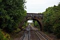 Ermin Way Bridge - geograph.org.uk - 1550314.jpg 640 × 427; 72 KB
-
 ErminStreetNearCirencester(DaveBushell)Sep2005.jpg 480 × 640; 93 KB
-
 Fosse Lodge - geograph.org.uk - 1104937.jpg 640 × 427; 84 KB
-
 Glebe Lane, Stockcross - geograph.org.uk - 869021.jpg 640 × 480; 196 KB
-
 House next to Ermin Way - geograph.org.uk - 1105849.jpg 640 × 427; 49 KB
-
 New road from the old - geograph.org.uk - 1104959.jpg 640 × 427; 99 KB
-
 Old Ermin Way - geograph.org.uk - 1104915.jpg 640 × 427; 105 KB
-
 Old Ermin Way - geograph.org.uk - 1104929.jpg 640 × 427; 75 KB
-
 Route to the A417 - geograph.org.uk - 1104979.jpg 640 × 427; 80 KB
-
 Seed drill on Ermin Way - geograph.org.uk - 1154740.jpg 640 × 426; 82 KB
-

-
-

-
 The Ermin Way near Birdlip - geograph.org.uk - 1154545.jpg 426 × 640; 91 KB
-
 The Ermin Way, Roman Road - geograph.org.uk - 95006.jpg 640 × 481; 38 KB
-
 The Kingsdown pub, Kingsdown, Swindon - geograph.org.uk - 753017.jpg 640 × 480; 90 KB
-
 The Lord Lyon at Stockcross - geograph.org.uk - 869016.jpg 640 × 480; 180 KB
-
 The old and the new A417, Birdlip - geograph.org.uk - 1154741.jpg 640 × 426; 74 KB
-
 The Red Lion - geograph.org.uk - 817235.jpg 640 × 480; 124 KB
-

-
 The Shepherds Rest on Ermin Street - geograph.org.uk - 869057.jpg 640 × 480; 148 KB
-
 The village of Baydon on Ermin Street - geograph.org.uk - 869044.jpg 640 × 480; 160 KB
-
 Wanborough High Street - geograph.org.uk - 1410915.jpg 640 × 480; 252 KB
-
 Wanborough Road, Covingham, Swindon - geograph.org.uk - 799852.jpg 640 × 480; 144 KB
-
 A419, south of Blunsdon - geograph.org.uk - 784686.jpg 640 × 395; 112 KB
-
 Cirencester Road, Latton - geograph.org.uk - 714259.jpg 640 × 480; 175 KB
-
 Cricklade Road, Cirencester - geograph.org.uk - 608963.jpg 640 × 480; 381 KB
-
 Entrance to Wanborough Plain Farm - geograph.org.uk - 1421760.jpg 640 × 480; 251 KB
-
 Ermin Street, Baydon - geograph.org.uk - 253170.jpg 640 × 480; 148 KB
-
 Ermin Way, Baydon - geograph.org.uk - 254626.jpg 640 × 480; 107 KB
-
 Ermin Way, Birdlip - geograph.org.uk - 130320.jpg 479 × 640; 91 KB
-
 Ermin Way, the old A419 at Latton. - geograph.org.uk - 286490.jpg 640 × 427; 78 KB
-
 Former Roman Road near Cirencester - geograph.org.uk - 48010.jpg 480 × 640; 88 KB
-
 Zoom^ - geograph.org.uk - 1421644.jpg 640 × 480; 259 KB


