Category:Envisat Advanced Synthetic Aperture Radar images
Jump to navigation
Jump to search
Media in category "Envisat Advanced Synthetic Aperture Radar images"
The following 200 files are in this category, out of 212 total.
(previous page) (next page)-
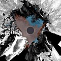
2007 Envisat mosaic of Arctic Ocean ESA210015.jpg 2,700 × 2,700; 1.69 MB
-
2007 Envisat mosaic of Arctic Ocean ESA210015.tiff 2,700 × 2,700, 2 pages; 20.93 MB
-
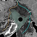
A 2007 ice-free portion of the Northwest Passage ESA215595.jpg 1,186 × 1,923; 2.59 MB
-
A 2007 ice-free portion of the Northwest Passage ESA215595.tiff 1,186 × 1,923, 2 pages; 6.57 MB
-
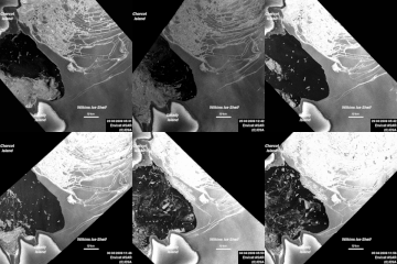
A further break-up in Wilkins Ice Shelf.gif 400 × 400; 1.15 MB
-
Alaska's Yukon Delta.jpg 4,587 × 3,101; 10.7 MB
-
Alaska’s Yukon Delta ESA232737.tiff 4,587 × 3,101; 37.35 MB
-
Algerian Sahara ESA204361.tiff 1,969 × 1,842; 10.92 MB
-
Algerian Sahara.jpg 1,969 × 1,842; 1.95 MB
-
Annotated image of the Northwest Passage ESA214455.jpg 1,217 × 1,437; 1.12 MB
-
Annotated image of the Northwest Passage ESA214455.tiff 1,217 × 1,437; 5.03 MB
-
Annotated image of Wilkins Ice Shelf acquired on 9 July 2008.jpg 1,377 × 1,886; 1.22 MB
-
Antarctic Peninsula - ASAR - 18 March 2002 ESA197368.jpg 1,131 × 2,835; 753 KB
-
Antarctic Peninsula - Radar Altimeter - 14 March 2002 ESA197576.jpg 1,017 × 733; 288 KB
-
Antarctic Peninsula Eddies - ASAR - 18 March 2002 ESA195265.jpg 2,736 × 2,713; 1.75 MB
-
Antarctica ice shelf system ESA230951.tiff 3,515 × 3,455; 17.91 MB
-
Antarctica ice shelf system.jpg 3,515 × 3,455; 4.29 MB
-
Archangel, Russia, and the White Sea - ASAR - 8 April 2002 ESA194676.jpg 346 × 1,417; 886 KB
-
Arctic ice cover June-August 2008.gif 2,650 × 2,650; 17.13 MB
-
Arctic islands.jpg 3,000 × 2,880; 2.95 MB
-
Arctic sea ice extent in September 2007 and September 2008.jpg 2,650 × 2,650; 1.76 MB
-
Arzamas, Russia - ASAR - 8 April 2002 ESA195538.jpg 878 × 1,154; 1.98 MB
-
ASAR image of Mauritania ESA235359.jpg 1,000 × 1,000; 410 KB
-
ASAR image of ships in the International Fleet Review ESA219876.jpg 3,857 × 2,842; 7.77 MB
-
ASAR looks at the Antarctic Peninsula ESA196911.jpg 2,052 × 3,213; 2.97 MB
-
ASAR looks at the Antarctic Peninsula ESA198056.jpg 2,376 × 3,213; 3.01 MB
-
ASAR wide-swath image acquired November 2002 ESA197294.jpg 837 × 876; 607 KB
-
B-15A break-up in progress, 30 October ESA217630.jpg 1,592 × 1,477; 1.58 MB
-
B-15A headed towards Drygalski, 8 March ESA230279.jpg 2,000 × 1,460; 1.84 MB
-
B15t 350.jpg 1,179 × 906; 337 KB
-
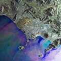
Bay of Naples - Envisat.jpg 5,000 × 5,010; 16.29 MB
-
Bay of Naples ESA218751.tiff 5,000 × 5,010; 69.84 MB
-
Birth of an iceberg ESA233555.gif 783 × 836; 3.47 MB
-
Boca do Acre Brazil.jpg 3,281 × 2,213; 6.92 MB
-
Boca do Acre, Brazil ESA300565.tiff 3,281 × 2,213; 20.8 MB
-
Brazil - ASAR - 13 March 2002 ESA197309.jpg 2,123 × 2,058; 1.07 MB
-
Break-up of the Wilkins Ice Shelf in Antarctica.gif 1,151 × 1,123; 4.53 MB
-
Break-up of the Wilkins Ice Shelf.gif 996 × 973; 5.25 MB
-
Bretagne France ASA WSM Orbit 10354 20040222.jpg 1,417 × 1,299; 973 KB
-
C19 Iceberg, Antarctica – ASAR - 18 July 2002 ESA198032.jpg 1,004 × 1,086; 202 KB
-
C19a.jpg 3,409 × 2,254; 608 KB
-
Canada, Ottawa - ASAR - 24 July 2002 ESA196506.jpg 1,203 × 1,560; 3.55 MB
-
Canadian Arctic and Greenland as seen by Envisat.jpg 4,647 × 4,647; 8.85 MB
-
Canary Islands - ASAR, 16 March 2002 ESA194842.jpg 859 × 1,500; 327 KB
-
Cape Town as seen by Envisat ESA229668.jpg 1,996 × 2,057; 1.54 MB
-
Cape Verde Archipelago.jpg 3,452 × 3,162; 2.17 MB
-
Changes in Arctic sea ice between June and September 2008.gif 662 × 662; 1.34 MB
-
Comparing surface deformation data ESA341141.jpg 3,271 × 2,720; 2.4 MB
-
Cool lava in Africa's Great Rift Valley.jpg 3,030 × 4,171; 7.48 MB
-
Cool lava in Africa’s Great Rift Valley ESA237110.tiff 3,030 × 4,171; 33.98 MB
-
Corsica – ASAR-MERIS - 26 June 2002 ESA197308.jpg 269 × 474; 53 KB
-
Corsica – ASAR-MERIS - 26 June 2002 ESA197517.jpg 597 × 730; 101 KB
-
Crisis image over the Cortes Department.jpg 990 × 622; 303 KB
-
Cyprus - Envisat.jpg 3,000 × 3,195; 8.43 MB
-
Cyprus ESA279938.tiff 3,000 × 3,195; 26.6 MB
-
Detail of India's remote Andaman islands showing the effects of the tsunami ESA205399.jpg 3,000 × 3,027; 5.96 MB
-
Detail of India's remote Andaman islands showing the effects of the tsunami ESA205399.tiff 8,413 × 8,596; 68.98 MB
-
Detail of Katrina's eye, seen by Envisat ESA229148.jpg 1,077 × 1,248; 609 KB
-
Detail of Katrina's eye, seen by Envisat ESA229148.tiff 1,077 × 1,248; 3.85 MB
-
Direct route through the Northwest Passage ESA221252.tiff 2,017 × 1,330; 4.04 MB
-
Direct route through the Northwest Passage.jpg 2,017 × 1,330; 1.34 MB
-
Dzerzhinsk, Russia, and the Volga River and - ASAR - 8 April 2002 ESA197410.jpg 873 × 1,176; 1.98 MB
-
Earth’s North Magnetic Pole ESA230869.tiff 1,200 × 1,200; 5.11 MB
-
Ecuador's highlands.jpg 6,023 × 5,196; 18.66 MB
-
Ecuador’s highlands ESA304486.tiff 6,023 × 5,196; 89.57 MB
-
Ellesmere Island and northwestern Greenland ESA206400.tiff 4,647 × 4,647; 63.69 MB
-
Ellesmere Island and northwestern Greenland.jpg 4,647 × 4,647; 17.48 MB
-
Envisat image of Kerguelen ESA210132.jpg 1,423 × 1,228; 702 KB
-
Envisat image of Kerguelen ESA210132.tiff 1,423 × 1,228; 5.01 MB
-
Envisat image of Rinks Isbrae glacier, Greenland ESA220629.jpg 1,500 × 865; 1,012 KB
-
Envisat image of the Larsen-B Ice Shelf ESA226884.jpg 400 × 921; 59 KB
-
Envisat image shows Drygalski crack ESA213825.jpg 561 × 861; 260 KB
-
Envisat radar composite of the port of Maracaibo in Venezuela ESA216507.tiff 2,480 × 2,774; 19.7 MB
-
Envisat radar image of the city of Karachi on the Arabian Sea ESA218002.tiff 2,516 × 2,480; 17.87 MB
-
Envisat radar image of the Gobi Desert ESA231227.tiff 5,011 × 4,708; 68.05 MB
-
Envisat radar image of the Gobi Desert.jpg 5,011 × 4,708; 21 MB
-
Envisat radar image of the Netherlands.jpg 8,346 × 8,525; 34.4 MB
-
Envisat radar image of the oil spill.jpg 1,271 × 930; 460 KB
-
Envisat radar image of the Panama Canal ESA232186.jpg 595 × 595; 632 KB
-
Envisat radar image of the Panama Canal ESA232186.tiff 1,140 × 1,140; 3.74 MB
-
Envisat radar image of the west part of Java ESA217090.jpg 1,023 × 1,033; 169 KB
-
Envisat radar image of the west part of Java ESA217090.tiff 4,557 × 4,600; 80.01 MB
-
Envisat view of an ice collision ESA210386.jpg 670 × 1,030; 343 KB
-
Envisat views of Hurricane Katrina ESA210339.jpg 1,412 × 996; 479 KB
-
Envisat views of Hurricane Katrina ESA210339.tiff 1,412 × 996; 4.03 MB
-
Envisat vs. Sentinel-1 radar ESA312147.tiff 2,296 × 1,436; 9.46 MB
-
Envisat vs. Sentinel-1 radar.jpg 2,296 × 1,436; 1.13 MB
-
Envisat's ASAR image shows tanker, Prestige, 100 km off Spanish coast. ESA194701.jpg 3,189 × 2,997; 1.74 MB
-
Envisat's ASAR sees Tianjin, China's third largest city ESA216958.jpg 1,023 × 1,001; 353 KB
-
Envisat's view of Pine Island and Thwaites glaciers.jpeg 3,013 × 4,461; 4.15 MB
-
Extent of fire damage in Norway.jpg 500 × 500; 557 KB
-
Flooding in Bangladesh ESA240522.jpg 4,371 × 7,503; 6.85 MB
-
Flooding in the Irrawaddy delta, Myanmar.jpg 2,400 × 1,196; 1.74 MB
-
Galapagos Islands in the Pacific Ocean ESA212084.jpg 2,677 × 6,963; 4.94 MB
-
Giant iceberg enters Nares Strait.gif 629 × 769; 4.21 MB
-
Greenland's east coast.jpg 5,448 × 4,945; 29.03 MB
-
Greenland’s east coast ESA221807.tiff 5,448 × 4,945; 88.34 MB
-
Guinea Bissau ESA218770.jpg 2,458 × 2,458; 1.46 MB
-
Guinea Bissau ESA218770.tiff 2,458 × 2,458; 17.32 MB
-
Guinea Conakry ASAR 02 August 2003 ESA203599.jpg 2,000 × 2,616; 706 KB
-
Guinea Conakry ASAR 02 August 2003 ESA203599.tiff 6,616 × 8,653; 163.79 MB
-
Hurricane Ike captured by Envisat.jpg 771 × 1,060; 513 KB
-
Hurricane Irene - Envisat.gif 318 × 836; 1.72 MB
-
Hurricane Isidore – ASAR-MERIS - 21 September 2002 ESA198663.jpg 782 × 499; 60 KB
-
Hurricane Isidore – MERIS - 21 September 2002 ESA194688.jpg 1,076 × 1,536; 231 KB
-
Indonesia's Kalimantan region.jpg 3,500 × 3,516; 15.28 MB
-
Indonesian islands.jpg 1,920 × 1,519; 1.18 MB
-
Indonesia’s Kalimantan region ESA218039.tiff 3,500 × 3,516; 17.87 MB
-
Indus River - Envisat.jpg 1,440 × 1,370; 1.09 MB
-
Inglefield Gulf.jpg 1,204 × 555; 409 KB
-
Irrawaddy Delta, Myanmar.jpg 1,024 × 916; 961 KB
-
Kamchatka Peninsula - Envisat.jpg 2,835 × 2,576; 5.8 MB
-
Kamchatka Peninsula ESA216447.tiff 2,581 × 2,835; 43.12 MB
-
Kampala on Lake Victoria ESA216283.jpg 1,749 × 1,401; 2.87 MB
-
Kuwaiti islands ESA236846.tiff 4,242 × 3,815; 25.85 MB
-
Kuwaiti islands.jpg 4,242 × 3,815; 5.39 MB
-
Lake Azhabachje - Envisat (cropped).jpg 627 × 291; 181 KB
-
Lake Mead, USA ESA240026.tiff 4,000 × 4,270; 54.12 MB
-
Lake Mead, USA.jpg 4,000 × 4,270; 14.38 MB
-
Lakes and mountains of western Uganda ESA298477.tiff 5,699 × 4,692; 76.53 MB
-
Lakes and mountains of western Uganda.jpg 5,699 × 4,692; 17.1 MB
-
Lena Delta.jpg 1,024 × 1,024; 1.03 MB
-
Manila ESA234363.jpg 605 × 595; 454 KB
-
Manila ESA234363.tiff 2,520 × 2,480; 17.89 MB
-
Mapping flood with Envisat's radar.jpg 789 × 1,152; 233 KB
-
Mertz Glacier Tongue and the B-9B iceberg in December 2007.jpg 2,059 × 2,940; 2.05 MB
-
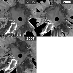
Mosaics of Arctic Ocean for 2005, 2006, 2007 ESA201174.gif 600 × 600; 927 KB
-
Northwest Passage.jpg 2,570 × 1,353; 1.2 MB
-
Okavango Delta in northern Botswana ESA292694.tiff 4,266 × 3,230; 39.47 MB
-
Okavango Delta in northern Botswana.jpg 4,266 × 3,230; 13.49 MB
-
Pine Island cracked ESA253149.tiff 4,042 × 2,599; 30.02 MB
-
Pine Island cracked.jpg 4,042 × 2,599; 5.3 MB
-
Qeshm Island Iran.jpg 4,000 × 3,726; 8.66 MB
-
Qeshm Island, Iran ESA201025.tiff 4,000 × 3,726; 42.81 MB
-
Queensland inundated.jpg 930 × 805; 424 KB
-
Radar image acquired on 2 May.jpg 1,228 × 931; 463 KB
-
Radar image of Hawaii.jpg 1,024 × 762; 179 KB
-
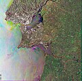
Radar image of Lisbon ESA200829.jpg 2,835 × 2,801; 22.04 MB
-
Radar image of Lisbon ESA200829.tiff 2,835 × 2,801; 22.74 MB
-
Radar image of the Danube Delta ESA223752.jpg 2,500 × 2,103; 1.63 MB
-
Radar image showing a fissure on the massive A53A iceberg ESA231514.tiff 2,717 × 2,717; 19.52 MB
-
Radar image showing a fissure on the massive A53A iceberg.jpg 2,717 × 2,717; 4.59 MB
-
Radar map of southern Norway ESA211680.jpg 985 × 974; 825 KB
-
Rainforest river Brazil.jpg 3,685 × 2,888; 8.42 MB
-
Rainforest river, Brazil ESA203077.tiff 3,685 × 2,888; 26.99 MB
-
Raystown Lake ESA294605.tiff 5,754 × 4,833; 87.9 MB
-
Raystown Lake.jpg 5,754 × 4,833; 27.85 MB
-
Rita seen in full ESA233201.jpg 1,381 × 1,805; 675 KB
-
Rita seen in full ESA233201.tiff 1,381 × 1,805; 7.14 MB
-
Rotterdam as seen by Envisat ESA226543.jpg 2,126 × 2,126; 2.11 MB
-
Rotterdam as seen by Envisat ESA226543.tiff 2,126 × 2,126; 12.96 MB
-
Russia's Tsimlyansk Reservoir.jpg 1,262 × 1,326; 1.06 MB
-
Russia's Volga Delta and the Caspian Sea.jpg 3,838 × 3,861; 8.25 MB
-
Russia’s Tsimlyansk Reservoir ESA219601.tiff 1,262 × 1,326; 4.44 MB
-
Russia’s Volga Delta and the Caspian Sea ESA203172.tiff 3,838 × 3,861; 36.71 MB
-
Salt Lake Utah.jpg 3,738 × 5,100; 3.37 MB
-
Sea-ice coverage in Aug 2008 and Sept 2007 minimum.jpg 2,000 × 2,000; 1.61 MB
-
Sea-ice coverage in Aug 2008 and Sept 2007 minumum ESA234197.tiff 2,000 × 2,000; 5.69 MB
-
Siberian 'gecko' ESA212004.tiff 1,417 × 1,390; 6.43 MB
-
Siberian 'gecko'.jpg 1,417 × 1,390; 2.33 MB
-
South Korea's crude oil leak captured by Envisat ESA235529.jpg 1,800 × 1,423; 1.41 MB
-
SouthKorea ASA 2007345 lrg.jpg 4,820 × 3,545; 5.15 MB
-
Spain, Strait of Gibraltar – ASAR - 20 May 2002 ESA194473.jpg 643 × 2,200; 458 KB
-
Spain, Strait of Gibraltar – ASAR - 20 May 2002 ESA195132.jpg 2,000 × 3,201; 1.77 MB
-
Spitsbergen Norway's largest island.jpg 3,539 × 3,540; 8.43 MB
-
Strait of Bonifacio - Envisat.jpg 2,621 × 2,000; 2.84 MB
-
Strait of Bonifacio ESA207131.tiff 2,621 × 2,000; 13.3 MB
-
Suez Canal - Envisat.jpg 2,161 × 2,484; 6.23 MB
-
Suez Canal ESA224312.tiff 2,161 × 2,484; 18.56 MB
-
Sulzberger Ice Shelf.jpg 1,320 × 855; 453 KB
-
The Bering Land Bridge Preserve in Alaska ESA203691.jpg 2,362 × 2,220; 3.2 MB
-
The Bering Land Bridge Preserve in Alaska ESA203691.tiff 2,362 × 2,220; 15.01 MB
-
The city of Instanbul shown in an Envisat radar image ESA229640.jpg 598 × 595; 429 KB
-
The city of Instanbul shown in an Envisat radar image ESA229640.tiff 2,492 × 2,480; 35.49 MB
-
The French island of Corsica ESA288440.tiff 2,166 × 2,730; 15.77 MB
-
The French island of Corsica.jpg 2,166 × 2,730; 3.7 MB
-
The Great Lakes of Africa.jpg 8,000 × 8,000; 18.11 MB
-
The island of Crete ESA211762.tiff 4,408 × 4,272; 41.09 MB
-
The island of Crete.jpg 4,408 × 4,272; 8.44 MB
-
The island of Elba Italy.jpg 3,000 × 2,981; 6.36 MB
-
The island of Elba, Italy ESA282884.tiff 3,000 × 2,981; 26.66 MB
-
The Larsen-B Ice Shelf captured by Envisat ESA205366.jpg 400 × 921; 201 KB
-
The Larsen-B Ice Shelf captured by Envisat ESA205366.tiff 400 × 921; 381 KB
-
The Netherlands - ASAR - 18 March 2002 ESA198500.jpg 876 × 2,662; 336 KB
-
The Netherlands – ASAR - 19, 23, 26 April 2002 ESA194286.jpg 2,000 × 3,650; 4.85 MB
-
The oil spill in the Gulf of Mexico pictured by Envisat.jpg 2,500 × 1,938; 1.7 MB
-
The Panama Canal ESA287115.tiff 2,952 × 1,681; 16.57 MB
-
The Panama Canal.jpg 2,952 × 1,681; 5.01 MB
-
The Strait of Gibraltar.jpg 2,500 × 2,441; 1.72 MB
-
UK wind farms ESA232345.tiff 1,754 × 1,436; 8.45 MB
-
UK wind farms.jpg 1,754 × 1,436; 2.04 MB
-
Upwelling off the coast of Mauritania ESA198590.jpg 4,485 × 5,452; 9.28 MB
-
Vietnam's Mekong Delta ESA219993.jpg 2,000 × 1,949; 1.84 MB
-
Vietnam's Mekong Delta.jpg 5,124 × 4,992; 23.35 MB
-
Virunga Mountains ESA294957.tiff 7,015 × 5,760; 115.64 MB
-
Virunga Mountains.jpg 7,015 × 5,760; 27.39 MB
-
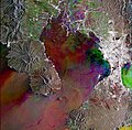
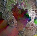
Volcanic uplift.jpg 1,366 × 992; 1.23 MB
-
Waters of central China ESA234044.tiff 2,876 × 2,679; 27.67 MB
