Category:Entrances in Kent
Jump to navigation
Jump to search
Subcategories
This category has the following 2 subcategories, out of 2 total.
N
- Norman Staircase, Canterbury (22 F)
Media in category "Entrances in Kent"
The following 151 files are in this category, out of 151 total.
-
 'Berfrestone' (DB) St Nicholas churchyard table tomb entrance Barfrestone Kent England.jpg 5,356 × 3,492; 22.53 MB
-
 All Saint's Church Chillenden Kent England - gate and gate post.jpg 2,000 × 3,000; 6.01 MB
-
 All Saint's Church Chillenden Kent England - gate and path to churchyard.jpg 2,000 × 3,000; 5.78 MB
-
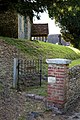
 Cast iron church gate at Monkton Kent England.jpg 3,000 × 2,000; 6.72 MB
-
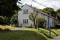 Churchyard cottages at Monkton Kent England - side view.jpg 3,000 × 2,000; 5 MB
-
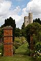
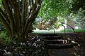 Entrance steps toward the Walled Garden of Goodnestone Park Kent England.jpg 3,000 × 2,000; 5.58 MB
-
 Holy Cross Church from Walled Garden of Goodnestone Park Kent England 1.jpg 3,000 × 2,000; 4.75 MB
-
 Eastry Court gateway at Eastry, Kent, England.jpg 3,000 × 2,000; 5.57 MB
-
 Church of St Mary the Virgin, Eastry, Kent - churchyard listed north gate and wall.jpg 2,000 × 3,000; 7.48 MB
-
 Church of St Mary the Virgin, Woodnesborough, Kent - entrance gate.jpg 3,000 × 2,000; 5.36 MB
-
 Church of St Mary the Virgin, Woodnesborough, Kent - churchyard path yew avenue 02.jpg 2,000 × 3,000; 6.57 MB
-
 Church of St Mary the Virgin, Woodnesborough, Kent - north porch.jpg 2,000 × 3,000; 4.31 MB
-
 Church of St Mary the Virgin, Woodnesborough, Kent - north porch door.jpg 2,000 × 3,000; 5.19 MB
-
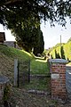
 Church of St Nicholas, Ash-with-Westmarsh, Kent - churchyard steps.jpg 2,000 × 3,000; 5.14 MB
-
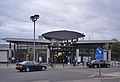
 2019 at Ramsgate station - exterior.JPG 1,366 × 910; 458 KB
-
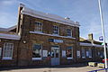
 Adisham railway station - geograph.org.uk - 2922275.jpg 4,320 × 3,240; 4.14 MB
-

-
 Arch and gate in brick entrance wall to Walled Garden of Goodnestone Park Kent England.jpg 3,000 × 2,000; 6.21 MB
-
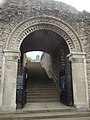
 Arch door and portal in Walled Garden at Goodnestone Park Kent England.jpg 2,000 × 3,000; 6.24 MB
-
 Arch in brick entrance wall to Walled Garden of Goodnestone Park Kent England.jpg 2,000 × 3,000; 5.05 MB
-
 Ash parish in Kent England - Cooper Street Drove.jpg 3,000 × 2,000; 6.33 MB
-
 Ashford International Station 01.JPG 560 × 383; 211 KB
-
 Back entrance to High Brooms Station - geograph.org.uk - 5135810.jpg 640 × 443; 87 KB
-
 Barn entrance gate at Easole Street, Nonington, Kent, England.jpg 2,000 × 3,000; 6.25 MB
-
 Beach toys for sale at garden gate in Broadstairs Kent England.jpg 2,000 × 3,000; 5.5 MB
-
 Bearsted Railway Station - geograph.org.uk - 1741669.jpg 800 × 600; 145 KB
-
 Blue door and portal in Walled Garden at Goodnestone Park Kent England.jpg 2,000 × 3,000; 5.64 MB
-
 Borders lawn and brick piers in Walled Garden of Goodnestone Park Kent England.jpg 3,000 × 2,000; 5.3 MB
-
 Bow Hill gateway to Upper Hardres Court at Upper Hardres Kent England - closer view.jpg 2,000 × 3,000; 6.69 MB
-
 Bow Hill gateway to Upper Hardres Court at Upper Hardres Kent England - lower view.jpg 2,000 × 3,000; 6.41 MB
-
 Bow Hill gateway to Upper Hardres Court at Upper Hardres Kent England.jpg 2,000 × 3,000; 6.65 MB
-
-

-
 Brick wall flint arch in Walled Garden of Goodnestone Park Kent England.jpg 2,000 × 3,000; 6.06 MB
-
 Dickens House Broadstairs Kent England.jpg 3,000 × 2,000; 4.45 MB
-
 Broadstairs railway station - geograph.org.uk - 2809104.jpg 3,264 × 2,448; 2.45 MB
-
 Broadstairs station - entrance - geograph.org.uk - 3846284.jpg 640 × 480; 77 KB
-
 Brogdale - geograph.org.uk - 418946.jpg 480 × 640; 151 KB
-
 Canterbury West railway station front elevation.jpg 2,592 × 1,944; 1.41 MB
-
 Canterbury West Station - geograph.org.uk - 3117213.jpg 640 × 381; 41 KB
-
 Canterbury west Station - geograph.org.uk - 5161172.jpg 640 × 426; 50 KB
-
 Canterbury West Station - geograph.org.uk - 5161174.jpg 640 × 426; 56 KB
-
 Canterbury West station, entrance - geograph.org.uk - 1921810.jpg 640 × 480; 68 KB
-
 Car park entrance, East Blean Woods - geograph.org.uk - 373332.jpg 640 × 480; 84 KB
-
 Carriage arch of Goodnestone Park Kent England.jpg 2,000 × 3,000; 4.69 MB
-
 Chatham Station - geograph.org.uk - 2560087.jpg 1,280 × 960; 204 KB
-
 Chestfield and Swalecliffe railway station - geograph.org.uk - 2112760.jpg 4,320 × 3,240; 4.77 MB
-
 Chiddingstone Castle entrance - geograph.org.uk - 5203832.jpg 640 × 426; 107 KB
-
 Chillenden Mill gate at Chillenden Kent England.jpg 3,000 × 2,000; 7.9 MB
-
 Gate hinge and post at Chillenden Kent England.jpg 3,000 × 2,000; 4.46 MB
-
 Dartford station building.JPG 1,600 × 1,200; 440 KB
-
 Dartford station entrance - geograph.org.uk - 1396539.jpg 640 × 480; 119 KB
-
 Deal Station (1).jpg 4,288 × 2,848; 4.99 MB
-
 Deal Station (2).jpg 4,288 × 2,848; 5.55 MB
-
 Dockyard Main Gate, Dock Road, Brompton - geograph.org.uk - 518042.jpg 640 × 480; 137 KB
-
 Dover Priory Station - geograph.org.uk - 821940.jpg 640 × 429; 78 KB
-
 Dover Priory Station 01.jpg 482 × 359; 86 KB
-
 Dover, Market Square - geograph.org.uk - 2623973.jpg 3,648 × 2,736; 1.41 MB
-
 Dover, Market Square - geograph.org.uk - 2623997.jpg 3,648 × 2,736; 1.37 MB
-
 Edenbridge station entrance - geograph.org.uk - 2911740.jpg 1,600 × 1,200; 536 KB
-
 Edenbridge Town Railway Station - geograph.org.uk - 1385354.jpg 640 × 480; 74 KB
-
 Edenbridge Town Station - geograph.org.uk - 1124347.jpg 640 × 480; 83 KB
-
 Entrance to Barming Station - geograph.org.uk - 1743203.jpg 3,488 × 2,616; 2.12 MB
-

-
 Entrance to Broomfield Woodland Park - geograph.org.uk - 385345.jpg 640 × 480; 41 KB
-
 Entrance to Dover Ferry Terminal - geograph.org.uk - 1410503.jpg 640 × 426; 68 KB
-

-

-
 Entrance to Hever Castle, Hever, Kent - geograph.org.uk - 1382207.jpg 640 × 428; 122 KB
-

-
 Entrance to Kent County Showground - geograph.org.uk - 730060.jpg 640 × 480; 84 KB
-
 Entrance to Knole - geograph.org.uk - 3033815.jpg 3,872 × 2,592; 4.89 MB
-
 Entrance to Leeds Castle - geograph.org.uk - 1555790.jpg 480 × 640; 103 KB
-

-
 Entrance to Shandon House, Pembury Rd - geograph.org.uk - 1173802.jpg 640 × 430; 117 KB
-
 Entrance to Spencer House, 6 Austen's Lane, Sandwich, August 2022.jpg 3,024 × 4,032; 5.59 MB
-
 Entrance to Tanyard Farm, Hadlow Rd - geograph.org.uk - 1314160.jpg 640 × 430; 98 KB
-

-
 Entrance to the King's School, Canterbury - geograph.org.uk - 3044242.jpg 3,872 × 2,592; 4.55 MB
-
 Entrance to Tonbridge Castle - geograph.org.uk - 3256774.jpg 640 × 430; 110 KB
-

-
 Entrance to Whitstable Harbour - geograph.org.uk - 1295844.jpg 640 × 480; 53 KB
-
 Entrance to Whitstable Harbour - geograph.org.uk - 1475451.jpg 640 × 430; 149 KB
-
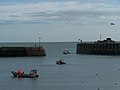 Folkestone Harbour Entrance - geograph.org.uk - 1023607.jpg 640 × 481; 37 KB
-
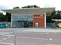
 Folkestone West Station - geograph.org.uk - 2105870.jpg 3,072 × 2,304; 1.66 MB
-
 Folkestone West Station 02.JPG 640 × 480; 147 KB
-
 Garden border and entrance at Goodnestone Park Kent England 1.jpg 3,000 × 2,000; 7.33 MB
-
 Garden border and entrance at Goodnestone Park Kent England 2.jpg 3,000 × 2,000; 7.75 MB
-
 Gate from the Castle - geograph.org.uk - 4409045.jpg 430 × 640; 79 KB
-
 Gatehouse - geograph.org.uk - 1007429.jpg 427 × 640; 75 KB
-
 Gatehouse - geograph.org.uk - 3462596.jpg 413 × 640; 63 KB
-
 Gateway, Tonbridge Castle - geograph.org.uk - 3805095.jpg 430 × 640; 81 KB
-
 Gillingham Station - geograph.org.uk - 3169754.jpg 640 × 430; 63 KB
-
 Drive and entrance of Goodnestone Park Kent England.jpg 3,000 × 2,250; 4.87 MB
-
 Greenhithe Station - geograph.org.uk - 918595.jpg 640 × 481; 72 KB
-
 Harrietsham station - geograph.org.uk - 3430461.jpg 4,000 × 3,000; 4.21 MB
-
 Headcorn railway station, Kent - geograph.org.uk - 4431968.jpg 1,600 × 1,200; 374 KB
-
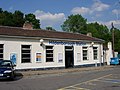
 Herne Bay station building.jpg 3,072 × 2,304; 4.32 MB
-
 Hever Castle entrance.jpg 1,600 × 1,200; 371 KB
-
 High Brooms Station - geograph.org.uk - 4938675.jpg 640 × 426; 67 KB
-
 HildenboroughRailwayStation.jpg 640 × 480; 110 KB
-
 Holy Cross Church from Walled Garden of Goodnestone Park Kent England 3.jpg 2,205 × 3,000; 5.47 MB
-
 Holy Cross Church from Walled Garden of Goodnestone Park Kent England 4.jpg 2,000 × 3,000; 4.71 MB
-
 Holy Cross Church from Walled Garden of Goodnestone Park Kent England 5.jpg 2,000 × 3,000; 4.69 MB
-
 IghthamMoteMainEntrance.jpg 2,590 × 3,813; 5.68 MB
-
 Kearsney railway station - geograph.org.uk - 3027647.jpg 4,320 × 3,240; 3.46 MB
-
 Leigh railway station entrance - geograph.org.uk - 2092725.jpg 2,048 × 1,536; 1.25 MB
-
 Leigh Station entrance - geograph.org.uk - 4217379.jpg 640 × 430; 123 KB
-
 Maidstone East Station 02.JPG 577 × 435; 125 KB
-

-
 Main entrance to Broome Park - geograph.org.uk - 345160.jpg 640 × 480; 119 KB
-
 Marden Station - geograph.org.uk - 5030690.jpg 640 × 426; 80 KB
-
 Margate railway station entrance Margate Kent England.jpg 4,993 × 3,422; 10.4 MB
-
 Minster railway station - geograph.org.uk - 2808976.jpg 3,264 × 2,448; 2.59 MB
-
 Otford Railway Station - geograph.org.uk - 1126476.jpg 640 × 480; 76 KB
-
 Otford Railway Station 1.jpg 3,488 × 2,616; 2.21 MB
-
 Paddock Wood Railway Station - geograph.org.uk - 1386329.jpg 640 × 480; 65 KB
-
 Paddock Wood Station - geograph.org.uk - 2984583.jpg 640 × 430; 54 KB
-
 Penshurst Station - geograph.org.uk - 4672503.jpg 640 × 426; 116 KB
-
 Pleasure Park entrance, Dreamland Margate - geograph.org.uk - 4531321.jpg 1,024 × 683; 152 KB
-
 Portcullis at Hever Castle - geograph.org.uk - 2644904.jpg 398 × 640; 83 KB
-
 Ramsgate Railway Station.jpg 640 × 451; 109 KB
-

-
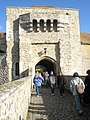
 Rochester, northwest castle entrance - geograph.org.uk - 3685879.jpg 480 × 640; 80 KB
-
 Selling Station approach - geograph.org.uk - 663087.jpg 640 × 480; 67 KB
-
 Sevenoaks railway station - geograph.org.uk - 3631994.jpg 640 × 360; 65 KB
-
 Sevenoaks Station - geograph.org.uk - 1255766.jpg 640 × 430; 74 KB
-
 Sevenoaks Station - geograph.org.uk - 3419607.jpg 640 × 430; 58 KB
-
 Stadium Entrance - geograph.org.uk - 388311.jpg 640 × 480; 254 KB
-
 Station House, High Brooms Station - geograph.org.uk - 1108473.jpg 640 × 430; 76 KB
-
 Station house, High Brooms Station - geograph.org.uk - 2117683.jpg 640 × 430; 121 KB
-
 Swanley station north entrance.JPG 1,600 × 1,200; 471 KB
-
 Swanscombe Railway Station - geograph.org.uk - 1910138.jpg 2,048 × 1,536; 1.15 MB
-

-
 The entrance to Dane Court - geograph.org.uk - 4521494.jpg 3,264 × 2,448; 3.4 MB
-
 The entrance to No. 5 Pembury Rd - geograph.org.uk - 1173768.jpg 640 × 430; 92 KB
-
 The Old Main Gate to Chatham Docks - geograph.org.uk - 1148623.jpg 640 × 430; 60 KB
-

-

-
 This way please... - geograph.org.uk - 1554439.jpg 640 × 480; 88 KB
-
 Tonbridge Grammar School entrance - geograph.org.uk - 1127874.jpg 640 × 430; 72 KB
-
 Tonbridge School entrance - geograph.org.uk - 3350483.jpg 640 × 447; 59 KB
-
 Tonbridge School, The Avenue entrance - geograph.org.uk - 1882447.jpg 640 × 430; 142 KB
-
 Tonbridge Station - geograph.org.uk - 3466294.jpg 640 × 430; 58 KB
-
 Tonbridge Station - geograph.org.uk - 3468387.jpg 640 × 430; 42 KB
-
 Tonbridge Station frontage - geograph.org.uk - 4389258.jpg 640 × 430; 56 KB
-
 Tonbridge Station frontage - geograph.org.uk - 4569029.jpg 640 × 426; 51 KB
-
 Tonbridge. Ridgeland's (3611526052).jpg 1,536 × 1,167; 1.17 MB
-
 Tunbridge Wells Station - geograph.org.uk - 2500689.jpg 640 × 430; 62 KB
-
 Whitstable railway station north side 8224.jpg 4,608 × 3,456; 3.04 MB
-
 Whitstable Station - geograph.org.uk - 3291090.jpg 640 × 426; 48 KB
_St_Nicholas_churchyard_table_tomb_entrance_Barfrestone_Kent_England.jpg)


.jpg)
.jpg)


.jpg)


