Category:English-language maps of Spain
Jump to navigation
Jump to search
Subcategories
This category has the following 2 subcategories, out of 2 total.
E
- ECHO Daily Maps of Spain (18 F)
T
Media in category "English-language maps of Spain"
The following 38 files are in this category, out of 38 total.
-
1815 Thomson Map of Spain and Portugal - Geographicus - Spain-t-15.jpg 3,000 × 2,515; 2.05 MB
-
Alarcia-in-spain.jpg 400 × 278; 38 KB
-
AVE map.svg 884 × 884; 343 KB
-
AVE.png 2,948 × 2,949; 820 KB
-
BAZA ESPAÑA.JPG 803 × 578; 66 KB
-
Bullfighting in Spain by province.png 719 × 395; 25 KB
-
Bullsinspainf19.png 719 × 395; 22 KB
-
Cadiz 1625.jpg 713 × 1,170; 145 KB
-
Ccaa-spain.png 1,705 × 1,185; 56 KB
-
Climate of Spain.jpg 785 × 641; 66 KB
-
Climates of Spain.png 503 × 393; 51 KB
-
HighSpeedSpain.png 2,131 × 1,647; 378 KB
-
Hispania3c.JPG 883 × 667; 154 KB
-
Map of the Canary Islands.svg 3,152 × 1,400; 835 KB
-
Nucleares.png 835 × 700; 158 KB
-
Population densities in Spain (2007).svg 568 × 387; 1.5 MB
-
Pvgis solar horiz ES.png 1,024 × 1,032; 750 KB
-
Pvgis solar optimum ES.png 1,024 × 1,032; 721 KB
-
Sp-map.png 326 × 350; 17 KB
-
Spain - DPLA - 0597f13fa5f14140fda9586321380ec5.jpg 3,591 × 4,629; 2.05 MB
-
Spain - DPLA - 0c14bb4bf3e0c5e49b826fcc09bdaf01.jpg 11,988 × 8,774; 10.6 MB
-
Spain - DPLA - 3624f648597bcad60fcbcd6e21f82c4b.jpg 3,583 × 4,686; 2.07 MB
-
Spain - DPLA - 624cdd8b3d840010a8d3eab56b247fd2.jpg 11,993 × 8,833; 9.77 MB
-
Spain - DPLA - 6bf2f5c63a2ac7cafc40e2fe7dd809a5.jpg 3,583 × 4,624; 1.91 MB
-
Spain - DPLA - a7b54774948762539e007651e00a7d31.jpg 11,983 × 8,828; 7.78 MB
-
Spain - Location Map (2013) - ESP - UNOCHA.svg 250 × 250; 973 KB
-
Spain Agriculture, Forestry and Mining - DPLA - 0b7adbdb25dc655bfed4abf8e09308ce.jpg 4,216 × 3,333; 1.9 MB
-
Spain Areas of Political Doninance 1931-1936 - DPLA - 7f9fb43e7a387e86dc06f8830fa75ae5.jpg 4,272 × 3,325; 1.88 MB
-
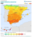
Spain GHI Solar-resource-map GlobalSolarAtlas World-Bank-Esmap-Solargis.png 1,842 × 2,106; 793 KB
-
Spain Land Holdings and Historical Regions - DPLA - 7b06a7e1e73456cf6fee50000fe9b01f.jpg 4,248 × 3,204; 1.55 MB
-
Spain Military Regions - DPLA - b2e56ca69c9fb16b2ef92caad015a901.jpg 4,232 × 3,384; 1.5 MB
-
Spain Transportation - DPLA - ef405303e1e654d7b20424fca68a056f.jpg 4,191 × 3,332; 1.78 MB
-
Spain, autonomous regions and major ethnolinguistic groups. LOC 2016586025.jpg 2,531 × 2,848; 529 KB
-
Spain-climate-en.png 503 × 393; 160 KB
-
Spanish Civil War August September 1936.png 459 × 380; 21 KB
-
The Basque lands. LOC 78696631.jpg 4,359 × 3,372; 1.69 MB
-
The Basque lands. LOC 78696631.tif 4,359 × 3,372; 42.05 MB
-
TurnoutSpainReferendum.png 671 × 475; 32 KB


