Category:English-language SVG maps of individual states of the United States
Jump to navigation
Jump to search
Media in category "English-language SVG maps of individual states of the United States"
The following 10 files are in this category, out of 10 total.
-
Blanchard ND.svg 338 × 159; 12 KB
-
High plains fresh groundwater usage 2000.svg 747 × 946; 1.48 MB
-
King's Highway.svg 251 × 509; 135 KB
-
Mississippi Embayment relief map 1.svg 474 × 914; 8.95 MB
-
Mississippi Embayment relief map 2.svg 474 × 914; 8.97 MB
-
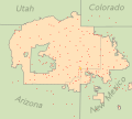
NavajoNation map en.svg 1,729 × 1,554; 193 KB
-
Ogallala changes 1980-1995.svg 761 × 1,002; 1.74 MB
-
Ogallala saturated thickness 1997-sattk97-v2.svg 656 × 960; 1.36 MB
-
Ogallala saturated thickness 1997-sattk97.svg 1,491 × 1,732; 5.64 MB
-
Ozark Trails road schematic.svg 1,414 × 922; 441 KB


