Category:English-language SVG maps of Washington, D.C.
Jump to navigation
Jump to search
States of the United States: Alabama · Alaska · Arizona · Arkansas · California · Colorado · Connecticut · Delaware · Florida · Georgia · Hawaii · Idaho · Illinois · Indiana · Iowa · Kansas · Kentucky · Louisiana · Maine · Maryland · Massachusetts · Michigan · Minnesota · Mississippi · Missouri · Montana · Nebraska · Nevada · New Hampshire · New Jersey · New Mexico · New York · North Carolina · North Dakota · Ohio · Oklahoma · Oregon · Pennsylvania · Rhode Island · South Carolina · South Dakota · Tennessee · Texas · Utah · Vermont · Virginia · Washington · West Virginia · Wisconsin · Wyoming – Washington, D.C.
Media in category "English-language SVG maps of Washington, D.C."
The following 13 files are in this category, out of 13 total.
-
2009PresidentialInaugurationCeremonyMap.svg 759 × 921; 467 KB
-
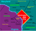
Area code 202.svg 422 × 359; 41 KB
-
Burnham Barrier.svg 512 × 344; 30 KB
-
Capital Beltway Map Color.svg 564 × 489; 279 KB
-
DC print districts map.svg 744 × 1,052; 855 KB
-
Dupont Circle Map.svg 512 × 428; 515 KB
-
I-395 DC.svg 750 × 738; 107 KB
-
Meridian hill park dc.svg 617 × 804; 11 KB
-
Radially concentric created streets in Washington, D.C..svg 1,799 × 1,216; 12.7 MB
-
Clara Barton Parkway map.svg 991 × 764; 1.69 MB
-
Solar Decathlon 2011 Map.svg 612 × 792; 340 KB
-
Washington, D.C. locator map.svg 750 × 550; 160 KB
-
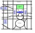
Whitehouse street map.svg 721 × 688; 28 KB


